

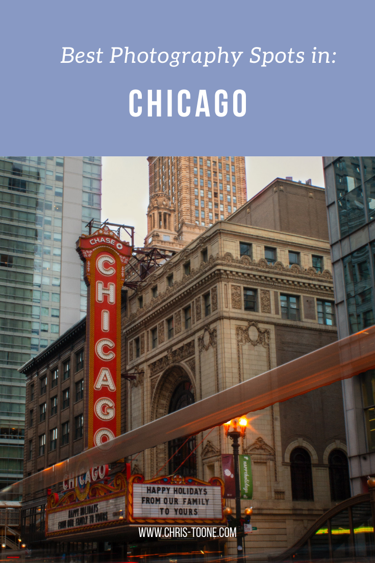
Best Photography Spots in Chicago: Everywhere you need to go on your next trip to the Windy City
Skip the tourist trail and check out this comprehensive list of incredible spots to photography Chicago. From where to find the best city skyline views to which parking garages best capture the 'L' train, this is a must-have guide before your next trip!
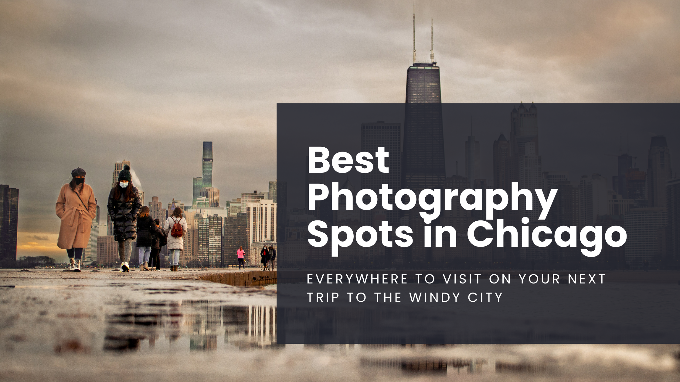
As it turns out, moving to Chicago has been the perfect way to expand my photography skills. With the hustle and bustle of city life, the famous ‘L’ train weaving through the towering buildings, and the glistening shores of Lake Michigan to the east, there’s a unique perspective everywhere you look.
Millennium Park and Michigan Ave are by far the most visited sites in this mid-western hub but trust me when I say there’s so much more to discover.
Here’s a list of the best places to photograph Chicago.
NORTHERLY ISLAND
Northerly Island is a peninsula park along the shores of Lake Michigan that comes complete with city skyline views, including the iconic Soldier Field.
Enjoy the fresh air and greenery as you combine your skilled nature shots with that of urban life.
Fun Fact: The 5-acre lagoon is home to many of Illinois’ wildlife, including monarch butterflies and heron.
Getting There: Red, orange, and green line trains to Roosevelt & walk from there

NORTH AVE. BEACH
Located in Lincoln Park, this popular beach offers some of the best skyline scenery in the entire city. Walk the jetty, stick your toes in the sand, and snap some shots as daily life in Chicago moves all around you.
Pro Tip: This is location is adjacent to the Lincoln Park Boardwalk (below), so it’s easy to combine the two shoots.
Fun Fact: North Avenue Beach came into existence from a multi-million project in the 1930s that was partially funded by President Roosevelt’s New Deal. The beach itself is an extension of an old landfill’s narrow path along Lakeshore Drive.
Getting There: Red, brown, or purple express lines to Fullerton & walk towards Lincoln Park

North Ave. Beach in Chicago, IL
ORLEANS ST. BRIDGE
The most popular way to take advantage of this location is to shoot towards the Wells St. Bridge. This is one of my favorite scenes in the city that perfectly encapsulates life in Chicago; boats cruising along the river below, the brown line trains traversing across the river and stunning architecture rising high towards the sky.
A unique feature of Chicago is that the city is constructed in a way that each building seems to command space of its own, demanding attention as an independent masterpiece. This location perfectly captures that.
Pro Tip: Shooting towards the Wells St. Bridge is great, but don’t forget to turn around and check out the trains coming across the Lake St. Bridge as well.
Fun Fact: The two leaves of the Wells St. Bridge were built offsite and then transported via the Chicago River for installation.
Getting There: Blue, orange, pink, green, brown, and purple express lines to Clark/Lake or brown/purple line to Merchandise Mart
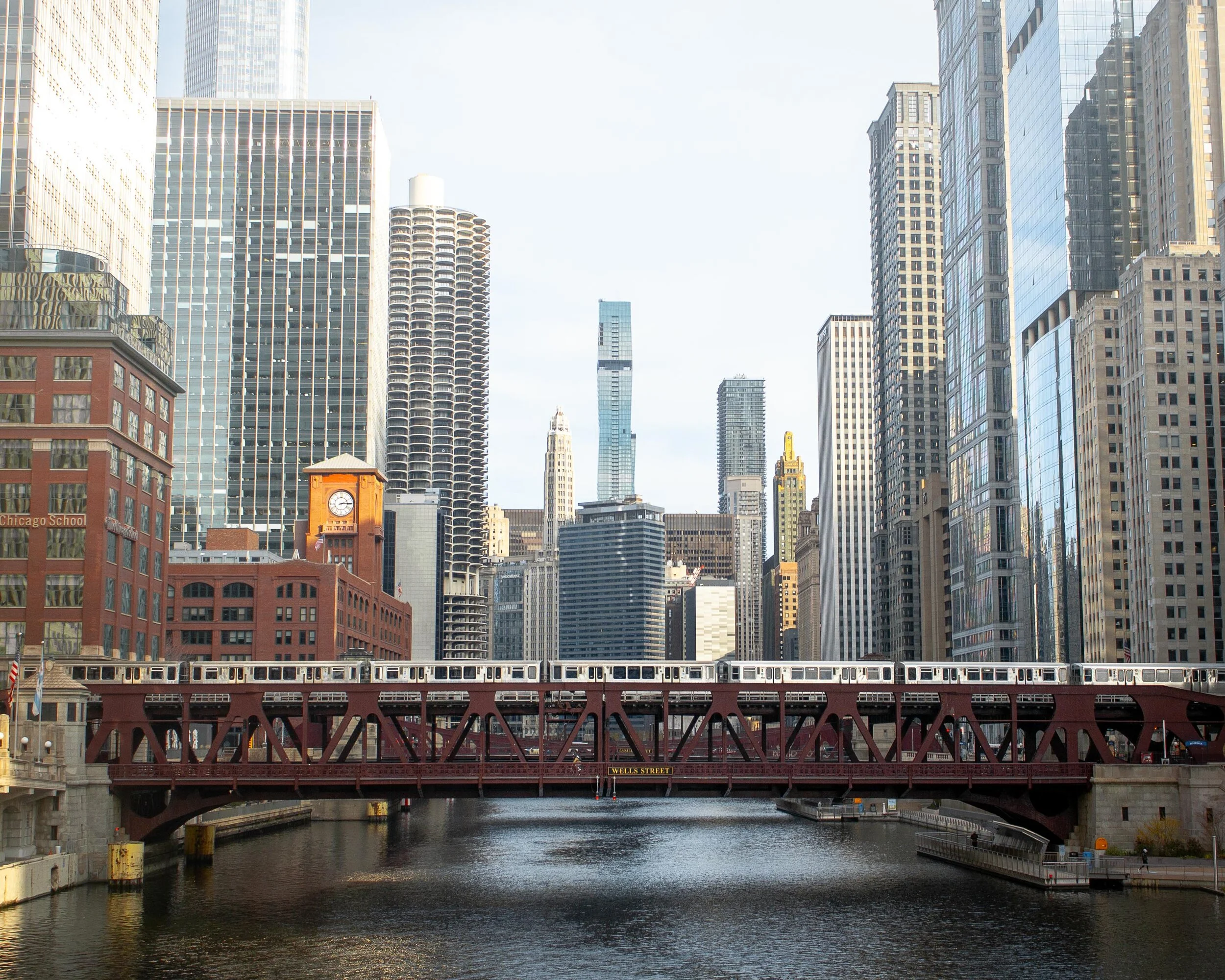
Downtown Chicago, IL
WELLS KINZIE GARAGE
One of my favorite parts of living in the city is finding unique angles to capture the famed ‘L’ train. There’s no better shot than the S-curve in the downtown loop.
Ride the elevator to the top of the Mart Parc Garage at the corner of Wells and Kinzie and watch the trains maneuver through the city’s infrastructure.
Remember: each level of the garage offers a different perspective of the tracks. Be sure to spend some time exploring to find what works best for you!
Fun Fact: In 2014, the “L” train was fourth in the nation for total route length at 102.8 miles.
Getting There: Brown and purple express lines to Merchandise Mart

‘L’ Train in Chicago, IL
437 N. ORLEANS
For the lesser-known view of the S-curve, head to the parking garage located at 437 N. Orleans. The top-level shows the trains as they head to/from the Merchandise Mart CTA station.
Located near the Orleans St. Bridge (above), this makes for a great day of chasing trains.
Pro Tip: For the symmetry enthusiasts, take note of the Assumption Catholic Church steeple against the red brick backdrop.
Fun Fact: The oldest sections of the “L” train began operations in 1892, making it the country’s second-oldest rapid transit system behind New York City’s elevated rail system.
Getting There: Brown or purple lines to Merchandise Mart

‘L’ Train as seen from 437 N. Orleans in Chicago
Need more ideas? Check out this list of curated tours!
PING TOM MEMORIAL PARK
This is the first park I visited after moving to Chicago and it remains at the top of my favorites.
Located in the Chinatown district, this is the perfect place to stock up on some warm buns and pastries, walk along the river, and shoot the city skyline. The boardwalk with the ornate rails helps to create some appealing leading lines.
Pro Tip: Ping Tom Memorial Park is commonly known as one of the best places to watch trains. Amtrak frequently crosses the bridge at the southern edge of the pathway while the CTA trains and freighters flank it to the east.
Fun Fact: This 17.4-acre park was originally the site of a Chicago and Western Indiana Railroad yard. The area began its transformation into a green space in 1998.
Getting There: Red line trains to Roosevelt or green line to Cermak-McCormick Place
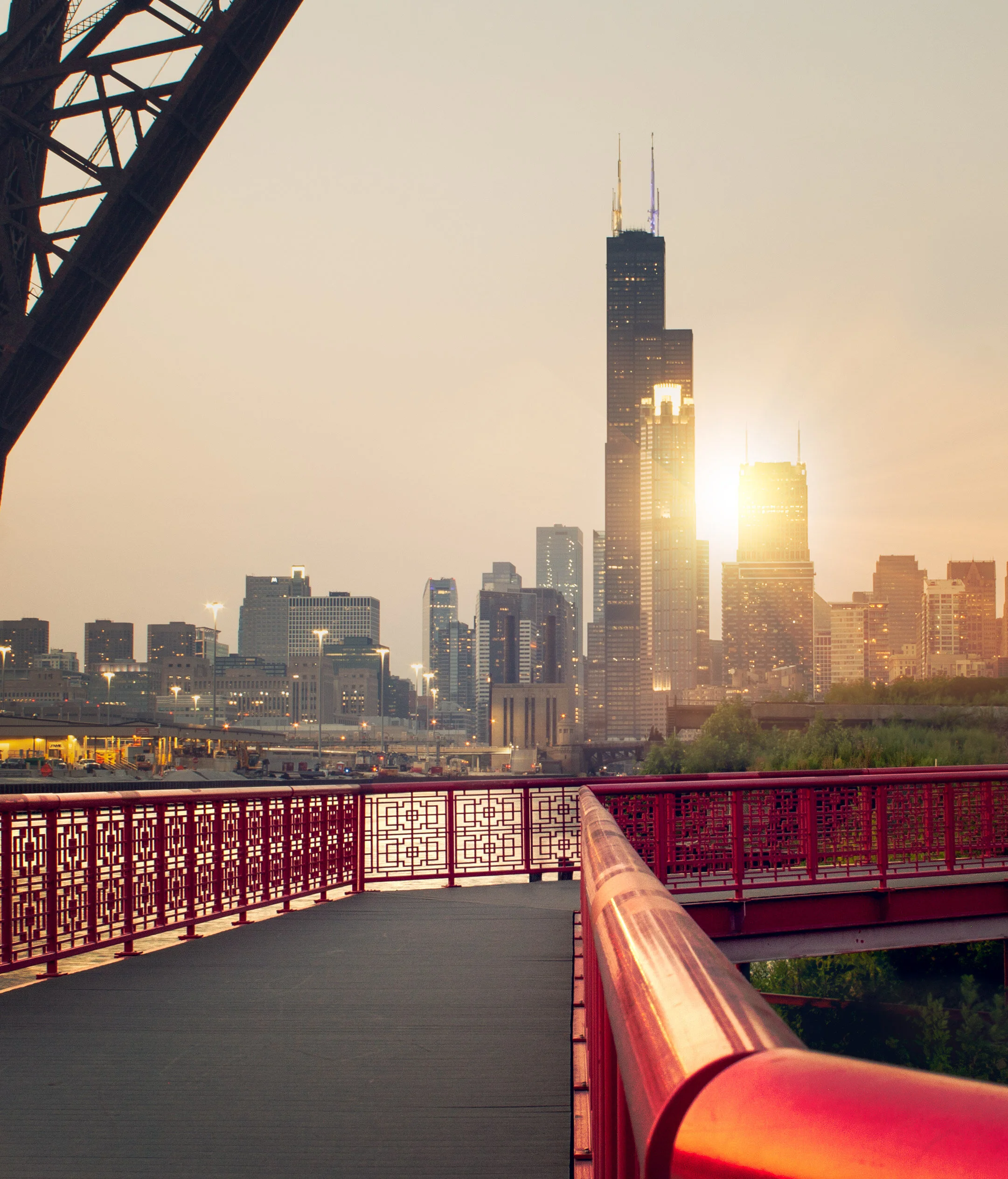
Downtown Chicago as seen from Ping Tom Memorial Park
18th STREET BRIDGE
Another spectacular city skyline view is on the 18th Street Bridge, located just above Ping Tom Memorial Park. Point the camera up the South Branch of the Chicago River and behold the Windy City in all its glory.
This is an especially great spot for nightscape photography.
Fun Fact: With a 1967 construction date, the 18th Street Bridge is one of the youngest in all of Chicago.
Getting There: Red line trains to Roosevelt or green line to Cermak-McCormick Place
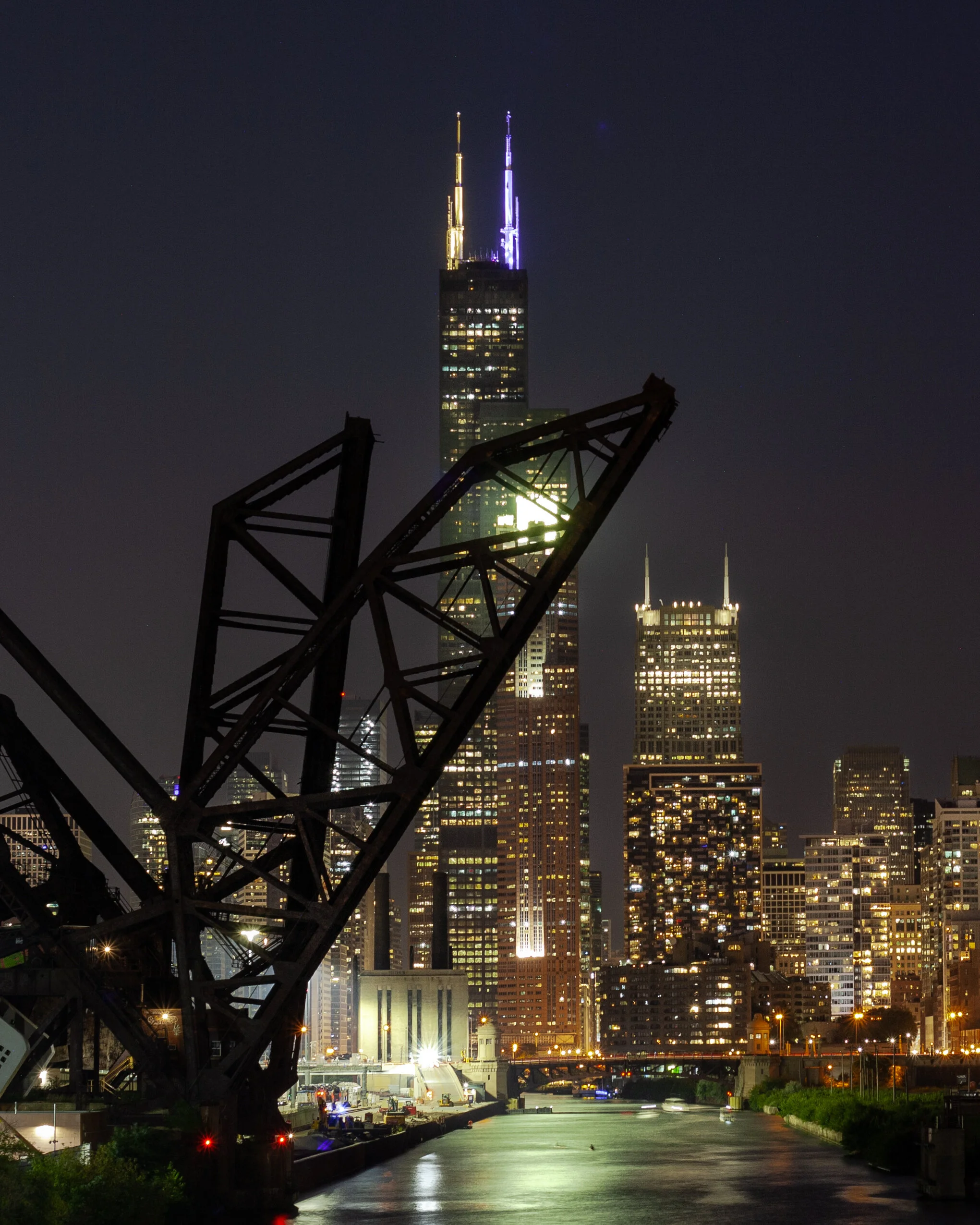
Chicago skyline as captured from the 18th street bridge in Chicago’s Chinatown
LINCOLN PARK BOARDWALK
The nature boardwalk at Lincoln Park makes for the perfect escape from the busy city streets. The pond is surrounded by prairie-style grass and is full of life with birds, frogs, and fish to name a few.
This is a great place to not only photograph the urban nature scene, but the John Hancock Building as well.
Pro Tip: Combine a visit here with North Ave Beach.
Fun Fact: The Nature Boardwalk acts as a living laboratory for the Urban Wildlife Institute in Chicago as they test new techniques to resolve human-wildlife conflict.
Getting There: Red, brown, or purple express line trains to Fullerton

Lincoln Park, Chicago
200 NORTH CLARK
In a massive city full of high rises, this is the place where you can see straight to the horizon and it feels as though the trains below are riding off into the sunset.
The reflective siding on the garage adds to the unique perspective and helps to create some stunning imagery.
Fun Fact: In 2016, the “L” train had 1,492 cars transporting passengers between 145 stations.
Getting There: Blue, green, pink, orange, brown, and purple express lines to Clark/Lake
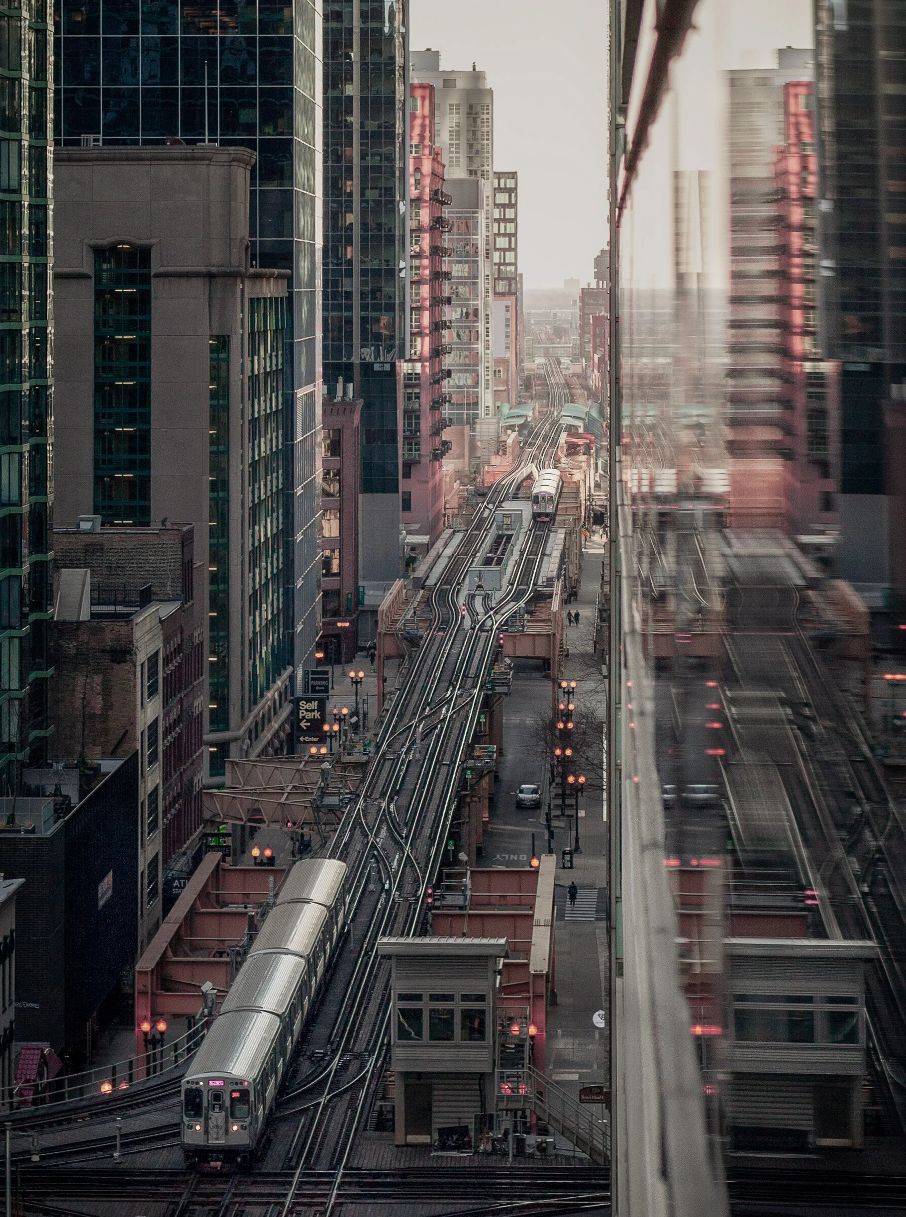
The view from the parking garage at 200 N. Clark St. in downtown Chicago
WABASH ARTS CORRIDOR
Commonly referred to as the “living urban canvas” because new pieces are being added on an annual basis, the Wabash Arts Corridor is a unique collection of colorful murals.
Stretching from as far north as Polk and as far south as Roosevelt, this is the perfect place to wander around with your camera. Be sure to check the website for more information, including a walking map of each masterpiece.
One of the most popular works is the Moose Bubblegum Bubble by artist Jacob Watts.
Pro-Tip: Start on the southern edge at Roosevelt and make your way north back into the city’s downtown loop.
Fun Fact: The Wabash Arts Corridor was founded in 2013 by Columbia College and continues to grow into being one of the largest, unique, and accessible art projects in the country.
Getting There: Red, orange, and green line trains to Roosevelt & walk north
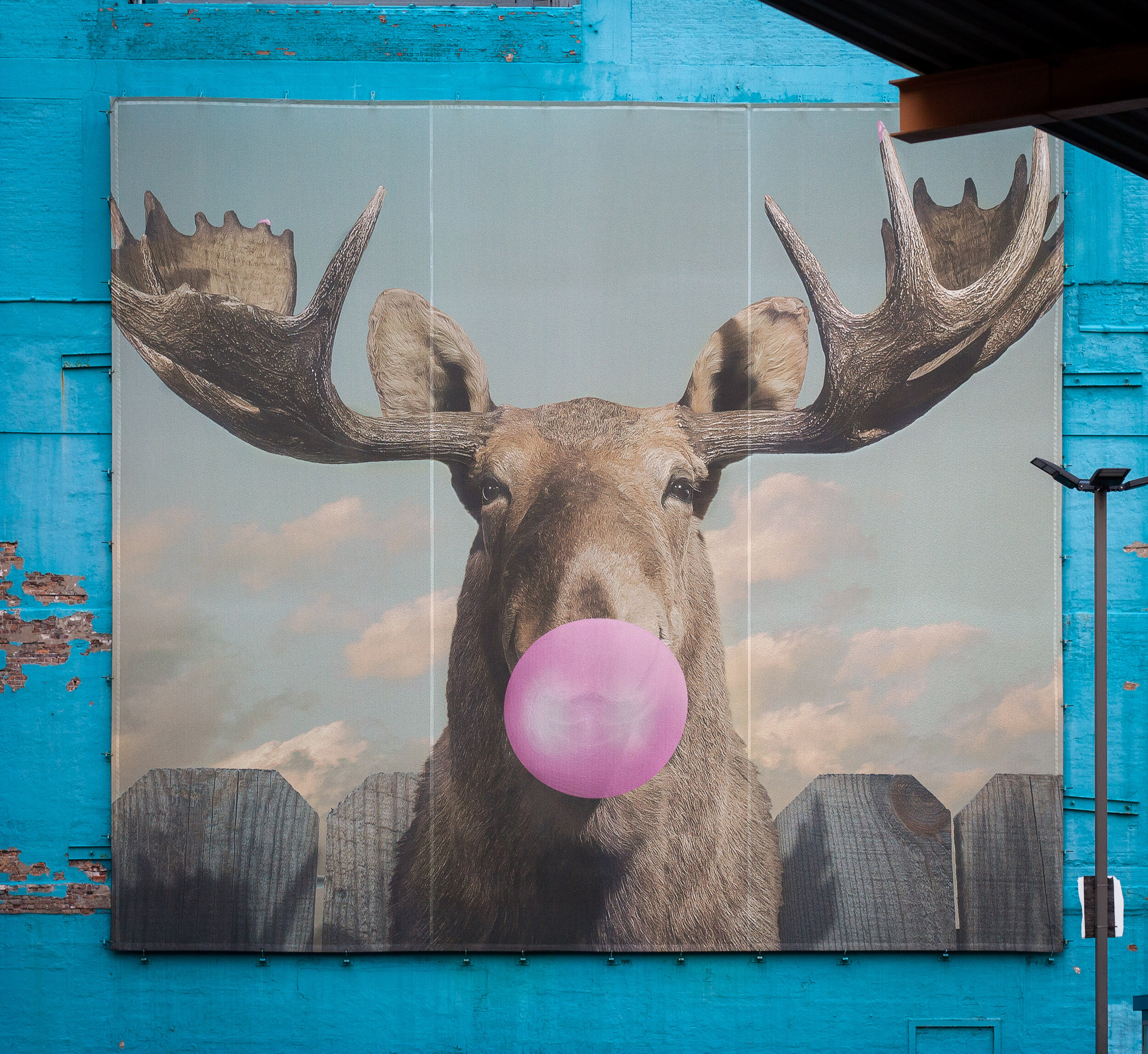
Moose Bubblegum Bubble mural by artist Jacob Watts
CHICAGO THEATER
Ok, you caught me. I can feel you rolling your eyes.
The vintage Chicago Theater sign isn’t exactly “off the beaten path”, but it does make for some pretty great long exposure shots and it’s a quick and easy stop on your tour of the city.
Fun Fact: The Chicago Theater was the first large movie palace in America and quickly became the prototype for all others. Constructed in a French Baroque style, look closely at the theater’s exterior to see if you can find the miniature Arc de Triomphe.
Getting There: Pink, green, brown, orange, and purple line express trains to State/Lake
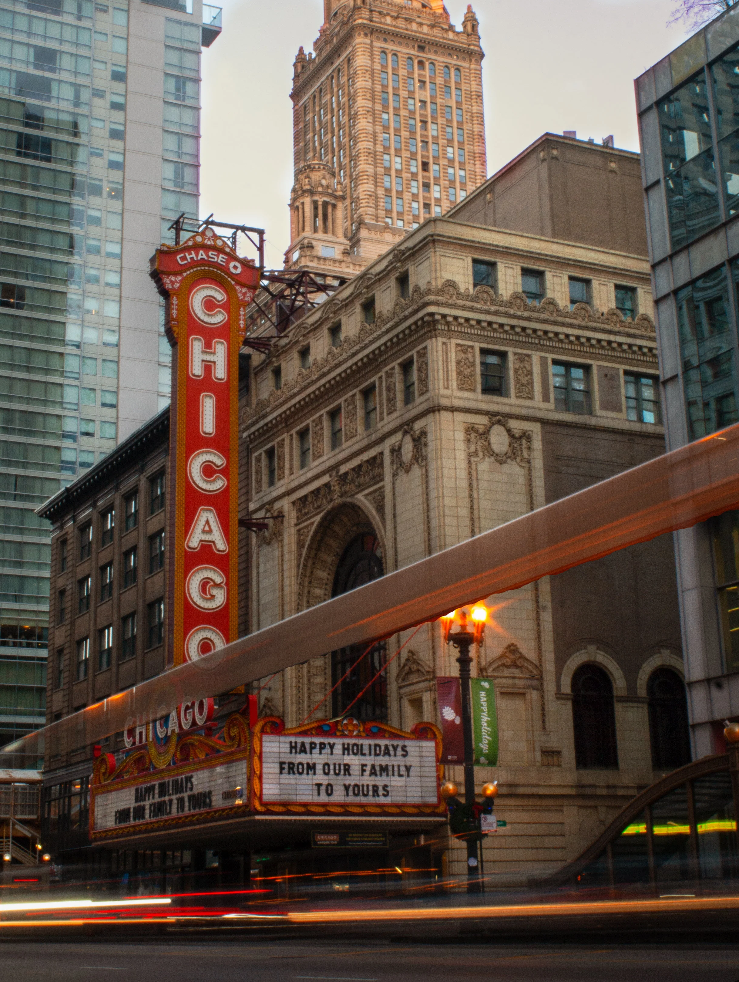
Chicago Theater standing tall in the downtown traffic

The Chicago Theater shines bright in the snow
The truth is you just need to come here yourself and wander around. Each neighborhood, train line, and person has something unique to offer!
Stay safe & happy travels.
Enjoy what you read? Pin this post for later!



The Ultimate Hiking Guide to Mississippi-Palisades State Park
With local travel the name of the game in 2020, it’s time to explore a little closer to home. With bluffs to climb, fall foliage to soak up, and expansive views of the Mississippi River, there’s every reason to visit Mississippi-Palisades State Park! Here’s everything you need to know…
Local travel is the name of the game in 2020 and with autumn in full bloom, it seemed like the perfect time to migrate away from the bustling streets of Chicago and into the woods to soak up all of the colorful glory.
My alarm rang far too early at 5 am, but it was well worth the sleepless night as I rolled into an empty Mississippi-Palisades State Park at the crack of dawn, nestled along the northern section of the great Mississippi River and complete with sweeping views of Iowa across the way.
Picnic areas, grassy fields, and overlooks are in abundance within the 2,500 acre National Natural Landmark, but the goal of the day was to explore the trails and gain some much-needed elevation (I’m still adjusting to living in the midwest — shout out to the Wasatch Mountains back in Utah).
Here’s everything you need to know about hiking in Mississippi-Palisades State Park:
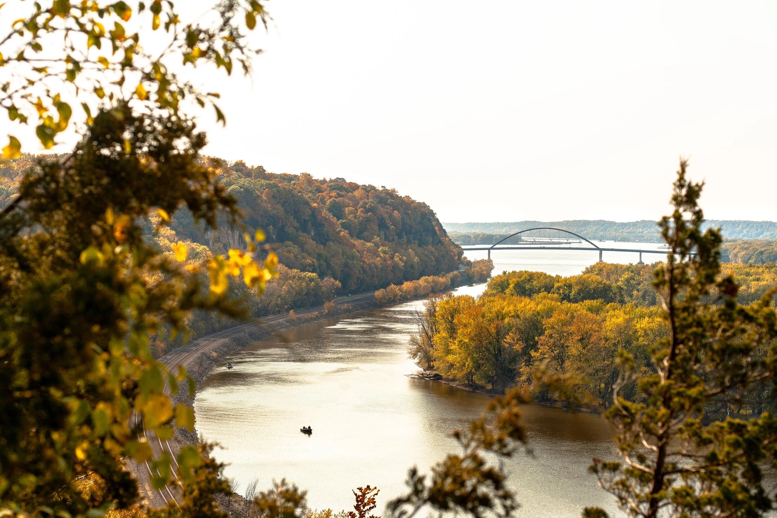
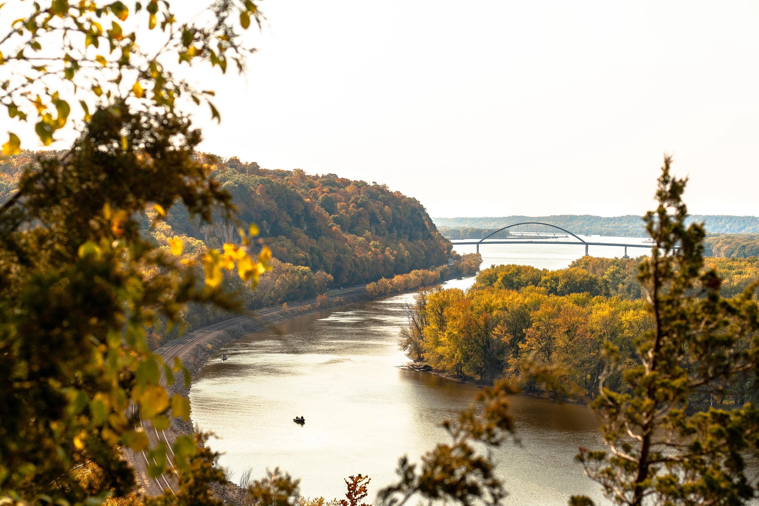
View of the Mississippi River as seen from the Sunset Trail at Mississippi-Palisades State Park
THE BASICS:
Location: Just north of Savanna, Illinois in Carroll County
Established: The park was founded in 1973
Trails: Hiking in the area is divided into the north and south systems, both containing 5 trails of their own for a cumulative 15-miles worth
Note: this post focuses on the southern trail system
Drive Time: 2 hours and 45 minutes from Chicago, depending on the time of day
Cost: FREE!
Facilities: Grills, gazebos, picnic areas, and restrooms can be found throughout the park
Why Mississippi-Palisades: The drive along the Great Northern Road as it pops in and out of small towns is just as stunning as the park itself, but there’s nothing quite like hiking up the bluffs and seeing the sweeping views above the Mississippi River in the peak of autumn
Difficulty: AllTrails rates this 4.6-mile multi-trail loop as ‘difficult’ due to a few sections of steeper terrain, but it’s a great combination of ascent, descent, and level ground. Plenty of families with young children were out and about
Great! Now that we’ve covered the basics, here’s how I spent my time wandering the southern trail system:
SUNSET TRAIL
I’d recommend starting with this trail as early as possible as the Lookout Point is by far the most popular overlook of the Mississippi River within the state park’s southern trail system. It’s here where you’ll soak up the sweeping views of the river and watch trains roll by below for as long as your heart desires.
The steepest part of the trail is departing from the parking lot as you climb the stairs and gain a quick chunk of elevation. Keep in mind that it’s a narrow, single-track dirt path with steep drop-offs to one side, so be on the lookout for other hikers and proceed with caution.
Once you reach the top of the bluff you’ll encounter a road that leads directly to the overlook. Do not head that way. Instead, cross over and continue on the trail. This winding path will take you down into a ravine thick with vegetation, complete with a wooden foot-bridge that’s set beneath a canopy of changing leaves.
As you make your way up and out of the trail’s low-point, you’ll stumble back onto the road and have the opportunity to scope the overlook. Pro tip: If it’s busy, continue south on the trail and you’ll find a separate, unofficial overlook with views downriver.

Sunset Trail in Mississippi-Palisades State Park
Don’t forget to pack these essentials!






SENTINEL TRAIL
Sentinel Trail is an easy 1.2-mile trail that is located directly across the road from the Sunset Trail, next to the picnic shelter and makes for a convenient second loop on the day.
As you cross the bridge and reach the fork, head left. This will take you up another set of wooden stairs and to a t-junction at which point you’ll choose left again. This will take you to an upper parking lot where you will pick up the less-trafficked Pine Trail.
After completing the short Pine Trail loop (see next section), head back up the Sentinel Trail path that led to the parking lot and continue straight past your previous left turn at the t-junction. This will take you back towards the Mississippi River and over to some last-minute views across the water before heading back down to the parking lot via stairs and narrow paths. Be sure to stop and check out some of the caves that have been carved into the side of the bluffs over the years!

Hiking through the narrow trails of Mississippi-Palisades State Park
PINE TRAIL
Pick up the Pine Trail once you’ve reached the upper parking lot after hiking part of the Sentinel. This was by far the least crowded path within the park, making it easy to avoid other hikers and find some serenity among the fall foliage.
After reaching yet another t-junction, head left. This will lead you out to a road in which you then follow to the right to pick up the trail again at the next parking lot.
As you start the ascent from the road you’ll immediately notice a gray spire affectionately known as The Sentinel. This is a popular rock climbing area so don’t be surprised if you run into some dare-devils as you make your way up to the next overlook before looping back into the woods and up to the Sentinel Trail.
In regards to peacefulness, fall foliage, and a great workout of ascending/descending paths, Pine Trail was the highlight of the day!

Fall foliage in Mississippi-Palisades State Park
There you have it; everything you need to know about hiking through Mississippi-Palisades State Park! The family-friendly area makes for a great day-trip from Chicago and it’s easy to turn it into a weekend getaway by continuing north along Route 84 up to Galena, a quaint town once home to Ulysses S. Grant.
Happy hiking!
Enjoy this post? Pin it for later!


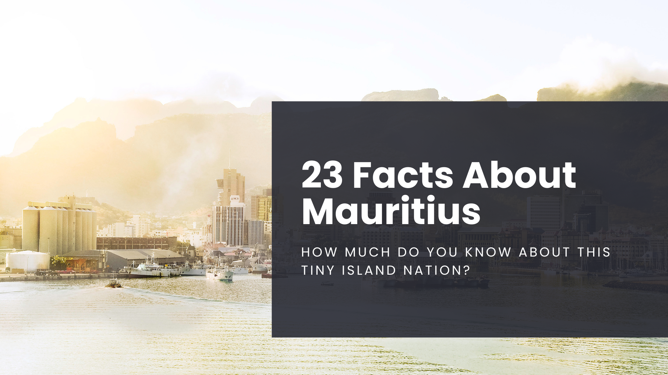
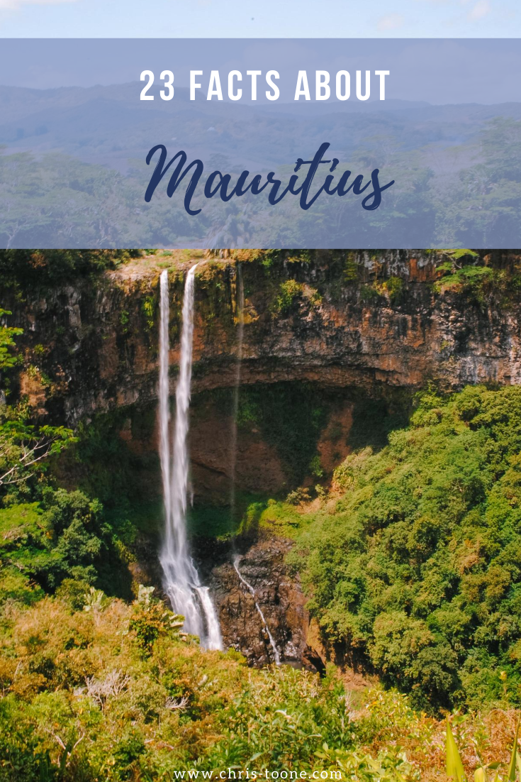
23 Facts About Mauritius: How much do you know about this tiny island nation?
From the Dodo bird inspiring a legendary children's novel to a multicolor landscape of volcanic dirt, how many of these facts do you know about the tiny island nation of Mauritius?
Mauritius is a country that has been on my mind a lot lately. As the world slips into the most politically and racially charged climate of my lifetime, I felt it important to highlight this tiny island nation because visiting here opened my eyes to a vital concept; acceptance.
This mindset is so ingrained in Mauritian way of life that the country is often referred to as a model for religious tolerance.
I’ll be the first to admit that as a 19-year-old traveling to this small slice of paradise off the coast of Madagascar with Semester at Sea, I knew next to nothing about the place.
So, other than what I just told you about their peaceful way of life, what about you? How much do you know about Mauritius?
Here are 23 facts to help paint a picture of what this country is all about; a beautiful picture at that!
1. The entire island of Mauritius is just 2040 square-kilometres
This makes it the world’s 181st largest nation in the world. The country is 45km wide and 65km long (CIA World Fact Book).
2. Mauritius is home to the Seven Colors of Earth
A popular tourist destination in Chamarel, these dunes of dirt contain a mix of colors that can be traced back to several volcanic eruptions, each that cooled at their own rate.

Seven Colors of the Earth | Mauritius
3. Three countries had control of the island prior to independence
The Netherlands ruled the land from 1638-1710 followed by France from 1715-1810. Surprise, surprise, in came the British in 1810 to take over and they remained in control of Mauritius until 1968.
4. More than 1.2 million people call this tiny nation home
This leads to a high population density. So high in fact that Mauritius has the highest of such in all of Africa.
5. Mauritius is the only African nation with Hinduism as the dominant religion
The country is 26.3% Roman Catholic, 17.3% Muslim, and 48.5% Hindu.
6. English and French are the most popular languages
You won’t find an official language for the country, but plenty of local Mauritians speak a form of Creole.
7. Mauritius’ flag is made up of four “bands”
Red represents the bloodshed for abolishing slavery and obtaining independence, blue for the vast Indian Ocean, yellow for the bright and shining future that lay ahead, while green symbolizes the lush green vegetation found throughout the island.
8. Mauritius was one of four countries around the world that were NOT engaged in domestic or international conflicts in 2017
Peace, tolerance and acceptance. It’s a concoction that works.
9. Even Mark Twain was rendered speechless by the island’s beauty
“Mauritius was made first and then heaven, and heaven was copied after Mauritius.”

Chamarel Falls, Mauritius
10. The Dodo Bird reigns supreme
Well… not really. The exotic flightless bird is now extinct, but Mauritius was the only known habitat. Due to the island’s lack of predators, the bird eventually lost it’s ability to fly.
11. Mauritius is a proud possessor of the UN Development Programs highest Human Development Index in all of Africa
Between 1990 and 2018, the country’s Human Development Index (HDI) increased from 0.620 to 0.796. The country is currently ranked 66th in the entire world and highest amongst the African continent.
12. More than 1.36 million visitors step foot onto the island each year
This figure significantly outnumbers the local Mauritian population.
13. Mauritius is a volcanic island that first rose 8 million years ago
14. The country does not maintain a standing army
Starting the see the peaceful mindset theme?
15. Port Louis is home to 40% of the population
This capital city was established back in 1736 by the French East Indian Company.

Port Louis, Mauritius
16. It’s widely believed that a stuffed Dodo Bird at the Oxford University Museum of Natural History inspired Lewis Carroll to write Alice in Wonderland
Thank you, Dodo bird.
17. Sugarcane is grown on around 90% of cultivated land in Mauritius
Other major land use includes tea, corn, potatoes, bananas, cattle and goats.
18. Black River Gorges National Park is home to one of the world’s rarest birds
Bird watchers worldwide flock here for a chance to spot the Mauritian Pink Pigeon.

Black River Gorge from above | Mauritius
19. The La Vanille Nature Park boasts an expansive collection of captive-bred giant Aldabra tortoises
The numbers stretch into the thousands and it’s a popular stopping point amongst visitors.

Giant Tortoise | Mauritius
20. Local cuisine is a tasty blend of Creole, Indian, Chinese, and French
Let your imagination (and taste buds) run wild.
21. The Grand Bassin Lake, or Ganga Talao, is Mauritius’ most sacred pilgrimage site for Hindus
A statue of Shiva lives along the lake and Hindus travel here annually to pay their respects.

Grand Bassin Lake, Mauritius
22. Sir Seewoosagur Ramgoolam Botanical Garden is the oldest in the Southern Hemisphere
23. Mauritius has received the World’s Leading Island Destination award not one, not two, but THREE times in the past decade
Between the exotic wildlife, lush mountains, and stunning beaches, it’s actually a mystery as to why they haven’t won it more.
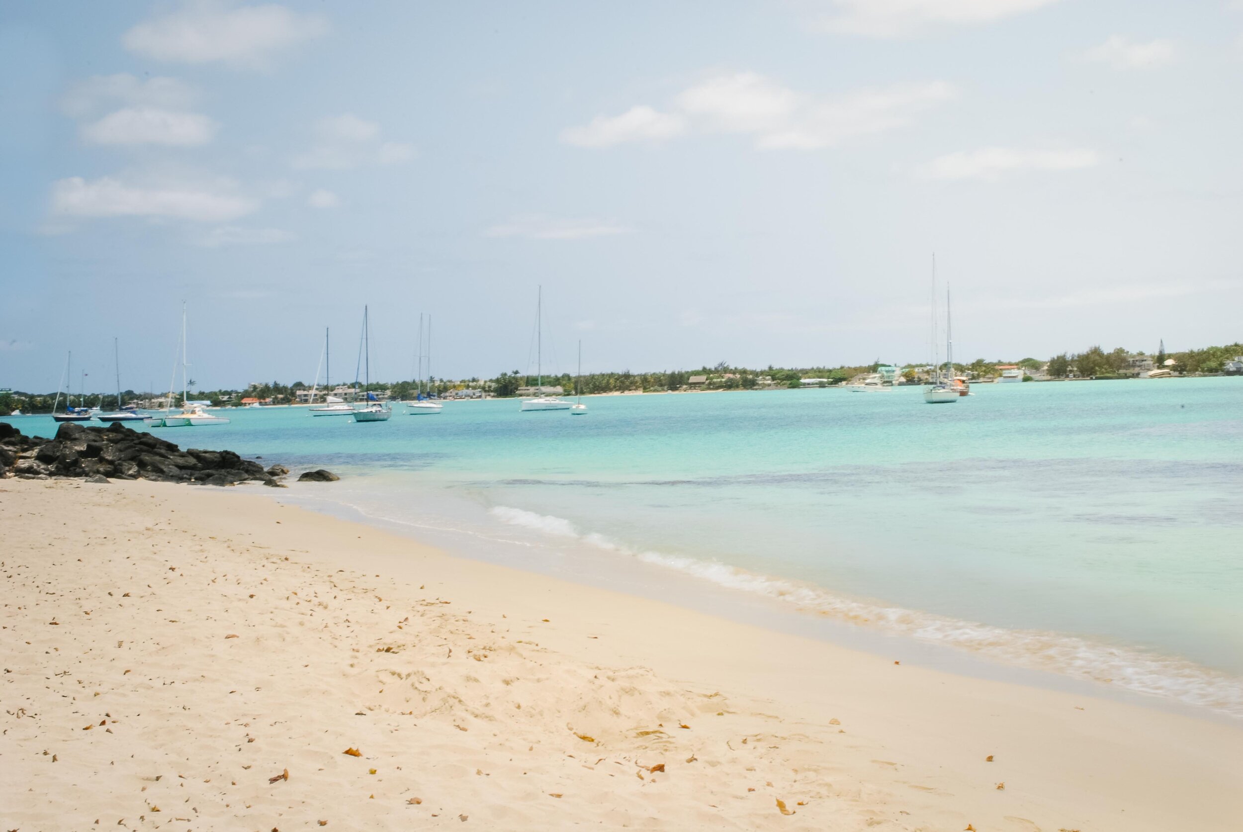
Grand Baie, Mauritius
Ready to plan your trip?
Check out these hand-picked tours!
Enjoy what you read? Pin it for later!




3 must-do day trips to take from Accra, Ghana
Ghana's capital city certainly has plenty to offer as is, but don't overlook the country's rich culture, natural beauty, and storied past. Here are 3 must-do day trips to take the next time you find yourself in Accra!
Please note: This post has been updated as of December 2023
A city of over 1.5 million people, Ghana’s capital of Accra certainly has plenty to do as is, but don’t let that stop you from seeing more! Step outside of the hustle and bustle to unlock the natural beauty, rich culture, and storied past of this West African nation.
Whether a short stay or part of a weeks long Ghana itinerary, here are 3 must-do day trips to take the next time you find yourself visiting Accra!
Kakum National Park
Located 170km from Accra along Ghana’s southern coast, Kakum National Park is home to 360 square-kilometers of the country’s rapidly receding rainforest and protects several endangered species such as the forest elephant, bongo antelope and more.
The park itself was established in 1992 and has since seen steady growth. Ghanaians and foreigners alike come from all around to hike through the butterfly-rich forest, birdwatch along the SunBird Trail and, most frequently, experience the famed canopy walkway (one of three on the African continent).
Suspended 30m above the forest floor, the 7 suspended bridges span a length of over 330m, zig-zagging between the trees along the way. It’s certainly not for the faint of heart as the precariously placed single planks of wood that separate you from plummeting to the ground seem suspiciously unstable, but rest assured it’s perfectly safe.
However you decide to experience Kakum National Park, trained guides are available every step of the way to help spot wildlife, discuss the environmental and economic impact of the area, as well as explain local medicinal purposes of the flora and fauna.
Once exhausted from a day of exploration, the visitors area at the main entrance offers a relaxing atmosphere amongst educational exhibits and the Rainforest Cafe, a place to rest your weary legs and enjoy a refreshing beverage. The cafe sources fresh produce and ingredients from the surrounding communities, so a meal here not only supports the national park but local farmers as well.
Not ready to leave? Kakum National Park offers several overnight accommodations from the primitive Afrafranto Campground (equipment not included) to the comfortable onsite Rainforest Lodge, but for a unique experience book a night in the canopy treehouse and fall asleep to the sounds of the surrounding forest.

Walking along the swinging bridges of Kakum National Park in Ghana
Associated Fees with Kakum National Park’s Canopy Walkway
Standard entrance fee: 2 GHC per person
Canopy Walkway: 60 GHC for non-Ghanaian adult (not including tips)
Guided Hike (1 hour): 50 GHC for non-Ghanaian adult (not including tips)
Cost fluctuates based on nationality and age, as well as inflation. For a full breakdown, visit the official website
Kakum National Park’s Hours of Operation
The park gate is open daily from 8 am - 4 pm
If using park accommodation, arrangements can be made to arrive earlier/later as needed
How to get to Kakum National Park
Hop on a shared tro-tro from Kaneshie Station in Accra. Once in Cape Coast, hire a taxi the rest of the way
VIP Bus from Accra to Cape Coast before hiring a taxi
Arriving via rental car is possible as the drive is fairly straight-forward. Be cautious and consider hiring a private driver as traffic in Accra can be overwhelming and be prepared for tolls and police stops along the way

Kakum National Park in Ghana
Maranatha Beach Camp
Welcome to Maranatha Beach Camp, where the Volta River meets the Gulf of Guinea.
A short 2.5-hour drive east of Accra will land travelers in the small fishing town of Ada-Foah. Ask around enough and someone will inevitably be able to point you in the direction of the beach camp, located at the edge of town along a picturesque strip of sand that’s dotted with palm trees and thatched huts.
It’s one of the best places to kick back in a hammock and enjoy a cold beer, only breaking the cycle to cool off in the river. By day, time seemingly stands still but at night, the camp transforms into a local hangout with blaring music and a full dance floor.
The Maranatha Beach Camp was first established by a man named Winifred who saw a need for education within his community. By founding the guest house, he began using the profits to establish a nursery school on the beach. What was once an open-air shelter has since blossomed into a Government-supported and fully-enclosed school and to this day, profits from the beach camp continue to directly benefit the community. Upon arrival, you may be offered a tour of the community. Don’t shy away; it’s great to see where the money is going!
Looking to explore more of the area? The staff at Maranatha are well-connected and are more than happy to arrange a local fisherman to get you more acquainted with Volta Estuary. During one of my visits, we stopped at a local crocodile farm — something I never expected to find on an island in the middle of the river!

Maranatha Beach Camp from the water
Getting to Maranatha Beach Camp, Ghana:
The first step is to hop in a tro-tro from Accra to Ada-Foah (2.5hrs, but plan for longer), then there are two options:
Option 1: Find a motorbike willing to take you from Ada-Foah to Maranatha (ask around and don’t be afraid to negotiate the price)
Option 2: Give the beach camp a call and they will send a boat to meet you. Price is typically 30GHC per person for a one-way trip
If travel via tro-tro isn’t in your repertoire, then consider hiring a reliable taxi cab for the day to take you to/from Ada-Foah
Tips & Tricks for Visiting Maranatha Beach Camp:
The camp is a cash-only establishment and there is no way to get more. It’s important to plan ahead and overestimate what you’ll need. During one of my trips I had to ask the tro-tro to stop at an ATM on the way back to Accra so that I would be able to pay them because I had run out of money
The restaurant serves great food, but it may be difficult to find something that fits within a vegan diet, so come prepared with snacks if you’re staying for the day. Similar to the lack of ATMs, there are also no stores in the area
Contact Info:
Phone: (+233) 243528248
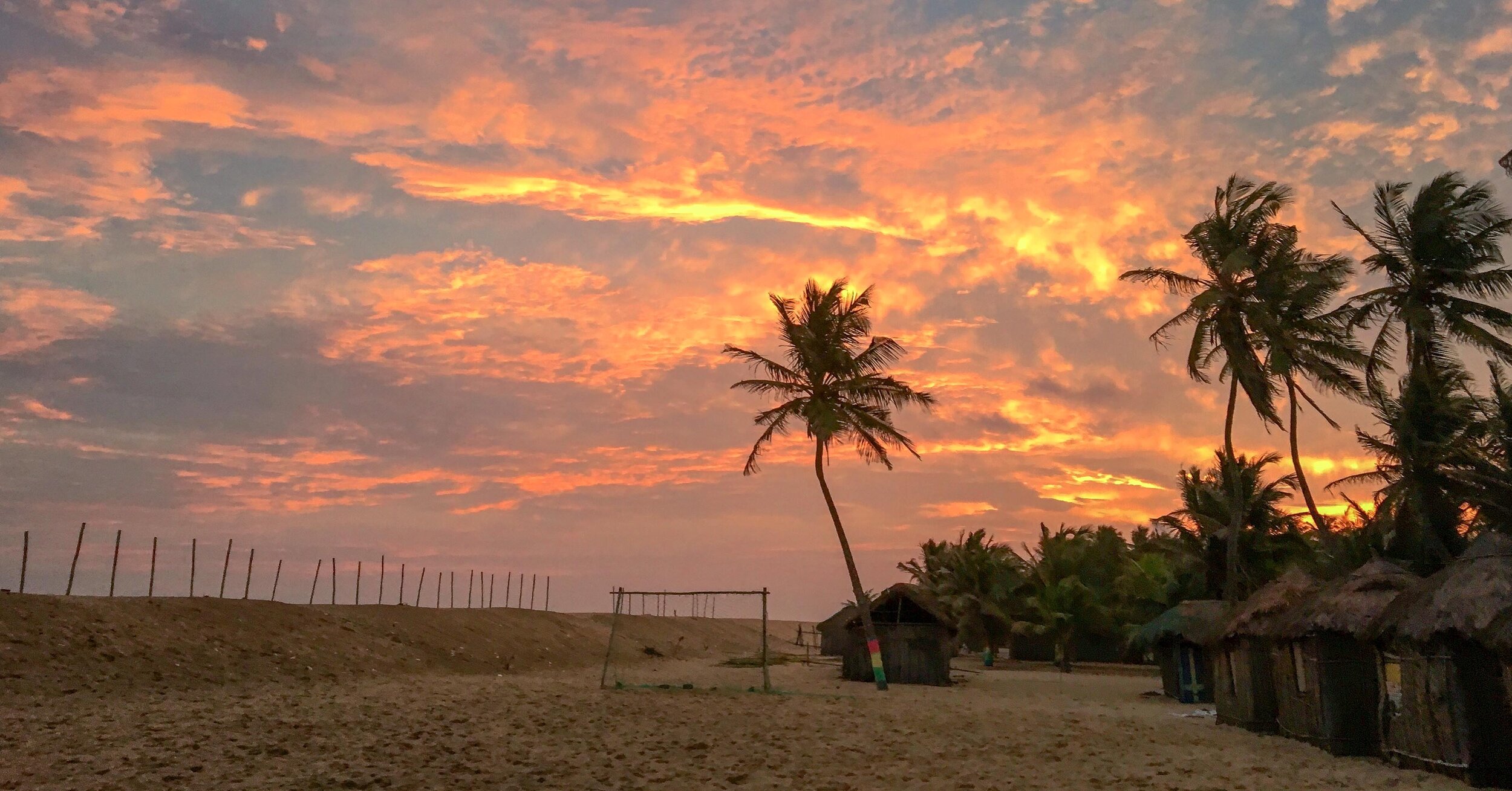
Sunset above the Maranatha Beach Camp
Cape Coast Castle
A visit to Cape Coast Castle certainly isn’t an experience that will leave you feeling happy and fulfilled, but it’s an important place to visit firsthand and will shed a heart-wrenching light on all that the Ghanaian people have been through.
This particular castle is just one of forty slave forts that were built along the Gold Coast of West Africa by European traders and, since being acquired by the Ghana Museums and Monuments Board, is widely touted as one the most restored and best maintained. It’s possible to visit Fort James back in Accra, but the prison is held under lock and key by the locals and is a far less informative experience.
At Cape Coast Castle, there is an eye-opening museum and guests have the chance to take a somber tour around the grounds. Step inside the damp dungeons underground that once housed up to 1,000 males and 500 females in separate rooms and feel a shiver down your spine as the tour guide slowly closes the door and total darkness descends upon the room. It’s an out-of-body-experience I’ll never soon forget.
As if stepping foot inside the dungeons isn’t heavy enough, the tour culminates by leading visitors through the “Door of No Return.” The exact hole in the fort’s exterior in which slaves once marched through before boarding ships bound for the New World. For the estimated 15% of the 12 million slaves thought to have died at sea, this door not only embodies their final steps on their homeland but also on this Earth.
It’s an emotional experience to be a part of, but I promise that you will have a much deeper connection to the people and culture of Ghana. It’s important to confront the terrible past to truly understand how far things have come. Some of the most positive and resilient people I’ve ever met have been during my travels through this beautiful West African nation.

Inside Cape Coast Castle, looking towards the path that leads to the “Door of No Return”
Associated Fees with Cape Coast Castle:
40 GHC for adult foreigners which includes entry into the museum and a guided tour
Cape Coast Castle’s Hours of Operation:
Open daily from 9 am-5 pm
Getting to Cape Coast Castle:
Take a local tro-tro to Cape Coast before flagging down a taxi to drive the rest of the way. Expect a 3-4 hour trip if using local transportation
Hire a private car or taxi for the day to make the 127km trip from Accra

Relics of the former life of Cape Coast Castle are now on display for visitors
Bonus: Aburi Botanical Gardens
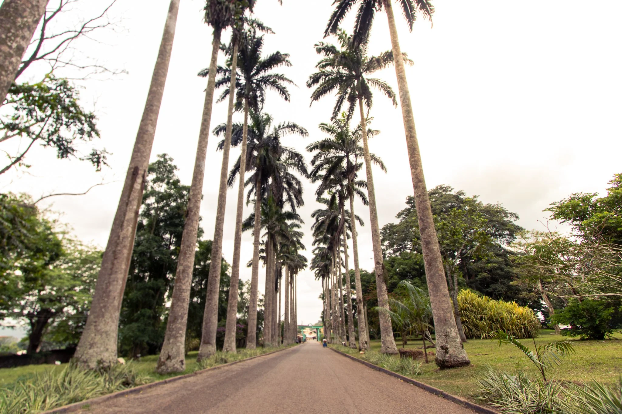
Located about one hour into the mountains above Accra, the gardens offers easy access to Ghana’s incredible nature. Spend an afternoon lounging in the park, escaping the heat and chaos of the city below.
Sound interesting? Check out my full guide to visiting the Aburi Botanical Gardens.
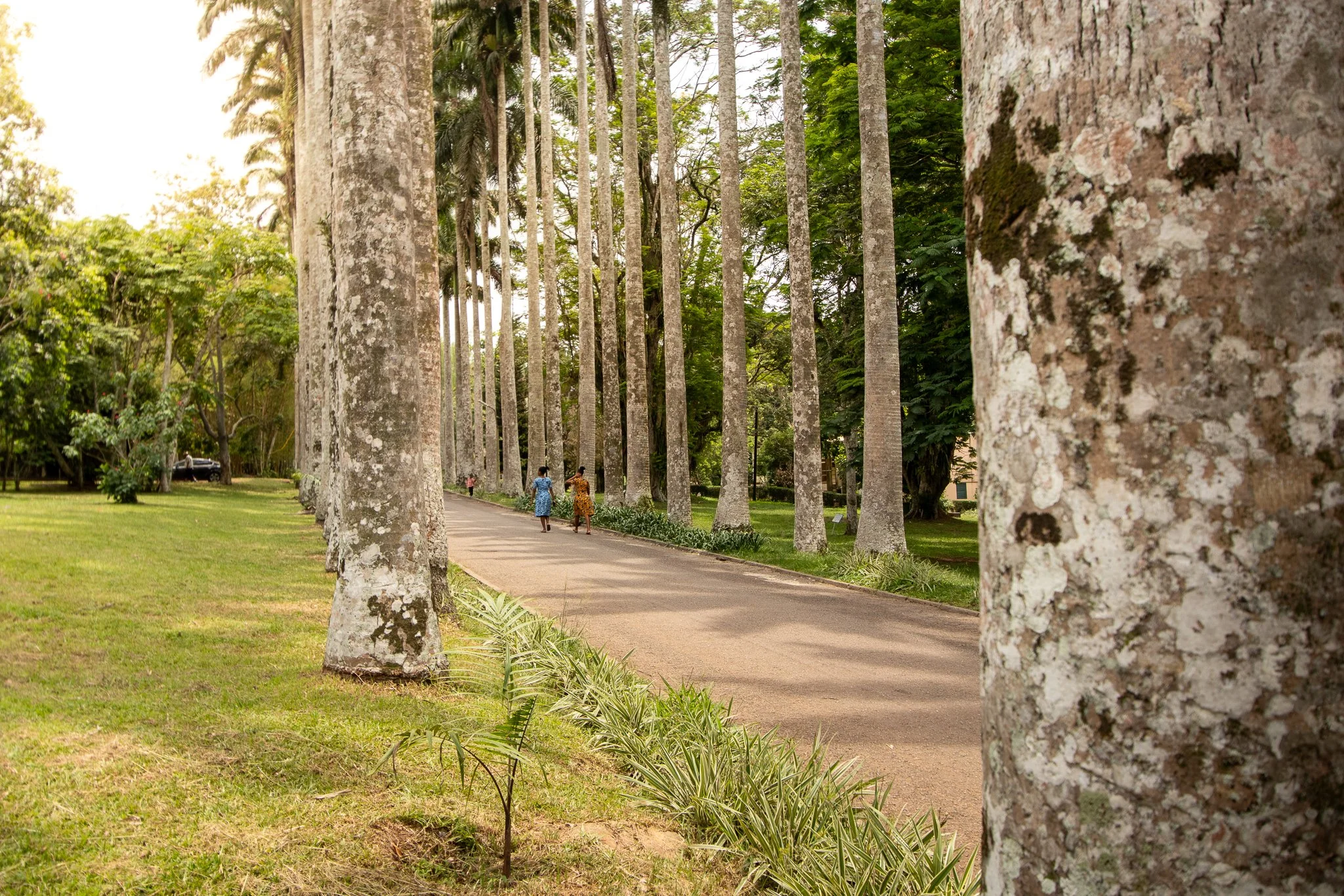
Visitors walk along the famed Avenue of Royal Palms at Aburi’s Botanical Gardens
Wherever you go in Ghana and whatever you do, just remember that there is so much more to the country than what Accra has to offer! Travel farther, expand your mind, and experience something new.
Have you been to Ghana before? What were some of your favorite parts? Let me know in the comments below!
Find this post helpful? Pin it and save it for later!




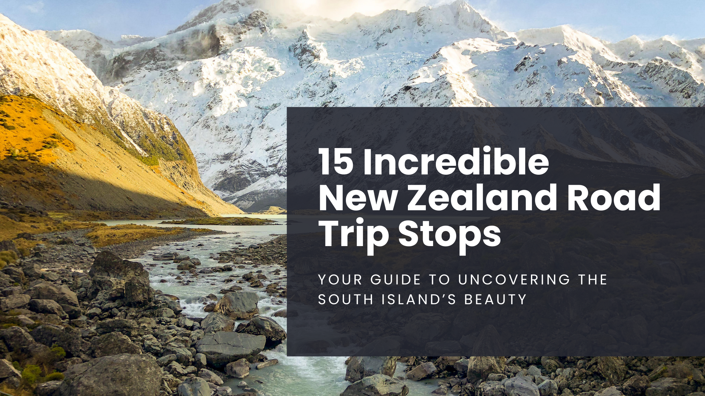
15 Incredible New Zealand Road Trip Stops: Your guide to uncovering the South Island's beauty
From Queenstown to the Milford Sound, New Zealand has plenty of natural beauty to offer, but what should you make time for during your trip? Here’s your guide to discovering 15 of the best road trip stops around the south island… you won’t be disappointed!
Please note: This post has been updated as of December 2023
New Zealand might seem like a blip on the map, but it is far more expansive than it appears.
The diversity of landscapes is unparalleled to anything I’ve ever encountered and with so much to offer, it can be overwhelming when attempting to narrow down what to see and where to go.
That’s certainly how I felt when my girlfriend and I planned a New Zealand road trip of our own last year.
So, I thought I’d throw together a short guide to unlocking the immense beauty that the south island holds. Here are 15 of the best road trip stops in New Zealand!
1. QUEENSTOWN
An adrenaline junkie’s heaven, Queenstown is situated on the shores of Lake Wakatipu and sits in the shadows of the famed Remarkable mountain range.
The raw beauty alone makes this stop worthwhile, but there’s plenty to do beyond staring at the surrounding mountainscape.
Strap yourself to the world’s first bungee jump and plummet 43 meters off of the Kawarau Bridge. or ride the Queenstown Gondola up to Skyline, a collection of restaurants, shops, and the most scenic zip-lining experience you’re likely to ever have. It’s also a perfect spot to observe the spectacular sunrise!

View from Queenstown Skyline
2. MOERAKI BOULDERS
The Moeraki Boulders are most easily described as unusual spherical rocks that dot the shoreline of Koekohe Beach along the south island’s Otago Coast.
Although formed through erosion of the adjacent coastal cliffs, Maori legend states that the boulders are remains of calabashes and eel baskets that washed ashore after the Araiteuru, a legendary canoe, capsized nearby.
Located 30min south of Oamaru, it makes for an easy day trip. Just be sure to visit during low tide, otherwise, the boulders become submerged in the South Pacific Ocean as the beach vanishes under the incoming water!
3. SLOPE POINT
The Catlins continues to be the hidden gem of the south island and here is where you will find Slope Point, the southernmost tip of New Zealand.
Once you’ve finished this short, albeit windy, walk out to the signpost, you’ll be standing closer to Antarctica than the equator, a pretty surreal experience if I’m being honest.
It takes less than an hour, is family-friendly and makes for a quick excursion along your road trip through the southern corridor of the island… just remember to pack a windbreaker!

Walk to Slope Point
4. PUNAKAIKI PANCAKE ROCKS
Hidden along the west coast is Punakaiki, best known for a collection of pancake rocks and blowholes that jut out into the Tasman Sea.
To get up close and personal with these 30 million-year-old limestone formations, take the short walking track that’s located across the highway from the visitors center.
Punakaiki is also the gateway to Paparoa National Park, so there are plenty of other activities in the area such as horseback riding, hiking, glow worm cave explorations, and more!

Punakaiki Pancake Rocks
5. HOKITIKA GLOW WORM DELL
Punakaiki is a great place to visit for a guided tour of the famous glow worms, but if your luck hasn’t panned out, be sure to make a quick stop in Hokitika.
Located along the side of the highway, the Hokitika Glow Worm Dell requires a 2 minute, family-friendly walk that’s well worth the small effort. Once the sun goes down, the walls of the forest light up with these luminescent creatures!
The best part? It’s completely free!
6. OAMARU BLUE PENGUIN COLONY
New Zealand prides itself on natural beauty and diverse wildlife, and the seaside town of Oamaru is no different.
It’s here you will find the Blue Penguin Colony, complete with nesting habitats and a grandstand for visitors to watch as the penguins make their return home from a long day at sea.
A visit is certainly not the cheapest of things to do (NZD 43 for general admission to the evening show), but to witness these creatures in their natural habitat is truly something special!
7. AORAKI NATIONAL PARK
Rising to over 3,700 meters, Mt. Cook is New Zealand’s largest peak and can be reached by visiting the sprawling Aoraki National Park.
Although the Hooker Valley Track is by far the most popular and easily accessible (and also leads to a glacier-filled lake in the winter months), there are plenty of other hikes to try as well.
Need to get your altitude fix in? Change things up and hop on a flight with nearby Lake Tekapo Air Safaris to view the landscape from above. Not that I didn’t already appreciate all that New Zealand has to offer, but being able to witness the expanse from the sky was a profound experience that I’ll never forget!

Hooker Valley Trek in Aoraki National Park
8. LAKE TEKAPO
Located just under an hour from Aoraki National Park sits the town of Tekapo, on the shores of… you guessed it… Lake Tekapo.
This tiny community packs a punch as the turquoise waters competing for your attention with the views of the Southern Alps across the horizon.
Make sure to visit the Church of the Good Shepherd, a small stone sanctuary that looks out over the water or stay the night and stare in awe of the expansive starry sky, taking full advantage of Tekapo’s distinction as an International Dark Sky Reserve. It will blow your mind, I promise!

Lake Tekapo as seen from Mt. John Observatory
9. CHRISTCHURCH
If not arriving through Queenstown, Christchurch will likely be your point of entry.
Do yourself a favor and set aside time to explore the town before starting your road trip as there’s plenty to do and see!
Take a jaunt through the Christchurch Botanical Gardens (NZD 25) or enjoy the surrounding scenery as you have a bite to eat aboard the Tramway Restaurant.
10. KAIKOURA
The sleepy seaside town of Kaikoura is located at the base of the Kaikoura mountain range and along the coast of the South Pacific Ocean.
It’s best known for having its own resident sperm whale population, making it the ideal spot to get out on the water with a whale watching tour.
Not confident in your sea legs? That’s ok! Take a stroll along the Kaikoura Peninsula Walkway and spot the colony of fur seals that reside on the nearby rocks.
With the mountains, sea and an abundance of wildlife, this is a road trip stop you won’t want to miss!

Dolphins in Kaikoura, New Zealand
11. FIORDLAND NATIONAL PARK
Also known as Te Wahipounamu, or “the place of greenstone,” Fiordland National Park can be found in the southwestern corner of the island.
With over 500km of trails, this slice of mountainous paradise offers hikers the chance to explore some of the most dramatic landscapes in all of the world. It’s so stunning that the park itself was listed as a UNESCO World Heritage Site in 1990.
Three of New Zealand’s Great Walks can also be found here: the Milford Track, the Kepler Track, and the Routeburn.
Here’s the moral of the story: Don’t just cruise in and out to visit the Milford or Doubtful Sounds, make sure you take some time to experience all that it has to offer!

Fiordland National Park
12. LAKE OHAU
It’s certainly not as popular as nearby Lake Pukaki or Lake Tekapo, but that doesn’t mean you should pass it by!
This off-the-beaten-path location is the perfect stop for a mini hideaway and offers the chance to ski at the Ohau Snow Fields or ride a section of the Alps 2 Ocean Cycle Trail. Be sure to say hi to Mike and Louise, the longtime owners and operators of the Lake Ohau Lodge and a friendly bunch, to say the least.
The drive through the McKenzie High Country to reach this remote location is worth it in its own right as the trademark yellow and orange hues of the fields sit in the shadows of the Southern Alps. The raw beauty here is truly unrivaled.
13. ABEL TASMAN NATIONAL PARK
Rainforests, waterfalls, golden beaches, and the beautiful ocean. Do you need me to name more reasons as to why you should swing by Abel Tasman National Park during your road trip? Although it’s New Zealand’s smallest national park, there are plenty of adventures to be had.
Low on time but still want to get out and stretch the legs? Take the short walk through the lush forest, over the swinging bridges, and up to Wainui Falls.
The hike is suitable for the entire family and, depending on impromptu stops along the way, should take just over an hour to complete.
We didn’t have long here during our travels, but the waterfall-rich forests seemingly colliding with the ocean made me feel as though I had truly discovered paradise.
14. WANAKA
This lakefront town is full of shops, restaurants, and cafes along the main road, providing a healthy dose of social interaction!
Here is where you will find That Wanaka Tree. It is what it sounds like, a tree in Lake Wanaka, and is one of the most popular things to photograph around town.
Wanaka also serves as the perfect home base to hike up to Roys Peak for stunning views towards Mt. Aspiring National Park. As popular as the trail is, it’s not the easiest of workouts, so make sure to do your research and plan accordingly.
Visiting in the winter months? Make some turns at the Treble Cone or Cardrona ski areas!
Much like Queenstown, Wanaka certainly opens the door to a seemingly endless amount of adventures.

Skiing at Treble Cone
15. MILFORD SOUND
Widely touted as New Zealand’s most spectacular attraction, Milford Sound is truly a sight to behold.
Hop on a cruise and get up close and personal with hundreds of waterfalls as they cascade down from the peaks above, or book a kayaking tour for a more serene experience.
We were lucky in that our visit coincided with a recent rainstorm that filled the waterfalls to max capacity and left a layer of clouds that slowly glided between the fiords.
It’s easy to hop on a fully-planned tour from nearby Queenstown, so there’s no reason to not visit this remote part of the country!

Milford Sound
Although I highly recommend these 15 stops based on my adventures, it’s important to note that New Zealand is full of less-traveled nooks and crannies, so be sure to improvise a bit on your road trip. After all, you never know what’s right around the corner until you check it out yourself.
Cheers to a great adventure ahead! Have you traveled through New Zealand’s south island before? What are some spots I should visit the next time I go? Let me know in the comments below and as always, stay safe & happy travels!
Pin this post!



7 Apps That Will Change The Way You Travel
From offline maps to easy translations and guided walks, check out these 7 apps that I guarantee will elevate your travel game!

Please note: This post was updated as of December 2023
It’s not as if smartphones invented travel, however, they have drastically changed the way in which we go about wandering the world. From booking itineraries to audio guides and even foreign communication, it’s entirely possible that everything you need - and even what you don’t need - can be done from the palm of your hand.
Although I’m not in any way, shape, or form suggesting that travelers should rely solely on their mobile device, there are a few apps floating around that help to enhance the travel experience, rather than control it. Here’s some 5-star advice from your favorite 3-star travel blogger!
Skip to app:
* Note to readers: This is NOT a sponsored post. All opinions are my own.
1. ALLTRAILS
In short, AllTrails utilizes a database of over 100,000 hikes to provide users with everything needed in order to get out and hit the trails.
I constantly find myself on the app while at home, scrolling through hikes like it’s Instagram (but much more productive, of course), however, it has also proved invaluable while traveling abroad and I am a huge fan of what it has to offer.
Most recently, AllTrails became my best friend while exploring Panama. I’m all for “getting lost” in the jungle, but I certainly felt a lot more comfortable being able to track my little blue dot along with the interactive trail maps.
Sign up is free so if you plan to explore the great outdoors during your travels, this is a must-have resource!
Keep in mind that the database is built from user interaction, so although a rarity, information can sometimes be slightly inaccurate or minimal.
Be sure to pay it forward and review your own adventures so others can have a great experience as well!
Apple users get it here.
Android users get it here.


AllTrails features including a trail overview, explore map, and interactive tracking
2. DUOLINGO
Although Duolingo touts itself as “the world’s best way to learn a language,” some people swear by it while others despise it, as is the case with most things I suppose.
When beginning a new language, you’ll find that the lessons are built for long term language comprehension through a guided curriculum, however, I’ve found it to have short term value as well.
The app includes 35 languages for English speakers, including the likes of Klingon and High Valyrian if you’re really looking to impress a date. Track me down on a transatlantic flight and you can surely bet I’ll be studying up on whatever language I’ll be greeted with when the wheels touch down.
At the very least, the lessons have significantly helped me to identify useful words, recognize key conversational phrases, and more.
Learn the basics with Duolingo and then put the rest of the puzzle together during your travels!
Apple users get it here.
Android users get it here.
3. GOOGLE TRANSLATE
Do you get frustrated when you can’t read a menu? What about when you’re not sure if a building is a restaurant or a day spa?
It’s ok. We’ve all been there. That’s where Google Translate comes in handy!
The app has gone through some significant transformations in the past few years and now allows users to translate in a few different ways: text, instant camera (just point your camera and read), photos (the app will scan a photo and translate accordingly), or even conversations on the fly.
No more trying to type out what it says on the bathroom door when you’ve really got to go; just point your camera and get down to business!
Don’t get me wrong, playing charades and trying to communicate in a foreign culture is one of my favorite things I get to do while traveling, but sometimes you just need help and that’s where Google Translate quickly becomes a saving grace whether you’re lost or trying to console a fellow hangry traveler.
Apple users get it here.
Android users get it here.
4. MAPS.ME
Shortly after booking a rental car in South Korea, I realized that I had no idea how to get from point A to point B. “Ah, no problem,” I thought, “that’s what Google Maps is for.” As it turns out, Google Maps doesn’t work in South Korea, so what’s a guy supposed to do?
Maps.me turned out to be an incredible alternative, providing comprehensive offline maps and driving directions as well as hiking trails, bike paths, and even metro maps.
The app also includes an offline search feature, making it easy to find transportation hubs, ATMs, hotels, or anything else you may need!
As useful as that all is, the most important feature may very well be the inclusion of speed camera locations. After all, nothing ruins a vacation quite like a speeding ticket!
In recent years the Maps.me has expanded its services, now offering hotel searches via integration with booking.com and even the ability to purchase tours with local guides.
This is definitely the way to go when you need maps for traveling! Just be aware that you need to download each individual country onto your phone, so if you’re heading to Germany and planning a road trip to Austria, be sure to download both ahead of time before you find yourself lost in the hills, although I hear they’re alive with the sound of music!
Apple users get it here
Android users get it here


Screenshots from Maps.me
5. LONLEY PLANET GUIDES
Lonely Planet isn’t exactly an “off the beaten path,” however, the Guides app offers some great functions that are worth exploring.
The collection of over 8,000 cities around the world includes offline maps as well as curated advice from local experts. It also integrates seamlessly with Lonely Planet’s TripApp which is a way for users to share photos and stories from their adventures.
One of the most useful features is the ability to get individualized advice on what to explore based on your budget. Simply plug in your restrictions and voilà! The app will take care of the rest.
The one downside is that unlimited access comes at a cost: $4.99 for one month, $21.99 for 6 months, or $39.99 for 1 year.
Is it worth the price? Only you can decide, but it’s certainly something to consider.
As of February 2022 Guides by Lonely Planet is no longer updated. The app can still be used, but development has ceased.
6. PACKPOINT
Are you the type of person that leaves packing to the last second? Welcome to the club.
My normal strategy is to shove a random collection of clothes into a duffle bag the night before a flight and hope for the best, all the while telling myself it “adds to the adventure.”
PackPoint is changing the game, mainly because it takes all of the thinking out of the packing process.
The app works to create a custom list based on a multitude of factors including gender, destination, travel dates, duration, and even type of travel (beach, adventure, etc). It goes as far as to check the forecast ahead of time to accurately determine what needs to fill your suitcase.
From there, users can modify number of items and finalize the list on their own… it’s as simple as that!
Basic access is free, while premium costs $2.99. Take the stress out of packing and give it a whirl… or don’t. I completely understand the thrill of playing “what’s in my bag” when arriving in a new country!
Apple users get it here
Android users get it here
7. TRIPLINGO
TripLingo is built by travelers, for travelers.
While Duolingo aims to help users become fluent in foreign languages, this app works to make picking up the local dialect as easy as 1-2-3.
There are hundreds of destinations to choose from and once you’ve selected a target country, you’ll be able to download the associated audio files. Phrase categories include conversation basics, slang, dining, and more.
The app also offers direct translations in a few different ways: voice and text or, if you find yourself in a jam, pay a small fee to call a live translator (something that would be very helpful in the event of an emergency).
Other features include cultural etiquette guides (travel tips, dining, body language, etc.) as well as important safety information, including embassy contact info and medical terminology amongst other things.
If there was ever an app that borders on being the Swiss army knife of travel, it’s TripLingo!


User interface of TripLingo
BONUS: YELP
Yes, I get it. Everyone knows what Yelp is. So then why is it so often overlooked while traveling abroad?
I’ll spare you the synopsis, but let this serve as a reminder to use it the next time you find yourself traversing the globe. From hidden gems to the top local restaurants, it’s a gold mine of information for indecisive people such as myself!
Apple users get it here
Android users get it here
Do you have a different app that you swear by while traveling? I’d love to hear about it in the comments below!
As always, thanks for following along. Stay safe & happy travels!
Find this post helpful? Pin it for later!





Commonly known as a “living urban canvas” because it’s constantly being added to, Chicago’s Wabash Arts Corridor feels like an open-air museum full of reclaimed public space. It’s collection of street art is one of the most diverse and expansive in the world, making it the perfect way to experience the Windy City’s South Loop neighborhood!