
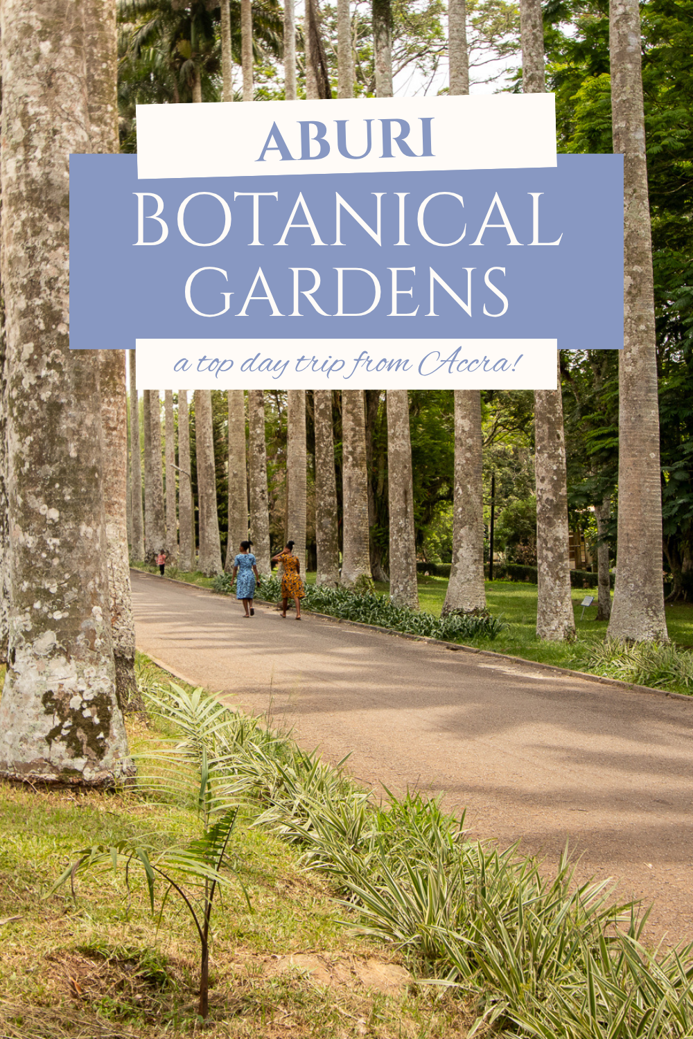
Aburi Botanical Gardens in Ghana: The Perfect Day Trip from Accra (2026 Guide)
It wasn’t until I began living here full-time that I slowed down enough to appreciate what this country truly offers beyond the cities. One place that continues to stand out is the Aburi Botanical Gardens in Ghana, a peaceful escape tucked into the Akuapem Hills and easily one of the best day trips from Accra. If you’re looking to trade chaos for calm, this is where you’ll find it…
When I first arrived in Ghana back in 2010 on Semester at Sea, most of my time was spent in transit—moving between bus stations and project sites.
It wasn’t until I began living here full-time that I slowed down enough to appreciate what this country truly offers. Although there are plenty of things to see and do in Accra, Ghana is so much more.
One place that continues to stand out is the Aburi Botanical Gardens, a peaceful escape tucked into the Akuapem Hills and easily one of the best day trips from Accra.
If you’re looking to trade chaos for calm, this is where you’ll find it. Here’s what to expect when visiting Ghana’s Aburi Botanical Gardens.
Aburi Botanical Gardens Quick Facts:
Location: Aburi, Eastern Region (1 hour from Accra)
Hours: 8:30am - 5pm (daily)
Entrance Fees: GHS 20-60 (see more below)
Best Time to Visit: Early morning before the crowds
History of the Aburi Botanical Gardens in Ghana
The history of the Aburi Botanical Gardens dates back to colonial times, specifically the late 19th century.
In 1875, British officials located the spot and built a sanatorium for recovering officers. The Akuapem Hills offer a peaceful environment with cool mountain air, providing the perfect combination to heal both mind and body.
It wasn’t until 1890 that Governor William Brandford-Griffith and his associate, Dr. John Farrell Easmon, officially converted the land into a botanical garden. At first, it played an important part in shaping Ghana’s agriculture by serving as a place of experimentation for the viability of crops, but as the early 20th century came to be, the site opened to the public on a recreational basis.
To this day, it remains an important partner in plant conservation and education, while serving as one of the most peaceful green spaces in Ghana.
Ready to visit the Aburi Botanical Gardens? Here’s everything you need to know.
Where are the Aburi Botanical Gardens Located? (Accra Distance & Map)
Nestled in the Akuapem Hills, the Aburi Botanical Gardens lies in the Eastern Region of Ghana and high above Accra.
Here’s a breakdown of the best options to reach the gardens:
Uber/Bolt: Costing ~GHS 150 one-way from Central Accra
Taxi: Use reliable contacts and negotiate down for the best rate
Tro-tro: Pick a car at Madina Market at head towards Aburi, costing between GHS 5 and 10 (ask to be dropped near the gardens)
Rideshares are less accessible once at the gardens for a return trip, so it’s important to arrange both ways. Hiring a car for half a day also allows you to visit other spots in the area (more below).
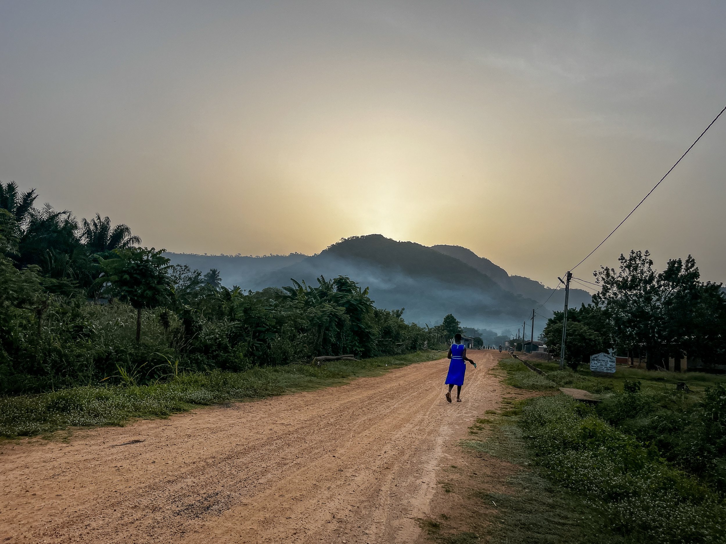
Getting to Aburi from Accra requires a steep climb up the mountainside, with plenty of tight turns. Driving in Ghana isn’t known for its calm energy, so if you tend to get motion sick, either ask the driver to be a bit safer or be sure to bring your medication. You won’t want to miss the stunning views along the way!
Check out these curated tours to make it a full day trip from Accra to Aburi:
Entrance Fees & Opening Hours of the Aburi Botanical Gardens
As of 2026, the price breakdown is as follows (cash only):
Ghanaian Adults: GHS 20
Ghanaian Students: GHS 3
Non-Ghanaian Adults: GHS 60 (~USD 5-6)
Non-Ghanaian Students/Volunteers: GHS 40 (just under USD 4)
In general, the Aburi Botanical Gardens are open to the public from 8:30am-5pm, 7 days a week.
With that said, morning hours tend to be cooler weather and fewer crowds, even more so during weekends when picnics, music, and activities tend to fill the grassy areas.
If you’re like me and prefer to decompress and bathe in the surrounding nature, prioritize an early visit from Accra.
In general, a self-planned trip to Aburi Botanical Gardens can cost between USD 10-40 (from Accra), depending on transportation, number of people traveling, snack and drink purchases onsite, etc.
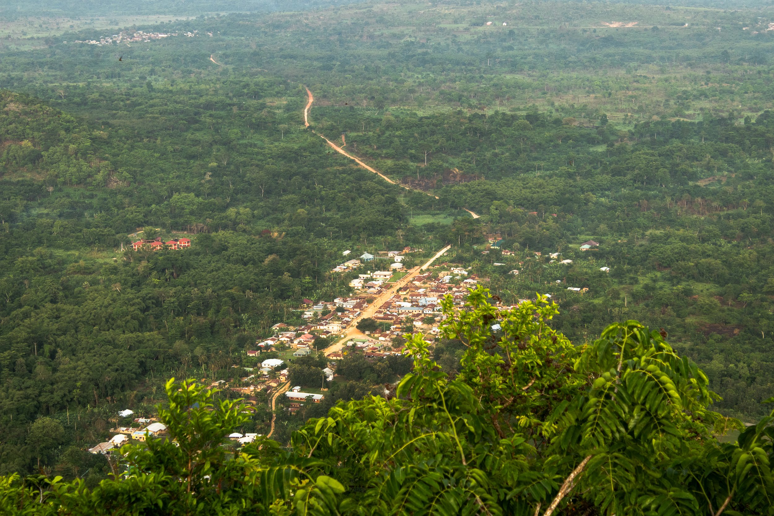
What to Expect at Aburi Botanical Gardens (Highlights, Experience, and More)
If you’re looking for an escape from the intense heat and chaos of Accra, then a visit to Aburi is a must-add to your itinerary.
The Botanical Gardens provide a peaceful experience with far less crowds than other tourist locations and is popular with both expats and locals alike. On weekends, it’s not uncommon to see families making the winding drive up the hillside from the city below to enjoy the cool breeze and sit in the grass.
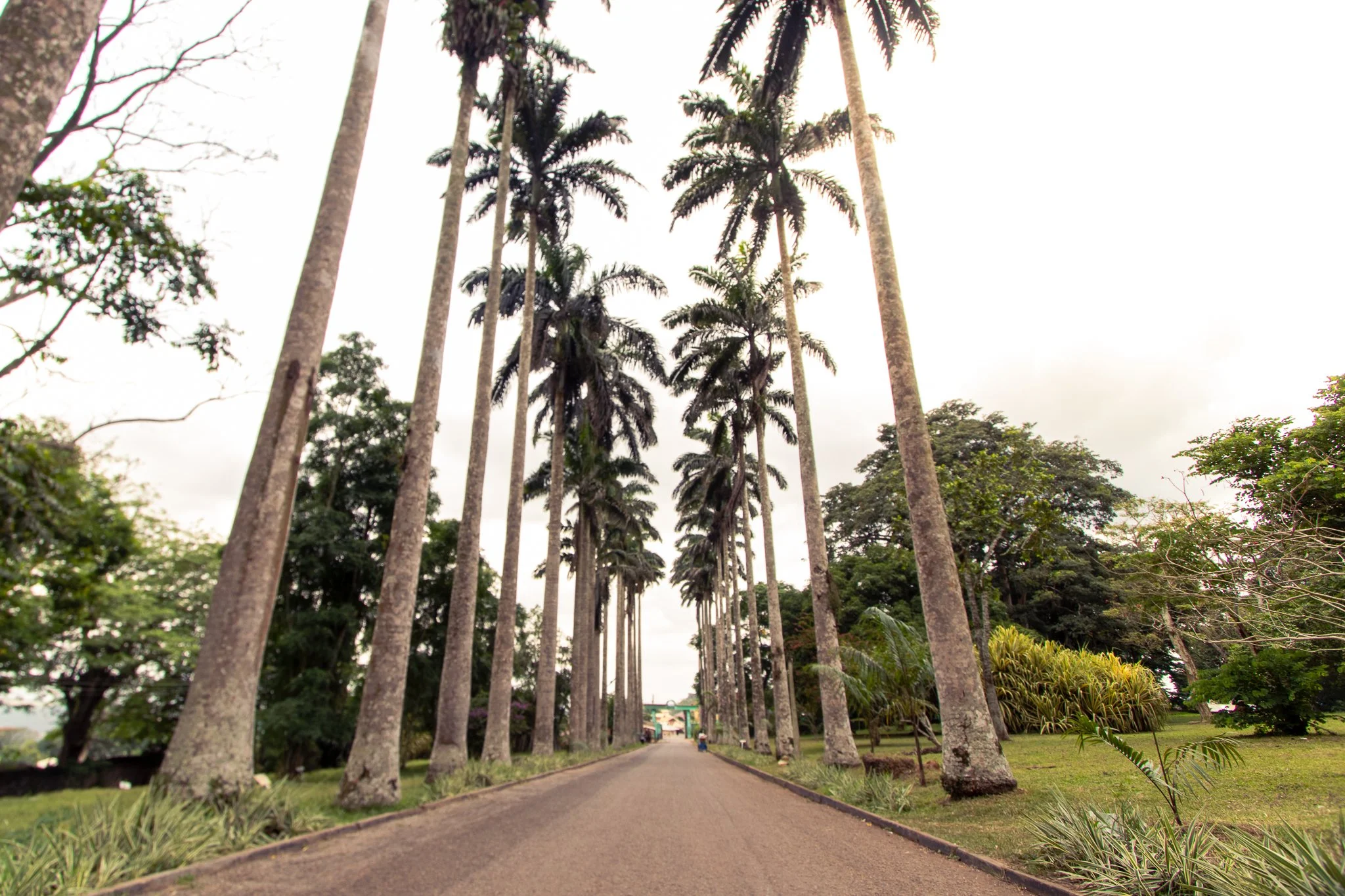
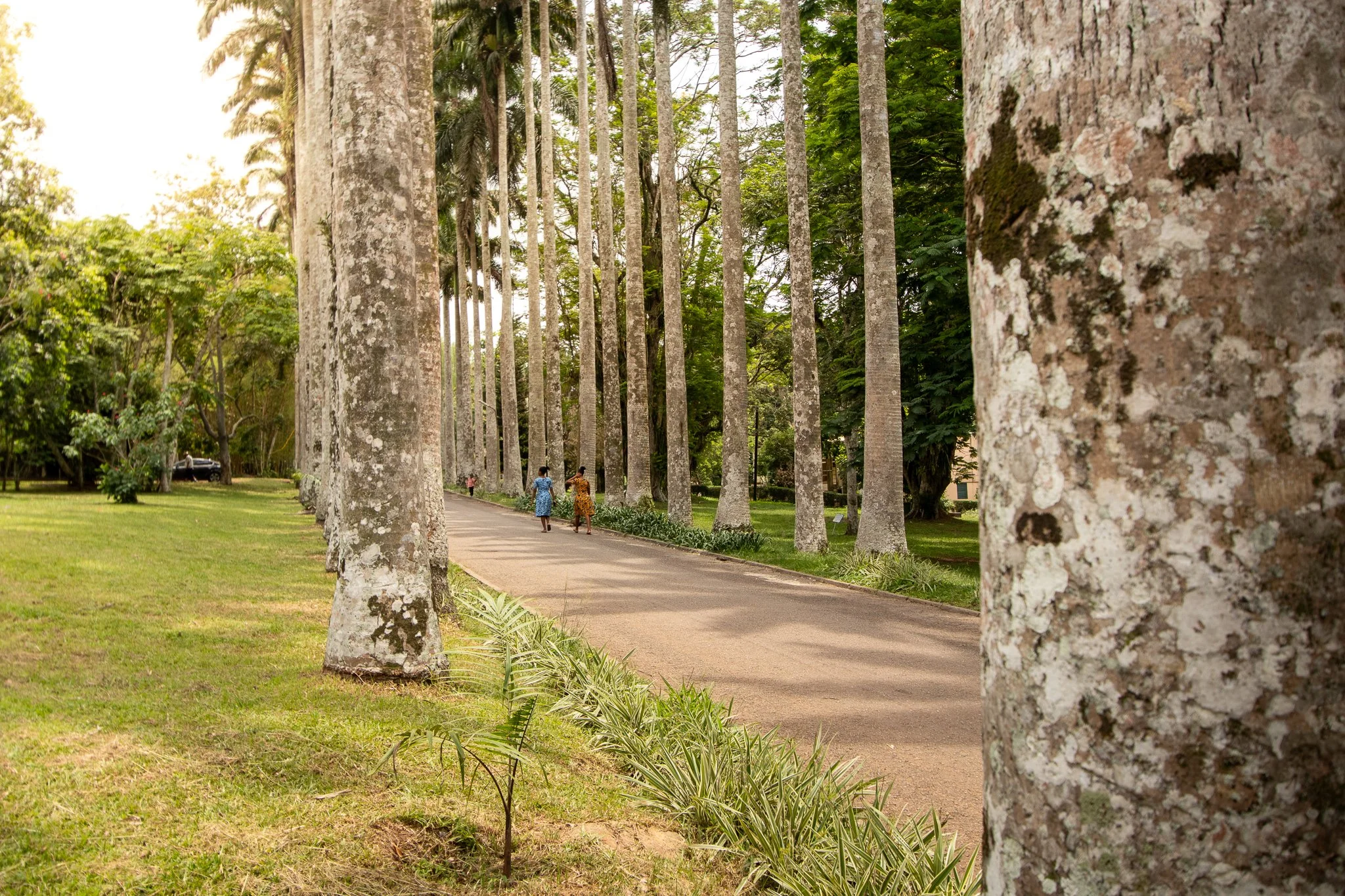
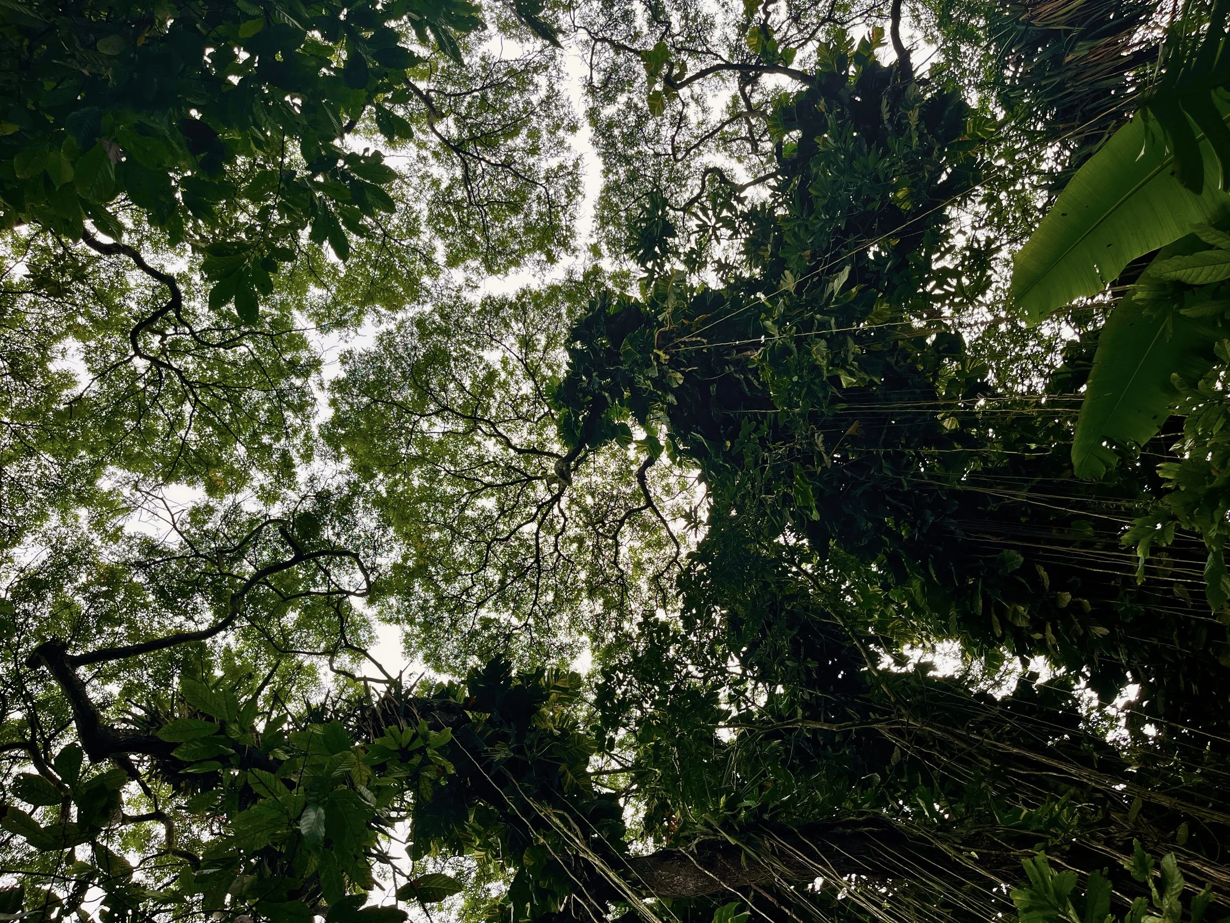
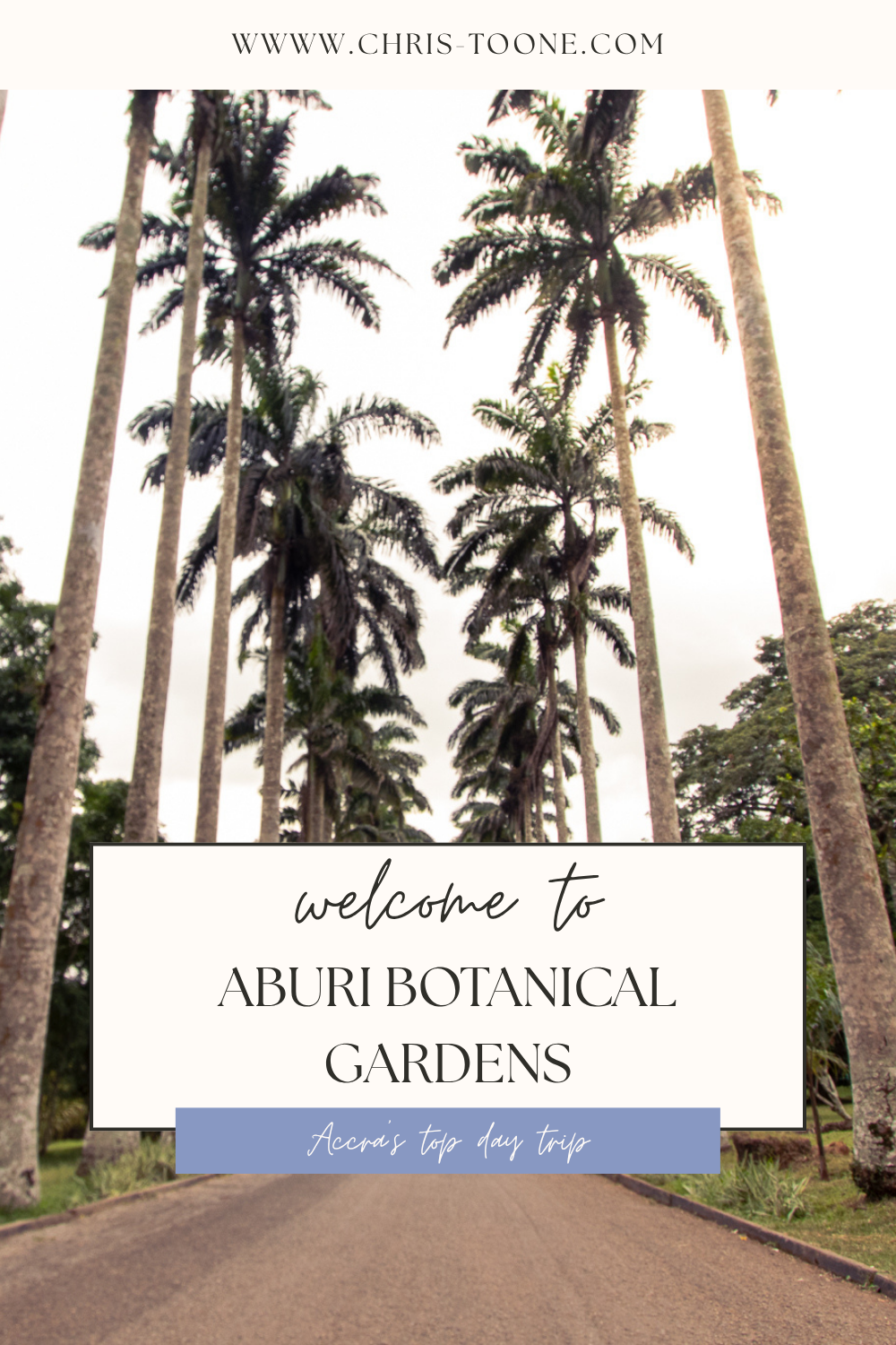
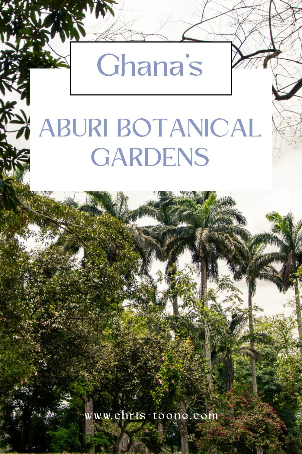
As you enter the park, you’ll immediately be mesmerized by the leading lines of the Royal Palm Tree Avenue. From here, the park is the perfect place to wander as paths are unmarked and the nature inviting for all levels of explorers.
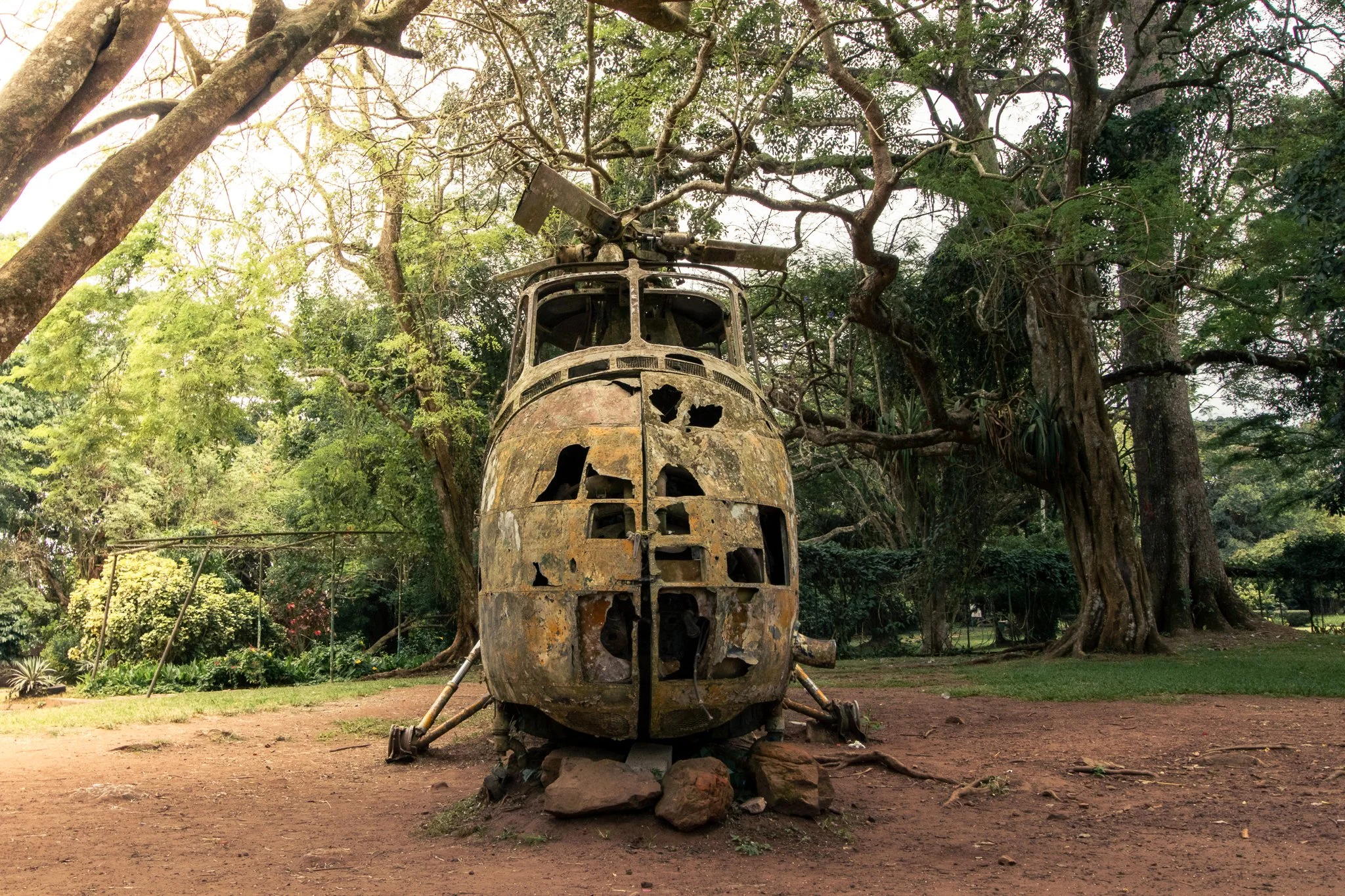
Pay close attention, and you’ll spot the first-ever cacao plant to penetrate Ghana’s soil, a cash crop that has brought the country to the second-world-leading producer, and an old rusted military helicopter provides the perfect photo opportunity.
Where to Eat Near Aburi Botanical Gardens
Although not many options inside the park, several restaurants near the Aburi Botanical Gardens provide quality meals. A few options include:
Hillburi ($$): A more middle-of-the-road option with stunning views of Accra and the surrounding mountains. The perfect place for an afternoon cup of coffee to pause and watch the world go by.
Peduase Chophouse ($): A staple of the community with everything from traditional dishes to delicious shawarma and even breakfast options. This is the local experience done right, and on a budget.
Peduase Valley Resort ($$$): Tucked deeper into the lush mountains, Peduase Valley Resort is an upscale option that has multiple restaurants to choose from.
Personally, I always recommend Hillburi to visitors. Quality food, peaceful ambiance, and friendly staff. Consistency in all of the above is often a challenge in Ghana, but I’ve never walked away disappointed from a meal there.
Pro Tip: Try the Obama Burger, still on the menu as a nod to Former United States President Barack Obama from when he visited during his time in office back in 2009.
If you’re planning more Ghana travel, don’t miss my guides to:
Things to Do Near Aburi Botanical Gardens
Although the Botanical Gardens are the main attraction in Aburi, there’s still plenty of experiences nearby, including:
Adom Waterfalls: Located in Obosomase, 5 minutes from the gardens
Obaka/Oboadaka Waterfalls: Approximately a 20-minute drive from the gardens
Aburi Craft Village: Aburi is known for its wood-working prowess. Here you’ll find everything from wooden utensils to tables and jewelry. It’s calmer and less frequented than the Accra Arts Center, so you’ll experience less hawking and be able to move about at a slower pace on your own terms.
We-Ape Adventure Park: A 15-minute drive from the gardens, We-Ape is an adventurer’s paradise. Situated on 3.5 acres of rainforest land, the facility offers two zipline adventure courses, one suitable for family members of all ages and a more advanced course for those looking for a bit more adrenaline.
Travel Tips When Visiting Aburi Botanical Gardens
When visiting Aburi, it’s important to come prepared, as amenities are few and far between once you leave Accra behind. Here are my top packing tips when visiting the Botanical Gardens and the surrounding Aburi area:
Bring Cash: ATMS are not easily accessible, and the gardens are cash-only. Cellular network is often poor and unstable, so even if there is an option to pay by card, it’s not always possible.
Wear Comfortable Shoes: Visiting the Aburi Botanical Gardens is the perfect way to get your steps in and immerse yourself in nature. Bring the right footwear and come prepared for any add-on excursion you may wish to check out.
A Trustworthy Rain Jacket: It’s not uncommon, especially in rainy months, for storms to move through the mountains several times throughout the day, so it’s important to come prepared. I never stray too far away from my house in Ghana without packing my Cotopaxi Cielo Rain Jacket.
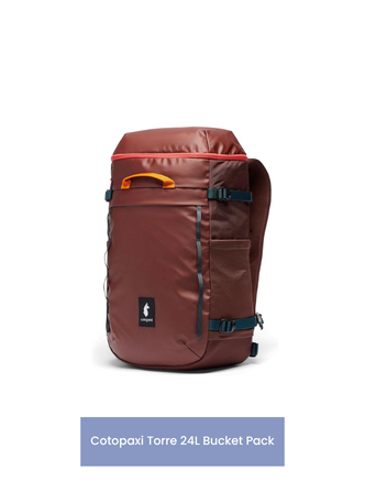
Daypack: A half-day trip to Aburi can easily turn into a full day with nearby attractions, so be sure to pack a bag with enough space to be prepared for any adventure that comes your way. The Cotopaxi CADA Dia 24L is the perfect size for everything I need, including camera gear.
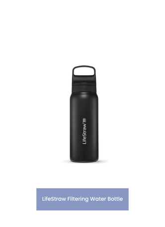
Water Bottle: Drink vendors are available within the park grounds. Ghana still relies heavily on plastics (including, at times, plastic satchels for drinking water). Consider a filtering water bottle to ensure you’re getting more hydration and fewer toxins.
A Good Book or Journal: Whether relaxing into nature with a book or writing in a journal, the botanical gardens are the perfect place to reflect.


Is it Worth Visiting the Aburi Botanical Gardens?
Overall, yes, as one of the best nature spots near Accra, visiting Aburi Botanical Gardens in Ghana is a must-do for travelers looking to experience a quieter, greener side of the country.
The grounds are ideal for both nature lovers and photographers, and offer a more relaxing experience to decompress, a stark contrast from the hustle and bustle of city life.
FAQs About Aburi Botanical Gardens
-
Yes—Aburi Botanical Gardens is one of the best day trips from Accra. It offers a peaceful escape from the city, cooler temperatures in the Akuapem Hills, and plenty of space to walk, relax, or take photos.
-
Aburi Botanical Gardens is located about 1 hour from Accra, depending on traffic. The drive includes a scenic climb into the Akuapem Hills, with winding roads and great views along the way.
-
The gardens are open daily from 8:30 AM to 5:00 PM. Visiting early in the morning is recommended for cooler weather and fewer crowds.
-
Yes, the gardens are easy to explore on your own. While local guides may be available at the entrance, they are optional, and most visitors choose to wander independently.
-
You can reach Aburi by:
Uber/Bolt or taxi (most convenient)
Private driver (best for flexibility)
Tro-tro + taxi (budget option)
It’s recommended to arrange your return trip in advance, as transport options at the gardens can be limited.
I’m fortunate to live along the banks of the Volta River, but anytime I transit to Accra, I’ll always try to find time to pass through Aburi and spend an hour enjoying the fresh mountain air in the gardens.
It’s the perfect way to spend a slow afternoon; you won’t regret it.
Have you ever been to the Aburi Botanical Gardens before? Anything to add? Be sure to like, comment, and share and, as always, stay safe and happy travels!
Sharing is caring! Pin this post for later.


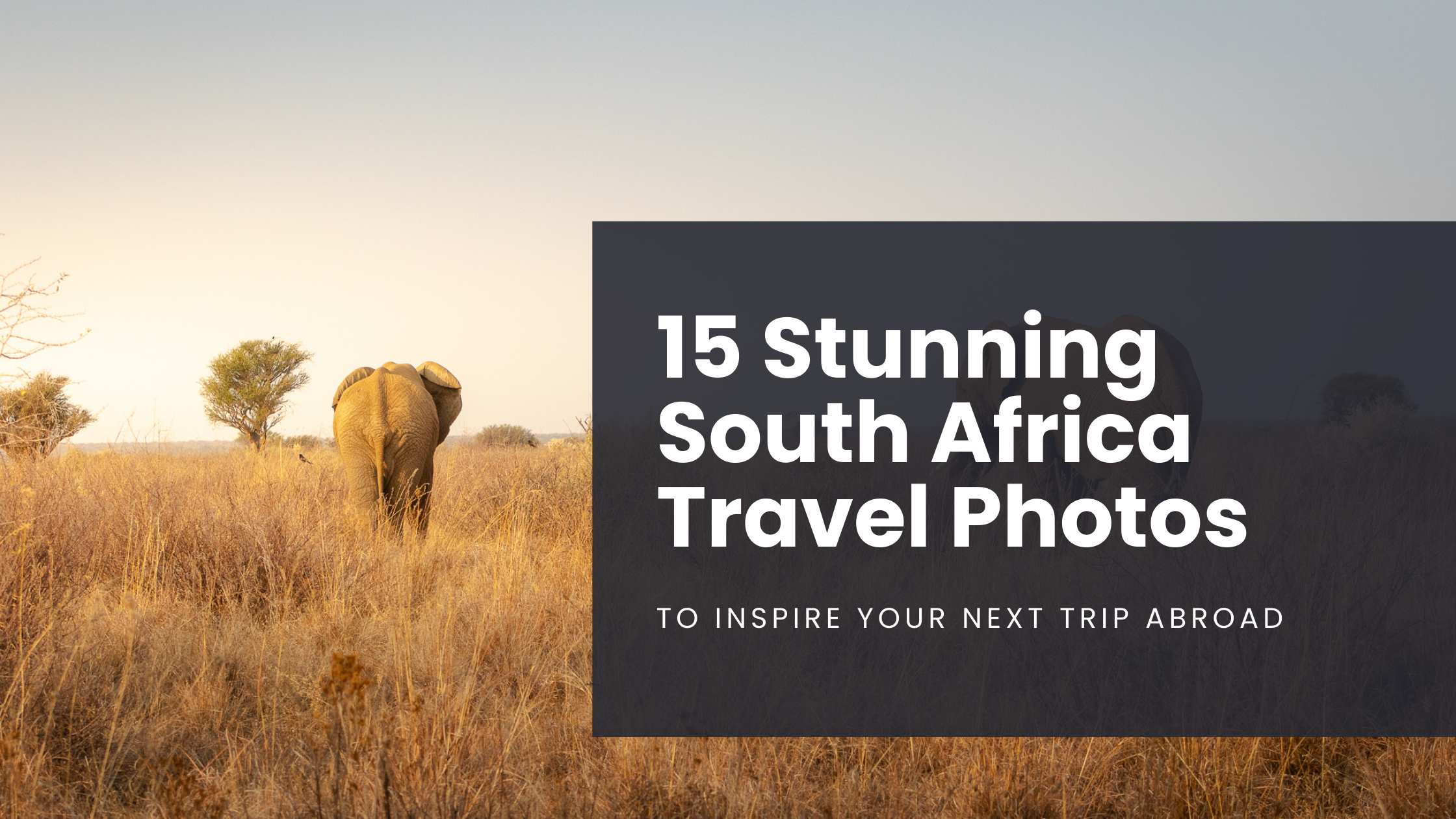
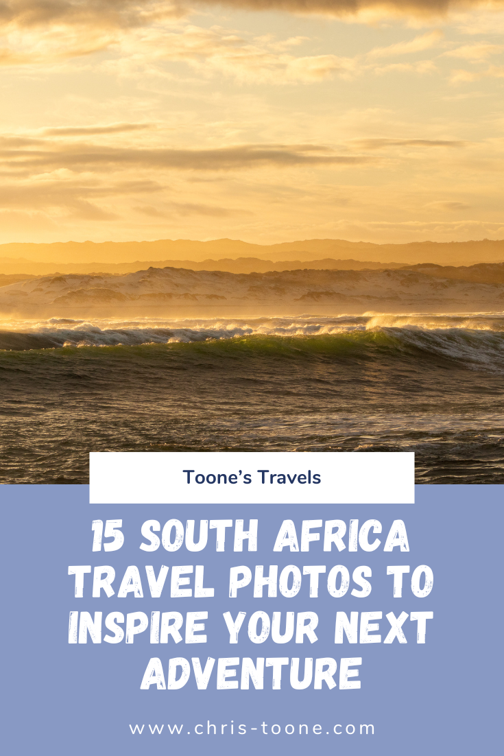
15 Stunning South Africa Travel Photos To Inspire Your Next Trip
The first time I visited South Africa was in 2010 on Semester at Sea. It was a crisp spring morning on the bow of the ship as the sun breached the horizon, lighting up the mighty Table Mountain—and in that moment, I was hooked…
The first time I visited South Africa was in 2010 on Semester at Sea. It was a crisp spring morning on the bow of the ship as the sun breached the horizon, lighting up the mighty Table Mountain—and in that moment, I was hooked.
Fast forward fifteen years. With a month off work and already situated on the African continent, there was only one place calling me back: South Africa.
It’s no secret that South Africa exists in a constant state of tension between its apartheid past and present-day realities. Townships still dot the outskirts of major cities, and crime rates continue to top the continent. But despite this complex backdrop, South Africa has a way of pulling you in—and refusing to let go.
From world-changing history, both evolutionary and geopolitical, and iconic wildlife to unforgettable safaris, dramatic coastlines, and vast landscapes, South Africa is one of the most visually striking countries in the world to photograph.
So, off I went—camera in hand.
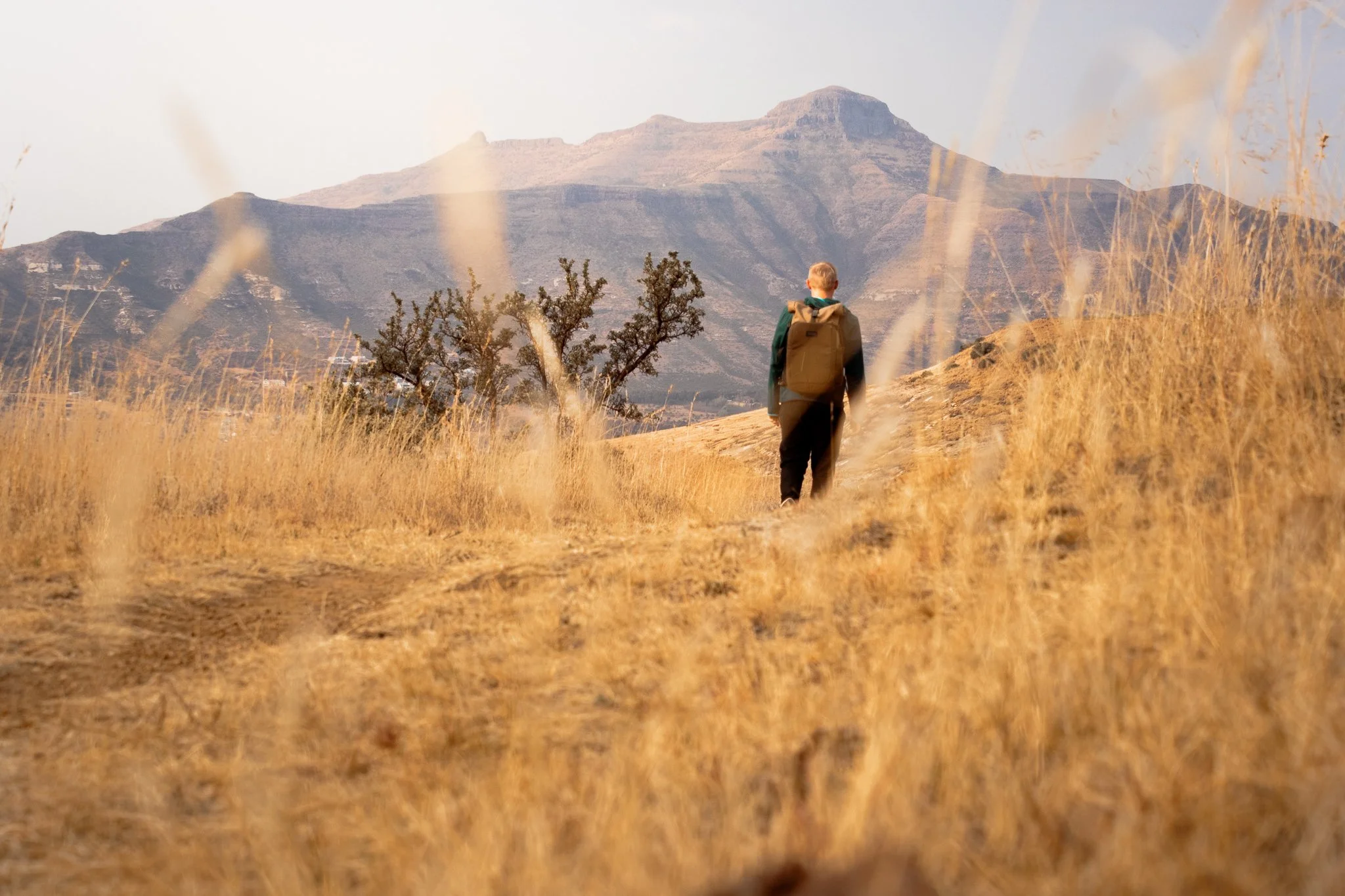
Maybe these 15 stunning South Africa travel photos will inspire your next trip (fingers crossed).
Ready for more South Africa content? Don’t miss these posts:
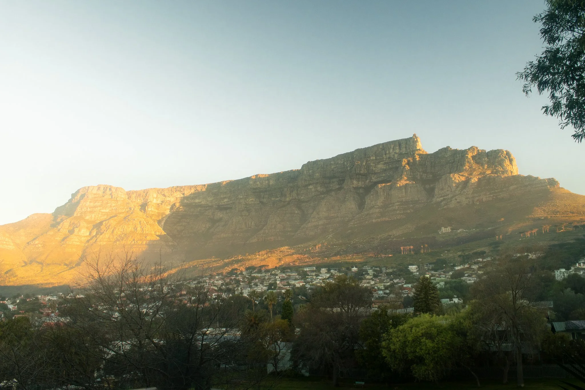
1. Good morning, Cape Town
Location: Cape Town, South Africa - Table Mountain
Is there any secret as to why Cape Town is consistently ranked as one of the most beautiful cities in the world for South Africa travel photography? All it takes is a window seat on approach into the airport to understand why. The magestic Table Mountain makes for one of the most unique city backdrops in the world, and is also a reason why it’s so hard to take a bad travel photo here.
This particular photograph was taken from the balcony of my apartment and it quickly became a daily ritual to watch the light move across Table Mountain on several crisp winter mornings.
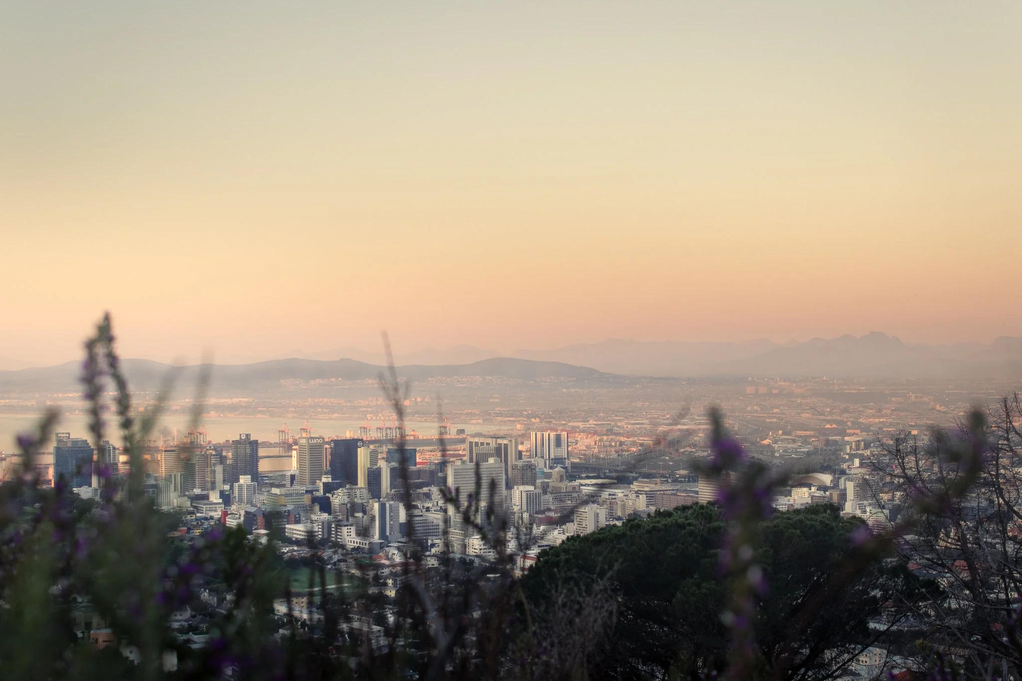
2. Cape Town in Pastel: View from the Gardens
Location: The Gardens Neighborhood, Cape Town, South Africa
Not long after arriving in Cape Town, I fell ill and quickly realized I had brought a case of malaria with me from Ghana (don’t worry—South Africa is malaria-free). Each afternoon, the fever would break just long enough for me to get outside and explore.
The walking paths behind the Gardens neighborhood quickly became my go-to, and it’s easy to see why. Soft pastel buildings, quiet streets, and views toward Table Mountain make this one of my favorite spots in the city—and one of my favorite South Africa travel photos to date. For me, it perfectly captures the calm, colorful essence of Cape Town travel photography.
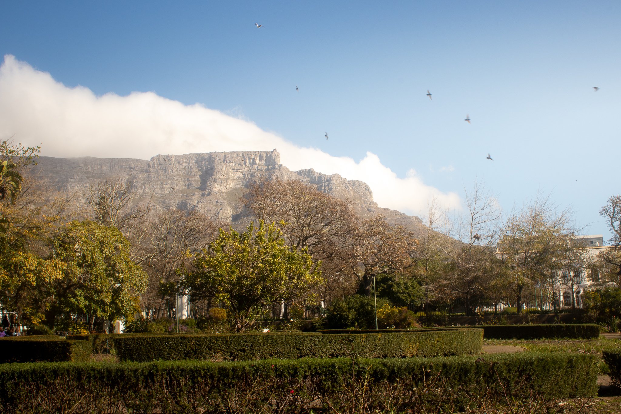
3. An Afternoon City Break in Cape Town’s Company’s Garden
Location: The Company’s Garden, Cape Town, South Africa
Despite visiting towards the end of the winter months, I stumbled upon one of my favorite Table Mountain viewing spots: The Company’s Rose Garden in the Central Business District.
Originally established in the 1650s to bring fresh supplies for ships passing through, the land now serves as a public park and the perfect spot for some stunning Cape Town travel photography, capturing city life in South Africa.
Once you’re done watching the birds and clouds (the “Tablecloth”) move in over Table Mountain, walk around the corner to Truth Coffee Roasting on Buitenkant Street for one of the best cups of coffee in your life (no embellishment necessary).
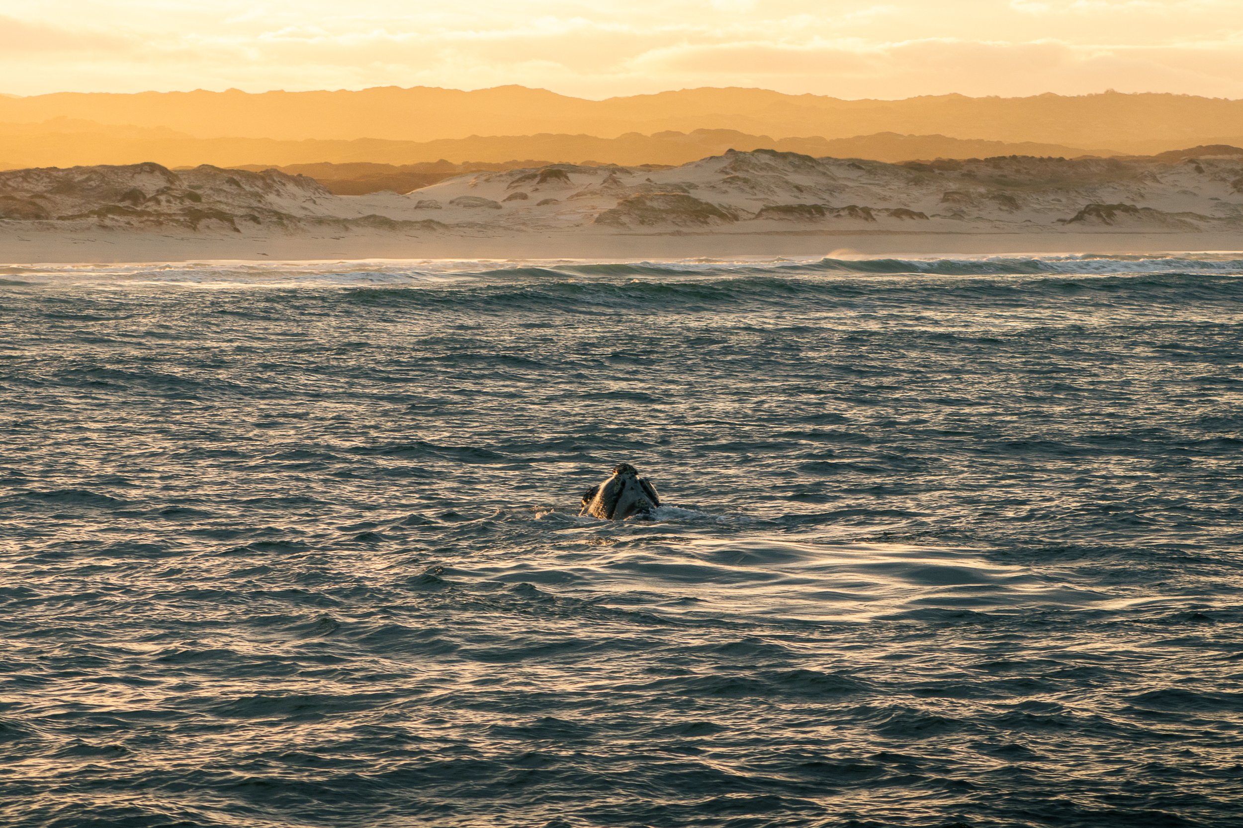
4. Golden Glow: Whale Watching in Hermanus
Location: Hermanus, Western Cape, South Africa
Every year, the quaint seaside town of Hermanus attracts so many visitors to Walker’s Bay that it’s commonly referred to as the “Whale Watching Capital of the World.”
After a month of solo-traveling around this incredible country, whale watching in Hermanus at sunrise was the experience of a lifetime that I hope to not soon forget.
The 5am wake up and freezing temperatures were worth it to capture this golden moment, one of my favorite travel photos from South Africa.
5. South Africa’s Nature Bath: Hermanus
Location: Hermanus, Western Cape, South Africa
The coastal landscapes are so pleasing to look at here that doctors once used to prescribe visits to Hermanus for recovering tuberculosis patients. The proof is in the medicine, right?
Even if getting out into the bay isn’t your cup of tea, there’s still plenty of South Africa’s nature to take in. Breathe a little easier and take the two hour drive from Cape Town. It’s worth the effort.

6. Golden Hour in Hermanus: Whales and Crashing Waves
Location: Hermanus, Western Cape, South Africa
No, I’m not done with Hermanus just yet. This travel photo lives rent-free in my mind so I wanted it in yours, too (you’re welcome).
Crashing waves, a golden sunrise, and whales rolling in the water. The coastal scenery provides all the recipe for a South Africa travel photography stunner, making a whale watching excursion in Hermanus a must-do activity.
7. Pure Bliss on the Hermanus Cliff Walk
Location: Hermanus, Western Cape, South Africa
If whale watching by boat isn’t for you there are still plenty of things to do in Hermanus, including a 12km cliff walk along the shore, making it easy to spot wildlife in the bay. The town even employs an official “Whale Crier”, blowing his conch every time one is spotted so you’ll never miss a beat.
8. Generational Differences: A Pilanesberg Safari Moment
Location: Pilanesberg National Park, North West Province, South Africa
A three hour drive from Johannesburg lies Pilanesberg National Park. Not nearly as vast as nearby Kruger, it serves as a smaller-scale safari for shorter trips.
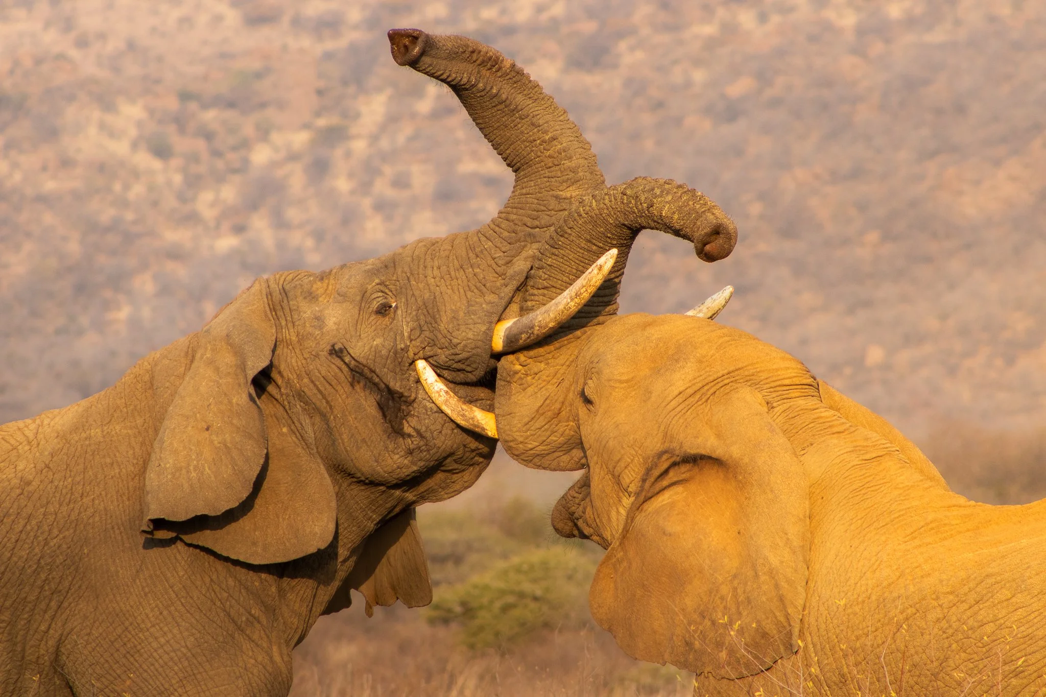
On one of my final game drives, the jeep was nearly empty and we came across this scene: an older male “arguing” with a teen. Luckily we were the only ones there to bear witness.
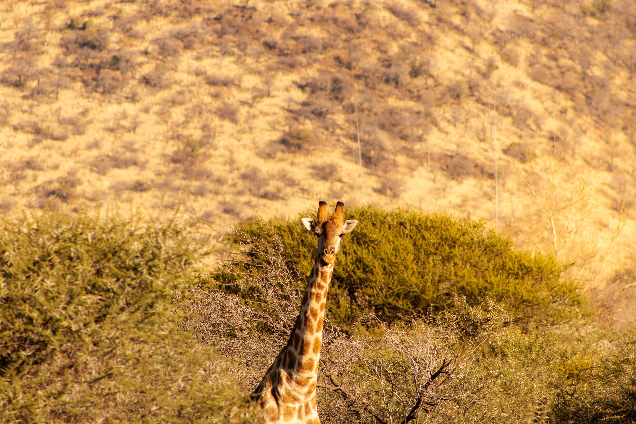
9. The Spotter Becomes the Spotted in Pilanesberg National Park
Location: Pilanesberg National Park, North West Province, South Africa
Our guide pulled over after spotting a giraffe hidden behind the bush. As I fiddled with my camera, it slowly emerged and turned to face us at the perfect moment.
We quickly became “the spotted” on our game drive as the tables turned—creating one of my favorite South Africa travel photos, captured during a quiet safari moment in Pilanesberg.
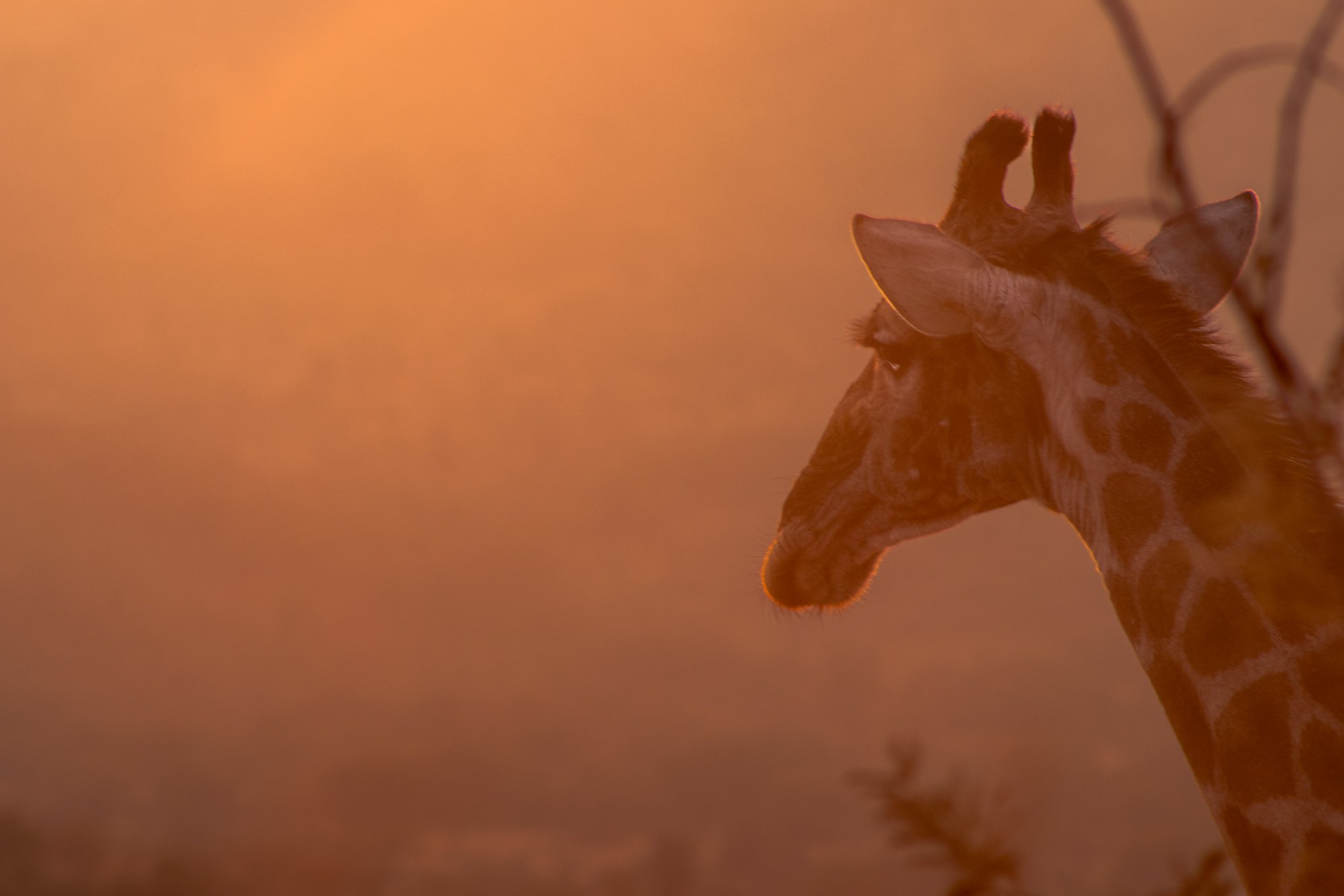
10. “Giraffe Valley” Mornings
Location: Pilanesberg National Park, North West Province, South Africa
An unofficial nickname, the phrase “Giraffe Valley” quickly took hold during my stay at Black Rhino Game Lodge because every time we drove this particular area, we were greeted by several giraffes.
On this particular morning in the freezing cold, the sun hit the frost and mist just right to create this orange glow. We couldn’t find what this giraffe was staring out over the valley, but it never diverted its gaze.
11. Into the Pilanesberg Sunset
Location: Pilanesberg National Park, North West Province, South Africa
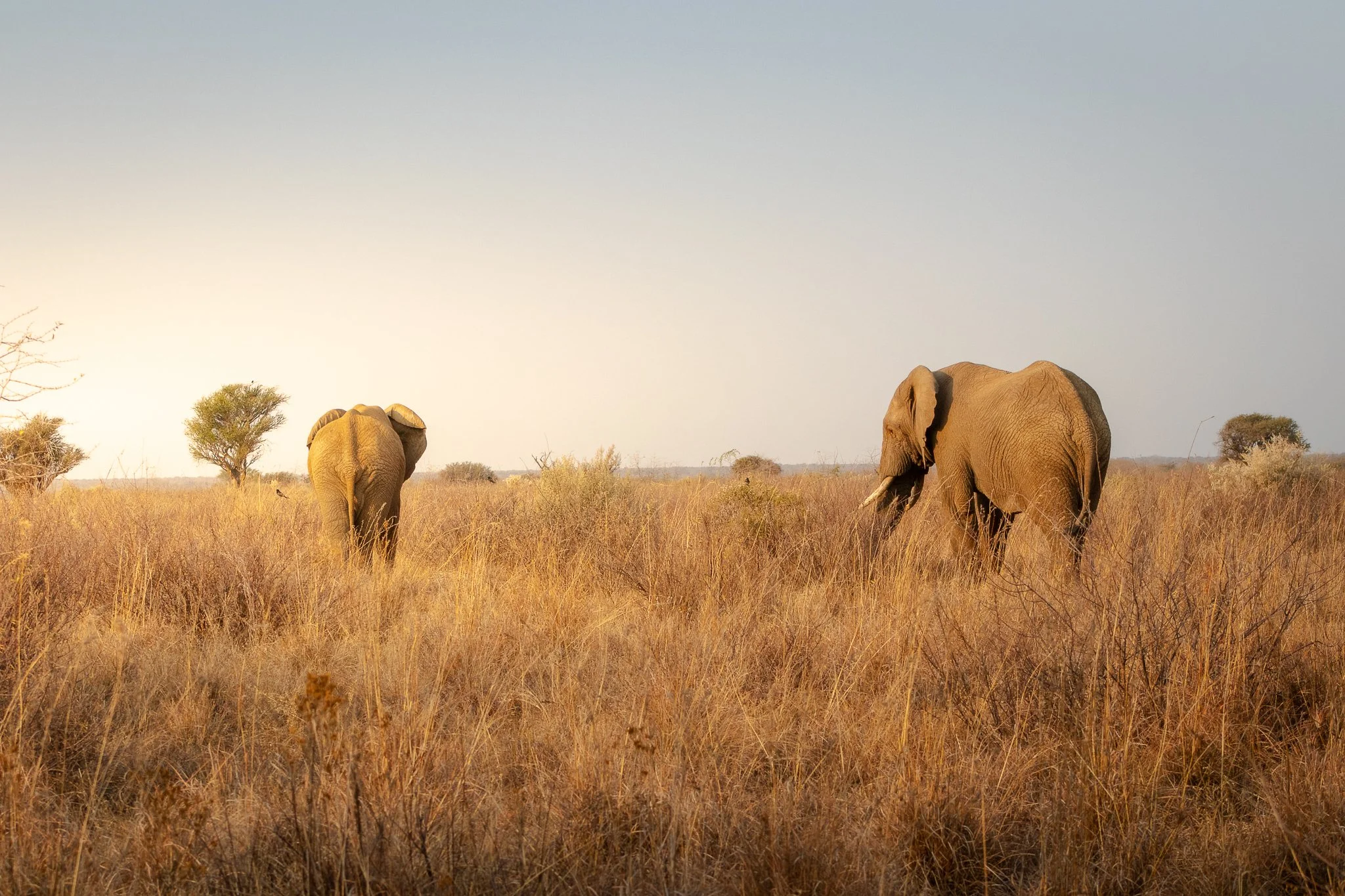
Once the aforementioned generational scuffle ended, we were treated to this scene: both elephants rumbling off into the sunset. One of the more peaceful South Africa travel photos I was able to capture and my favorite Pilanesberg safari moments.

Here’s my go-to camera gear when traveling:


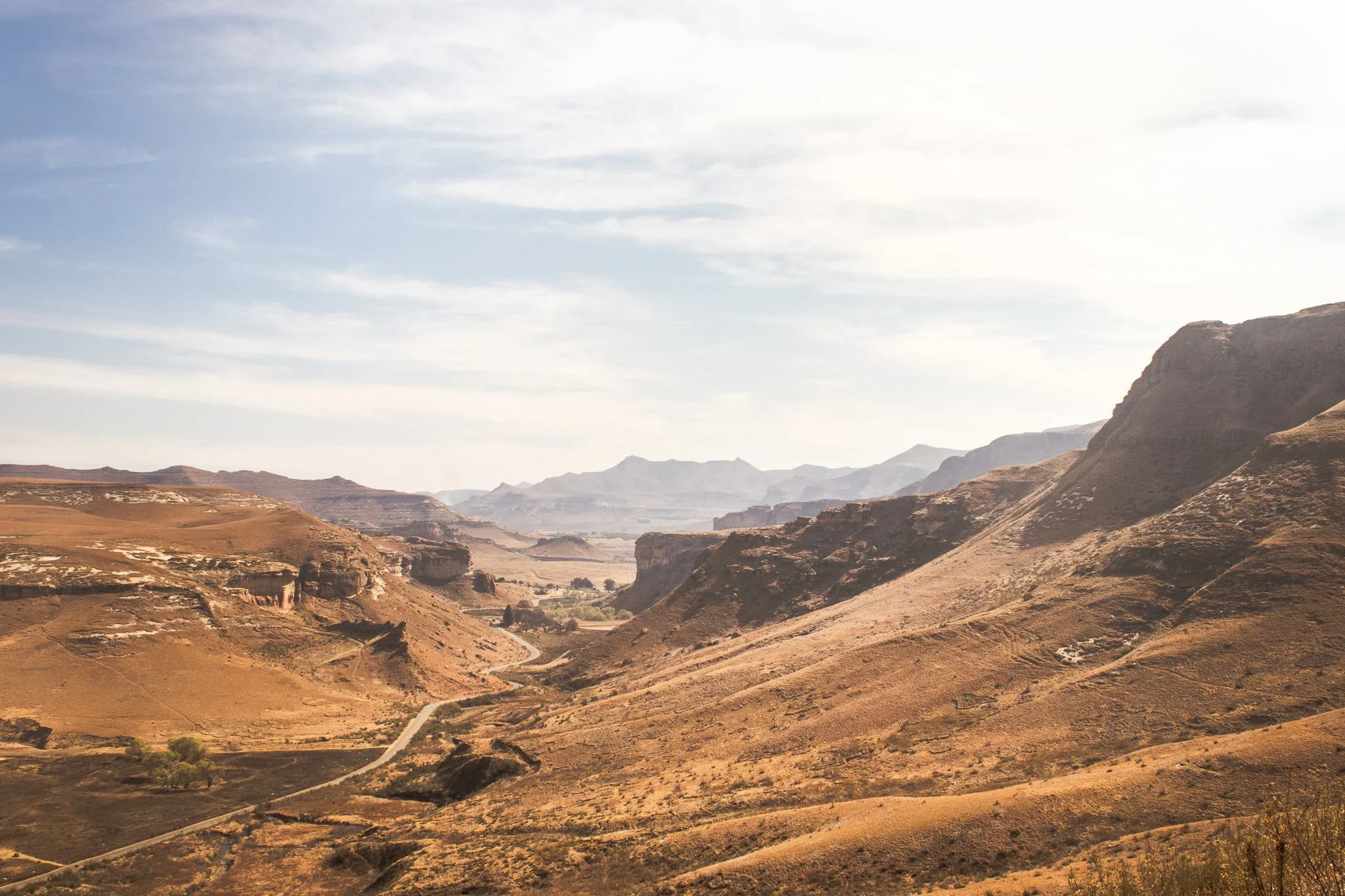
12. The Road to Nowhere in Golden Gate Highlands National Park
Location: Golden Gate Highlands National Park, Free State, South Africa
I had a gap in my plans during my South Africa roadtrip after visiting Pilanesberg National Park. One thing led to another and I ended up in nearby Clarens as a base to visit Tugela Falls via the infamous Chain Ladders Route, the second-highest waterfall in the world.
Long story short, a combination of poor planning, time of day, and weather nixed that hike. But the drive back to Clarens passed through Golden Gate Highlands National Park and I decided to pull off and do a short walk. I was treated to the stunning Free State landscapes, herds of wild zebra, and solitude. The afternoon was a lesson in following your gut: things will work out.
13. The Perfect Stopover in Clarens, South Africa
Location: Clarens, Free State, South Africa
Clarens was never part of the plan, but it seemed a good home base for the next stage of my trip — driving into Lesotho.
Lined with cafes, breweries, and art galleries, this quaint town in South Africa’s Free State is also at the doorstep of jaw-dropping landscapes at neighboring Golden Gate Highlands National Park.
14. Toyota RAV4 vs. Sani Pass
Location: Sani Pass, Drakensberg Mountains, Lesoth-South Africa Border
Driving the Sani Pass was the top item to accomplish during my solo travel around South Africa, so when the rental company in Johannesburg couldn’t give me a 4x4 as was required to drive the road, I had a decision to make.
Do I skip it, or find a way?
That’s the story of how my trusted RAV4 and I (slowly) made our way down from Lesotho and back into South Africa along the infamous Sani Pass. The road was rough and the descent difficult, but the sweeping views of the surrounding Drakensberg Mountains were worth it.
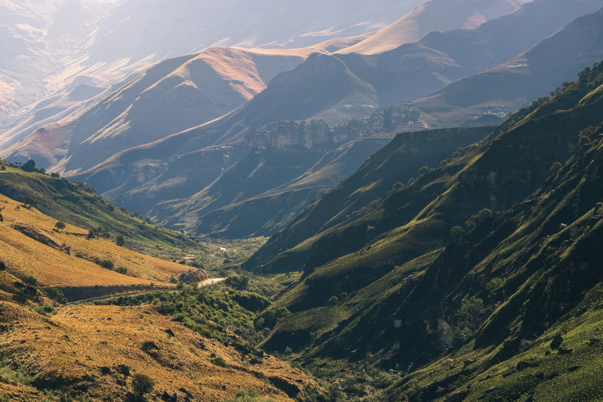
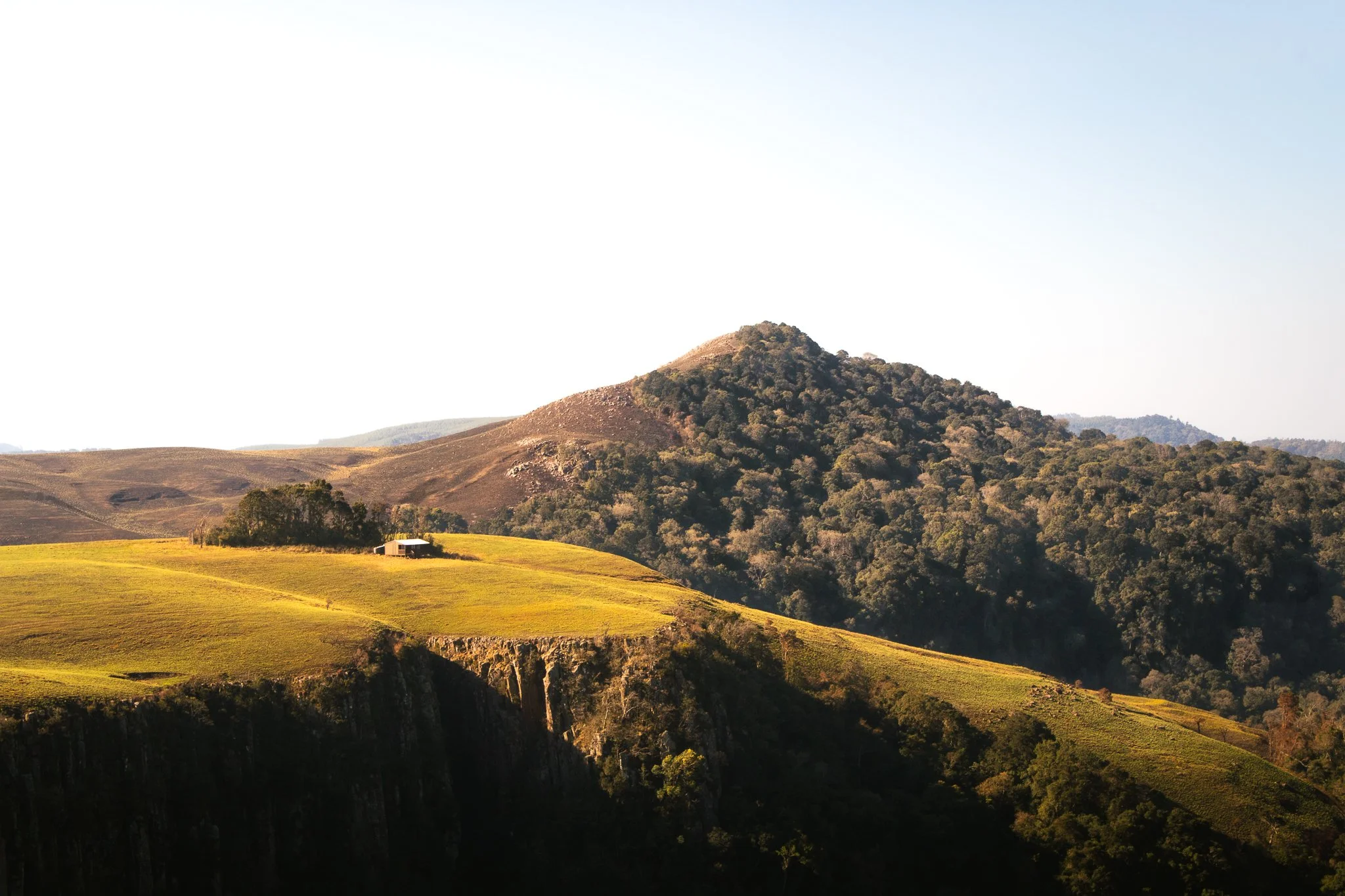
15. Unexpected Peace in KwaZulu-Natal
Location: Howick, KwaZulu-Natal, South Africa
From the Drakensberg Mountains, I made my way into the rolling hills of the KwaZulu-Natal Midlands with the intention of visiting Nelson Mandela’s capture site.
What I found instead was unexpected calm—gentle landscapes, open skies, and endless greenery like Gray Mare’s Trail in nearby Karkloof Nature Reserve. It was a quiet reminder that some of the most peaceful moments of travel come when plans take a back seat
My solo travel started in Cape Town, often named the world’s most beautiful city by Time Out Magazine — and it’s easy to see why. Mountains, outdoor space, coffee, rich culture and endless diversity… you could leave me there and I’d be set for life.
But when you inevitably book that trip, push yourself beyond the city limits and into the far corners of the country. Discover the KwaZulu-Natal Midlands and Drakensberg Mountains. Drive the wide-open roads of the Free State and jump into South' Africa’s wildlife.
You won’t regret it.
In the meantime, I hope these 15 South Africa travel photos help to keep that wanderlust alive and offer a little inspiration for your next adventure.
Questions? Anything to add? Drop it in the comments below. Until next time, stay safe & happy travels!
Sharing is caring! Pin this post for later.


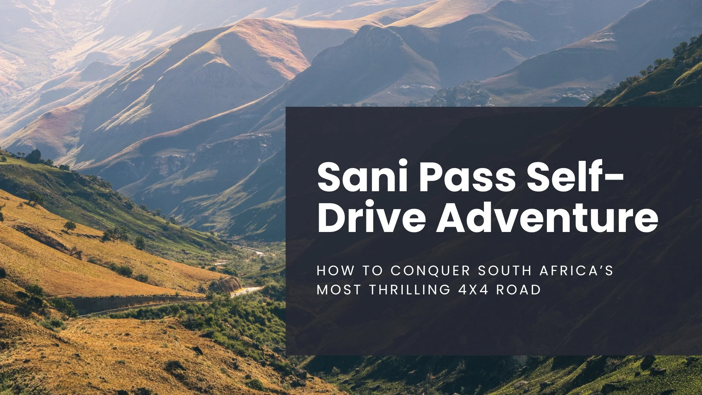
Sani Pass Self-Drive Adventure: How to Conquer South Africa’s Most Thrilling 4x4 Route
The 13 hairpin turns and the 1:3 gradient up/down the Drakensberg Escarpment well, let's say it's not for the faint of heart. So, if you're seeking a thrilling road trip with jaw-dropping scenery and a real sense of accomplishment, driving the Sani Pass should be high on your list…
*Note: All informations is up to date as of April 2025
If you're like me, then when planning trips you'll find one thing, maybe a place to stay or a sight to see, latch onto it, and then build an entire itinerary around that.
On my one-month road trip around South Africa, the thing I latched onto the most was self-driving the Sani Pass, a notorious 9km stretch of tumultuous terrain connecting the country with the mountain kingdom of Lesotho.
Why did I choose the Sani Pass experience? Truthfully, I'm not sure. It's just one of those things that when you know, you know.
The 13 hairpin turns and the 1:3 gradient up/down the Drakensberg Escarpment well, let's say it's not for the faint of heart. But, in some false-confidence part of my brain, I told myself the spectacular views of the mountains would be well worth the effort (and by effort, I mean risk).
So, if you're seeking a thrilling road trip with jaw-dropping scenery and a real sense of accomplishment, driving the Sani Pass should be high on your list.
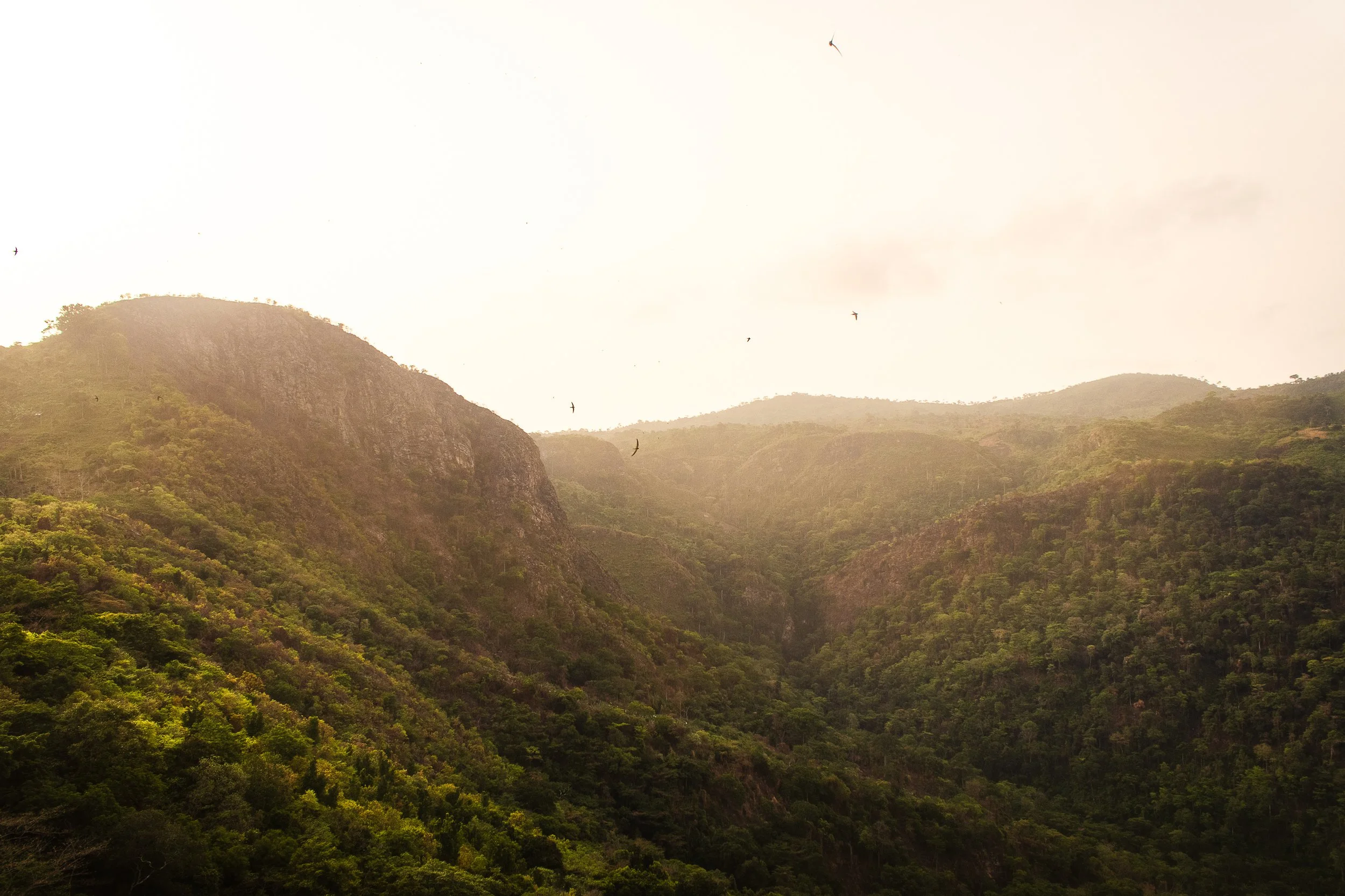
Winding from the lush foothills of KwaZulu-Natal, South Africa into the highlands of Lesotho, this is one of Africa's most iconic mountain passes — and a must-do for adventurers (don't forget to buckle up).
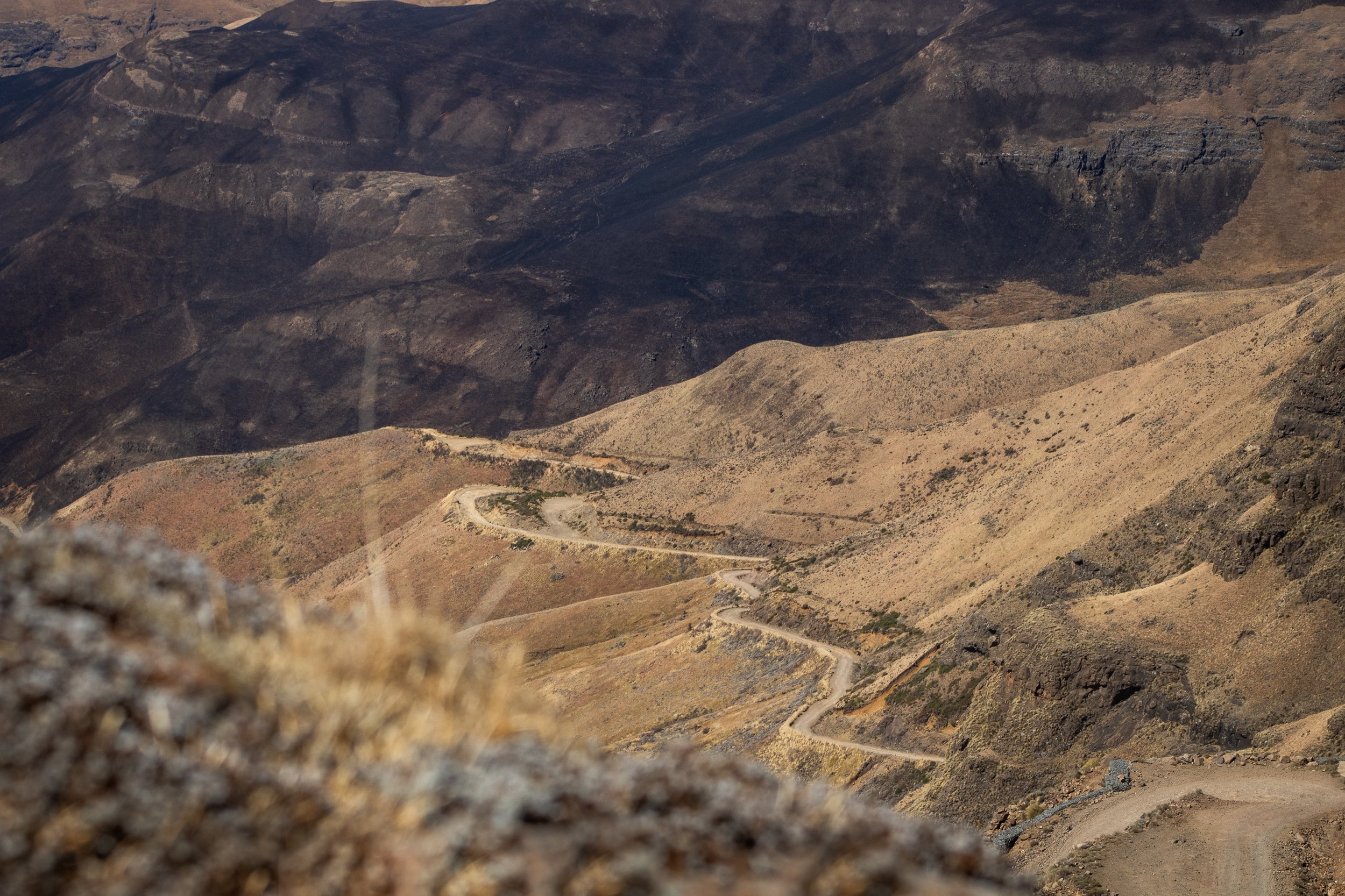
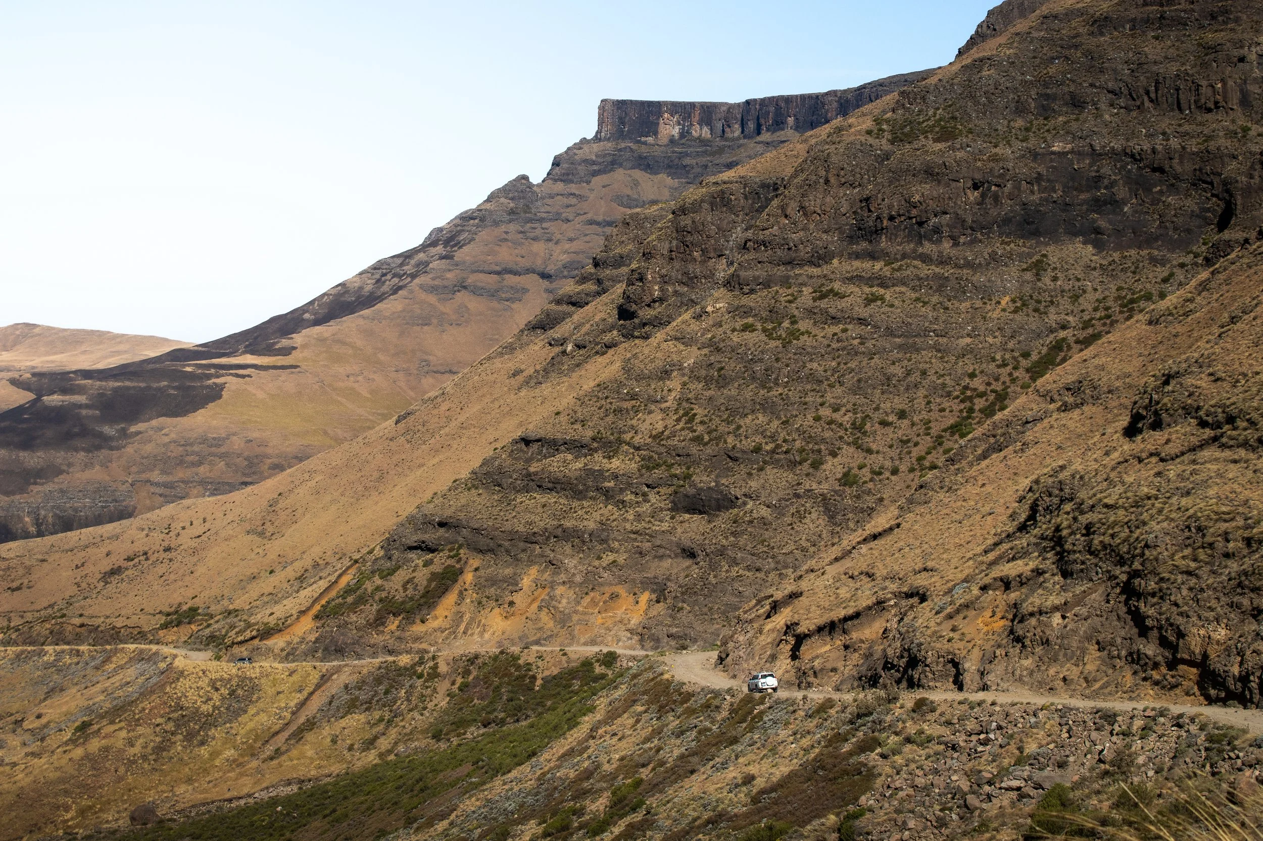
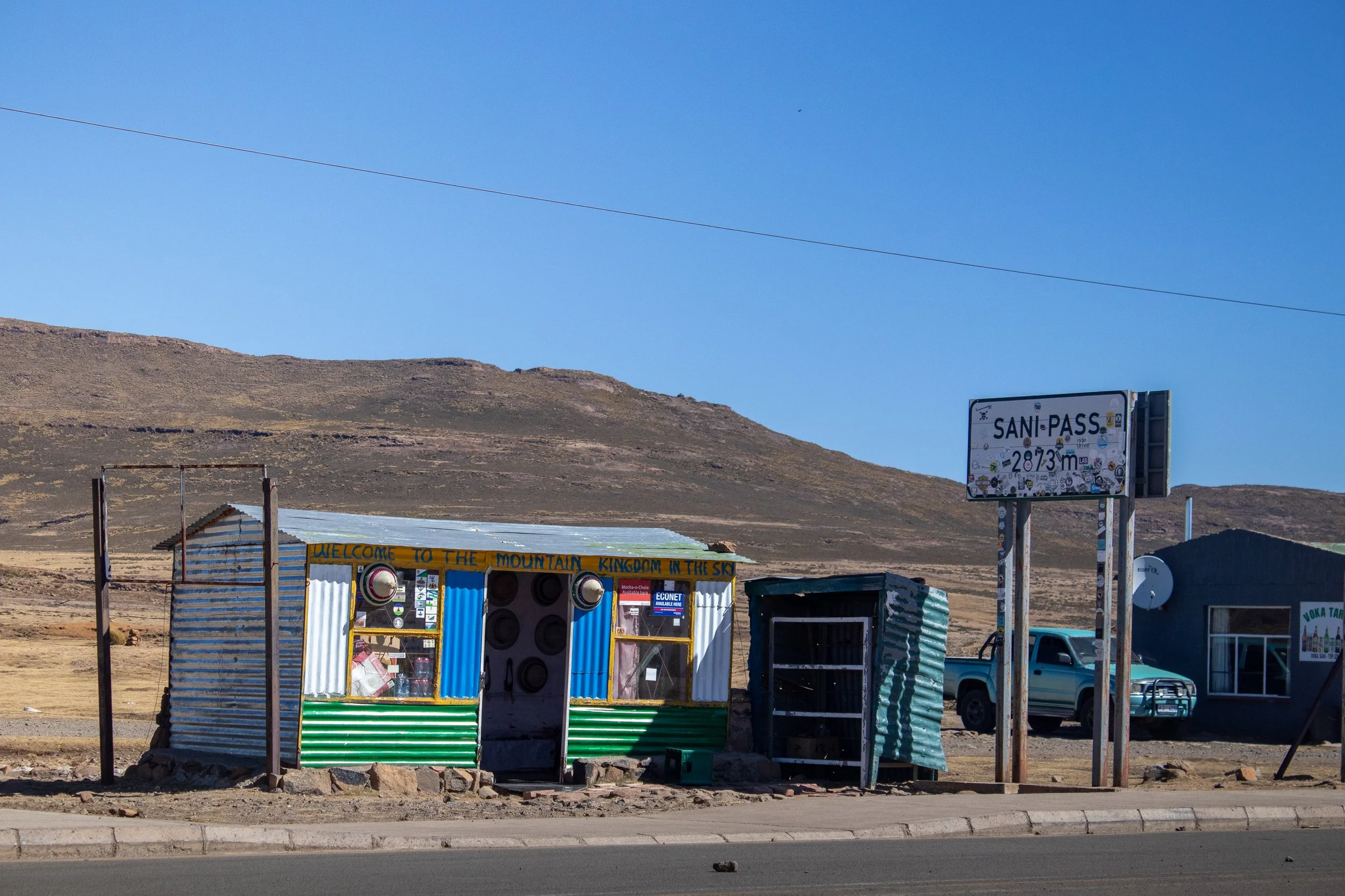
The infamous Sani Pass winds its way from Lesotho down into South Africa
What is the Sani Pass and why is it so special?
The Sani Pass is a high mountain road that links the borders of South Africa and Lesotho (the only border in Kwazulu-Natal), ascending over 1,000 meters in less than 10 kilometers.
Completed in 1950, the road starts at 1544m in elevation on the South African side and rises to 2876m on the Lesotho border, earning it’s name as the “Roof of Africa”. Previously utilized for pack animals, it is now one of the most challenging and dramatic 4x4 drives in Southern Africa and attracts off-road enthusiasts, photographers, and curious travelers alike (I'm the latter).
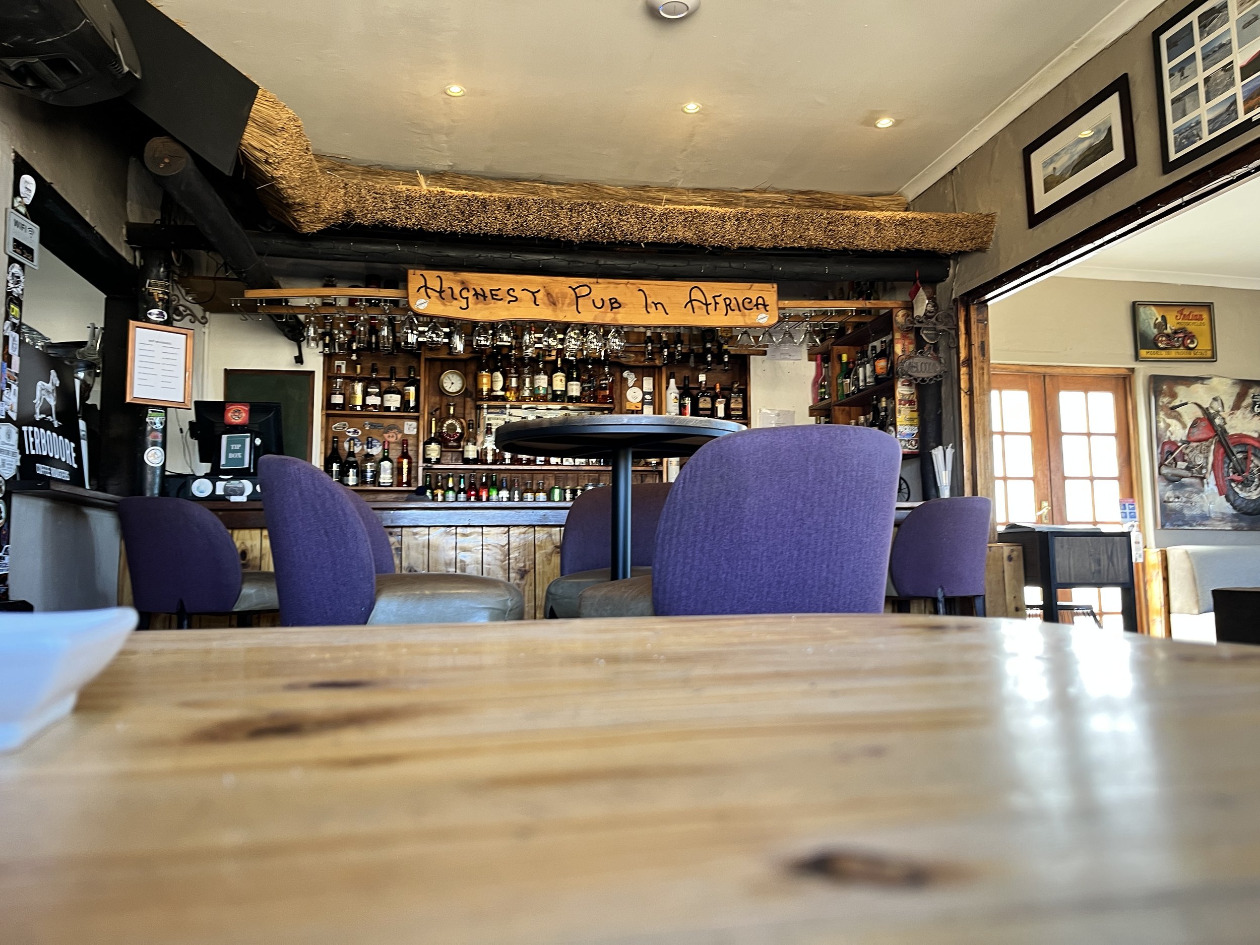
If you can brave the occasionally maintained loose gravel track, test your nerves on Devil's Corner and Suicide Bend, and survive being flanked by a steep drop-off for the entirety of the journey, you'll be treated to spectacular views of the surrounding Drakensberg Mountains, and a trip to the Highest Pub in Africa.
The beauty in this particular journey is in the remoteness. Nothing comes close to the feeling of standing on top of the pass, peering over the edge to see the winding road below. Meanwhile everything is eerily silent except for the wind whipping about, reminding you of just how forceful Mother Nature can be.
Ready to leap, or in this case slowly and arduously drive? Let's get into the details.
Looking for more South African adventures?
How difficult is it to drive the Sani Pass?
Make no mistake — driving the Sani Pass is not for the faint of heart.
With tight turns and oncoming traffic, it's important to have some prior driving experience not just for your safety but for everyone's. Remember, you won't be the only one on the road.
Despite re-graveling and flattening every month, the road is steep, rough, and unpredictable, with hairpin bends testing even experienced drivers. This, combined with the ever-changing weather, it’s best to have an alternative plan incase you’re forced to forego the drive that day.
It's not uncommon for drivers to embark on the Sani Pass before turning around and bailing out but, if you're committed to it, the drive requires 1.5-2 hours of constant concentration.
This is long enough to go slow, pull over for breaks, and pictures, or to give yourself a little pep talk, and still make it to the top safely.
Although I did a solo self-drive Sani Pass experience, it's safest to go with at least one other person to help you pick your lines of clearance. Some parts of the road can be a challenge and one wrong move can send you closer to the steep drop-offs.
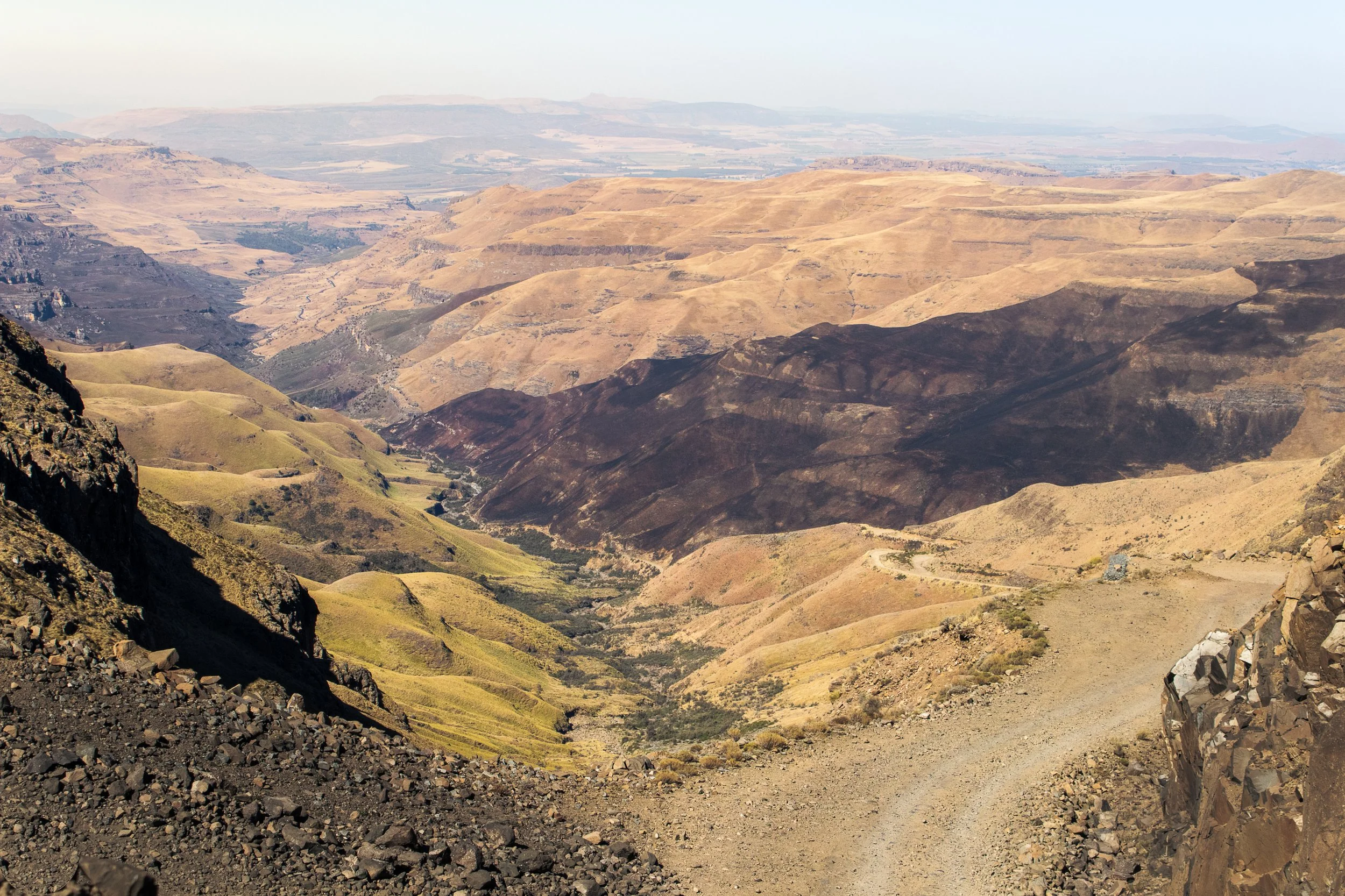
The Sani Pass is made up of steep declines, narrow paths, and abrupt drop-offs
Sani Pass Requirements
First things, first, is a 4x4 required to drive the Sani Pass? Yes. It’s mandatory and is actively enforced at the South African border.
Even if you do have a 4x4, the border patrol agents have been known to turn away vehicles they deem not fit for the current conditions.
In addition, you'll need to meet the following requirements:
Passport.
No visa is required for Lesotho if visiting for 14 days or less.
Proof of Ownership of Vehicle.
It’s standard practice to provide registration documentation when entering and exiting any country.
Letter of Authority.
Rental cars must obtain a letter of authority from the agency that gives the driver permission to cross specific borders. This comes at an additional cost to the rental rate, usually around R650, about USD 35.
Spare Tire.
It's not necessarily a requirement that's checked, but it is safest to have one. The road is often littered with rocks and boulders, and if I have a choice between a flat tire and veering towards the ledge, I'm choosing the tire every time.
Finally, it's important to note that both the South African and Lesotho borders open their gates between 6 am and 6 pm. You must clear both by that time, otherwise, you'll be stuck.
This means that for a round-trip adventure, assuming a slow 2-hour journey, plan to start from South Africa no later than 12 pm and be checked in at Lesotho immigration by 2 pm.
Spend an hour or so snapping pictures and calming your nerves at the Sani Mountain Lodge, maybe purchase a quick souvenir from one of the small shops at the top of the pass, and exit Lesotho no later than 4 pm.
When to Drive the Sani Pass
Best time:
The best time to drive the Sani Pass is during the dry months. May to September offer clear skies and stable conditions.
Maybe it's not as photogenic (there will be less greenery on the pass), but it's still an unbelievable experience.
Avoid:
The worst time to attempt to drive is during the rainy summer months (November–March). Storms move through the mountains every afternoon, often striking at unpredictable times.
With such a steep gradient, you can imagine how prone the road is to landslides and flooding.
Winter note:
Winter on the Sani Pass is from June to August and is generally drier, making for an optimal experience. With that said, it's not uncommon for snow and ice to coat the road, making it slippery and un-passable.
It’s ideal to plan for winter months and when no recent storms have hit (easier said than done, I know).
A car carefully drives the perilous Sani Pass
Best Sani Pass Tours (2025)
Still interested, but maybe you're questioning your ability (or sanity) at this point? Don't worry, there are plenty of daily tours leaving from Underberg on the South African side.
Most depart at 9 am and include lunch at the Sani Pass Lodge and a visit to a Basotho Village in Lesotho before descending the Sani Pass and back into South Africa.
Total time is typically between 6 and 7 hours.
Here are a few reliable options to check out (all departing from Underberg):
Private Sani Pass Classic Tour (Top Rated)
First-Hand Experience: What it’s like to drive the Sani Pass
Here's where I need to put a disclaimer, don't do what I did. But, before you pass judgment, let me explain.
As I mentioned earlier in this post, driving the Sani Pass was imprinted into my brain while planning my road trip around South Africa. I made sure to book a 4x4 in Johannesburg, thinking I would be driving up the pass, across Lesotho, and back into South Africa somewhere else.
Spoiler alert: that plan fell apart very quickly.
When I arrived at the rental desk, they told me no 4x4s were available and I would have to wait multiple hours if there was any chance of locating one, but it wasn't guaranteed.
Meanwhile, time is ticking away to check in at the Black Rhino Game Lodge and, at some point, the gates will close and I'll be out of luck.
Once the rental agency sent me to the garage to pick up a BMW, I immediately said no, trying not to laugh at them knowing what I had planned. Their second try yielded a Rav4 that was, at least, AWD and had a downhill lock for the breaks.
At that point a decision needed to be taken. Do I put my foot down and demand a 4x4, wait it out and hope for the best? Or do I stay on track and adjust elsewhere?
Ultimately, I decided to take the Rav4 and reverse my itinerary. Instead of ascending Sani Pass from the South African side, I would enter Lesotho and Caledonspoort and descend.
An overnight stay in Mokhotlong, Lesotho before attempting the Sani Pass
There were a couple of reasons for this. For starters, it's much easier to go down than up. I can see the track better, make safer decisions, and gravity is in my favor when trying to get over rough terrain. Secondly, I took a gamble that if Lesotho border patrol wouldn't check the vehicle's 4x4 capacity. By the time I got back down to South Africa what could they do? I felt I had a better chance of still driving the Sani Pass if I planned it like this.
Again, get a 4x4. The only reason this crazy plan worked, was because I lucked out with a beautiful day and dry conditions.
So, I crossed my fingers, drove across Lesotho, and reached the top of Sani Pass after staying the night in Mokhotlong.
From the warm comforts of the Sani Mountain Lodge, I watched the morning traffic slowly crawl to the top, carefully maneuvering over every rock and boulder, fighting the wind to stay stable.
Why was I doing this again? Is this really a good idea? But, at that point, the only other option was to drive straight back across Lesotho.
After striking a full-on athletic-dad stance to avoid the whipping wind at the overview to snap a few pictures and once the Highest Pub in Africa reached capacity with adrenaline-filled tourists, it was clear that my time was now or never.
I stumbled over to border patrol while fighting the wind and, before I could say anything, the agent looked at my passport, mumbled something under his breath, and handed back my booklet with an exit AND entry stamp, failing to see I had entered Lesotho elsewhere. Instead, he assumed I had just failed to get my passport stamped once at the top, probably a common theme as people are filled with the cathartic feeling of escaping death on Sani Pass.
Either way, my passport now has two entry stamps into Lesotho and only one exit, so I guess it's a good thing it's not an electronic system and no one has bothered to check!
As the car slowly rolled under the "Thank you for visiting Lesotho" sign, that was the moment I realized there was no turning back and I had to lock in.
The hairpin turns and steep decline came quick. The phrase 'slow and steady wins the race' has never been so true. So much so that I let tourist vans pass me on their way back down.
As you'll read later in this post, patience and humility are two keys to success when driving the Sani Pass. Let everyone else go at their pace! In hindsight, one of the best decisions I made was to arrive at Sani Mountain Lodge in the morning and wait for those ascending to finish.

Looking back up towards the Sani Pass, from the South African Side
I can't imagine having to descend with traffic on the way up. Instead, I ran into maybe one car on their way to Lesotho. This allowed me to remain fully focused on white-knuckling the steering wheel and methodically trying to plot every minor adjustment to the tire angles while also not killing the undercarriage of the car because, as a reminder, a Rav4 is generally not equipped for this South African adventure.
After about an hour of riding the gas pedal, the slope leveled out and the anticipation of being on South African soil and paved roads again became real. It wasn't long before the little roadside "Welcome to South Africa" sign came into view and I was greeted by the smiling border patrol.
"How are you," they asked.
"Better now," I replied, laughing as I stomped on the pavement.
The gentleman checked some documents, looked in my passport, and glanced up at me before stamping and returning it. Surely he would be curious about why I have two entry stamps into Lesotho, right?
Instead, as he handed my passport back, he asked "This is a 4x4, right?"
Panic set in. I mumbled some deflection about how it "got the job done".
He smiled unconvincingly, and I drove off into the literal sunset, parking farther down the road to look back on what I had just accomplished.
Long story short, yes the Sani Pass is self-drivable, even for solo travelers like me, but there are some important factors to consider.
It's one hell of an adventure and one that I won't soon forget!
What to do at the top of the Sani Pass
The Drakensberg Mountains are an incredible playground in the wild, full of natural beauty and trails and the Sani Pass drops visitors at the perfect starting point. Whether you plan a round-trip excursion or want to see more of Lesotho, here's what you can do:
Grab a Drink at the Sani Mountain Lodge
Unless you're on a tour, be careful with what "drink" you choose. Remember, at 2,874 meters above sea level, alcohol will have an amplified effect and you do not want to be compromised on your descent down the Sani Pass.
Grab a cappuccino and a warm ham and cheese toastie and marvel out the window at your latest accomplishment as you watch cars struggle up the pass. This is also the optimal spot for some photos from the top of the pass as it looks out across the valley below and surrounding Drakensberg Mountains.
Explore Lesotho's Highlands
Consider continuing into Lesotho's remote interior for a few days before heading back down the Sani Pass to South Africa, or do what I did in reverse and exit Lesotho via Caledonspoort to see both Lesotho's stunning terrain and spend some time in Clarens, SA.
If you choose to traverse the Moutain Kingdom during the winter months, be sure to stop over at AfriSki and carve some turns on the African continent!
Overnight Stay
Wanting to stay overnight at the top of the pass? Here are some options:
Sani Mountain Escape ($-$$)- From 1 May 2025 to 31 August 2025, all accommodation at Sani Mountain Escape will be closed for renovation.
The Highest Pub in Africa remains open, but as such a high-demand destination, it now requires a R100 entrance fee and can often reach capacity at peak hours (get there early).
Sani Lodge and Cottages ($$-$$$) - Nestled at the base of the Sani Pass in South Africa, they have a range of accommodation available ranging from campsites to Rondavels (a traditional, circular hut).
The lodge also partners with Drakensburg Adventures, a Fair Trade Tourism company, making it easy to get in and out of Lesotho.
Sani Stone Lodge ($-$$) - For a more authentic Basotho experience, book a stay at Sani Stone Lodge. A bed in a mixed dorm costs R250, around USD 15, while a twin room with ensuite will run R1,100, or USD 60.
Take a break at the Highest Pub in Africa before heading down the Sani Pass
Top tips for self-driving the Sani Pass
Ready for your adventure?
This is truly one of the most beautiful drives in the world, but it's also one of the most challenging so it's important to come prepared. Here are some of my top tips for self-driving the Sani Pass:
Stick to the 4x4 Rule:
Don't attempt this in a regular vehicle. Seriously. Learn from the error of my ways.
What Goes Up, Must Come Down:
When I was unable to secure the 4x4 I had promised, I figured what goes up, must come down, right? In my experience, it was far easier to maneuver a Rav4 on the descent than the ascent, so I changed my route.
Consider which direction you want to drive and what makes most sense with your experience and expertise.
Less Congestion Equals Easier Maneuvering:
Morning drives offer better visibility and fewer vehicles, but it's also best to be aware of the tours.
I spent my morning sipping cappuccinos at the Highest Pub in Africa, watching the tour convoys haul their customers up and, when the restaurant became congested, that was my time to take off and descend the pass with far less ascending traffic.
How Low Can You Go:
Use low gear, especially on the descent. I cannot express this enough. You will be driving slower than you walk.
Thankfully, the Rav4 had downhill locks to keep sustained pressure on the breaks and limit the speed.
Pack Essentials:
This can mean different things for everyone, but in general consider water, snacks, warm clothing, a spare tire, and a sense of adventure.
Here are some of the things I brought along:
Hand warmer/power bank - Because you never know when you’ll need that little extra bit of warmth (or a flashlight, but hopefully just the heat).
Cotopaxi Fuego Down Vest - A great choice for layering. All the warmth, with more freedom! Add a windbreaker on top and you’re ready to brave the Sani Pass.
Mini Tripod - You won’t want to miss capturing the views, but at the same time it’s crucial to stay focused on the road. Set the tripod up in the car and rest assured you’ll collect some great images and videos.
First Aid Kit - It sounds unnecessary until it’s not and I didn’t want to risk the car rental not providing one, so I brought along my mini first aid kit.
Pocket Knife - Again, you never know when it comes to the Sani Pass. Better to be prepared for the unexpected.


Small shops line the roads at the top of the Sani Pass
Don’t Forget…
Fill the Tank:
Petrol is not readily available on either side of the border, so plan to fill up in Underburg (if coming from South Africa) or Mokhotlong (if arriving from Lesotho).
Don't Feel Pressured:
Yes, self-driving the Sani Pass is one of the most difficult 4x4 road-trips in South Africa, if not the southern part of the continent. It is still a route used by local transportation and many locals drive the road for leisure.
Don't panic if someone is passing you or ascends in 45 minutes. That's fine. Be patient, stick to what you're comfortable with, and trust the process.
Time doesn't matter, but remaining in one piece to share your adventure does!
Carry Cash:
The Sani Mountain Escape is now cashless and, oddly enough, even one or two of the small souvenir shops at the top of the road take cards, but it's best to still carry some cash.
The shop I wanted something from the most, of course, didn't take card and I was left with the memory (not a bad consolation prize, though).
South Africa SIM:
Be sure to use your South Africa SIM card in case of emergency.
If you haven't yet, try the Airalo e-sims. I've quickly grown to love the ease of flipping between SIM cards without fumbling through my bag to find something to open the slot with.
In the event of an emergency, the South African Border number is +27 033 202 1169.
Stamp the passport:
South Africa has a car park to pull into and it's very clear where you need to go. Lesotho, at the top of the Sani Pass, is a bit more relaxed.
Don't forget to walk over to the immigration window on both entry and exit. If you're doing a one-way self-drive, like me, be sure to tell them to avoid a wrongful assumption that you forgot to stamp into the country.
However it does make for a fun story, how I have two passport stamps into Lesotho and only one stamp out!
Sharing is caring! Pin this post for later.


Can you feel the excitement building?
Then it's probably time to book that trip to South Africa and experience the infamous Sani Pass in person!
Grab a drink at the Highest Pub in Africa, marvel at the surrounding geography, swap stories with other adventurers, and have the (literal) ride of a lifetime.
The Sani Pass awaits.
Anything I've missed? Have you visited before? Let me know in the comments below and, as always, stay safe & happy travels!

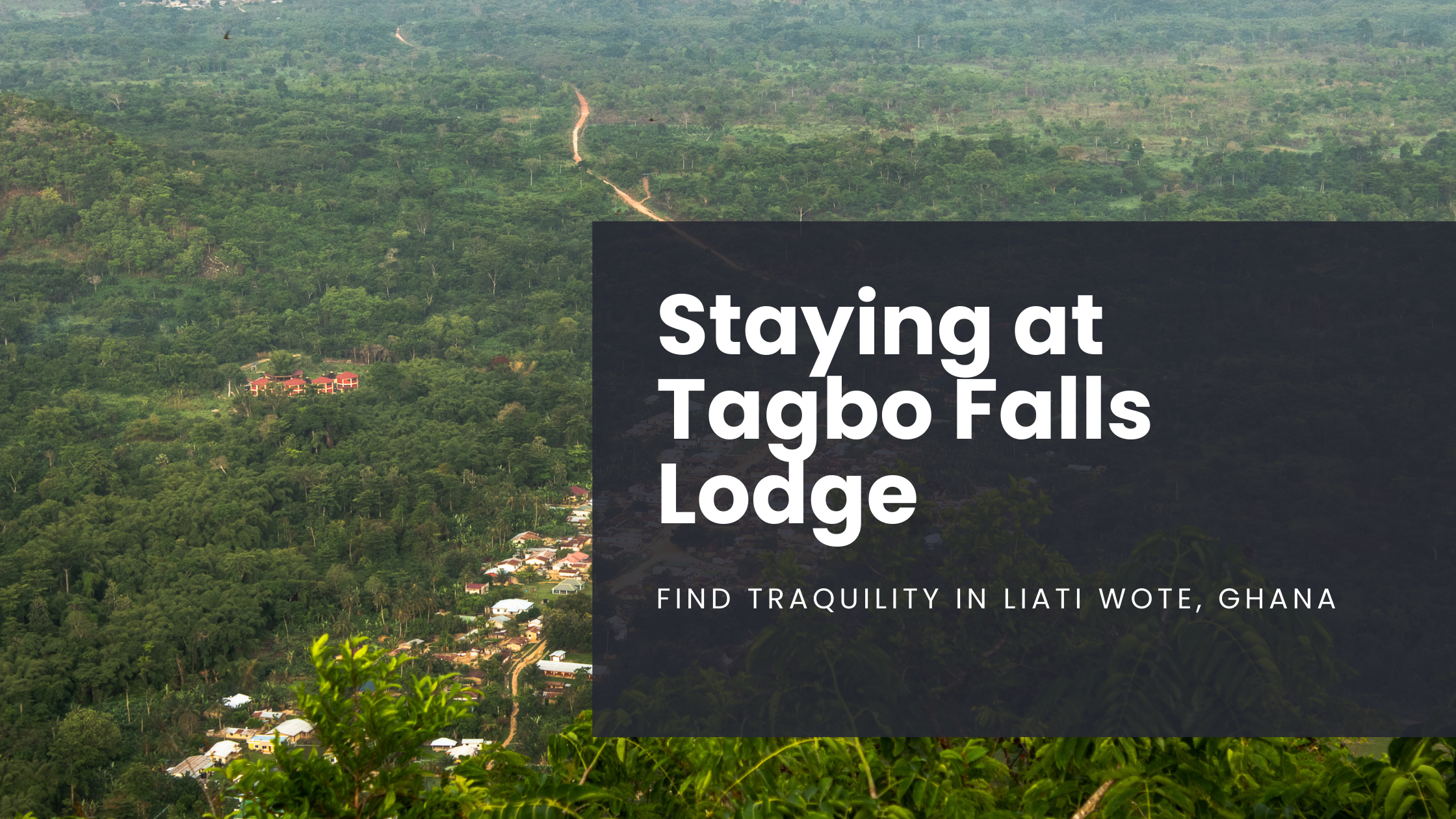
Discover Tranquility at Tagbo Falls Lodge in Liati Wote, Ghana
Looking for a serene escape in nature's lap? Welcome to Tagbo Falls Lodge, my favorite place in Ghana. This small and unassuming lodge is the perfect retreat for travelers seeking peace, adventure, and a connection with nature deep within Ghana’s Volta Region…
Note: All information is updated as of April 2025
Looking for a serene escape in nature's lap? Welcome to Tagbo Falls Lodge, my favorite place in Ghana.
Owned by Jolinaiko Eco-Tours, this small and unassuming lodge is the perfect retreat for travelers seeking peace, adventure, and a connection with nature deep within Ghana’s Volta Region.
Relax in a hammock and get lost in a good book, enjoy delicious food, or explore the village… there’s something for everyone.
Here’s everything you need to know about staying at this hidden gem in Liati Wote, Ghana.
Let me be the first to welcome you to Tagbo Falls Lodge!
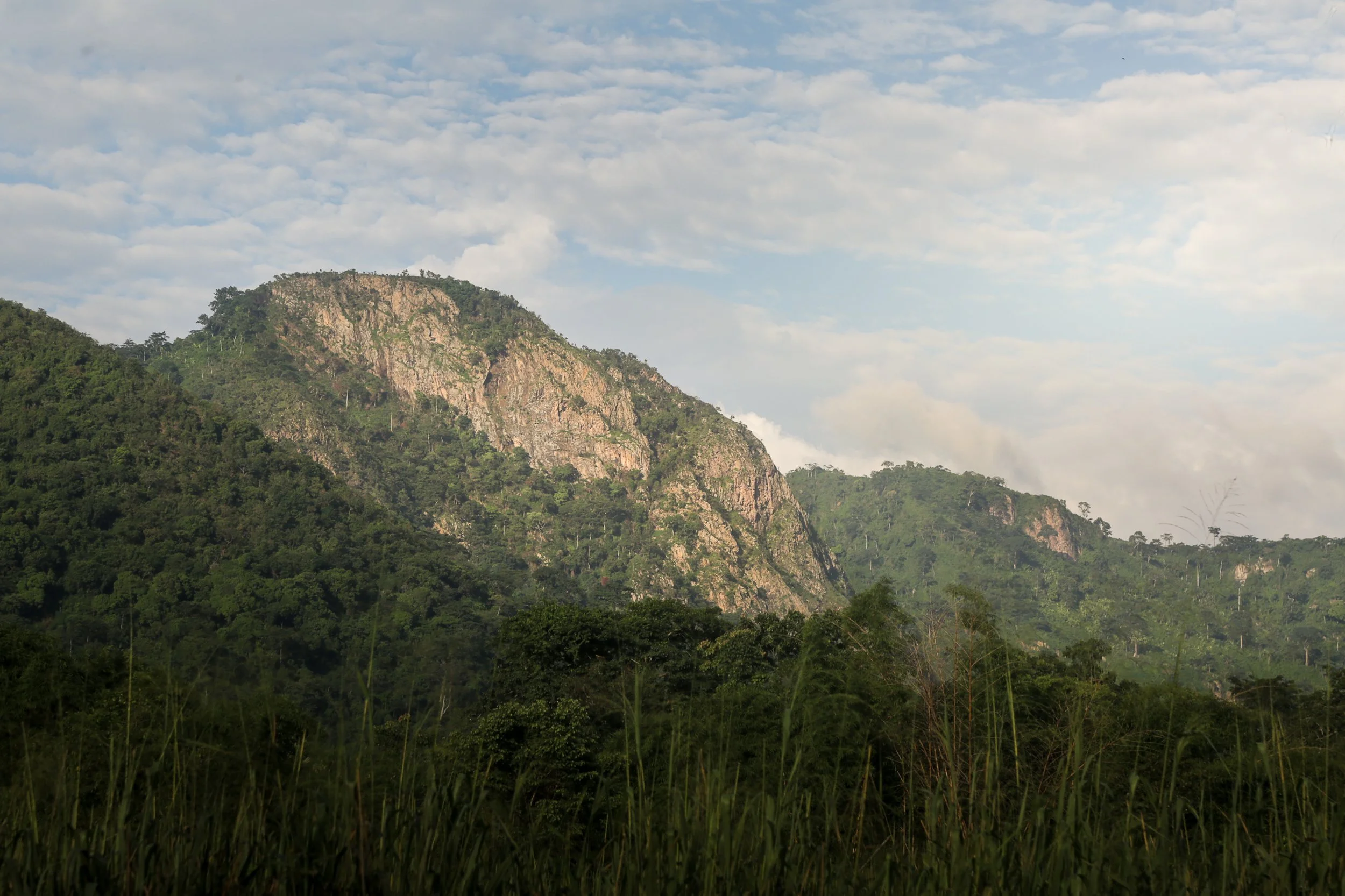
Mount Aduadu above the lush forests of Ghana’s Volta Region
About the Area: Liati Wote and Ghana’s Volta Region
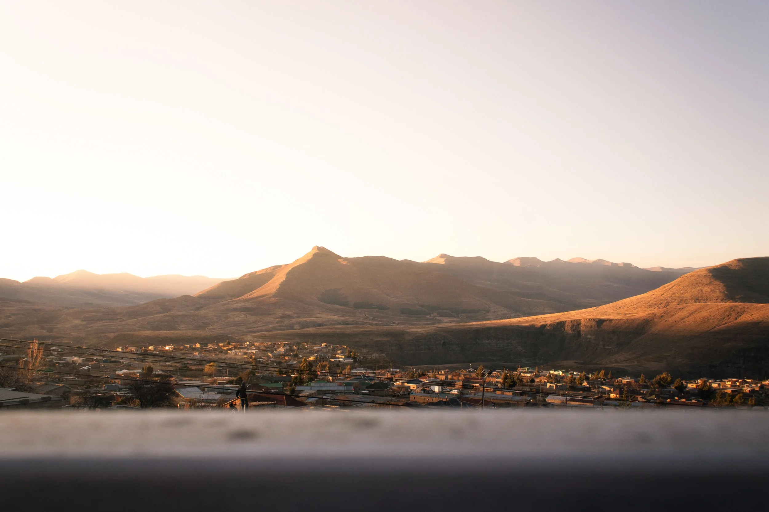
Tagbo Falls Lodge is situated on the edge of a picturesque village, Liati Wote. Nestled near the border with Togo in Ghana’s Volt Region, this part of the country is renowned for its rolling hills, lush forests, and cascading waterfalls.
Although less than 600 members, Liati Wote prides itself on its community-based tourism approach, warmly welcoming people from all over the world to their slice of paradise in the mountains.
At first, I’ll admit, I was a bit put off by the term “tourist village”, imagining the all-too-often haggling on the streetside, drummers and dancers dressing up to beat drums for eager ears, ultimately existing to please the tourists rather than educate.
Boy, I was wrong. Liati Wote is nothing but laid back, making it possible to coexist to whatever degree you wish during your stay. That’s hard to find a world full of overtourism and the opportunism that comes from it.
Take a few steps down the dirt road outside the entrance and you’ll find yourself in the shadow of Ghana’s highest peak, Mount Afadjato. Keep walking towards town and you’ll find your way to the trailhead to the stunning Tagbo Falls (be sure to bring a swimsuit).
Liati Wote isn’t just about nature, though. Wander around town and you’ll quickly spot waste bins all around, part of a plastic waste reduction initiative from the Stepping Stones of Africa Foundation.
More recently, the NGO established the Nuku Arts Center in town, offering a workspace for upcycling while providing locally handmade goods for purchase.
Are you sold yet? Whether you’re a solo traveler, backpacker, or nature enthusiast, Liati Wote is a must-visit spot on any Volta Region travel itinerary.
Looking for more posts about Ghana’s Volta Region? Check these out:
How to get to Liati Wote, Ghana and Tagbo Falls Lodge
Getting to Tagbo Falls Lodge isn’t necessarily easy, but that’s part of the fun, right? From Accra, take a bus or drive to HoHoe, the largest city in the Volta Region. From there, you can hire a taxi or take a shared minibus (locally called “tro-tro”) to Liati Wote.
In the past, I’ve taken tro-tro from the Tema-Akosombo road to Golokwati, before hiring a motorbike to take me the final 45min to Liati Wote. This is the more adventurous way to arrive, but there’s nothing quite like cruising down dirt roads in the fresh mountain air.
Estimated travel time from Accra: 5–6 hours
From Hohoe to Liati Wote: ~40min by road
Pro tip: Wherever you’re coming from, do yourself a favor and plan to take a private taxi. It eliminates stress, and Ghana’s tro-tro system has a less-than-stellar safety record. Worry less about how to get there, and more about what you’ll do once you reach the lodge!
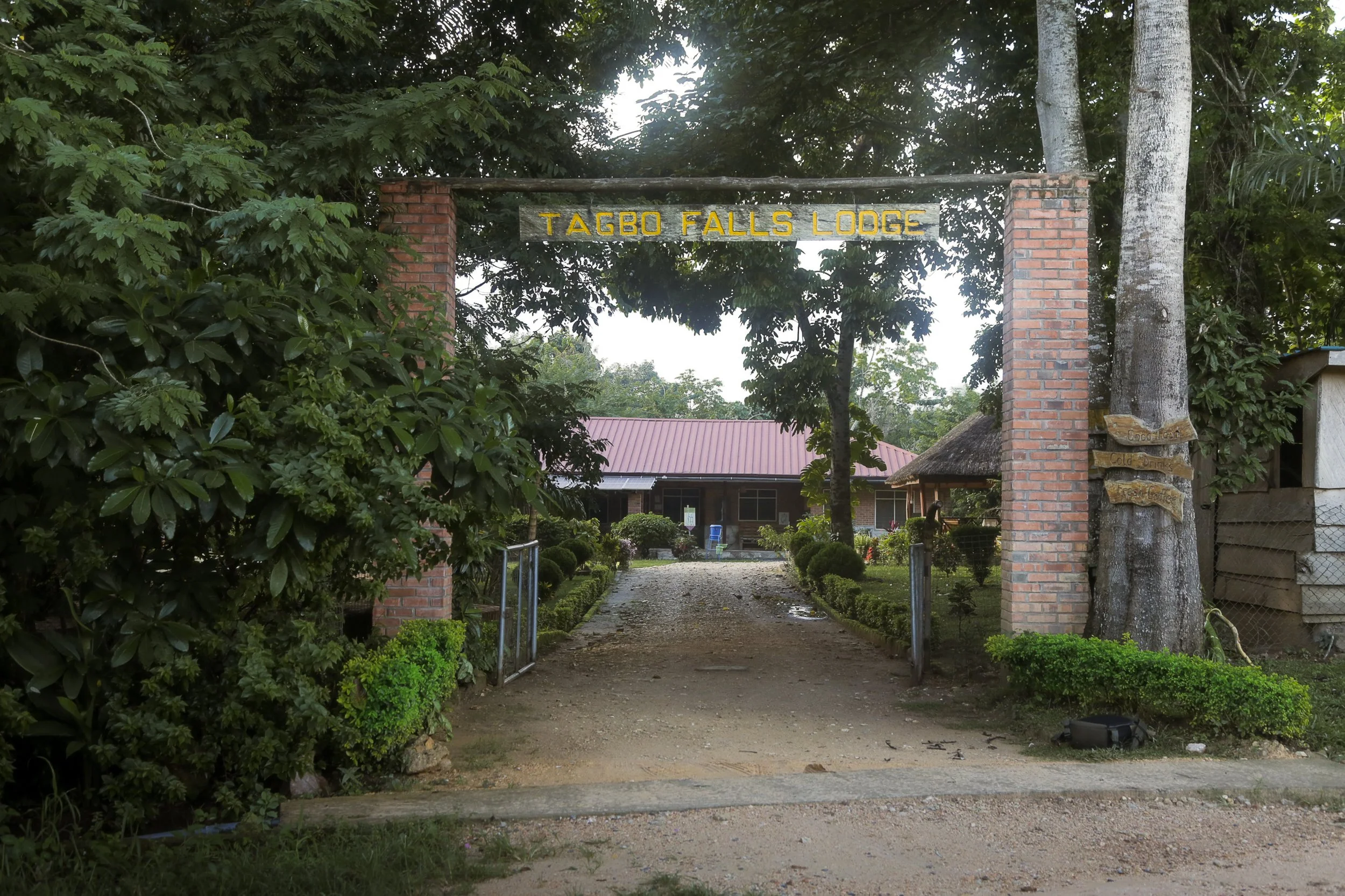
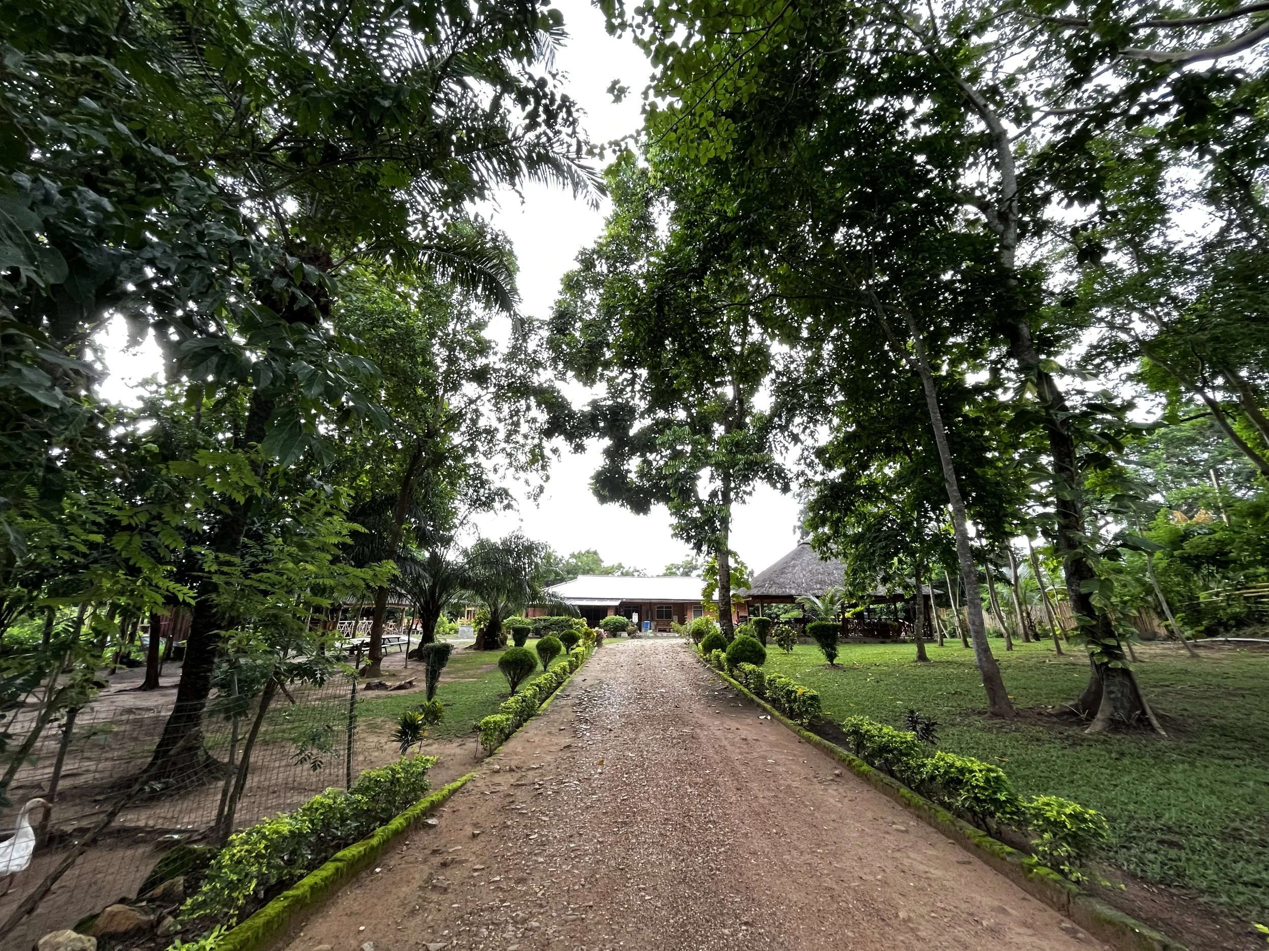
Entrance to Tagbo Falls Lodge in Liati Wote, Ghana
Cost of Accommodation at Tagbo Falls Lodge
Tagbo Falls Lodge offers a range of accommodations that suit every budget, making it ideal for families and solo travelers, alike. Here is the current list of rooms available, as of 2025:
Banana Room (1 queen bed, private bathroom): 400/550* GHS/night (USD 26/33)
Orange Room (2 single beds, private bathroom): 400/550* GHS/night (USD 26/33)
Papaya Room R3 (2 single beds, shared bathroom): 300 GHS/night (USD 20)
Papaya Room R4 (1 queen bed, shared bathroom): 300 GHS/night (USD 20)
Pineapple Room (1 double bed, 2 single beds, private bathroom): 500/650* GHS/night (USD 32/42)
Chalet R6 (1 double bed, private bathroom): 600/750* GHS/night (USD 39/49)
Chalet R7 (2 single beds, private bathroom): 600/750* GHS/night (USD 39/49)
Chalet R8 (2 single beds, private bathroom): 600/750* GHS/night (USD 39/49)
The asterisk is the price for using solar-powered air conditioning. If you can survive off fans, then you’ll pay the lower rate.
Accommodation at Tagbo Falls Lodge does not include breakfast, so that’s important to factor in. With that said, the food here is some of the best I’ve had at any eco-lodge in Ghana. It will be well worth the nominal cost, I promise.
Speaking from experience, it’s important to plan ahead and book early. Weekends fill up quickly, so if you need more flexibility it’s best to try to visit during the week and off-holiday periods.
Ready to book? Contact them directly via WhatsApp at +233 54 955 8307 for any enquiries.
Morning sunrise in Liati Wote, Ghana
What to expect during your stay at Tagbo Falls Lodge
Tagbo Falls Lodge makes it easy to unplug and reconnect with nature. Upon arrival to the beautiful grounds, you’ll meet the friendly staff, get situated in your room, and immediately start to feel any stress melt away.
Everything about the lodge is cultivated to slow down and step back. If you need guidance they’re there to help, but if you need space, no one will bug you. I have met some wonderful people and have heard some incredible stories from those working there, though, so take time to interact and get to know them (especially Madam Philomina, who cooks all of the delicious meals).
In the middle of the lodge is the communal lounge where meals are served, complete with a bar stocked with local drinks. My personal favorites are the hibiscus juice and Tale Beer’s Hibiscus IPA… I guess you can see a trend there, huh?
Not a fan of independent travel? Check out these top-rated tours:
There’s limited Wi-Fi (very limited), so bring a good book and be ready to slow down. The data network is also virtually nonexistent except for certain spots in the village, which is my favorite aspect (good luck getting in touch, work colleagues).
If you’re lucky enough to be there as a storm hits, grab a drink and head for the viewing platform and the front of the property to watch clouds and lightning roll in through the mountains surrounding Liati Wote.
One of the best parts of staying at Tagbo Falls Lodge that I haven’t touched on is the food. This is some of the best and most affordable food I’ve had in Ghana and if I find myself within an hour’s drive, I always make it a point to stop by for lunch.
Madam Philomina and her team do a fantastic job, offering both local and continental dishes, including plenty of vegetarian options. Personal favorites include the baobab smoothie (baobab is a superfood native to Northern Ghana but lesser known), coconut curry rice (85 GHS/USD 5.50), and the homemade bread and garlic butter (40 GHS/USD 3).
This is one of the few places you can taste the passion and effort that goes into making the food. I will forever be a Philomina fan – be sure to ask about her duty as Queen Mother of Kpando, a small village on the bank of Lake Volta!
Whether it’s the end of a day full of relaxation or adventure, fall asleep with a happy stomach to the sound of crickets and rushing water and wake up to misty mountain views and crisp, clean air (a rarity in Ghana).
Tagbo Falls Lodge is a top eco-lodge in the country when it comes to its staff, cost, and location, and is a must-include for any Ghana itinerary.
It’s not hard to relax in the gardens of Tagbo Falls Lodge
Must-do attractions nearby
Although it’s easy to lose track of time and relax at Tagbo Falls Lodge, it also serves as the perfect home base for many other Volta Region activities. Here's what you can do nearby:
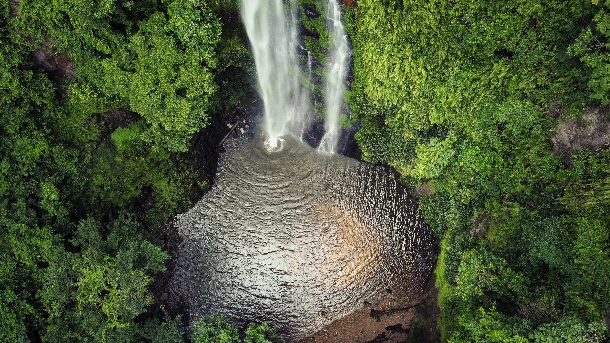
Hike to Tagbo Falls
The trail to Tagbo Falls is scenic and moderately easy, with a short 45-minute walk through the forest. The waterfall itself is spectacular—cascading into a clear pool that’s perfect for a refreshing dip.
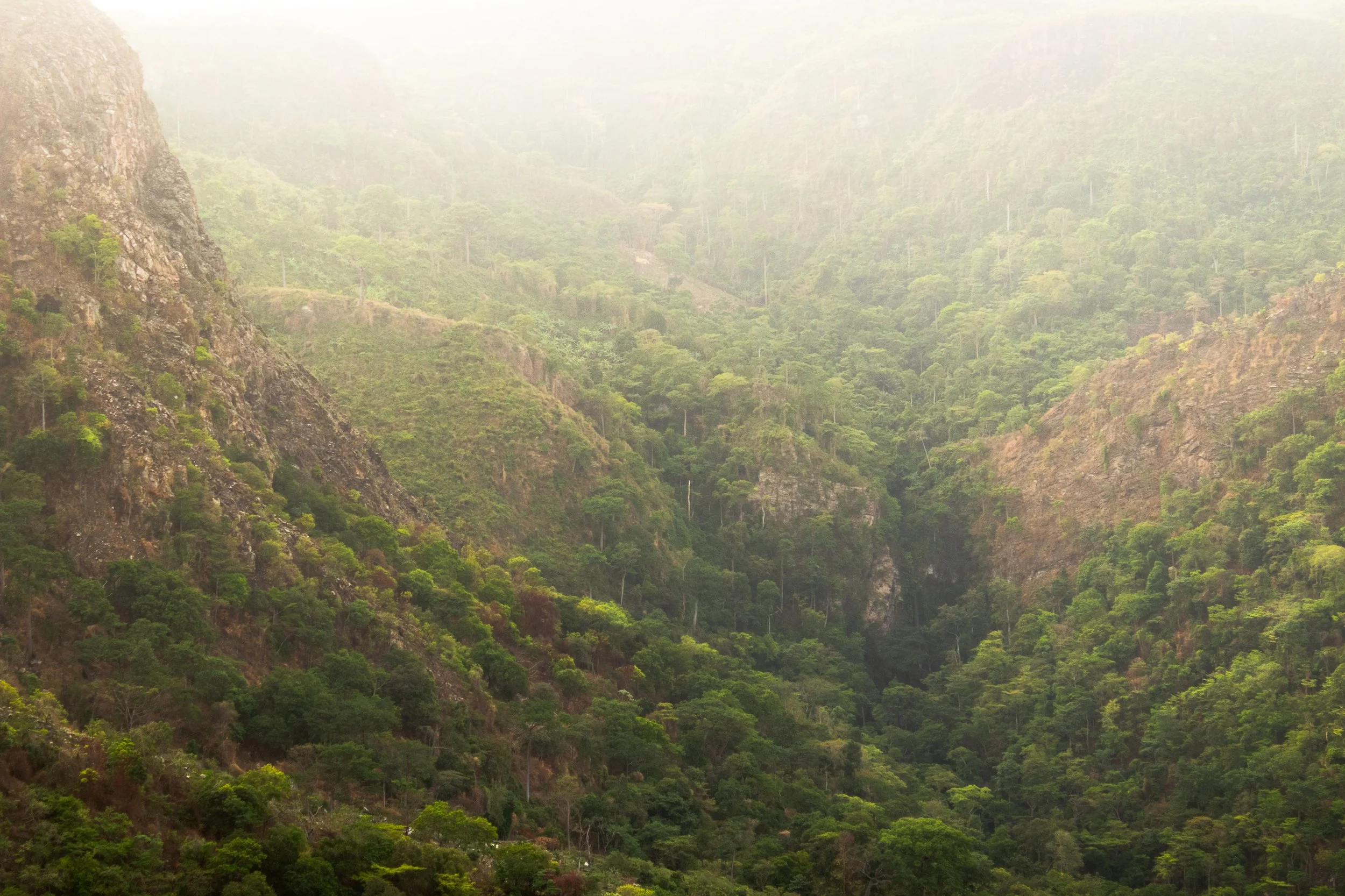
Climb Mount Afadjato
Up for a challenge? Mount Afadjato is Ghana’s highest peak. It’s a steep but rewarding 1–2 hour hike, offering panoramic views over the Volta highlands and into neighboring Togo.
Visit Amedzofe, Ghana’s Highest Elevated Settlement
Just an hour’s drive away, Amedzofe is another eco-tourism paradise. Walk to the top of Mount Gemi for unparalleled views across the valley below or stroll along the canopy walkway through the forest.
Swim in West Africa’s Tallest Waterfall
Pick a moto and ride 40 minutes north along stunning mountain landscapes before arriving at the Wli tourist center. Follow a short, easily accessible trail, and feel the power of Wli Falls, one of Ghana’s top waterfall hikes.
Tagbo Falls is one of Ghana’s best waterfall hikes in the Volta Region
If the above doesn’t sell you on a visit to Tagbo Falls Lodge, then it’s possible you’re on the wrong blog! Just kidding (sort of).
In all seriousness, there are few places I’ve visited throughout my travels in Africa that are as authentic and wholesome as this. It’s time to book that trip for the real Ghana experience.
Tagbo Falls Lodge, Liati Wote, Ghana—add it to your travel list.
Have you visited Ghana’s Volta Region before? Share your experiences in the comments below and, as always, stay safe and happy travels!
Sharing is caring! Pin this post for later.


Climbing Mount Afadjato: A Complete Guide to Hiking Ghana's Tallest Mountain
If you’ve been on this blog before, it’s no surprise that this is yet another post about the unbelievable nature of Ghana’s Volta Region. When I first moved to West Africa, I immediately searched for “top places to hike in Ghana,” and every result pointed back to this mountain. So naturally, the surrounding forests and waterfalls of Mount Afadja have become my safe haven…

Note: All information below is accurate as of April 2025
If you’ve been on this blog before, it’s no surprise that this is yet another post about the unbelievable nature of Ghana’s Volta Region.
When I first moved to West Africa, I immediately searched for “top places to hike in Ghana,” and every result pointed back to this mountain. So naturally, the surrounding forests and waterfalls of Mount Afadja have become my safe haven.
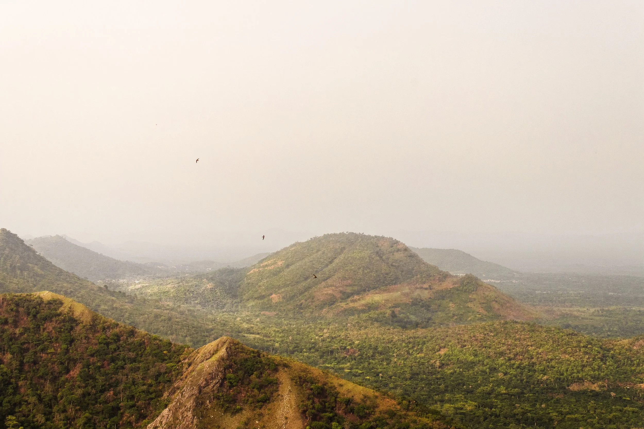
Standing at 885 meters (2,904 feet), Mount Afadjato is Ghana’s tallest mountain and offers stunning views of surrounding villages, verdant forests, and even neighboring Togo.
Even more, it’s located in a small, peaceful village with plenty of other trails and waterfalls to explore, including my favorite place to stay: Tagbo Falls Lodge.
Fancy a bit of outdoor adventure on your trip to Ghana? Mount Afadjato is for you!
The view of the Volta Region while hiking Mount Afadjato in Ghana
History and meaning of Mount Afadjato
Mount Afadjato derives its name from the Ewe word “Avadzeto,” meaning “at war with the bush.”
As the Ewe tribe settled here from Togo, they were prone to attacks from wild animals. The village revolted, pushing them back into the mountains but as they reached the forest, they were overcome by plants making them itch.
Afadja, Afadjato, it’s all the same! Another way to break it down in the Ewe language: ‘Afar’ means ‘war’, ‘dja’ means ‘plant’, and ‘to’ means ‘mountain.
Despite the name and history, I’m happy to report that the itching plants have since been tamed and it is very safe to hike the trails (but consider long pants, just in case)!
The area remains a symbol of pride for the Ewe people, as Mount Afadja is believed to house the spirits of their ancestors who look over and protect the surrounding communities.
Interested in exploring more of Ghana’s Volta Region? Check out these posts:
Location and how to get to Mount Afadjato
Nestled in the mountains that border Togo, the trailhead is located in the small village of Liati Wote in Ghana’s Volta Region. Sounds great, right? Here’s how to get to Mount Afadjato:
By Car:
From Accra, take the Accra–Hohoe road and follow signs to Liati Wote. The roads are well-maintained (for the most part), making the drive smooth and scenic as you wind through the mountains. The drive should take ~6 hours.
By Public Transport:
Buses and shared taxis from Accra to Hohoe are affordable. From Hohoe, hire a taxi or take a shared ride to Liati Wote. Another option is to take a tro-tro to Golokwati, but this often requires 2-3 changes in vehicles along the way.
From Nearby Attractions:
If you’re already exploring Wli Waterfalls or Tafi Atome Monkey Sanctuary, Liati Wote is just a short drive away (20-40 min depending on where you’re coming from).
If you don’t want to plan your own transportation, consider one of these pre-arranged tours from Get Your Guide. They depart Accra and sort travel, food, and accommodations along the way!
Pro Tip: Whenever I can, I try to travel around Ghana on Sundays. Everyone is in church and this means much less traffic and dangers on the road – and I get to where I’m going quicker! I have my own car, but your safest option is to either rent or hire a reliable taxi. Although cheap, tro-tros (Ghana’s public transportation) are prone to breakdowns and accidents.
Aerial view of Liati Wote as seen from the trail of Mount Afadjato in Ghana’s Volta Region
Entrance fees & costs
Liati Wote markets itself as a tourist village (don’t worry, I was initially turned off by this as well, but it’s not what we’re used to when we see that tagline).
There are plenty of tours and options available around town, including multi-day hiking, local gin tours, and surrounding waterfalls, but be warned that each one requires a guide (this is used as a means to boost the local economy).
You can find a guide and look at the options available by checking in at the Liati Wote Toursim Office upon arrival, located at the base of Mount Afadja on the main road of town and typically open 8am, daily.
The tourism office accepts cash only, so come prepared as there are no ATMs within a one hour radius.
Hiking only Mount Afadjato requires a modest fee:
Ghanaians: 25 GHS (USD 1.60)
Non-Ghanaians: 50 GHS (USD 3)
You can add on and combine with a trip to Tagbo Falls (GHS 40/USD 2.50 for Ghanaians, GHS 80/USD 5 for non Ghanaians), or continue past Mount Afadjato to Mount Aduadu (GHS 70/USD 4.50 for Ghanaians, GHS 100/USD 6.50 for non-Ghanaians).
A Note on Guide Fees: Guides for hiking Mount Afadjato and surrounding tours don’t get paid from trail fees, so come prepared to tip them for their service to support their income. For this hike, GHS 50-100 is reasonable (USD 3-6).
The trail fees do, however, contribute to maintaining the paths and supporting local community projects, such as their recycling initiative – something that is unique to this village!
Pro Tip: There are many guides and not many visitors, meaning it’s important to find one of quality. The only one I’ll use is Faith (+233 55 083 0914). I will meet him at the reception office, pay the entrance fee, give him a tip, and often he’ll let me take myself on the trail!
What to Expect: Hiking Mount Afadjato
Although Mount Afadjato is considered a popular tourist destination in Ghana, let me be direct with you: It’s not for everyone. The trail starts on a flat path, but quickly becomes a leg burner, what feels like a perpetual stair climber machine.
Most people will tell you it takes, on average, around 2 hours round trip, which I found to be accurate, but it was by no means easy. It’s important to wear sturdy shoes and bring plenty of water and fuel.
Along the way you’ll come across convenient rest stops with scenic views, offering the perfect spot to recharge your legs and observe surrounding wildlife.
Did you know that Ghana is home to over 860 species for butterflies? Don’t worry, I didn’t before moving here, but spotting them is one of my favorite parts of spending time in the Volta Region!
Finally, after 45min-1 hour you’ll reach the peak and soak up the sweeping views across Lake Volta, neighboring Togo, and Liati Wote below. You may even spot Togolese coffee farmers wandering the foohills!
The Volta Region is where both Kawa Moka and Jamestown, two of Ghana’s top coffee companies, produce their beans.
For the most part, the trail is well preserved and shorts and t-shirt will suffice, but if you’re planning to go beyond the peak to nearby Mount Aduadu as I did, be sure to wear long pants.
Reaching this secondary mountain requires bushwhacking lesser-frequented pathways and it’s not uncommon to come across snakes and biting ants.
View of Mount Aduadu at sunrise, shot from the peak of Mount Afadjato
Nearby attractions
Tagbo Falls:
Located near Mount Afadjato, this tranquil waterfall is an excellent spot to cool off after your hike. I’d recommend climbing Afadja in the morning, and then continuing on (for an additional trail fee) to Tagbo Falls. It’s a flat, short, 40min hike and the trailheads start from the same location! It’s one on my favorite places to spend an afternoon swimming.
Wli Waterfalls:
Ghana’s highest and most famous waterfall is just a short drive away (20min) and offers another fantastic nature experience. Similar to Tagbo, this short trail is accessible to everyone and cooling off in the pool under the cascading water is a spiritual experience.
Amedzofe Village:
Amedzofe is Ghana’s highest-elevated settlement, originally established by the Germans during colonial times. The area offers cooler weather, more waterfalls, a better (and less frequented) canopy walk than Kakum National Park, and a small climb to the cross on top of Mt. Gemi. If coming from Ho, you’ll pass the turnoff for Amedzofe along the way (less than 1 hour from Liati Wote).
Best time to hike Mount Afadjato
The Harmattan, or dry season, (November to April) is the best time for hiking, as the trails are less muddy. However, the dust being blown from the Sahara can significantly reduce visibility (although makes for beautiful, glowing sunrise).
The rainy season (May to October) brings lush greenery, making the scenery even more vibrant, but the steep trail can get slippery, so be sure to wear proper footwear and plan accordingly.
Finally, beat the heat and hike Mount Afadjato in the morning. If arranged ahead of time, your guide can meet you at the tourist office before sunrise and you can start on the trail before fighting the humidity.
Top packing tips for your hike to Mount Afadjato
Shoes are essential. Especially if planning to visit during rainy season. The trail is steep and can quickly become slippery, so it’s safest to have good treads.
Sunscreen and insect repellent. The trail itself traverses dense forest, and the peak is completely exposed so you’ll have to plan for all elements. After years of sweating off my sunscreen in the humidity, I’ve finally switched over to using a stick instead and it’s been a gamechanger!
A good camera. The top of Mount Afadjato provides some of the most stunning views in the area. If you’re into landscape photography, this is the place to come. Personally, my Canon 80d has been my best travel companion over the years.
A quality dry bag. Hiking in West Africa can be unpredictable, especially during the rainy season. I’ll always bring my Marchway dry bag to protect my valuables.
Don’t forget a quick-dry towel. Whether caught in the rains or planning to add on a visit to Tagbo Falls, a lightweight towel is the perfect item to add to your pack.
Water and Fuel. Regardless of season or time of day, you’ll work hard to get to the top of Mount Afadjato. Come prepared with plenty of water and snacks. There aren’t many options available in town, but you can always also your guide where to pick up supplies.
A reliable SIM card. Traveling outside of Accra is never easy and it pays to have a reliable in-country SIM. Recently, I’ve been using Airalo on my travels and, although I enjoy collects SIM cards, they take away the stress of losing it or always looking for a pin to open the port!


A view into the valley below, shot from the peak of Mount Afadjato
Standing on top of Ghana’s tallest mountain at sunrise is a scene I won’t soon forget. Accra is great, but experiencing the breathtaking nature in the Volta Region is a must during any visit to Ghana, and Liati Wote is the perfect place to base.
Explore, rest, and walk away refreshed from your time in these stunning mountains.
Have you conquered Mount Afadjato or plan to visit? Share your experience in the comments below. As always, stay safe and happy travels!
Sharing is caring! Pin this post for later.


Whale Watching in Hermanus, South Africa: Top Tips for an Unbeatable Experience
Imagine a sleepy seaside town, unassumingly lying in the shadows of the mountains, but comes to life every year with marine life. Hermanus, South Africa. Ever heard of it? You may know it as the “Whale Watching Capital of the World” as it’s sometimes referred to….
Note: All information is updated as of April 2025
Imagine a sleepy seaside town, unassumingly lying in the shadows of the mountains, but comes to life every year with marine life.
Hermanus, South Africa. Ever heard of it? You may know it as the “Whale Watching Capital of the World” as it’s sometimes referred to.
What once was a peaceful village, so much so that doctors used to prescribe visits for recovering tuberculosis patients, now attracts between 75,000 and 130,000 visitors every September/October to celebrate the return of the Southern Right Whales to the harbor.
Less than a two-hour drive from Cape Town, the question isn’t ‘why go’; rather, it’s ‘why not? ' After a month of solo travel around South Africa, Hermanus remains at the top of my list of places to return!
From majestic marine life to stunning coastal views, here’s everything you need to know to make the most of your whale-watching trip in Hermanus.

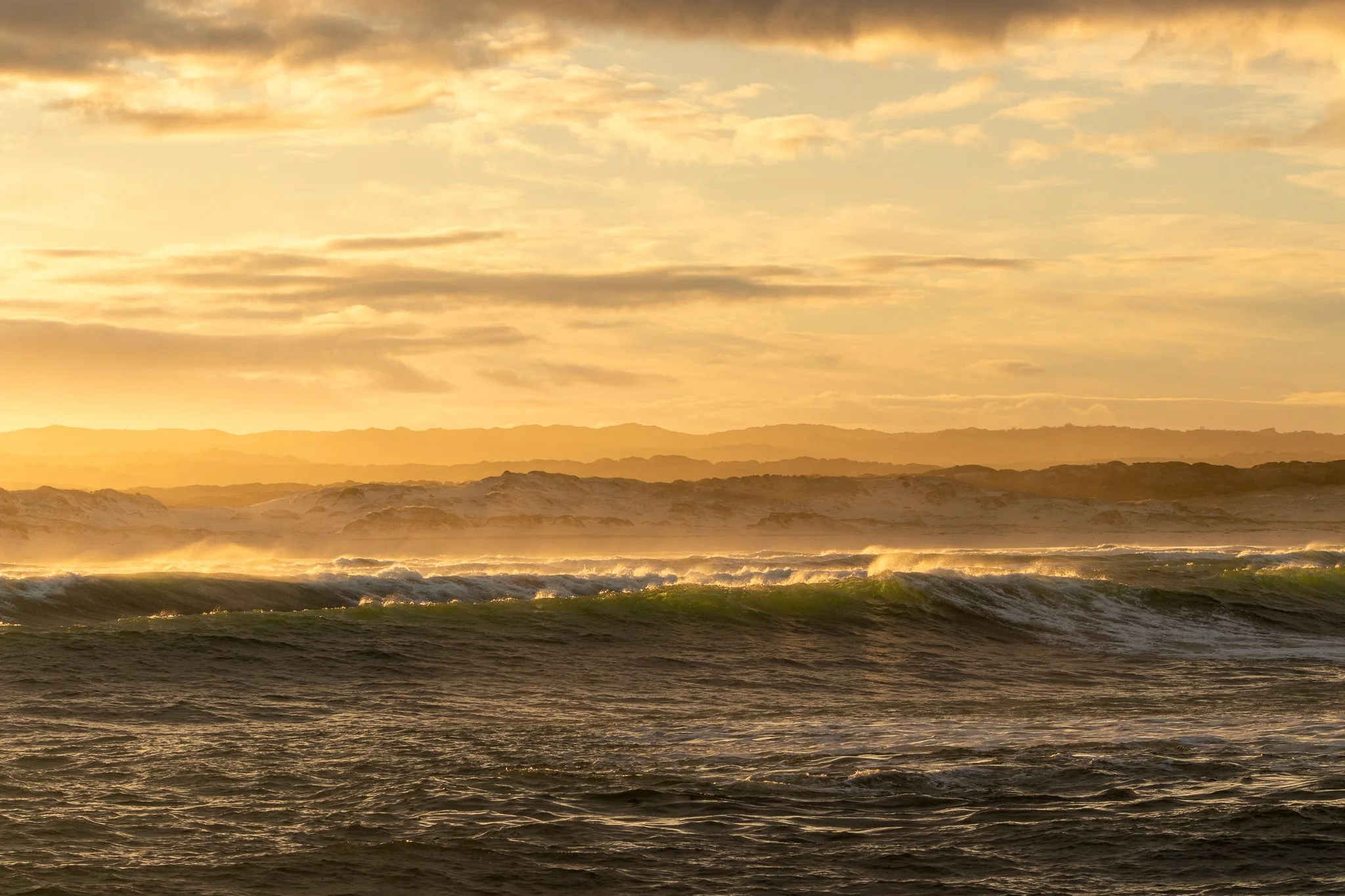
The town of Hermanus, South Africa as seen from the Hermanus Cliff Walk
History of Hermanus, South Africa
Hermanus, a small coastal town in the Western Cape of South Africa, has long been a haven for southern right whales. These gentle giants migrate to the warm waters of the South African coastline between June and November to mate and calve, en route to warmer Mozambican waters.
The whales get their namesake, “Right”, simply by being labeled as the “right” whale to kill, nearly to the brink of extinction in the early 20th century. Still, these majestic creatures have been protected in South Africa since 1935 and have gradually increased their population.
Other species spotted in Walker’s Bay include Orcas, Humpback Whales, and Byrde’s Whales.
Whale watching originally began in Hermanus as a land-based activity, thanks to the incredible visibility from the town’s cliffs. In fact, the 12km cliff walk is still an easy (and free) way to spot the whales from the shore.
So much so, in 1992 Hermanus employed an official “Whale Crier” to sound a kelp horn and alert tourists to sightings. Yes, this still exists today, and the Hermanus Whale Crier is the only one of its kind in the world!
Fun fact: At one point, Hermanus and the town Whale Crier was so popular, that he was known as the second most photographed South African… behind Nelson Mandela.
Today, companies like Southern Right Charters offer eco-friendly boat tours that bring you closer to these magnificent creatures while respecting their natural habitat.

Sunrise over Walker Bay in Hermanus, South Africa
How to get to Hermanus, South Africa
The beauty in Hermanus is how conveniently located it is, about 120 km (75 miles) from Cape Town, making it an easy weekend getaway. Of course, a day trip works as well but when you arrive and feel the energy, you won’t want to leave.
By Car:
Drive along the scenic R43 route, which takes approximately 1.5–2 hours from Cape Town.
I rented a car, picking up and dropping off at Cape Town International Airport. A two-day rental from Alamo cost less than USD 90 and allowed me to explore more along the way. It was completely worth it.
By Shuttle or Tour:
Many tour operators offer guided transport options from Cape Town. Check out these reliable options from Get Your Guide if you’d like more relaxation, and less planning!
Pro tip: Opt for the car rental and pair the drive from Cape Town to Hermanus with stopovers at Cape of Good Hope and Boulders Beach to make the most of this scenic drive.
Interested in more posts from South Africa? Don’t miss these posts:
Whale Watching in Hermanus: What to expect
There are a limited number of tour operators licensed to move from Hermanus’ Harbor, so be sure to plan in advance during the peak whale-watching season. For my visit, I chose Southern Right Charters because I was trying to make the most of my time in town, and they offer a unique, 6:30am sunrise tour that no one else does.
Southern Right is one of the most trusted and environmentally responsible companies for whale watching in Hermanus, having been in operation since 1999, so it seemed like a perfect fit (and it was). Here’s what you need to do before booking a tour:
Details & Costs
Tour Duration:
A trip can last anywhere between 1.5-3 hours, with most excursions averaging 2 hours. They don’t limit a trip based on time, rather it's based upon the best experience possible.
Cost (as of April 2025):
Adults: R1440 (USD 75)
Students/Seniors: R1350 (USD 70)
Under 12: R720 (USD 40)
Under 3: Free
Booking:
It's best to reserve your spot online in advance, especially during peak season, however bookings can be made in person at their office.
Note: Remember this tour is about spotting wildlife and Southern Right Charters can’t control how many whales are seen. One of the perks of booking through this company is that they offer either a 50% refund or a free reservation on another tour if your trip is canceled, interrupted, or unsuccessful.

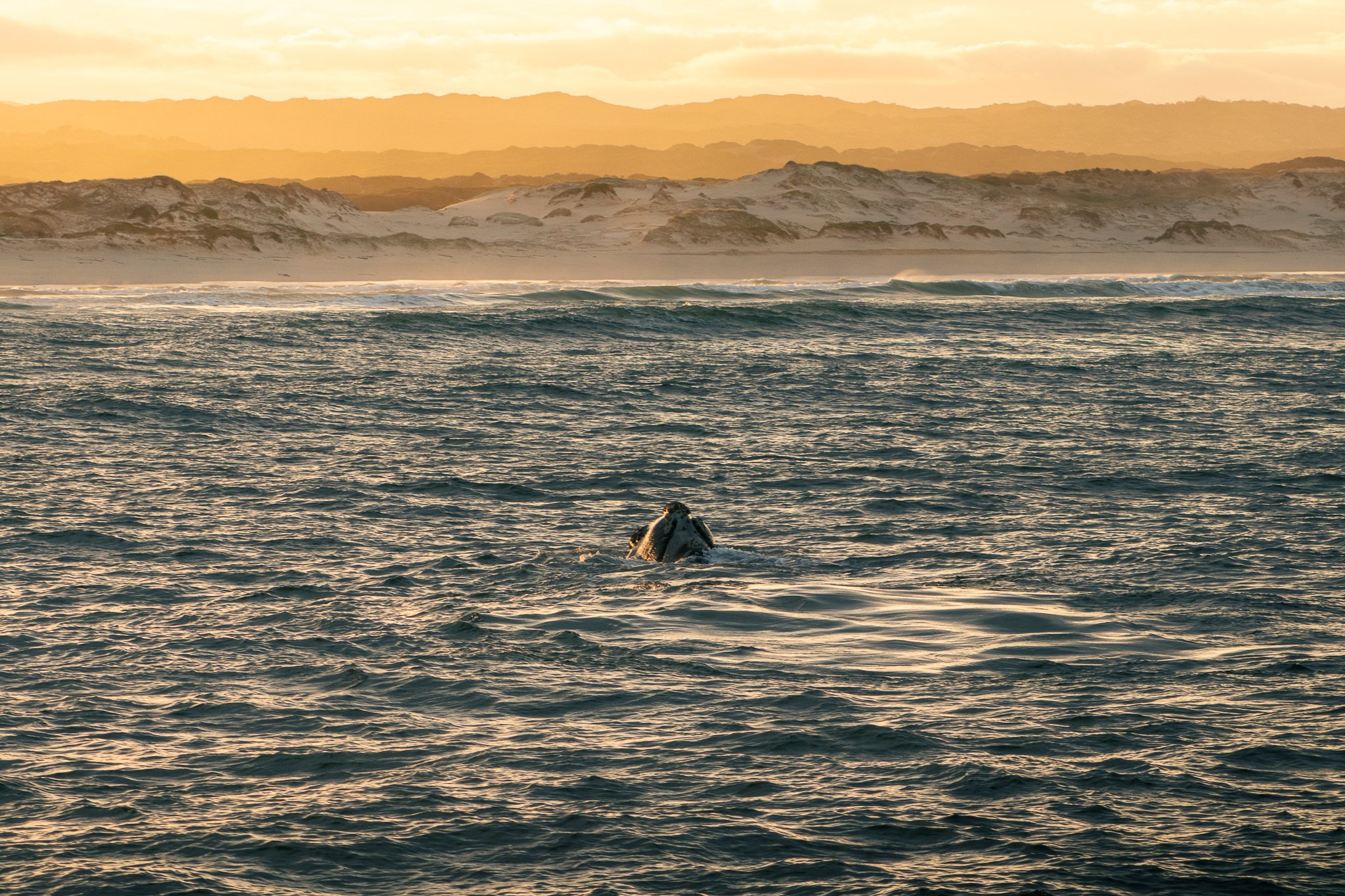
A Southern Right Whale breaches the waters of Walker Bay in Hermanus, South Africa
How to prepare for a Southern Right Charter tour
I visited in August and one thing I did NOT account for after living in West Africa for a year, was that it was winter in South Africa. That, combined with the 6:30am pre-sunrise departure, let’s just say I was grossly underprepared.
So, here’s your chance to learn from my mistakes!
Layer Up.
Both base layers and an outer layer to cut the wind. The trip sets off in the dark. Whether seated inside the catamaran or standing on the top deck, you’ll the crisp morning air. Needless to say, my Cotopaxi Cielo Rain Jacket was well worth the investment.
Pack gloves or hand warmers.
There’s nothing worse than spotting a whale rolling in the waves with the sun rising in the background and going to snap a photo with frozen fingers. The warm drinks that Southern Right Charters offers is a good start, but best to back a back-up plan. Here’s the power bank/electric warmer I never leave home without, because you don’t want your phone to die or hands to freeze as you get to take the photo of the year!
Any medications needed.
Yes, Southern Right has a boat that offers maximum stability, but this does not mean you won’t sill be rocking and rolling in the waves. If you get seasick, plan ahead. You don’t want to feel unwell on a magical experience like this! If you don’t like medication, try these anti-nausea bands that use acupressure. They were a lifesaver during my time on Semester at Sea!
Get there early.
Each trip starts with a required safety briefing. Don’t be that late shower that holds the group up. Get there ahead of the suggested time and be ready to go.
Overall, I’d highly recommend the sunrise tour as it was a unique experience to witness the whales rolling in the waves with sand dunes and the sun rising over the mountains as a backdrop. This trip was right up there on my list of top whale watch experiences, right alongside Kaikoura, New Zealand.
Of course, South Africa is far more than just whale watching so it’s important to plan ahead, do your research, and put together a comprehensive packing list!


Setting out with Southern Right Charters at sun rise for a whale watch excursion
Other ways to whale watch in Hermanus, South Africa
No problem! That’s where the Hermanus Cliff Walk comes into action. This 12km paved pathway winds its way along the rocky coastline, providing the ultimate viewpoints to whale watch from land.
Personally, I spent my morning with Southern Right Charters on the sunrise tour, and the rest of the day spotting Southern Right Whales breaching the waters from the cliff walk while popping in and out of cafes around town. It's hard to miss the whales with a reliable Whale Crier surveilling the bay!
Note: As the path is paved, most of the cliff walk is accessible to wheelchairs, making it easy for anyone to experience the magic of whale watching.

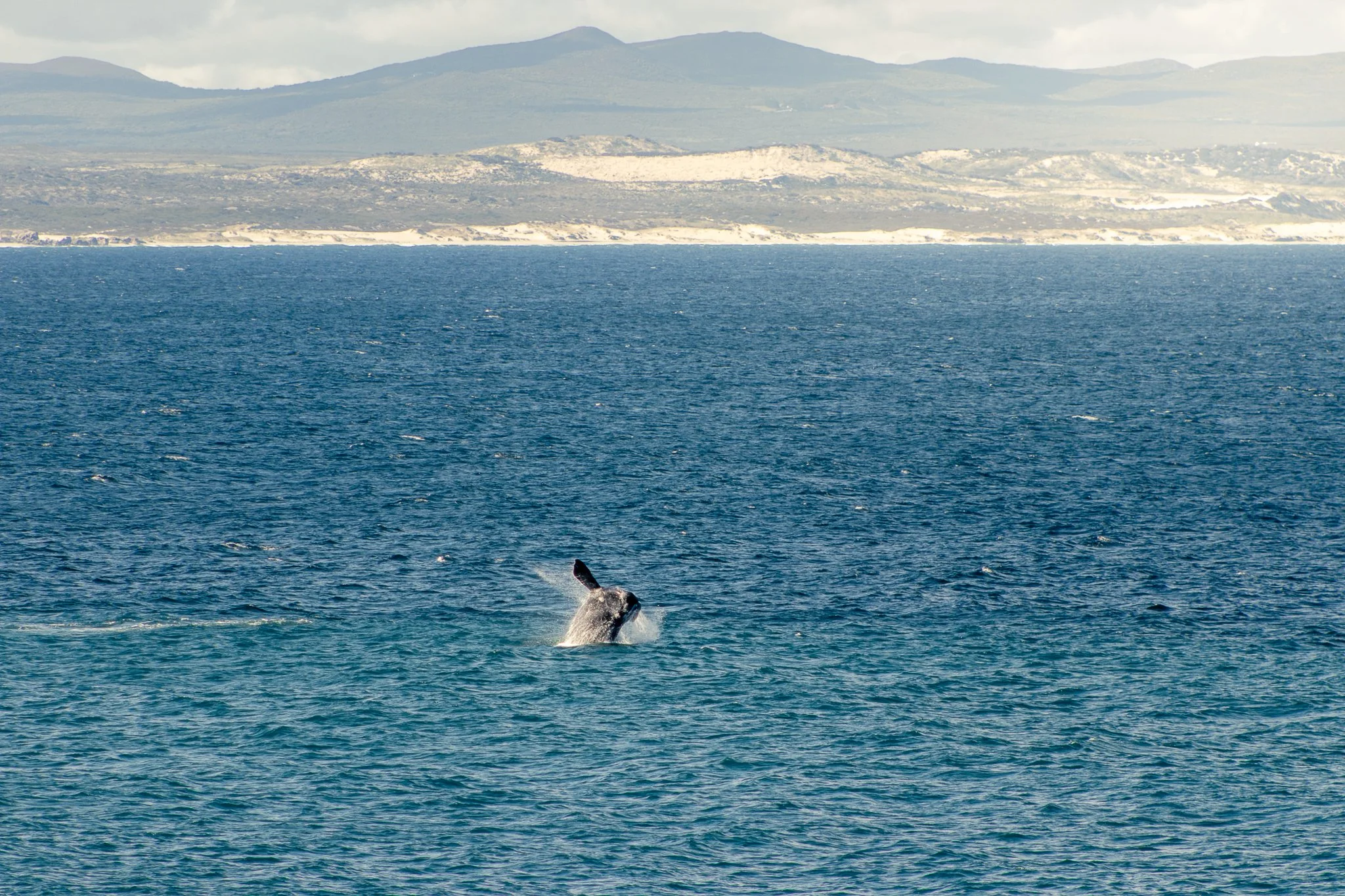
A Southern Right Whale spotted from the Hermanus Cliff Walk in South Africa
Beyond whale whatcing in Hermanus
Although world famous thanks to the Southern Right Whales, Hermanus is more than just marine life with plenty to explore. Located on Market Square St. in the heart of town is the Old Harbor Market, a collection of handcrafts and locally made goods.
Spend an afternoon wandering the Whale Museum or hop between cozy coffee shops to slow down and enjoy village life (Platō Coffee is my favorite).
Looking for more activity and nature? Be sure to explore the Fernkloof Nature Reserve and all 60km of trails that zigzag through the mountains.
Where to stay for the best Hermanus experience
For my trip, I chose to stay at an Airbnb after finding this cozy place located just across the street from the Hermanus Cliff Walk. It was a perfect mix of peace and quiet while remaining within walking distance of the town center and a supermarket.
Other options include Hermanus Backpackers ($), Zzzone Boutique Hostel ($$), and Bamboo Guest House ($$$).
Pro Tip: Ever heard of load shedding? This is when planned power outages occur in South Africa to conserve the energy grid. After living in West Africa for nearly three years, it was a welcomed improvement to at least be told when the power would cut and for how long! Pay attention so you can be sure your devices are charged ahead of time.

Sunrise from the helm of Southern Right Charters tour in Hermanus, South Africa
A whale-watching trip in Hermanus is an unparalleled experience and at the top of my list of things to do in South Africa. Whether you're spotting these majestic creatures from the boat or enjoying the coastal walkway of Hermanus, this journey is well worth the short trip from Cape Town.
Have you been whale watching in Hermanus or elsewhere around the world? Let me know in the comments below and, as always, stay safe and happy travels!
Sharing is caring! Pin this post for later.


