

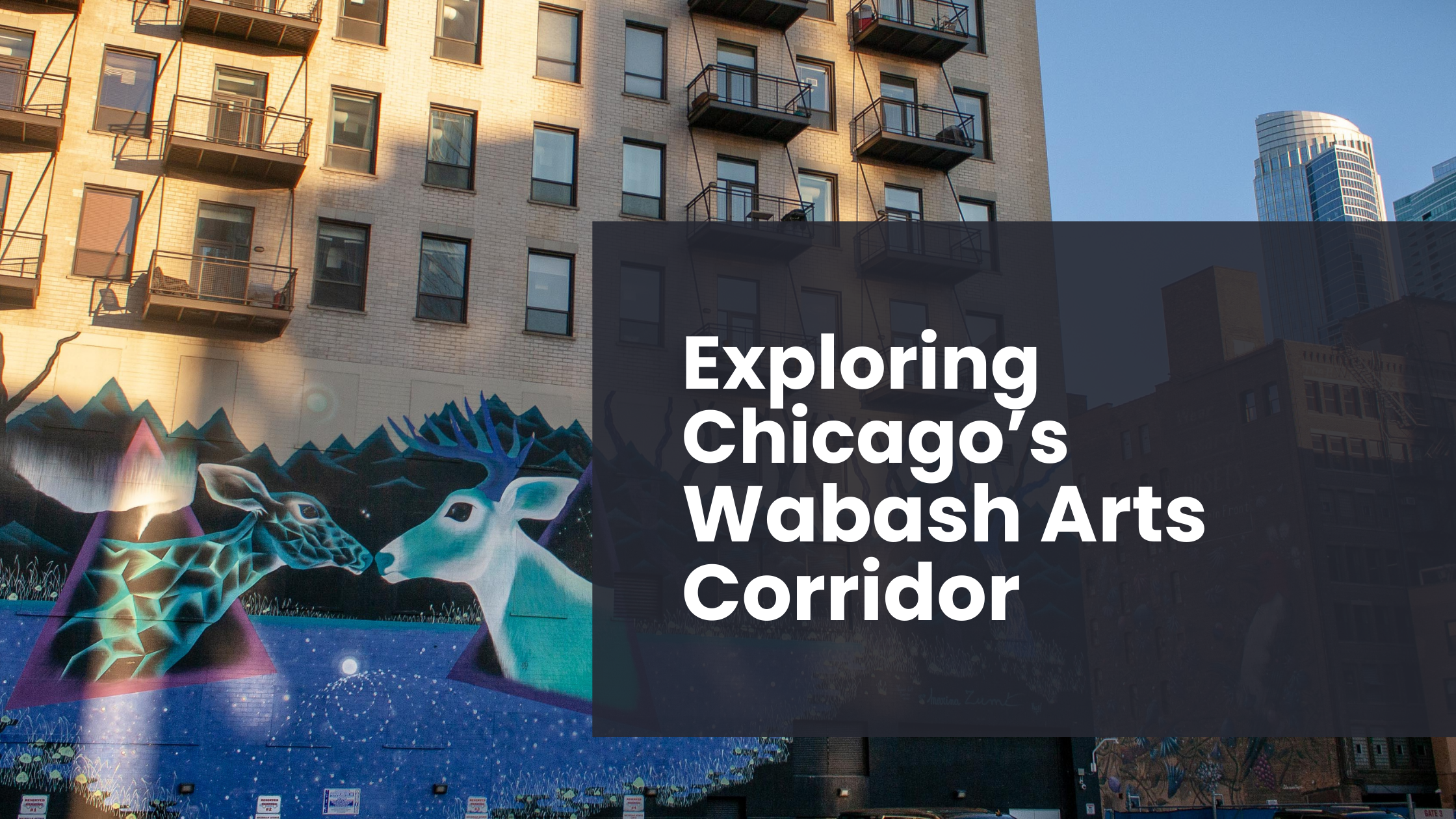
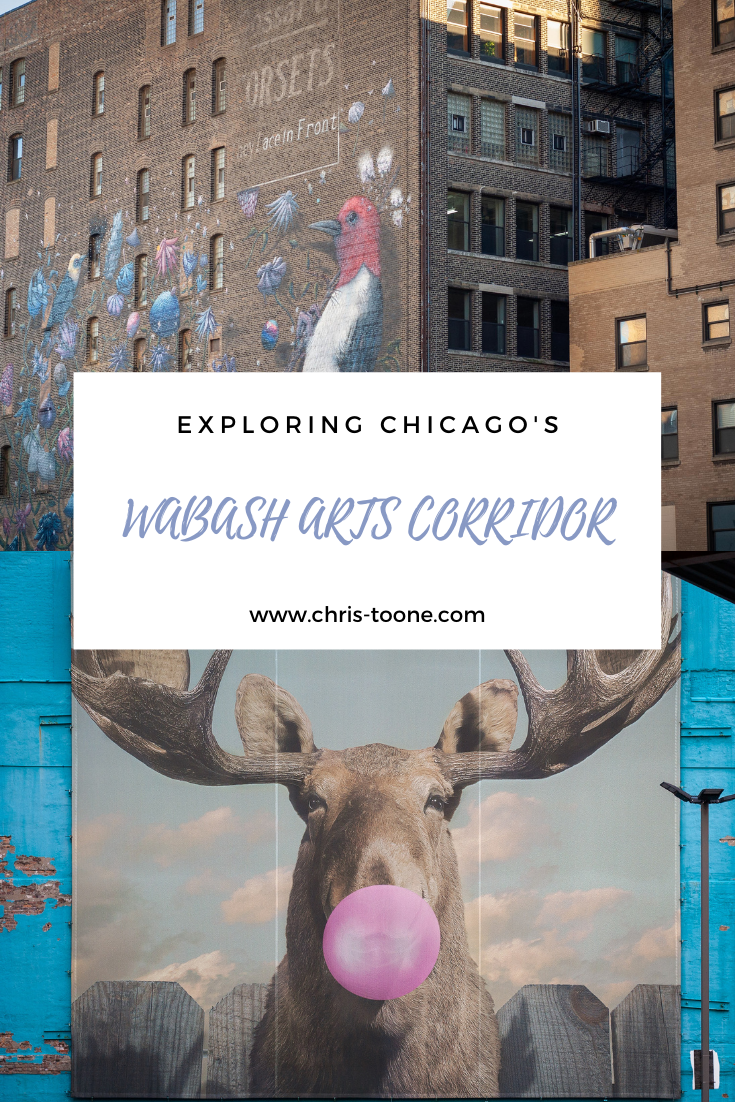
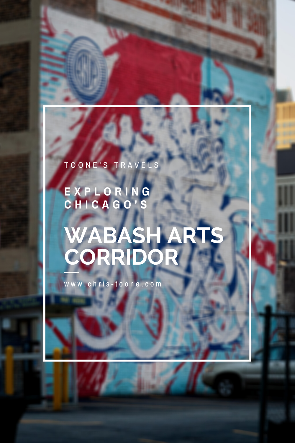
Exploring Chicago's Wabash Arts Corridor
Commonly known as a “living urban canvas” because it’s constantly being added to, Chicago’s Wabash Arts Corridor feels like an open-air museum full of reclaimed public space. It’s collection of street art is one of the most diverse and expansive in the world, making it the perfect way to experience the Windy City’s South Loop neighborhood!
It was just my luck that a week after I moved to Chicago last year, the world seemingly stopped, shutting everything down in the process.
I’d be lying if I said I wasn’t frustrated at first. It’s my second nature to instantly get out and explore a new place, but that didn’t seem possible here.
Here’s what I didn’t realize: Chicago is actually a mecca for street art in the Midwest. Each neighborhood seemingly has its own collection of masterpieces, making it feel as though you’ll discover something new at each turn. With the bright colors, thought-provoking illustrations, and sheer volume of images, the city is basically one large open-air museum.
One of the most expansive, diverse, and well-known street art destinations in the city is the Wabash Arts Corridor (WAC) in the South Loop neighborhood.
Here’s what you need to know.
For Chicago’s top photography spots, don’t miss this post:
KNOW BEFORE YOU GO
The Wabash Arts Corridor was founded in 2013 by Chicago’s Columbia College. Since then, it has grown to be one of the most “expansive, diverse, and accessible public art programs in the country” according to the WAC website.
Beginning in 2016, the corridor shifted its focus to promoting diversity, equity, and inclusion and, in that time, has amassed one of the largest collections of street art created by people of color and women artists.
Pretty sweet, huh?
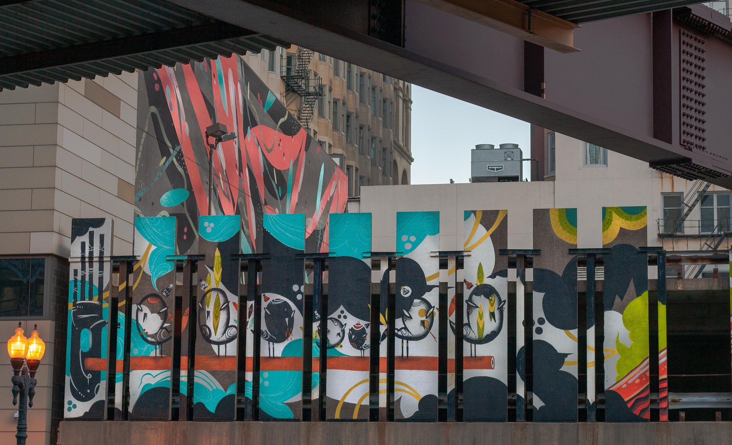
Many people refer to the Wabash Arts Corridor as a “living urban canvas” due to the fact that new murals are constantly being added and, as a result, public space is reclaimed and transformed into an immersive experience.
Most of the art can be viewed from the sidewalk, making it the perfect sunny day activity that’s free of charge.
The southern border of the corridor is Roosevelt and runs as far north as VanBuren. Within that space, the artwork is scattered within two city blocks running east to west, Michigan Ave to State St.
To get there, take the ‘L’ train to Roosevelt Station (red, orange, green lines) and make your way north along Wabash Ave.
Don’t forget to walk “off the path” and into the alleys. You never know what’s waiting around the next corner!
Before you go, be sure to print off the downloadable map online. This will greatly help along the way. If solo exploring isn’t for you, then it’s easy to sign up for a guided tour ($18/$12/free, adults/students K-12 & seniors/children under 5)!
WHERE TO STAY NEAR THE WABASH ARTS CORRIDOR
Located in the heart of ‘The Loop’ in downtown Chicago, there are plenty of high quality places to stay to suit any budget. From some of the top boutique hotels to something more in the budget, there are plenty of options to chose from. A few to consider are:
THE ARTWORK
The Wabash Arts Corridor map lists 30+ pieces of artwork, so this list by no means encompasses each one.
After all, you don’t want me to spoil everything for you, right?
Without further ado, here are some of my favorite murals found thus far:
IMPOSSIBLE MEETING
Artist: Marina Zumi | Location: 901 S. Michigan
Artist Marina Zumi traveled from her home in Sao Paulo, Brazil in 2016 to complete this fantasy-depicting mural. The pastel colors expose an otherworldly scene that are signature to her pieces around the globe, including in Berlin, London, Buenos Aires, and more.

I AM YOU, YOU ARE ME
Artist: Ricky Lee Gordon | Location: 634 S. Wabash
Ricky Lee Gordon is a South African artist whose work tends to depict interconnectedness. It’s fitting as the word Ubuntu originates from the southern part of the continent and is translated as I am, because you are. This mural is easy to miss, so keep a close eye out.

STARS & STYLES
Artist: DMNOLOGY | Location: 618 S. Wabash
DMNOLOGY is known as a graffiti sorcerer of sorts. A homegrown artist, he labels his style as “Wild Onion,” paying homage to the indigenous meaning of Chicago from the Algonquin language.

FROM BOOM TO DOOM
Artist: Collin van der Slujis | Location: 1006 S. Michigan
Collin’s mural features a yellow-headed blackbird that was once common to the area but has since disappeared due to a loss of habitat from invasive species and poor land management. This piece of work stands as a reminder to protect the environment around us.

MAKE YOUR OWN LUCK
Artist: ASVP | Location: 1 E. Balbo
Part of the Vertical Wall Gallery’s “Power of Paint” series, Brooklyn duo ASVP created this piece to express using art to help others. A portion of each sale was donated to the charity of their choice.

STOP TELLING WOMEN TO SMILE
Artist: Tatyana Fazlalizadeh | Location: 801 S. Wabash
Is the title a little uncomfortable for you? Good. Brooklyn artist Tatyana Fazlalizadeh set out to depict the pervasiveness of street harassment by highlighting the faces of 25 young women that have been catcalled while going about their daily life.
She nailed it.

UNTITLED
Artist: Lady Lucx & Sarah Stewart | Location: 525 S. Wabash
Lady Lucx utilized the location as inspiration for this piece, noting that the view from the parking garage includes the orange line of the ‘L’ train as it transitions from the south side of Chicago into the bustling loop.
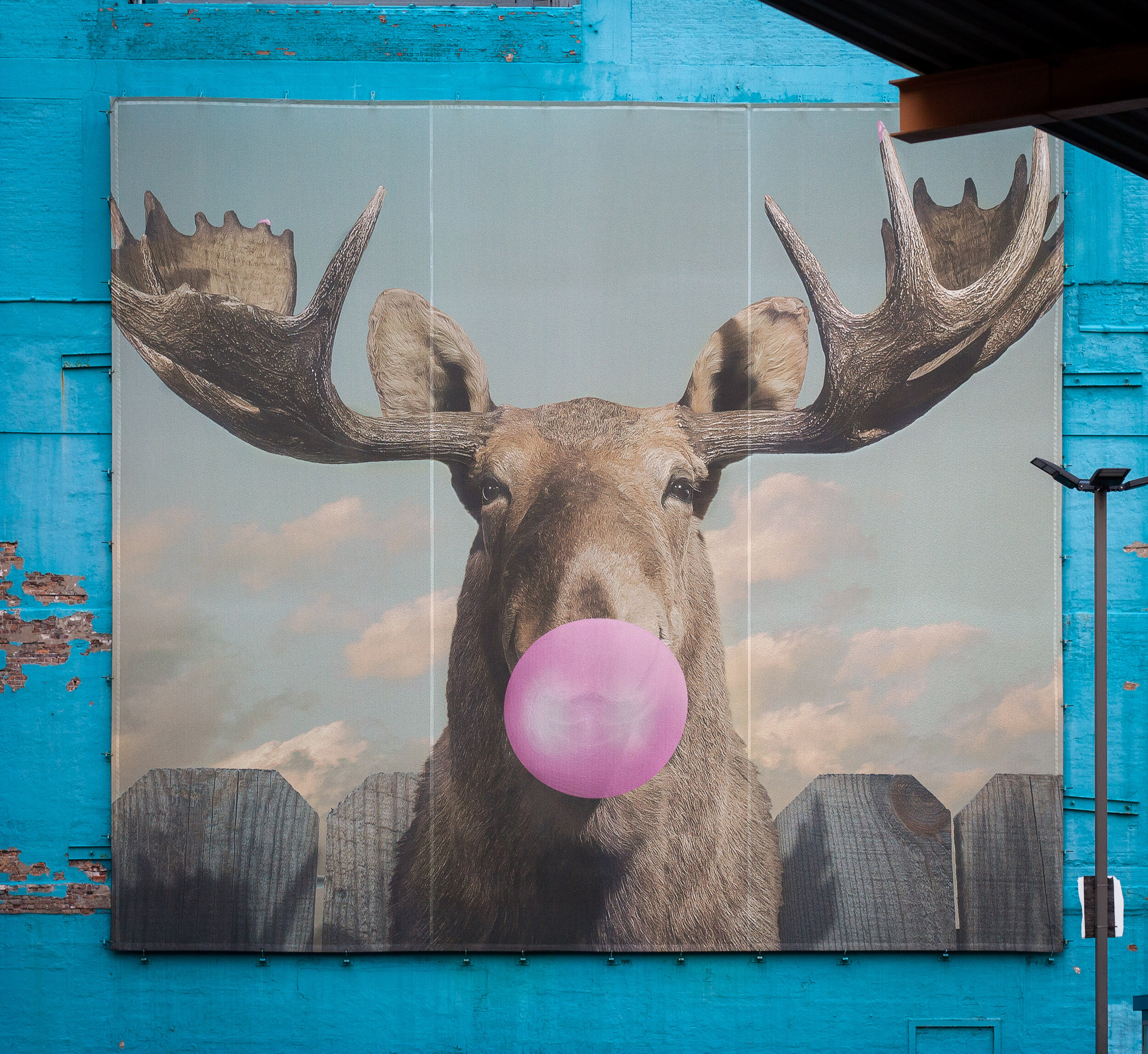
MOOSE BUBBLEGUM BUBBLE
Artist: Jacob Watts | Location: 33 E. Congress
Columbia College launched a student and alumni competition in 2014 and Moose Bubblegum Bubble was selected as the winner. This is one of the most iconic pieces in the Wabash Arts Corridor and can be seen while riding the ‘L’ train south into Roosevelt or north from the same station.
Come explore and bask in Chicago’s open-air museum. The Wabash Arts Corridor may be the most established and well-known collection of street art in the city, but it is by no means the only one. Be sure to check out some of the city’s other neighborhoods and see what you can discover!
Stay safe & happy travels.
Enjoy this post? Pin it and share with your friends!


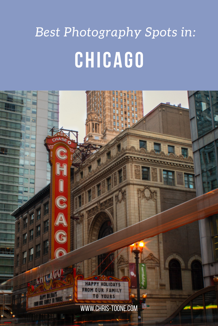
Best Photography Spots in Chicago: Everywhere you need to go on your next trip to the Windy City
Skip the tourist trail and check out this comprehensive list of incredible spots to photography Chicago. From where to find the best city skyline views to which parking garages best capture the 'L' train, this is a must-have guide before your next trip!

As it turns out, moving to Chicago has been the perfect way to expand my photography skills. With the hustle and bustle of city life, the famous ‘L’ train weaving through the towering buildings, and the glistening shores of Lake Michigan to the east, there’s a unique perspective everywhere you look.
Millennium Park and Michigan Ave are by far the most visited sites in this mid-western hub but trust me when I say there’s so much more to discover.
Here’s a list of the best places to photograph Chicago.
NORTHERLY ISLAND
Northerly Island is a peninsula park along the shores of Lake Michigan that comes complete with city skyline views, including the iconic Soldier Field.
Enjoy the fresh air and greenery as you combine your skilled nature shots with that of urban life.
Fun Fact: The 5-acre lagoon is home to many of Illinois’ wildlife, including monarch butterflies and heron.
Getting There: Red, orange, and green line trains to Roosevelt & walk from there

NORTH AVE. BEACH
Located in Lincoln Park, this popular beach offers some of the best skyline scenery in the entire city. Walk the jetty, stick your toes in the sand, and snap some shots as daily life in Chicago moves all around you.
Pro Tip: This is location is adjacent to the Lincoln Park Boardwalk (below), so it’s easy to combine the two shoots.
Fun Fact: North Avenue Beach came into existence from a multi-million project in the 1930s that was partially funded by President Roosevelt’s New Deal. The beach itself is an extension of an old landfill’s narrow path along Lakeshore Drive.
Getting There: Red, brown, or purple express lines to Fullerton & walk towards Lincoln Park

North Ave. Beach in Chicago, IL
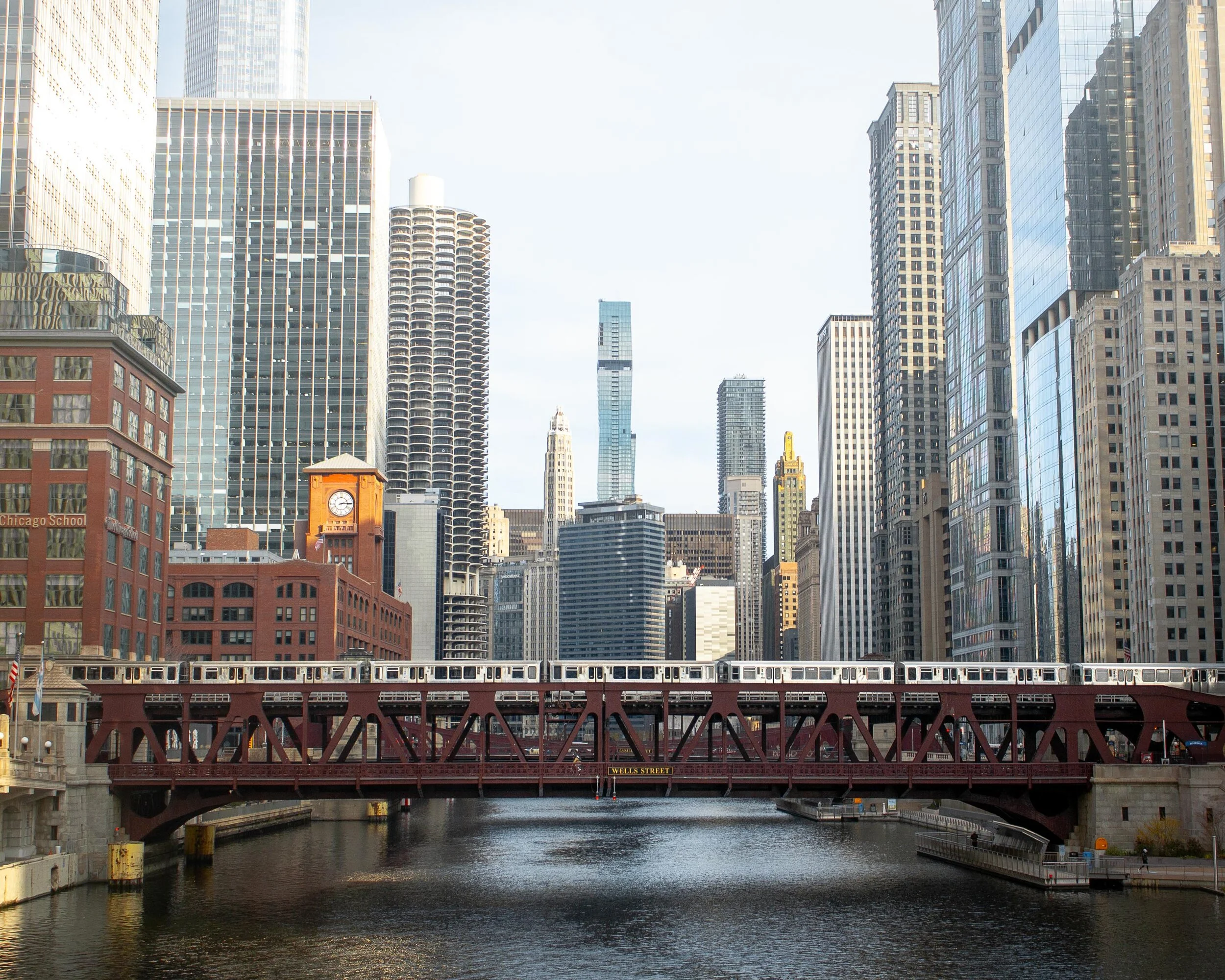
ORLEANS ST. BRIDGE
The most popular way to take advantage of this location is to shoot towards the Wells St. Bridge. This is one of my favorite scenes in the city that perfectly encapsulates life in Chicago; boats cruising along the river below, the brown line trains traversing across the river and stunning architecture rising high towards the sky.
A unique feature of Chicago is that the city is constructed in a way that each building seems to command space of its own, demanding attention as an independent masterpiece. This location perfectly captures that.
Pro Tip: Shooting towards the Wells St. Bridge is great, but don’t forget to turn around and check out the trains coming across the Lake St. Bridge as well.
Fun Fact: The two leaves of the Wells St. Bridge were built offsite and then transported via the Chicago River for installation.
Getting There: Blue, orange, pink, green, brown, and purple express lines to Clark/Lake or brown/purple line to Merchandise Mart
Downtown Chicago, IL
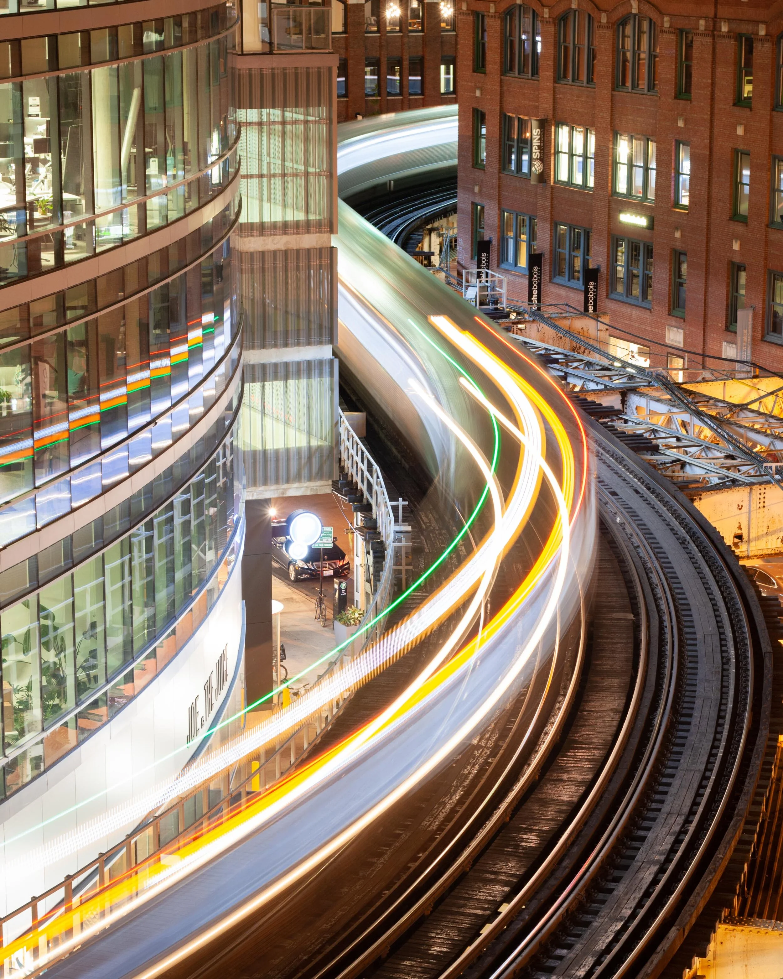
WELLS KINZIE GARAGE
One of my favorite parts of living in the city is finding unique angles to capture the famed ‘L’ train. There’s no better shot than the S-curve in the downtown loop.
Ride the elevator to the top of the Mart Parc Garage at the corner of Wells and Kinzie and watch the trains maneuver through the city’s infrastructure.
Remember: each level of the garage offers a different perspective of the tracks. Be sure to spend some time exploring to find what works best for you!
Fun Fact: In 2014, the “L” train was fourth in the nation for total route length at 102.8 miles.
Getting There: Brown and purple express lines to Merchandise Mart
‘L’ Train in Chicago, IL
437 N. ORLEANS
For the lesser-known view of the S-curve, head to the parking garage located at 437 N. Orleans. The top-level shows the trains as they head to/from the Merchandise Mart CTA station.
Located near the Orleans St. Bridge (above), this makes for a great day of chasing trains.
Pro Tip: For the symmetry enthusiasts, take note of the Assumption Catholic Church steeple against the red brick backdrop.
Fun Fact: The oldest sections of the “L” train began operations in 1892, making it the country’s second-oldest rapid transit system behind New York City’s elevated rail system.
Getting There: Brown or purple lines to Merchandise Mart

‘L’ Train as seen from 437 N. Orleans in Chicago
Need more ideas? Check out this list of curated tours!
PING TOM MEMORIAL PARK
This is the first park I visited after moving to Chicago and it remains at the top of my favorites.
Located in the Chinatown district, this is the perfect place to stock up on some warm buns and pastries, walk along the river, and shoot the city skyline. The boardwalk with the ornate rails helps to create some appealing leading lines.
Pro Tip: Ping Tom Memorial Park is commonly known as one of the best places to watch trains. Amtrak frequently crosses the bridge at the southern edge of the pathway while the CTA trains and freighters flank it to the east.
Fun Fact: This 17.4-acre park was originally the site of a Chicago and Western Indiana Railroad yard. The area began its transformation into a green space in 1998.
Getting There: Red line trains to Roosevelt or green line to Cermak-McCormick Place
Downtown Chicago as seen from Ping Tom Memorial Park
18th STREET BRIDGE
Another spectacular city skyline view is on the 18th Street Bridge, located just above Ping Tom Memorial Park. Point the camera up the South Branch of the Chicago River and behold the Windy City in all its glory.
This is an especially great spot for nightscape photography.
Fun Fact: With a 1967 construction date, the 18th Street Bridge is one of the youngest in all of Chicago.
Getting There: Red line trains to Roosevelt or green line to Cermak-McCormick Place

Chicago skyline as captured from the 18th street bridge in Chicago’s Chinatown
LINCOLN PARK BOARDWALK
The nature boardwalk at Lincoln Park makes for the perfect escape from the busy city streets. The pond is surrounded by prairie-style grass and is full of life with birds, frogs, and fish to name a few.
This is a great place to not only photograph the urban nature scene, but the John Hancock Building as well.
Pro Tip: Combine a visit here with North Ave Beach.
Fun Fact: The Nature Boardwalk acts as a living laboratory for the Urban Wildlife Institute in Chicago as they test new techniques to resolve human-wildlife conflict.
Getting There: Red, brown, or purple express line trains to Fullerton

Lincoln Park, Chicago
200 NORTH CLARK
In a massive city full of high rises, this is the place where you can see straight to the horizon and it feels as though the trains below are riding off into the sunset.
The reflective siding on the garage adds to the unique perspective and helps to create some stunning imagery.
Fun Fact: In 2016, the “L” train had 1,492 cars transporting passengers between 145 stations.
Getting There: Blue, green, pink, orange, brown, and purple express lines to Clark/Lake

The view from the parking garage at 200 N. Clark St. in downtown Chicago
WABASH ARTS CORRIDOR
Commonly referred to as the “living urban canvas” because new pieces are being added on an annual basis, the Wabash Arts Corridor is a unique collection of colorful murals.
Stretching from as far north as Polk and as far south as Roosevelt, this is the perfect place to wander around with your camera. Be sure to check the website for more information, including a walking map of each masterpiece.
One of the most popular works is the Moose Bubblegum Bubble by artist Jacob Watts.
Pro-Tip: Start on the southern edge at Roosevelt and make your way north back into the city’s downtown loop.
Fun Fact: The Wabash Arts Corridor was founded in 2013 by Columbia College and continues to grow into being one of the largest, unique, and accessible art projects in the country.
Getting There: Red, orange, and green line trains to Roosevelt & walk north
Moose Bubblegum Bubble mural by artist Jacob Watts
CHICAGO THEATER
Ok, you caught me. I can feel you rolling your eyes.
The vintage Chicago Theater sign isn’t exactly “off the beaten path”, but it does make for some pretty great long exposure shots and it’s a quick and easy stop on your tour of the city.
Fun Fact: The Chicago Theater was the first large movie palace in America and quickly became the prototype for all others. Constructed in a French Baroque style, look closely at the theater’s exterior to see if you can find the miniature Arc de Triomphe.
Getting There: Pink, green, brown, orange, and purple line express trains to State/Lake

Chicago Theater standing tall in the downtown traffic

The Chicago Theater shines bright in the snow
The truth is you just need to come here yourself and wander around. Each neighborhood, train line, and person has something unique to offer!
Stay safe & happy travels.
Enjoy what you read? Pin this post for later!


The Ultimate Hiking Guide to Mississippi-Palisades State Park
With local travel the name of the game in 2020, it’s time to explore a little closer to home. With bluffs to climb, fall foliage to soak up, and expansive views of the Mississippi River, there’s every reason to visit Mississippi-Palisades State Park! Here’s everything you need to know…

Local travel is the name of the game in 2020 and with autumn in full bloom, it seemed like the perfect time to migrate away from the bustling streets of Chicago and into the woods to soak up all of the colorful glory.
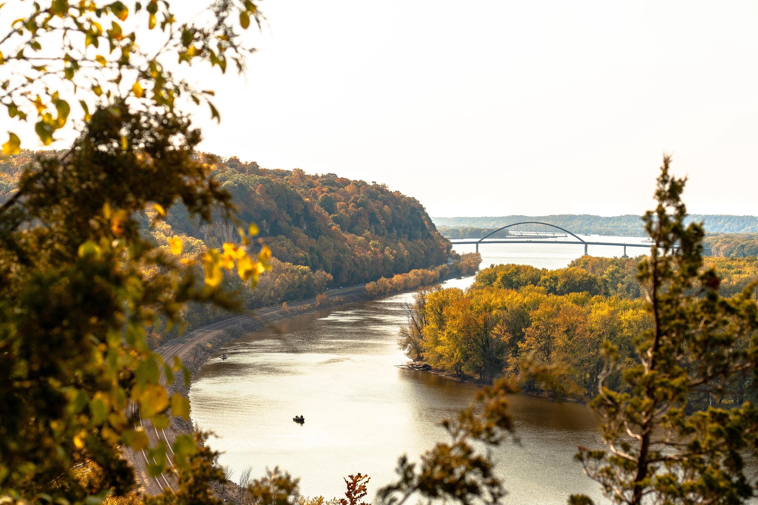
My alarm rang far too early at 5 am, but it was well worth the sleepless night as I rolled into an empty Mississippi-Palisades State Park at the crack of dawn, nestled along the northern section of the great Mississippi River and complete with sweeping views of Iowa across the way.
Picnic areas, grassy fields, and overlooks are in abundance within the 2,500 acre National Natural Landmark, but the goal of the day was to explore the trails and gain some much-needed elevation (I’m still adjusting to living in the midwest — shout out to the Wasatch Mountains back in Utah).
Here’s everything you need to know about hiking in Mississippi-Palisades State Park:

View of the Mississippi River as seen from the Sunset Trail at Mississippi-Palisades State Park
THE BASICS:
Location: Just north of Savanna, Illinois in Carroll County
Established: The park was founded in 1973
Trails: Hiking in the area is divided into the north and south systems, both containing 5 trails of their own for a cumulative 15-miles worth
Note: this post focuses on the southern trail system
Drive Time: 2 hours and 45 minutes from Chicago, depending on the time of day
Cost: FREE!
Facilities: Grills, gazebos, picnic areas, and restrooms can be found throughout the park
Why Mississippi-Palisades: The drive along the Great Northern Road as it pops in and out of small towns is just as stunning as the park itself, but there’s nothing quite like hiking up the bluffs and seeing the sweeping views above the Mississippi River in the peak of autumn
Difficulty: AllTrails rates this 4.6-mile multi-trail loop as ‘difficult’ due to a few sections of steeper terrain, but it’s a great combination of ascent, descent, and level ground. Plenty of families with young children were out and about
Great! Now that we’ve covered the basics, here’s how I spent my time wandering the southern trail system:
SUNSET TRAIL
I’d recommend starting with this trail as early as possible as the Lookout Point is by far the most popular overlook of the Mississippi River within the state park’s southern trail system. It’s here where you’ll soak up the sweeping views of the river and watch trains roll by below for as long as your heart desires.
The steepest part of the trail is departing from the parking lot as you climb the stairs and gain a quick chunk of elevation. Keep in mind that it’s a narrow, single-track dirt path with steep drop-offs to one side, so be on the lookout for other hikers and proceed with caution.
Once you reach the top of the bluff you’ll encounter a road that leads directly to the overlook. Do not head that way. Instead, cross over and continue on the trail. This winding path will take you down into a ravine thick with vegetation, complete with a wooden foot-bridge that’s set beneath a canopy of changing leaves.
As you make your way up and out of the trail’s low-point, you’ll stumble back onto the road and have the opportunity to scope the overlook. Pro tip: If it’s busy, continue south on the trail and you’ll find a separate, unofficial overlook with views downriver.

Sunset Trail in Mississippi-Palisades State Park
Don’t forget to pack these essentials!


SENTINEL TRAIL
Sentinel Trail is an easy 1.2-mile trail that is located directly across the road from the Sunset Trail, next to the picnic shelter and makes for a convenient second loop on the day.
As you cross the bridge and reach the fork, head left. This will take you up another set of wooden stairs and to a t-junction at which point you’ll choose left again. This will take you to an upper parking lot where you will pick up the less-trafficked Pine Trail.
After completing the short Pine Trail loop (see next section), head back up the Sentinel Trail path that led to the parking lot and continue straight past your previous left turn at the t-junction. This will take you back towards the Mississippi River and over to some last-minute views across the water before heading back down to the parking lot via stairs and narrow paths. Be sure to stop and check out some of the caves that have been carved into the side of the bluffs over the years!
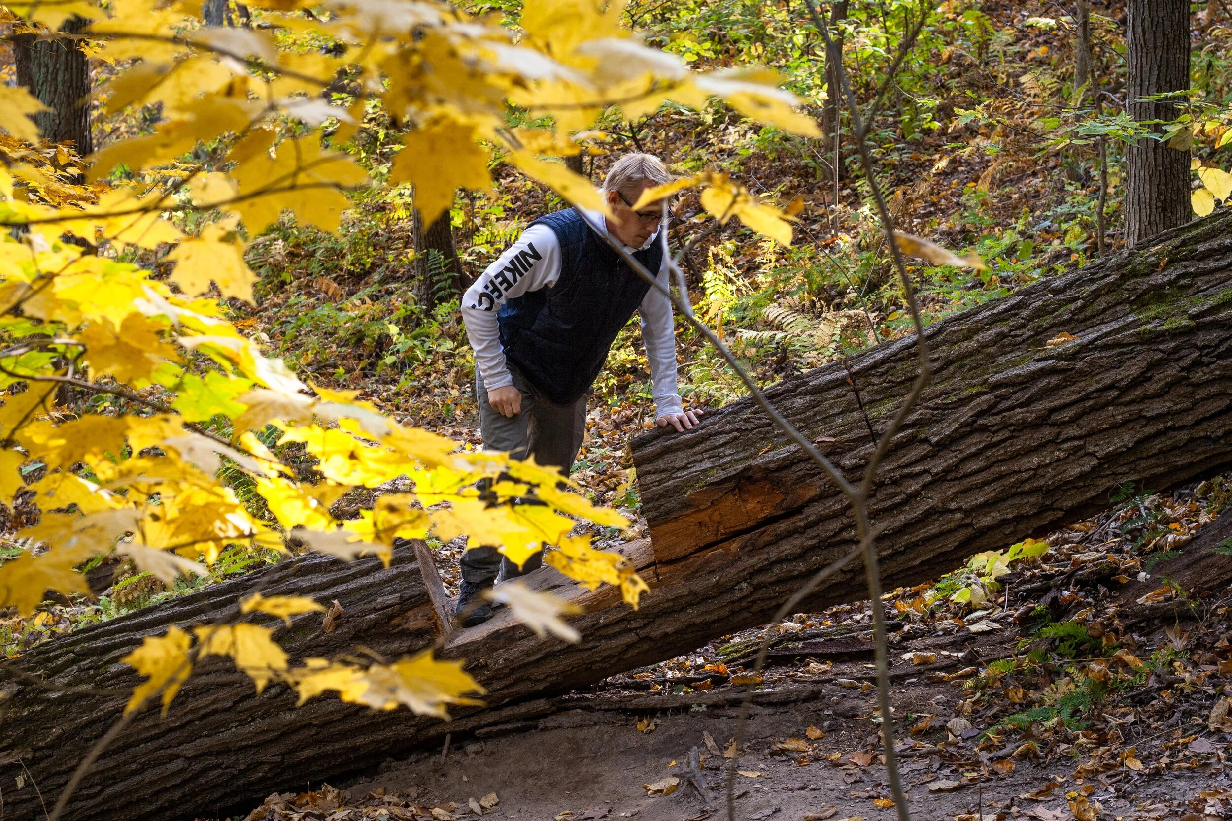
Hiking through the narrow trails of Mississippi-Palisades State Park
PINE TRAIL
Pick up the Pine Trail once you’ve reached the upper parking lot after hiking part of the Sentinel. This was by far the least crowded path within the park, making it easy to avoid other hikers and find some serenity among the fall foliage.
After reaching yet another t-junction, head left. This will lead you out to a road in which you then follow to the right to pick up the trail again at the next parking lot.
As you start the ascent from the road you’ll immediately notice a gray spire affectionately known as The Sentinel. This is a popular rock climbing area so don’t be surprised if you run into some dare-devils as you make your way up to the next overlook before looping back into the woods and up to the Sentinel Trail.
In regards to peacefulness, fall foliage, and a great workout of ascending/descending paths, Pine Trail was the highlight of the day!

Fall foliage in Mississippi-Palisades State Park
There you have it; everything you need to know about hiking through Mississippi-Palisades State Park! The family-friendly area makes for a great day-trip from Chicago and it’s easy to turn it into a weekend getaway by continuing north along Route 84 up to Galena, a quaint town once home to Ulysses S. Grant.
Happy hiking!
Enjoy this post? Pin it for later!


