15 Stunning South Africa Travel Photos To Inspire Your Next Trip
The first time I visited South Africa was in 2010 on Semester at Sea. It was a crisp spring morning on the bow of the ship as the sun breached the horizon, lighting up the mighty Table Mountain—and in that moment, I was hooked…

The first time I visited South Africa was in 2010 on Semester at Sea. It was a crisp spring morning on the bow of the ship as the sun breached the horizon, lighting up the mighty Table Mountain—and in that moment, I was hooked.
Fast forward fifteen years. With a month off work and already situated on the African continent, there was only one place calling me back: South Africa.
It’s no secret that South Africa exists in a constant state of tension between its apartheid past and present-day realities. Townships still dot the outskirts of major cities, and crime rates continue to top the continent. But despite this complex backdrop, South Africa has a way of pulling you in—and refusing to let go.
From world-changing history, both evolutionary and geopolitical, and iconic wildlife to unforgettable safaris, dramatic coastlines, and vast landscapes, South Africa is one of the most visually striking countries in the world to photograph.
So, off I went—camera in hand.
Maybe these 15 stunning South Africa travel photos will inspire your next trip (fingers crossed).
Ready for more South Africa content? Don’t miss these posts:
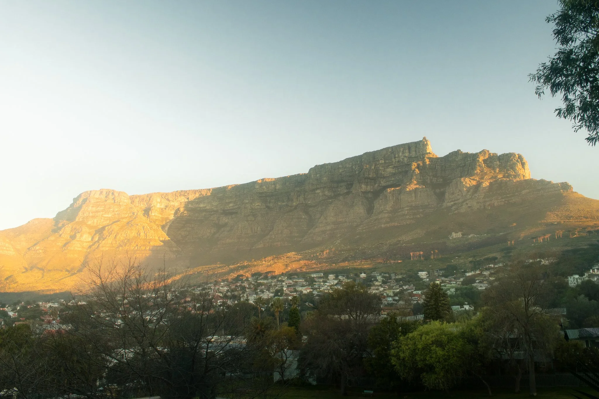
1. Good morning, Cape Town
Location: Cape Town, South Africa - Table Mountain
Is there any secret as to why Cape Town is consistently ranked as one of the most beautiful cities in the world for South Africa travel photography? All it takes is a window seat on approach into the airport to understand why. The magestic Table Mountain makes for one of the most unique city backdrops in the world, and is also a reason why it’s so hard to take a bad travel photo here.
This particular photograph was taken from the balcony of my apartment and it quickly became a daily ritual to watch the light move across Table Mountain on several crisp winter mornings.
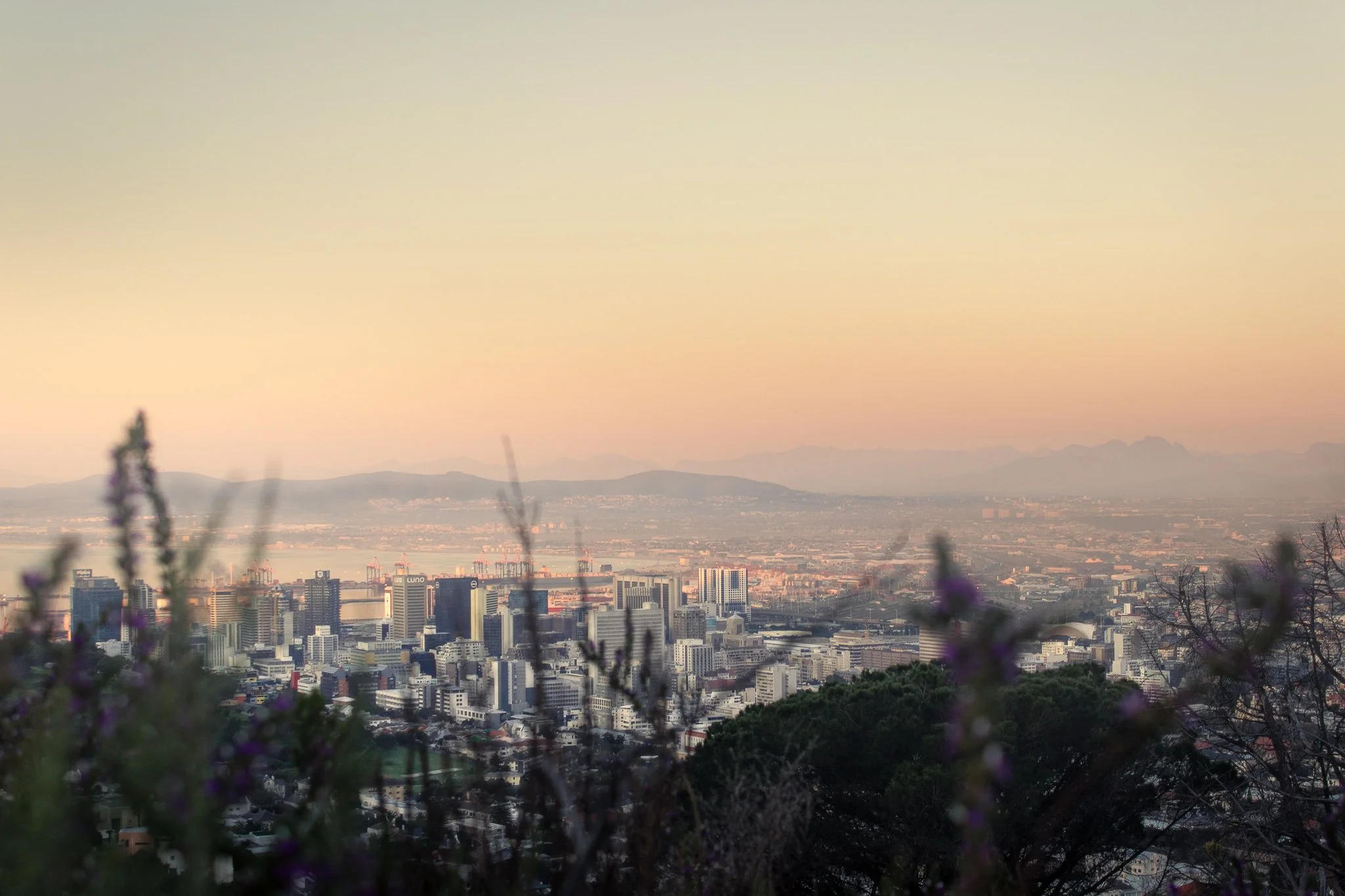
2. Cape Town in Pastel: View from the Gardens
Location: The Gardens Neighborhood, Cape Town, South Africa
Not long after arriving in Cape Town, I fell ill and quickly realized I had brought a case of malaria with me from Ghana (don’t worry—South Africa is malaria-free). Each afternoon, the fever would break just long enough for me to get outside and explore.
The walking paths behind the Gardens neighborhood quickly became my go-to, and it’s easy to see why. Soft pastel buildings, quiet streets, and views toward Table Mountain make this one of my favorite spots in the city—and one of my favorite South Africa travel photos to date. For me, it perfectly captures the calm, colorful essence of Cape Town travel photography.
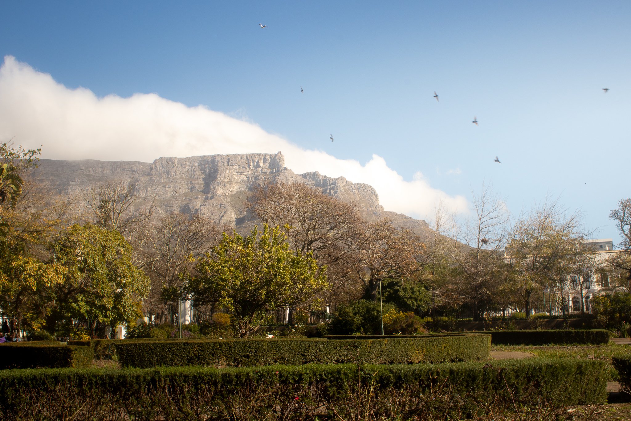
3. An Afternoon City Break in Cape Town’s Company’s Garden
Location: The Company’s Garden, Cape Town, South Africa
Despite visiting towards the end of the winter months, I stumbled upon one of my favorite Table Mountain viewing spots: The Company’s Rose Garden in the Central Business District.
Originally established in the 1650s to bring fresh supplies for ships passing through, the land now serves as a public park and the perfect spot for some stunning Cape Town travel photography, capturing city life in South Africa.
Once you’re done watching the birds and clouds (the “Tablecloth”) move in over Table Mountain, walk around the corner to Truth Coffee Roasting on Buitenkant Street for one of the best cups of coffee in your life (no embellishment necessary).
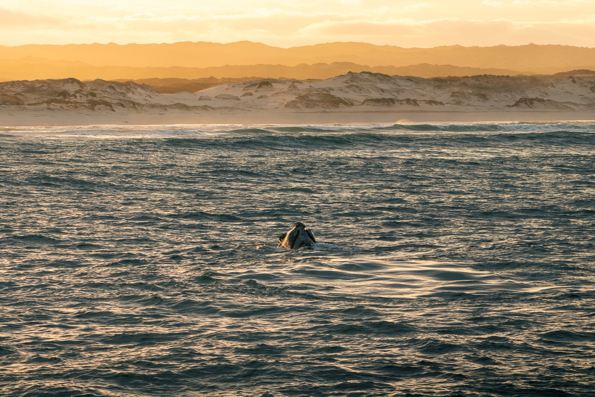
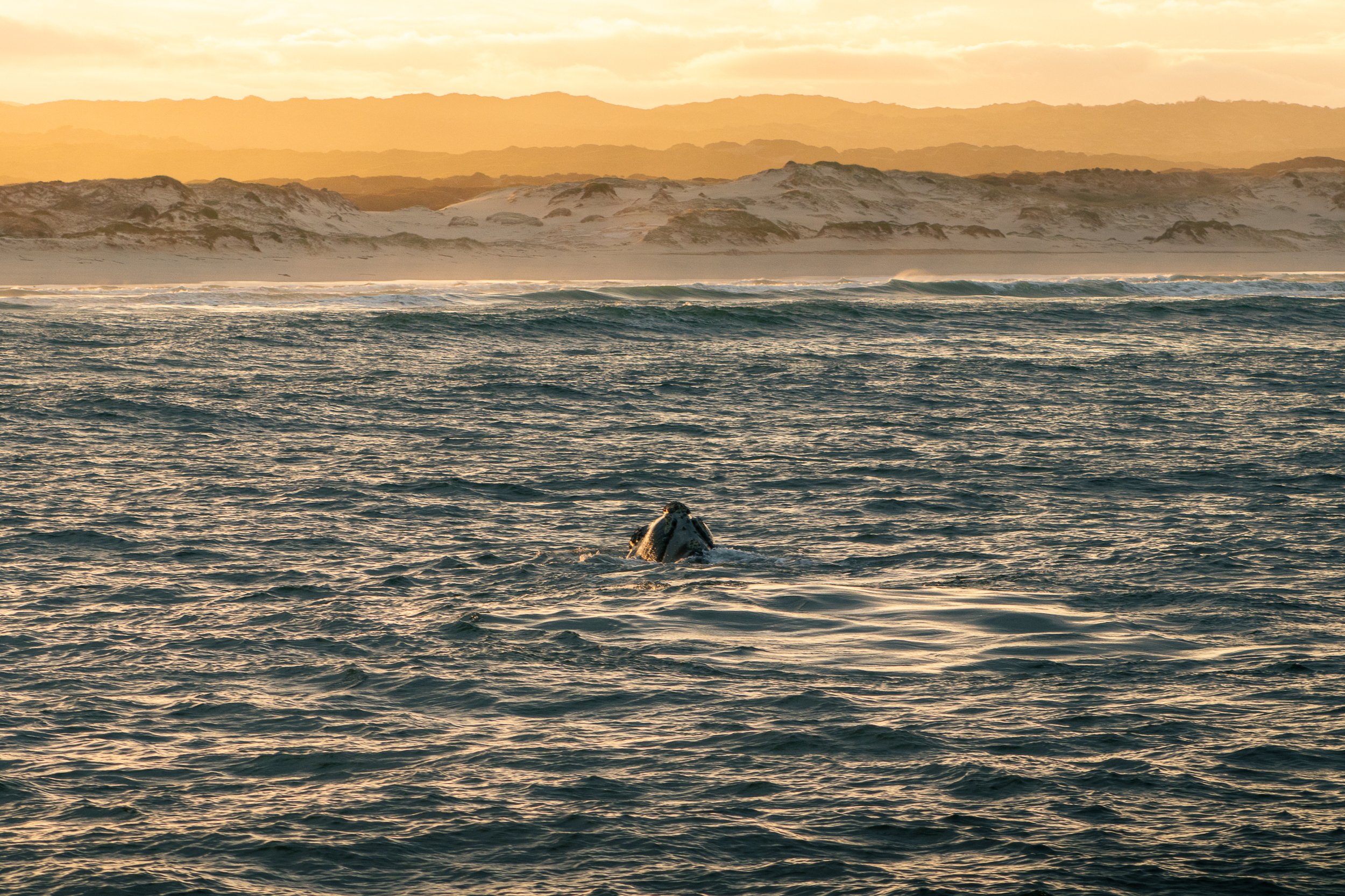
4. Golden Glow: Whale Watching in Hermanus
Location: Hermanus, Western Cape, South Africa
Every year, the quaint seaside town of Hermanus attracts so many visitors to Walker’s Bay that it’s commonly referred to as the “Whale Watching Capital of the World.”
After a month of solo-traveling around this incredible country, whale watching in Hermanus at sunrise was the experience of a lifetime that I hope to not soon forget.
The 5am wake up and freezing temperatures were worth it to capture this golden moment, one of my favorite travel photos from South Africa.
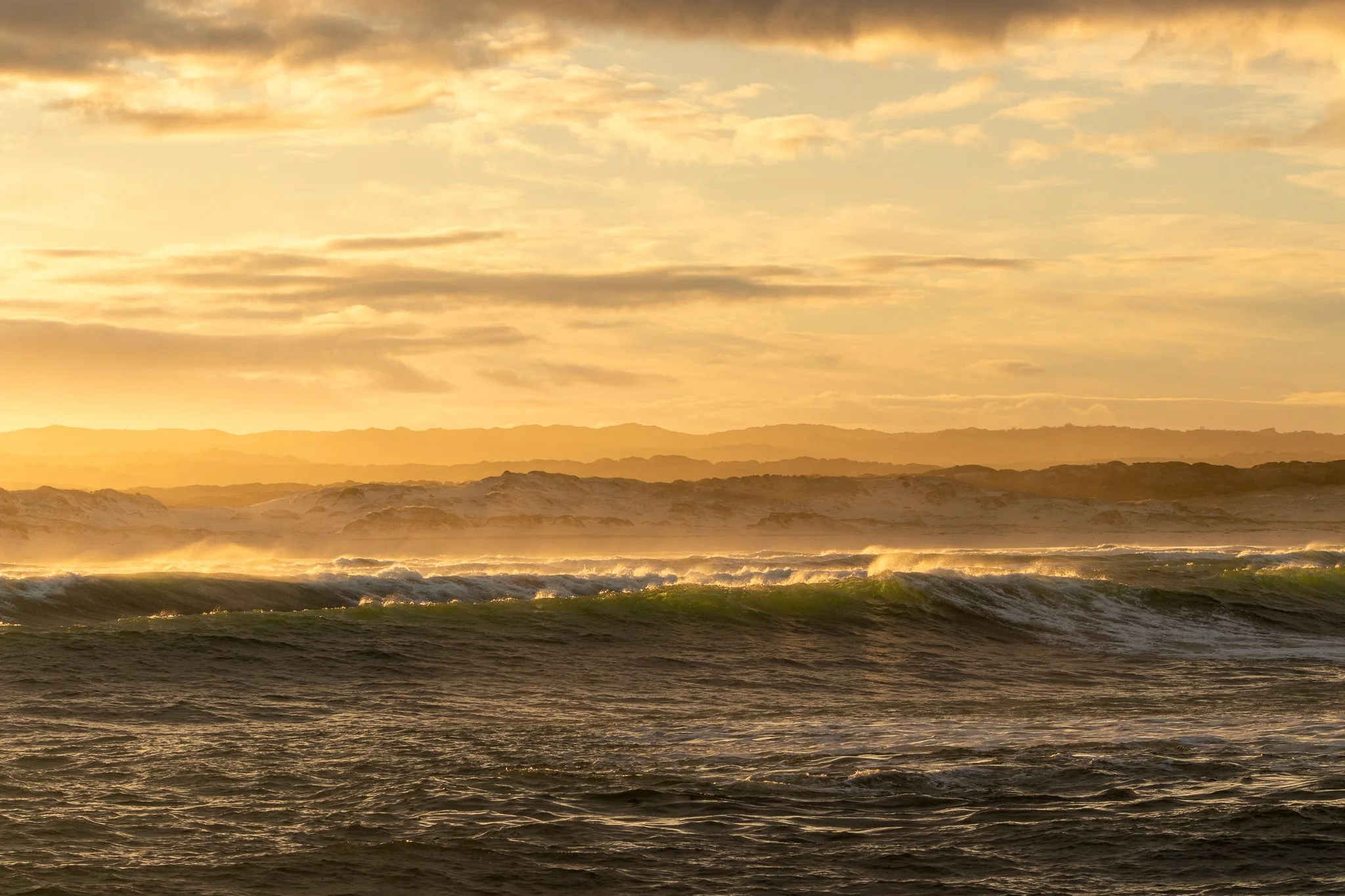
5. South Africa’s Nature Bath: Hermanus
Location: Hermanus, Western Cape, South Africa
The coastal landscapes are so pleasing to look at here that doctors once used to prescribe visits to Hermanus for recovering tuberculosis patients. The proof is in the medicine, right?
Even if getting out into the bay isn’t your cup of tea, there’s still plenty of South Africa’s nature to take in. Breathe a little easier and take the two hour drive from Cape Town. It’s worth the effort.

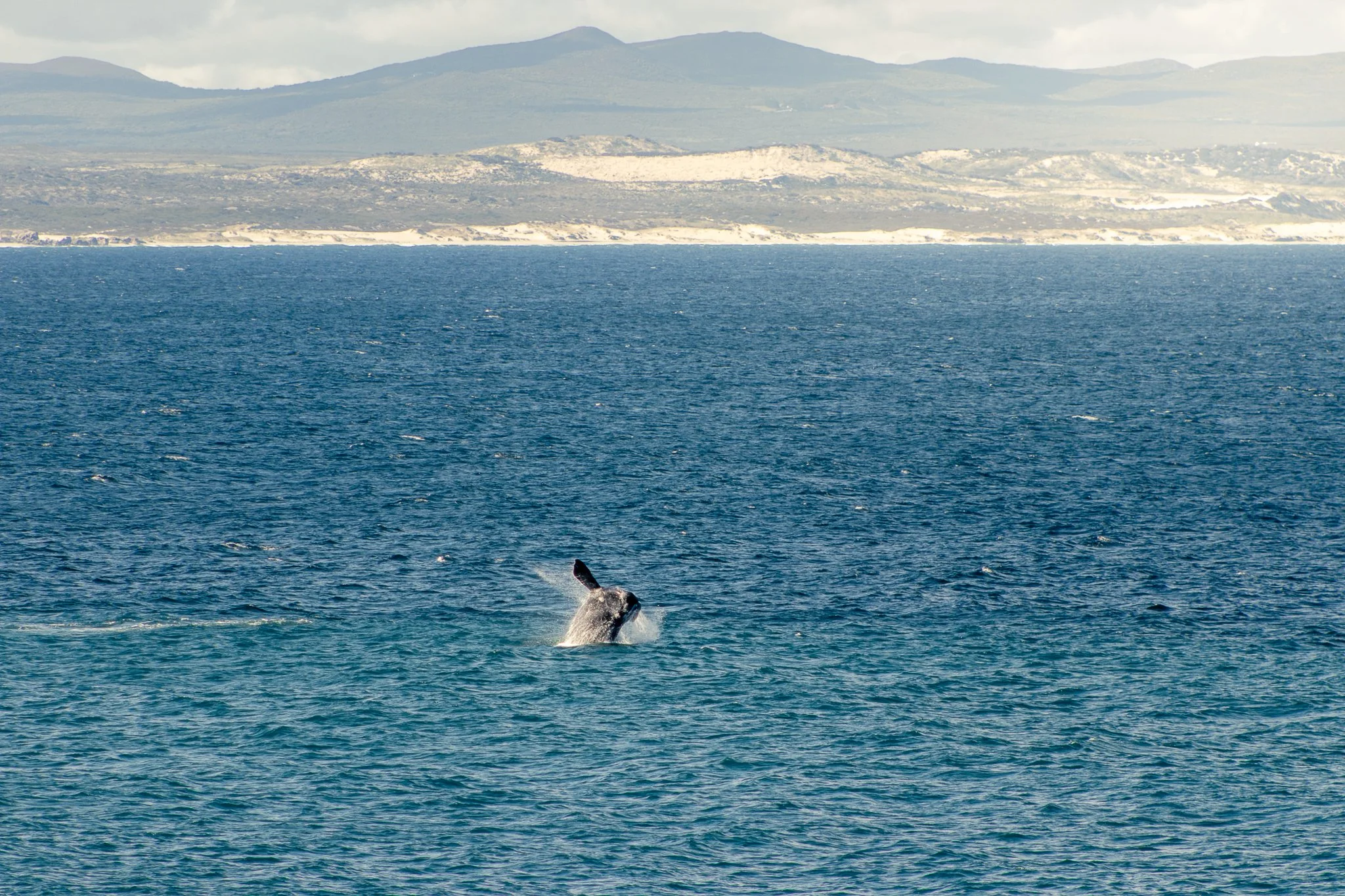
6. Golden Hour in Hermanus: Whales and Crashing Waves
Location: Hermanus, Western Cape, South Africa
No, I’m not done with Hermanus just yet. This travel photo lives rent-free in my mind so I wanted it in yours, too (you’re welcome).
Crashing waves, a golden sunrise, and whales rolling in the water. The coastal scenery provides all the recipe for a South Africa travel photography stunner, making a whale watching excursion in Hermanus a must-do activity.
7. Pure Bliss on the Hermanus Cliff Walk
Location: Hermanus, Western Cape, South Africa
If whale watching by boat isn’t for you there are still plenty of things to do in Hermanus, including a 12km cliff walk along the shore, making it easy to spot wildlife in the bay. The town even employs an official “Whale Crier”, blowing his conch every time one is spotted so you’ll never miss a beat.
8. Generational Differences: A Pilanesberg Safari Moment
Location: Pilanesberg National Park, North West Province, South Africa
A three hour drive from Johannesburg lies Pilanesberg National Park. Not nearly as vast as nearby Kruger, it serves as a smaller-scale safari for shorter trips.
On one of my final game drives, the jeep was nearly empty and we came across this scene: an older male “arguing” with a teen. Luckily we were the only ones there to bear witness.

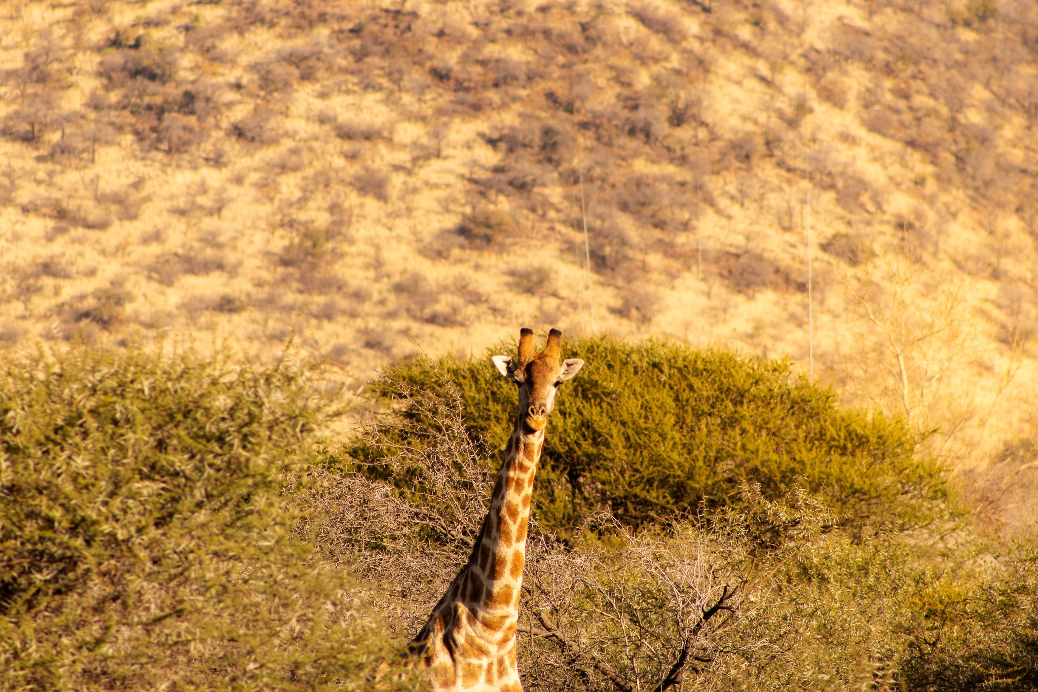
9. The Spotter Becomes the Spotted in Pilanesberg National Park
Location: Pilanesberg National Park, North West Province, South Africa
Our guide pulled over after spotting a giraffe hidden behind the bush. As I fiddled with my camera, it slowly emerged and turned to face us at the perfect moment.
We quickly became “the spotted” on our game drive as the tables turned—creating one of my favorite South Africa travel photos, captured during a quiet safari moment in Pilanesberg.
10. “Giraffe Valley” Mornings
Location: Pilanesberg National Park, North West Province, South Africa
An unofficial nickname, the phrase “Giraffe Valley” quickly took hold during my stay at Black Rhino Game Lodge because every time we drove this particular area, we were greeted by several giraffes.
On this particular morning in the freezing cold, the sun hit the frost and mist just right to create this orange glow. We couldn’t find what this giraffe was staring out over the valley, but it never diverted its gaze.

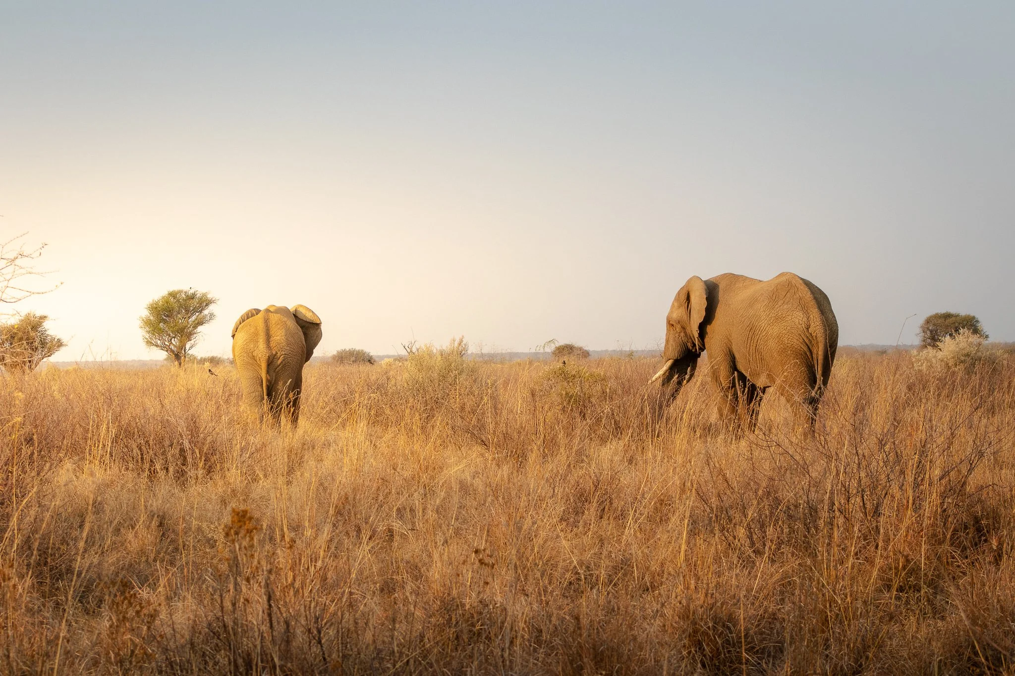
11. Into the Pilanesberg Sunset
Location: Pilanesberg National Park, North West Province, South Africa
Once the aforementioned generational scuffle ended, we were treated to this scene: both elephants rumbling off into the sunset. One of the more peaceful South Africa travel photos I was able to capture and my favorite Pilanesberg safari moments.

Here’s my go-to camera gear when traveling:


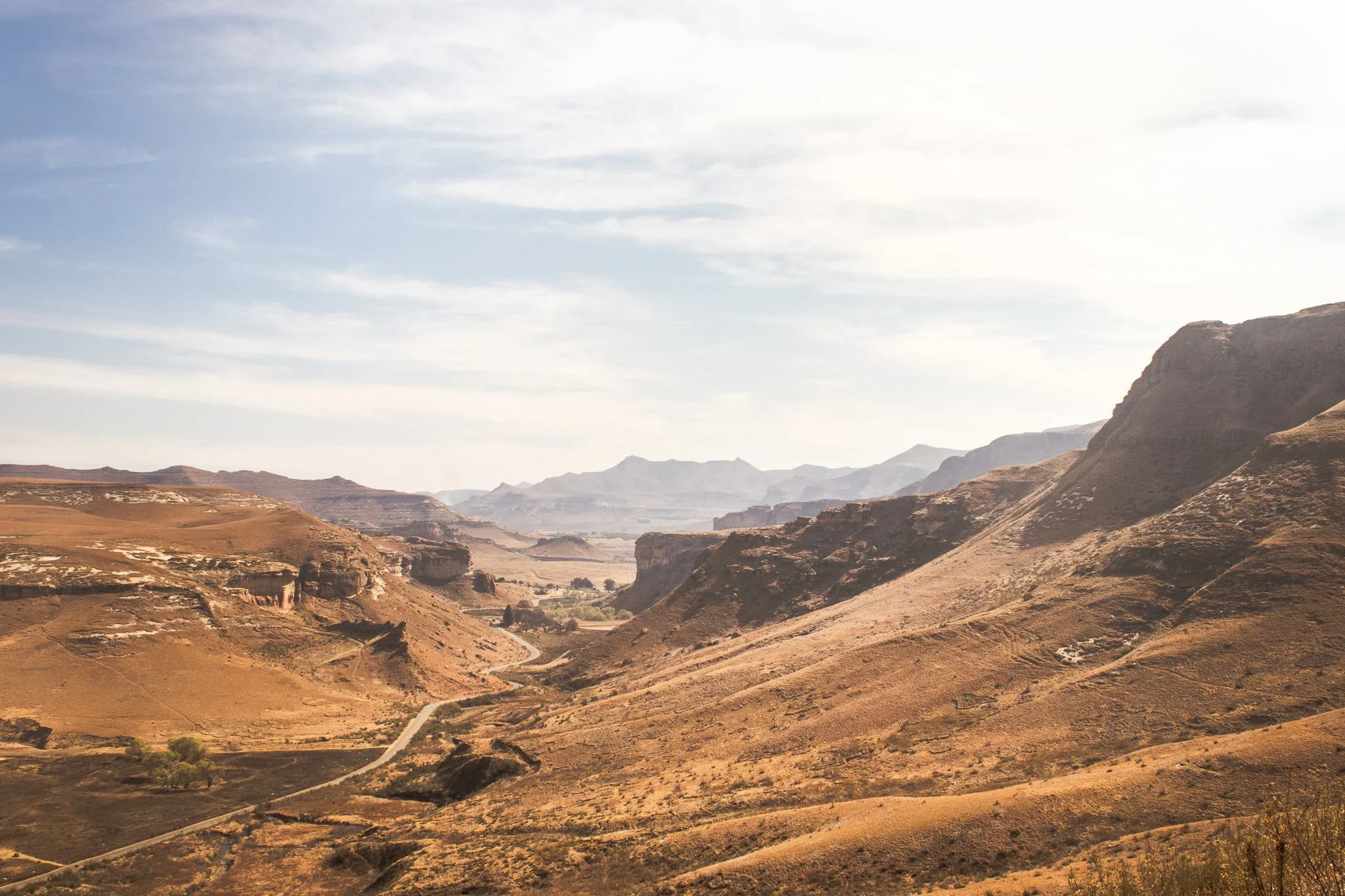
12. The Road to Nowhere in Golden Gate Highlands National Park
Location: Golden Gate Highlands National Park, Free State, South Africa
I had a gap in my plans during my South Africa roadtrip after visiting Pilanesberg National Park. One thing led to another and I ended up in nearby Clarens as a base to visit Tugela Falls via the infamous Chain Ladders Route, the second-highest waterfall in the world.
Long story short, a combination of poor planning, time of day, and weather nixed that hike. But the drive back to Clarens passed through Golden Gate Highlands National Park and I decided to pull off and do a short walk. I was treated to the stunning Free State landscapes, herds of wild zebra, and solitude. The afternoon was a lesson in following your gut: things will work out.
13. The Perfect Stopover in Clarens, South Africa
Location: Clarens, Free State, South Africa
Clarens was never part of the plan, but it seemed a good home base for the next stage of my trip — driving into Lesotho.
Lined with cafes, breweries, and art galleries, this quaint town in South Africa’s Free State is also at the doorstep of jaw-dropping landscapes at neighboring Golden Gate Highlands National Park.
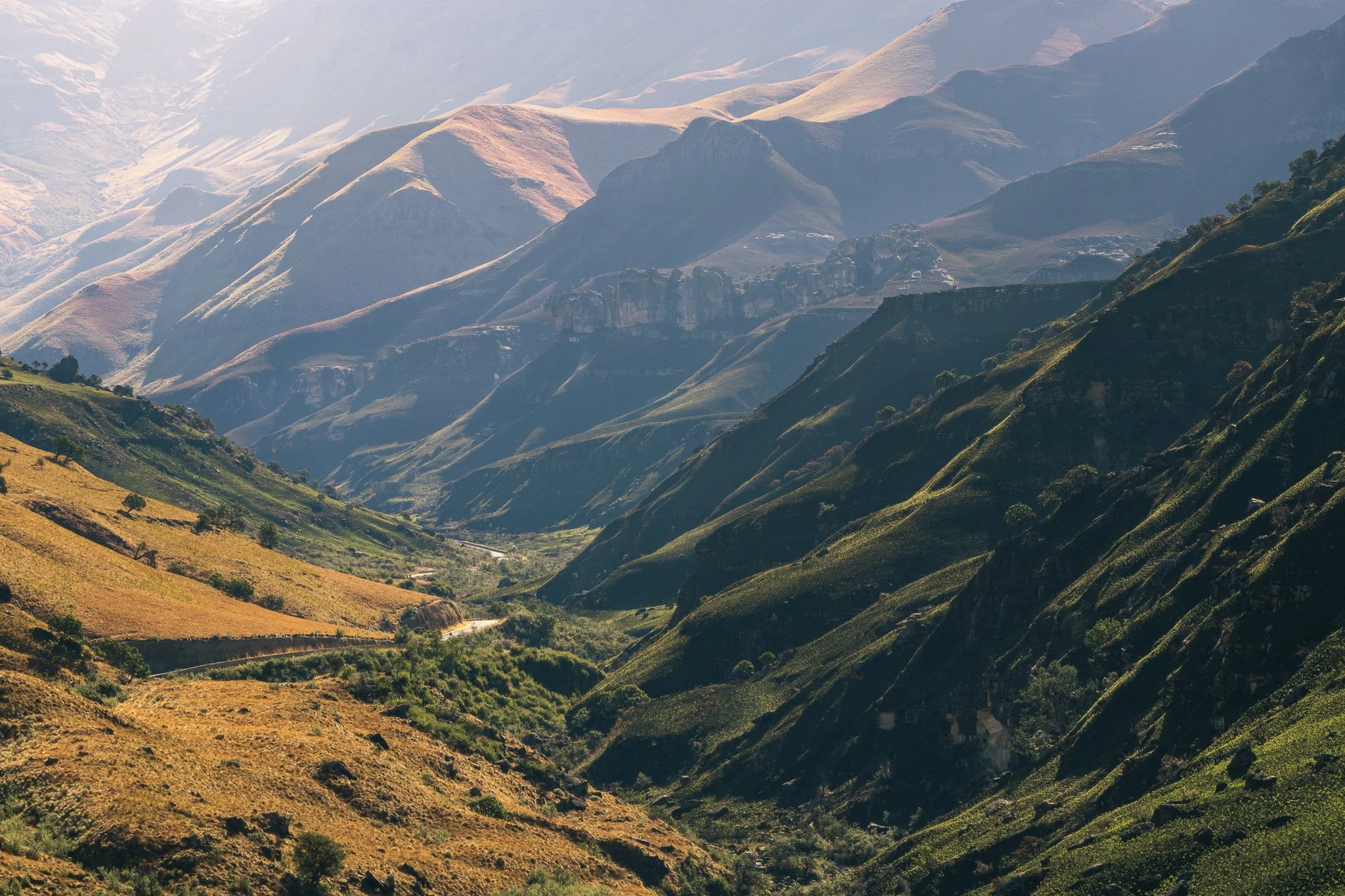
14. Toyota RAV4 vs. Sani Pass
Location: Sani Pass, Drakensberg Mountains, Lesoth-South Africa Border
Driving the Sani Pass was the top item to accomplish during my solo travel around South Africa, so when the rental company in Johannesburg couldn’t give me a 4x4 as was required to drive the road, I had a decision to make.
Do I skip it, or find a way?
That’s the story of how my trusted RAV4 and I (slowly) made our way down from Lesotho and back into South Africa along the infamous Sani Pass. The road was rough and the descent difficult, but the sweeping views of the surrounding Drakensberg Mountains were worth it.
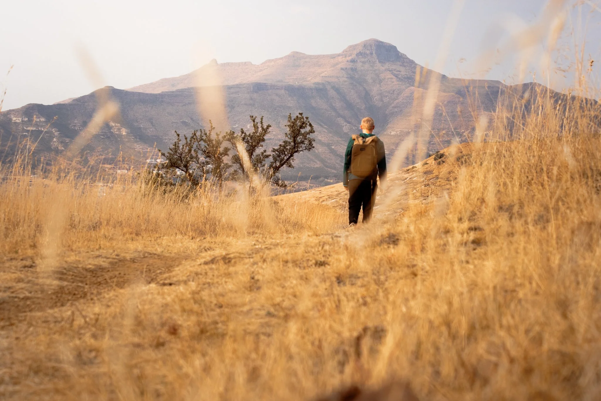
15. Unexpected Peace in KwaZulu-Natal
Location: Howick, KwaZulu-Natal, South Africa
From the Drakensberg Mountains, I made my way into the rolling hills of the KwaZulu-Natal Midlands with the intention of visiting Nelson Mandela’s capture site.
What I found instead was unexpected calm—gentle landscapes, open skies, and endless greenery like Gray Mare’s Trail in nearby Karkloof Nature Reserve. It was a quiet reminder that some of the most peaceful moments of travel come when plans take a back seat
My solo travel started in Cape Town, often named the world’s most beautiful city by Time Out Magazine — and it’s easy to see why. Mountains, outdoor space, coffee, rich culture and endless diversity… you could leave me there and I’d be set for life.
But when you inevitably book that trip, push yourself beyond the city limits and into the far corners of the country. Discover the KwaZulu-Natal Midlands and Drakensberg Mountains. Drive the wide-open roads of the Free State and jump into South' Africa’s wildlife.
You won’t regret it.
In the meantime, I hope these 15 South Africa travel photos help to keep that wanderlust alive and offer a little inspiration for your next adventure.
Questions? Anything to add? Drop it in the comments below. Until next time, stay safe & happy travels!
Sharing is caring! Pin this post for later.


Best Photography Spots in Chicago: Everywhere you need to go on your next trip to the Windy City
Skip the tourist trail and check out this comprehensive list of incredible spots to photography Chicago. From where to find the best city skyline views to which parking garages best capture the 'L' train, this is a must-have guide before your next trip!

As it turns out, moving to Chicago has been the perfect way to expand my photography skills. With the hustle and bustle of city life, the famous ‘L’ train weaving through the towering buildings, and the glistening shores of Lake Michigan to the east, there’s a unique perspective everywhere you look.
Millennium Park and Michigan Ave are by far the most visited sites in this mid-western hub but trust me when I say there’s so much more to discover.
Here’s a list of the best places to photograph Chicago.
NORTHERLY ISLAND
Northerly Island is a peninsula park along the shores of Lake Michigan that comes complete with city skyline views, including the iconic Soldier Field.
Enjoy the fresh air and greenery as you combine your skilled nature shots with that of urban life.
Fun Fact: The 5-acre lagoon is home to many of Illinois’ wildlife, including monarch butterflies and heron.
Getting There: Red, orange, and green line trains to Roosevelt & walk from there

NORTH AVE. BEACH
Located in Lincoln Park, this popular beach offers some of the best skyline scenery in the entire city. Walk the jetty, stick your toes in the sand, and snap some shots as daily life in Chicago moves all around you.
Pro Tip: This is location is adjacent to the Lincoln Park Boardwalk (below), so it’s easy to combine the two shoots.
Fun Fact: North Avenue Beach came into existence from a multi-million project in the 1930s that was partially funded by President Roosevelt’s New Deal. The beach itself is an extension of an old landfill’s narrow path along Lakeshore Drive.
Getting There: Red, brown, or purple express lines to Fullerton & walk towards Lincoln Park

North Ave. Beach in Chicago, IL
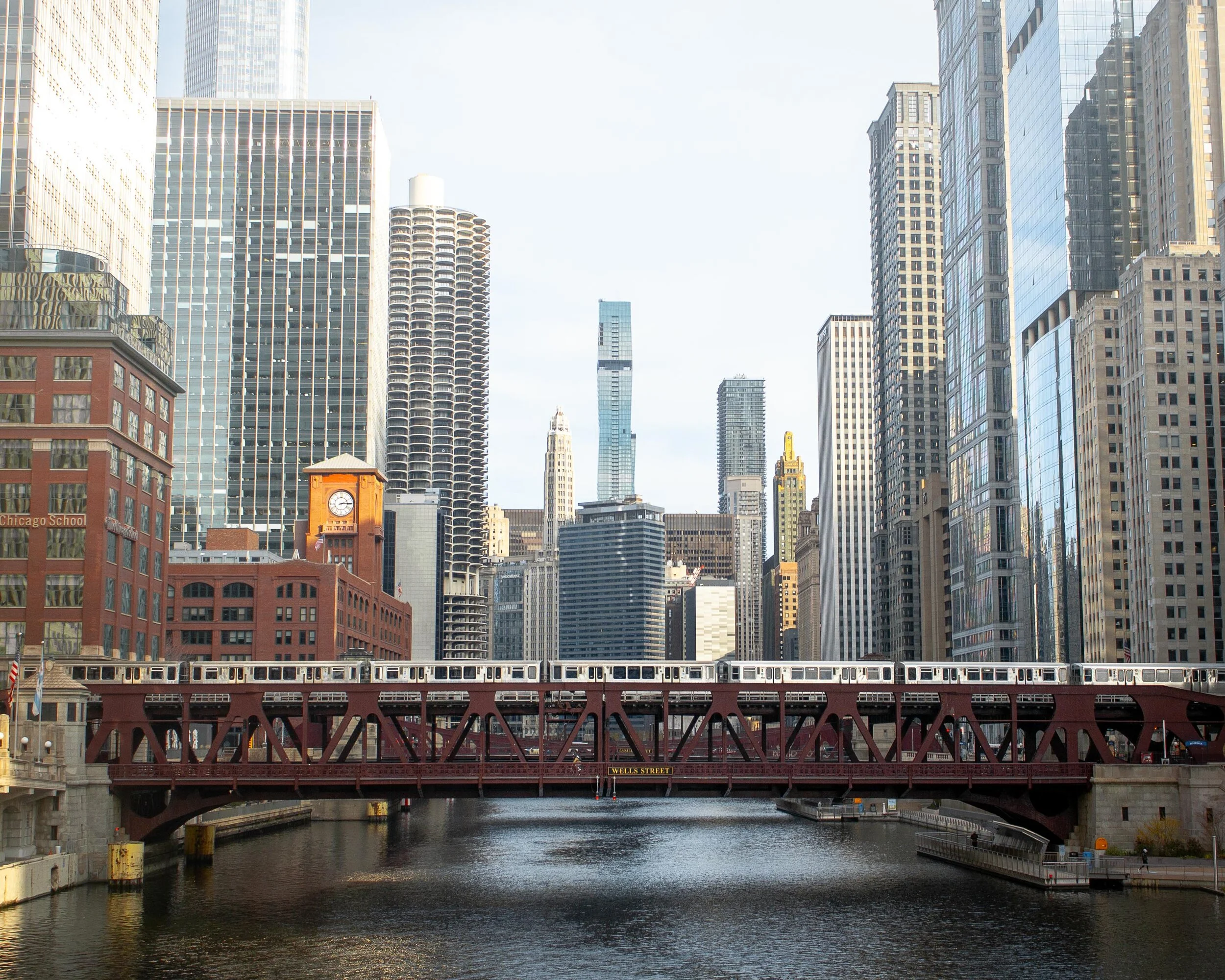
ORLEANS ST. BRIDGE
The most popular way to take advantage of this location is to shoot towards the Wells St. Bridge. This is one of my favorite scenes in the city that perfectly encapsulates life in Chicago; boats cruising along the river below, the brown line trains traversing across the river and stunning architecture rising high towards the sky.
A unique feature of Chicago is that the city is constructed in a way that each building seems to command space of its own, demanding attention as an independent masterpiece. This location perfectly captures that.
Pro Tip: Shooting towards the Wells St. Bridge is great, but don’t forget to turn around and check out the trains coming across the Lake St. Bridge as well.
Fun Fact: The two leaves of the Wells St. Bridge were built offsite and then transported via the Chicago River for installation.
Getting There: Blue, orange, pink, green, brown, and purple express lines to Clark/Lake or brown/purple line to Merchandise Mart
Downtown Chicago, IL
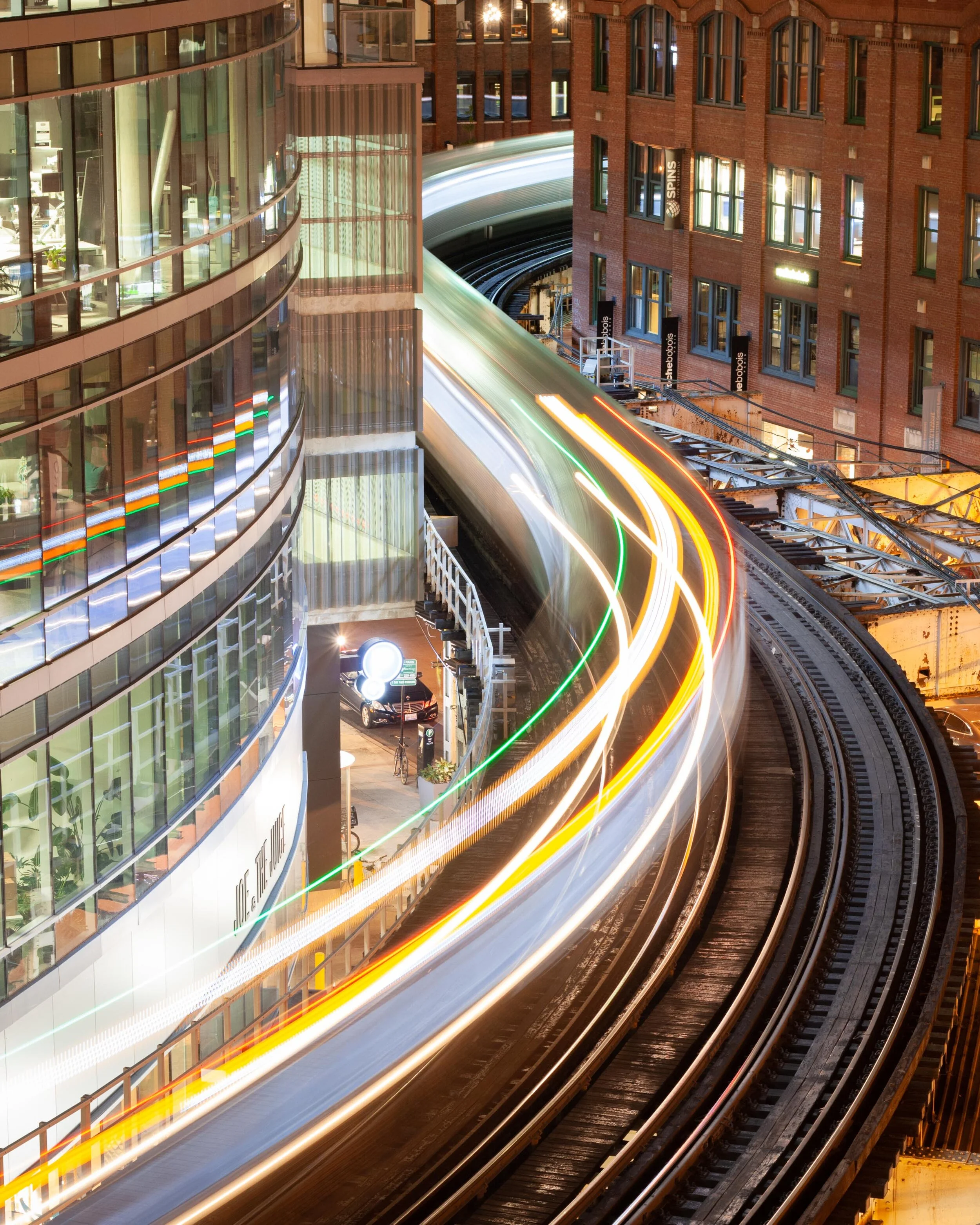
WELLS KINZIE GARAGE
One of my favorite parts of living in the city is finding unique angles to capture the famed ‘L’ train. There’s no better shot than the S-curve in the downtown loop.
Ride the elevator to the top of the Mart Parc Garage at the corner of Wells and Kinzie and watch the trains maneuver through the city’s infrastructure.
Remember: each level of the garage offers a different perspective of the tracks. Be sure to spend some time exploring to find what works best for you!
Fun Fact: In 2014, the “L” train was fourth in the nation for total route length at 102.8 miles.
Getting There: Brown and purple express lines to Merchandise Mart
‘L’ Train in Chicago, IL
437 N. ORLEANS
For the lesser-known view of the S-curve, head to the parking garage located at 437 N. Orleans. The top-level shows the trains as they head to/from the Merchandise Mart CTA station.
Located near the Orleans St. Bridge (above), this makes for a great day of chasing trains.
Pro Tip: For the symmetry enthusiasts, take note of the Assumption Catholic Church steeple against the red brick backdrop.
Fun Fact: The oldest sections of the “L” train began operations in 1892, making it the country’s second-oldest rapid transit system behind New York City’s elevated rail system.
Getting There: Brown or purple lines to Merchandise Mart

‘L’ Train as seen from 437 N. Orleans in Chicago
Need more ideas? Check out this list of curated tours!
PING TOM MEMORIAL PARK
This is the first park I visited after moving to Chicago and it remains at the top of my favorites.
Located in the Chinatown district, this is the perfect place to stock up on some warm buns and pastries, walk along the river, and shoot the city skyline. The boardwalk with the ornate rails helps to create some appealing leading lines.
Pro Tip: Ping Tom Memorial Park is commonly known as one of the best places to watch trains. Amtrak frequently crosses the bridge at the southern edge of the pathway while the CTA trains and freighters flank it to the east.
Fun Fact: This 17.4-acre park was originally the site of a Chicago and Western Indiana Railroad yard. The area began its transformation into a green space in 1998.
Getting There: Red line trains to Roosevelt or green line to Cermak-McCormick Place
Downtown Chicago as seen from Ping Tom Memorial Park
18th STREET BRIDGE
Another spectacular city skyline view is on the 18th Street Bridge, located just above Ping Tom Memorial Park. Point the camera up the South Branch of the Chicago River and behold the Windy City in all its glory.
This is an especially great spot for nightscape photography.
Fun Fact: With a 1967 construction date, the 18th Street Bridge is one of the youngest in all of Chicago.
Getting There: Red line trains to Roosevelt or green line to Cermak-McCormick Place

Chicago skyline as captured from the 18th street bridge in Chicago’s Chinatown
LINCOLN PARK BOARDWALK
The nature boardwalk at Lincoln Park makes for the perfect escape from the busy city streets. The pond is surrounded by prairie-style grass and is full of life with birds, frogs, and fish to name a few.
This is a great place to not only photograph the urban nature scene, but the John Hancock Building as well.
Pro Tip: Combine a visit here with North Ave Beach.
Fun Fact: The Nature Boardwalk acts as a living laboratory for the Urban Wildlife Institute in Chicago as they test new techniques to resolve human-wildlife conflict.
Getting There: Red, brown, or purple express line trains to Fullerton

Lincoln Park, Chicago
200 NORTH CLARK
In a massive city full of high rises, this is the place where you can see straight to the horizon and it feels as though the trains below are riding off into the sunset.
The reflective siding on the garage adds to the unique perspective and helps to create some stunning imagery.
Fun Fact: In 2016, the “L” train had 1,492 cars transporting passengers between 145 stations.
Getting There: Blue, green, pink, orange, brown, and purple express lines to Clark/Lake

The view from the parking garage at 200 N. Clark St. in downtown Chicago
WABASH ARTS CORRIDOR
Commonly referred to as the “living urban canvas” because new pieces are being added on an annual basis, the Wabash Arts Corridor is a unique collection of colorful murals.
Stretching from as far north as Polk and as far south as Roosevelt, this is the perfect place to wander around with your camera. Be sure to check the website for more information, including a walking map of each masterpiece.
One of the most popular works is the Moose Bubblegum Bubble by artist Jacob Watts.
Pro-Tip: Start on the southern edge at Roosevelt and make your way north back into the city’s downtown loop.
Fun Fact: The Wabash Arts Corridor was founded in 2013 by Columbia College and continues to grow into being one of the largest, unique, and accessible art projects in the country.
Getting There: Red, orange, and green line trains to Roosevelt & walk north
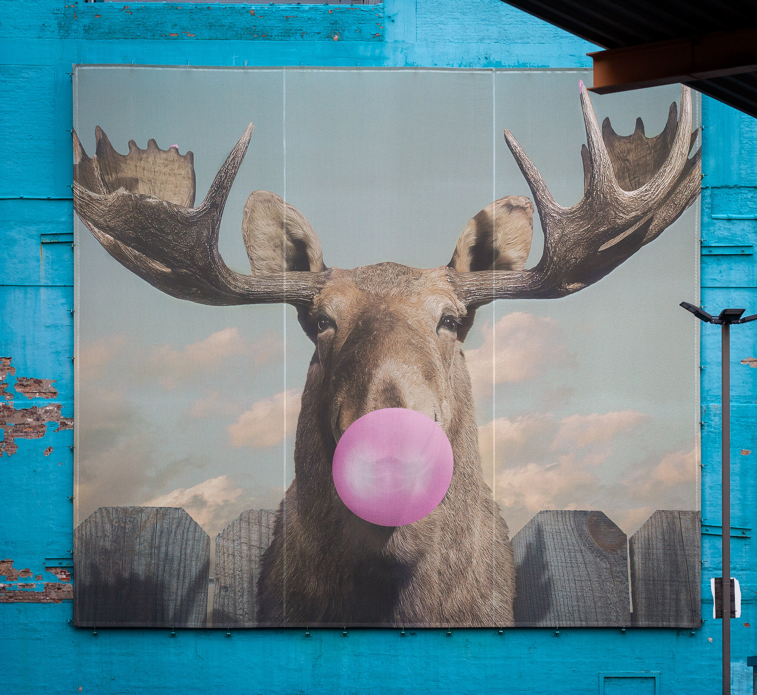
Moose Bubblegum Bubble mural by artist Jacob Watts
CHICAGO THEATER
Ok, you caught me. I can feel you rolling your eyes.
The vintage Chicago Theater sign isn’t exactly “off the beaten path”, but it does make for some pretty great long exposure shots and it’s a quick and easy stop on your tour of the city.
Fun Fact: The Chicago Theater was the first large movie palace in America and quickly became the prototype for all others. Constructed in a French Baroque style, look closely at the theater’s exterior to see if you can find the miniature Arc de Triomphe.
Getting There: Pink, green, brown, orange, and purple line express trains to State/Lake

Chicago Theater standing tall in the downtown traffic

The Chicago Theater shines bright in the snow
The truth is you just need to come here yourself and wander around. Each neighborhood, train line, and person has something unique to offer!
Stay safe & happy travels.
Enjoy what you read? Pin this post for later!


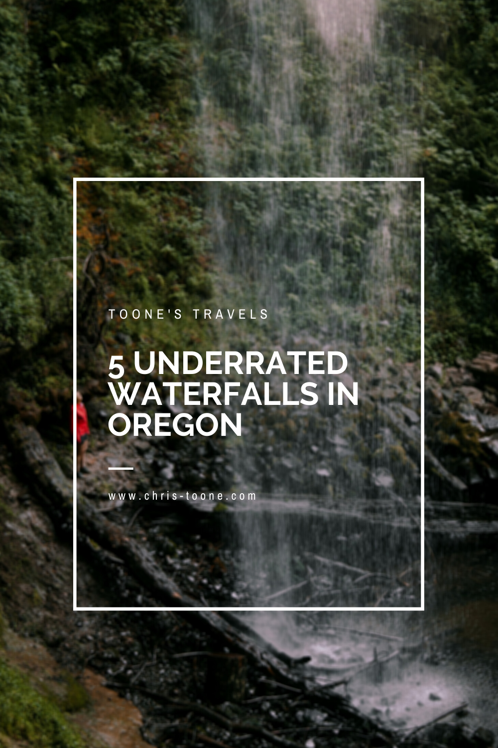
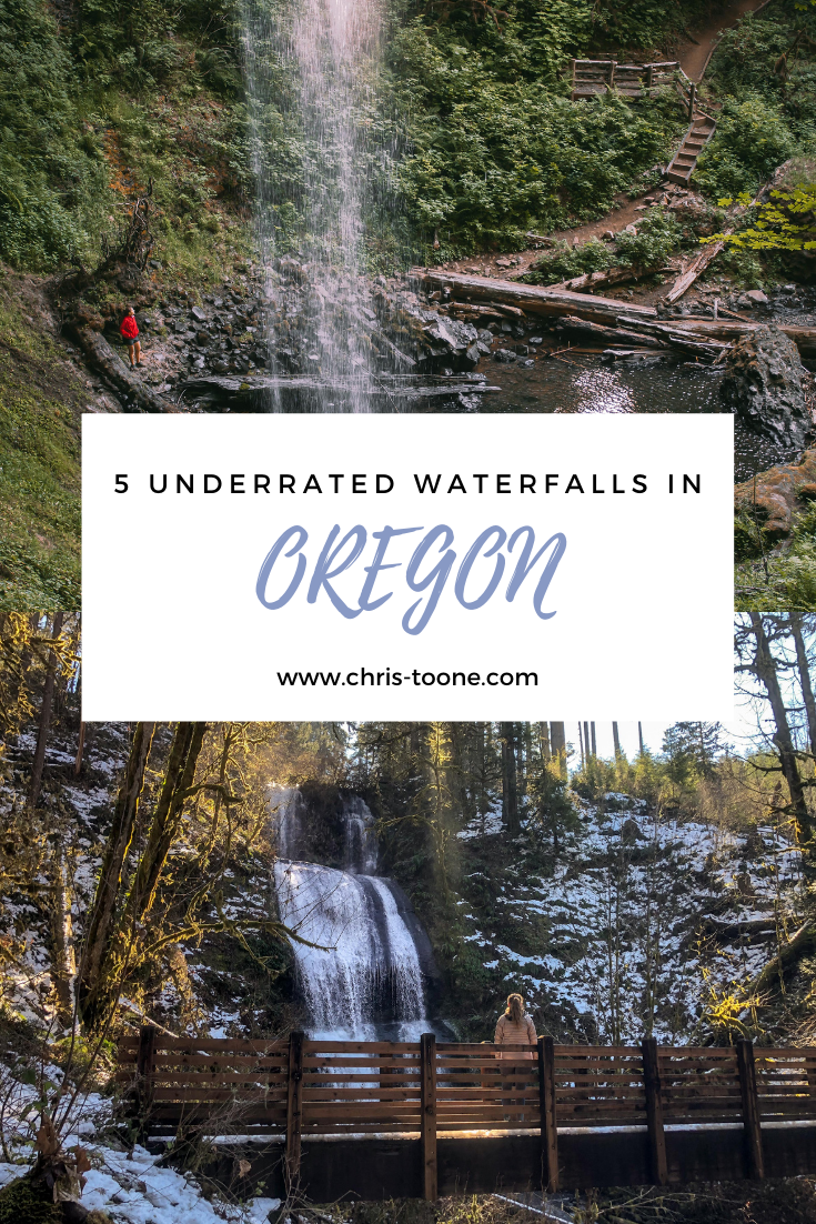
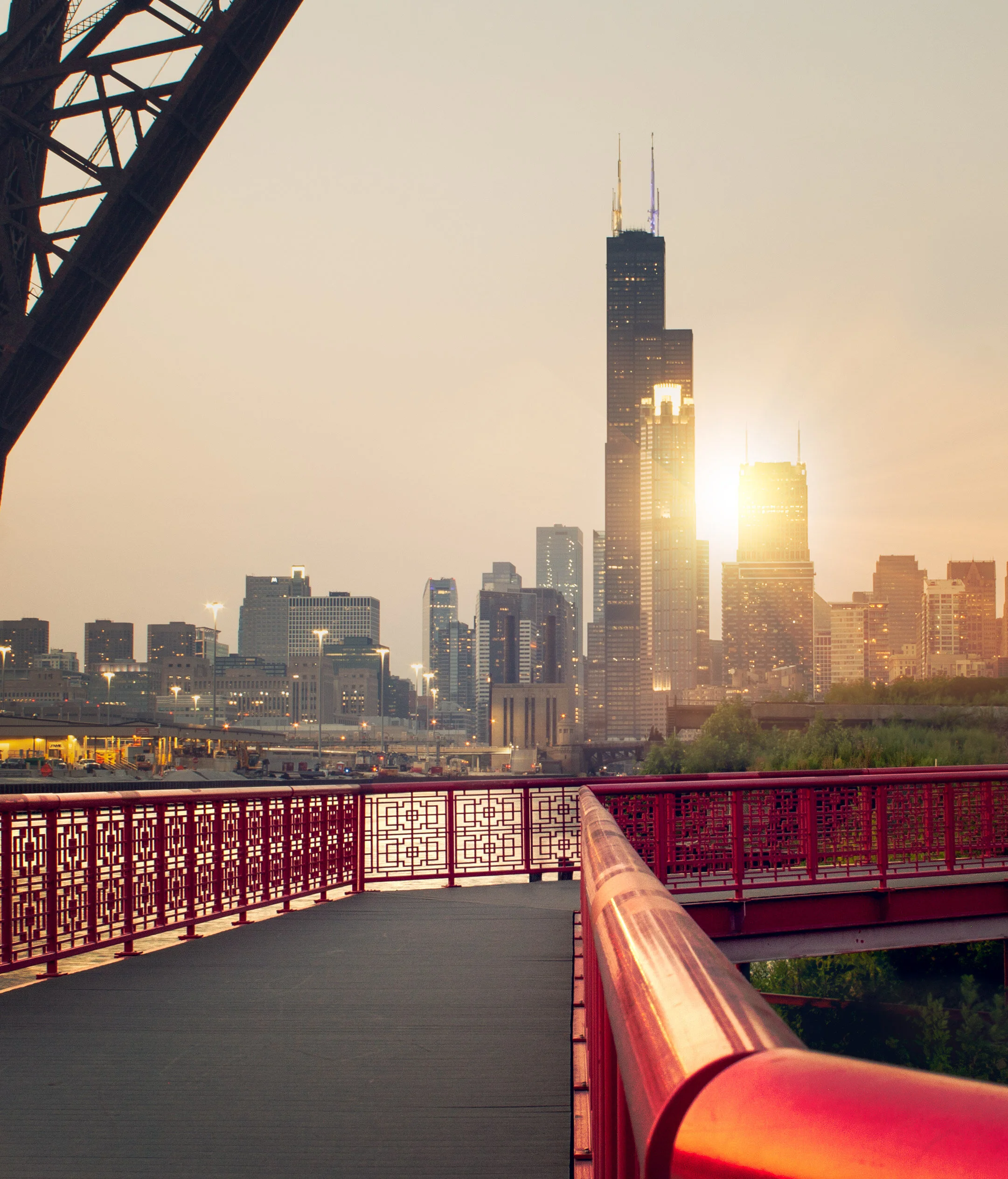
5 of the most underrated waterfalls in Oregon
Although Multnomah may be the most popular waterfall in Oregon, the state is home to at least 237 others! Here’s a list of 5 of the most underrated waterfalls, deep within the verdant forests of this mystical place. It’s time to break out the hiking shoes for these incredible adventures!

Please note: All information below is updated as of May 2023
Growing up just outside of Buffalo, New York, I had the luxury of being able to visit Niagara Falls whenever I wanted. Needless to say, with one of the seven natural wonders of the world in my backyard as a child, my standard for waterfalls may be a bit unfair - or so I thought!
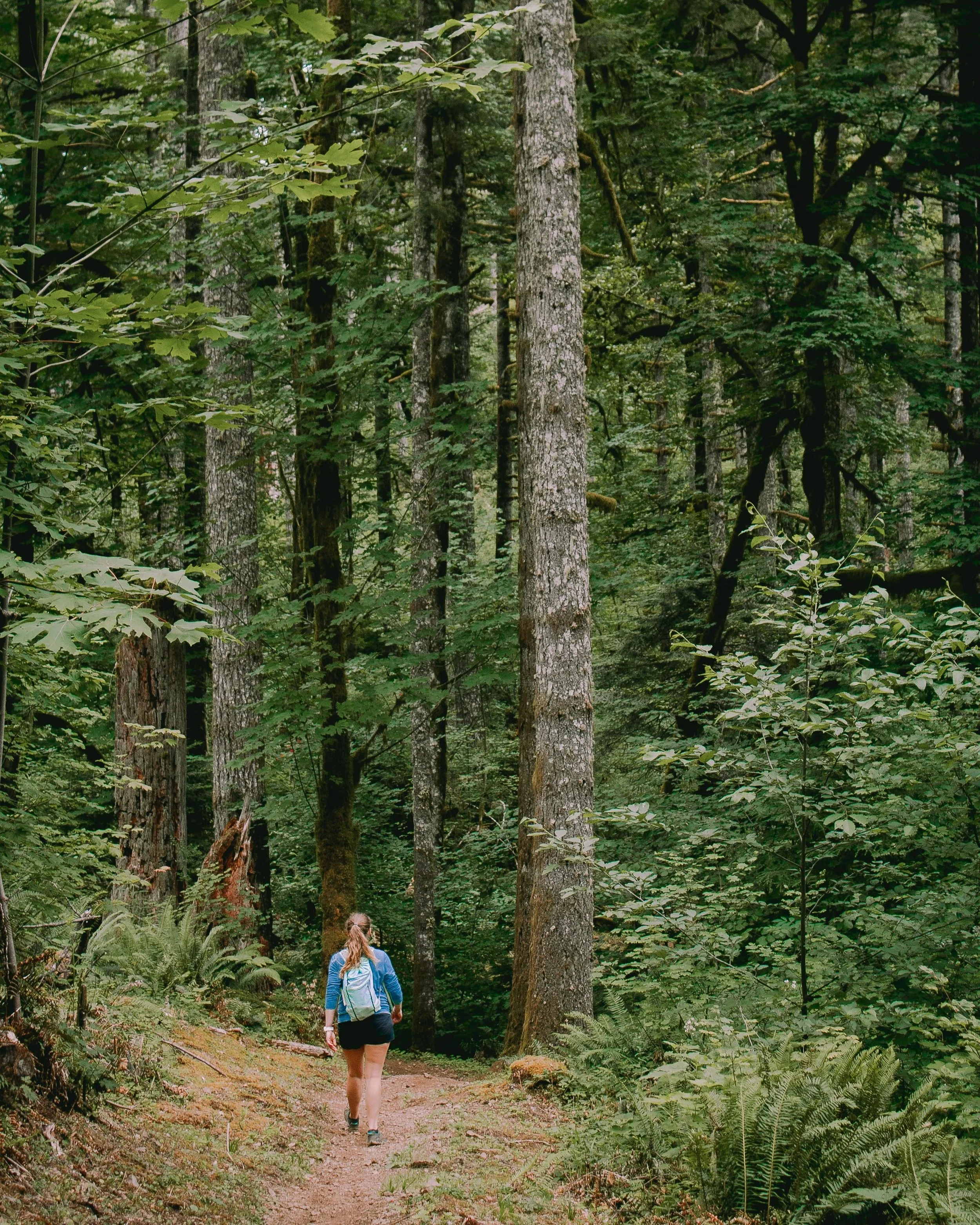
Although Multnomah Falls may be the most well known and photographed waterfall in all of Oregon, the beaver state is home to over 230 others. It’s hard to find a hike in Central Oregon that doesn’t lead to a magical view of these natural wonders.
With a plethora of hidden gems all around, here are my top 5 most underrated waterfalls found in Oregon, USA. It’s time to break out the hiking shoes!
1. SHELLBURG FALLS
Located in the Santiam Foothills near Mehama, Oregon, Shellburg Falls is a 100ft tall cascading waterfall that flows over a stunning basalt ledge.
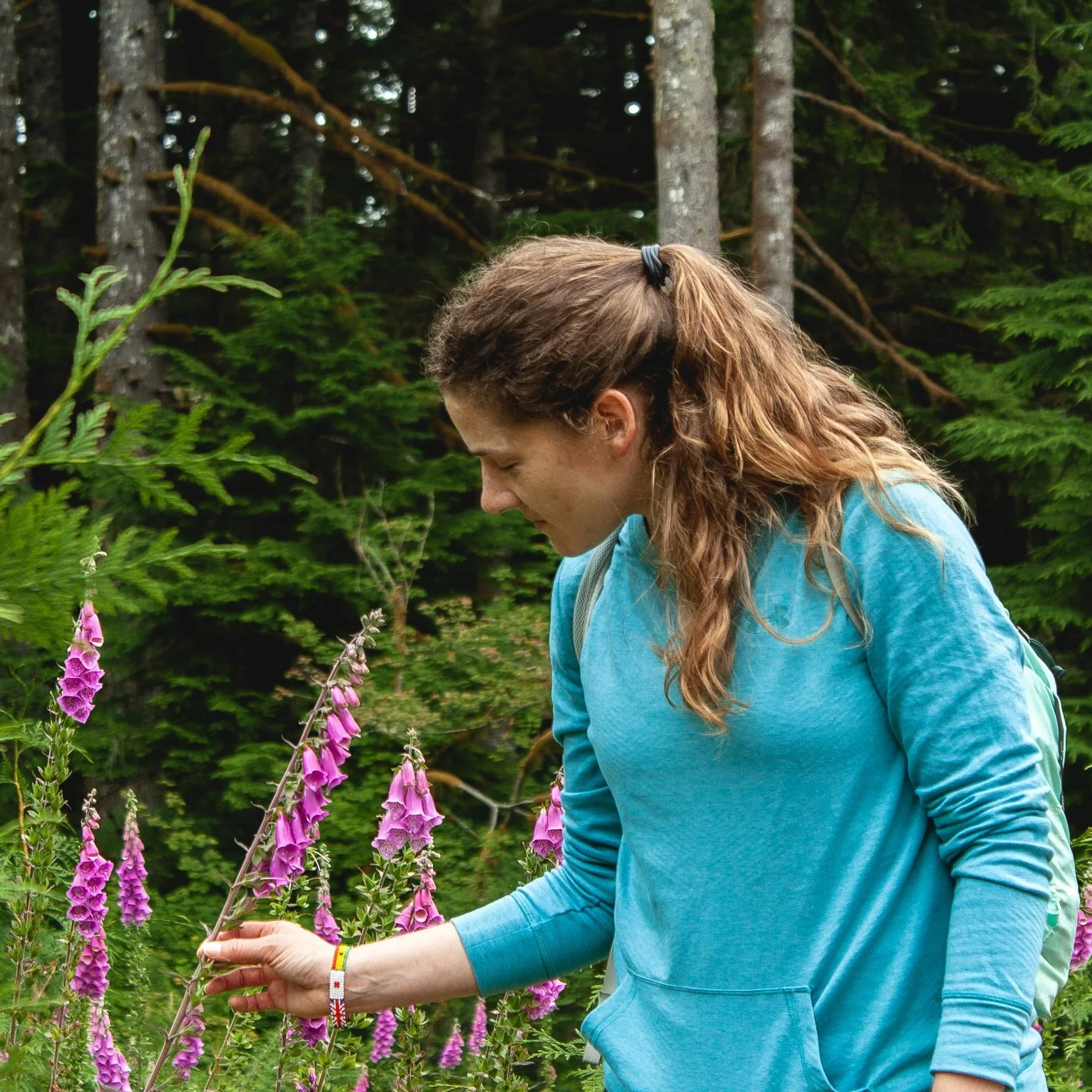
The hike starts by following a gravel road before entering the old-growth forest. Note: this road is private property and crosses through an open cattle range. Once you’ve reached a small bridge that crosses above Shellburg Creek, there will be stairs on the left that mark the beginning of the trail to the waterfall.
The path leads directly to Shellburg Falls and even takes hikers beneath the ledge and behind the flowing water, offering a unique perspective. Continue trekking through the forest and wildflowers before rejoining the gravel road at the other end of the loop. Pro Tip: Go early. This hike is easily accessible and good for all ages, making it heavily trafficked.
Hiking Distance: 6.0mi loop trail
Elevation Gain: 1,036 feet
Rating: Easy to moderate
Fee: None
Bathrooms: Vault toilets are located at the Shellburg campground, approximately 0.6mi past the waterfall


2. OPAL CREEK WILDERNESS (SAWMILL FALLS)
This trail is currently listed as CLOSED.
The Opal Creek Wilderness trail is a 6.9mi loop near Lyons, Oregon. Surrounded by stunning cedar trees, the hike flanks the Little North Santiam River as it winds its way through an abandoned mining operation from over a century ago.
The real gem of this trail is the numerous cut-offs to various waterfalls and swimming holes along the way, the most beautiful of which is Sawmill Falls. Make sure to bring a swimsuit and take a dip in the beautiful blue water!
Hiking Distance: 4mi. out and back to Sawmill Falls, 6.9mi. loop through Jawbone Flats
Elevation Gain: 652 feet
Rating: Easy
Fee: $5.00
Bathrooms: Vault toilets located at trailhead parking lot and in Jawbone Flats

Sawmill Falls
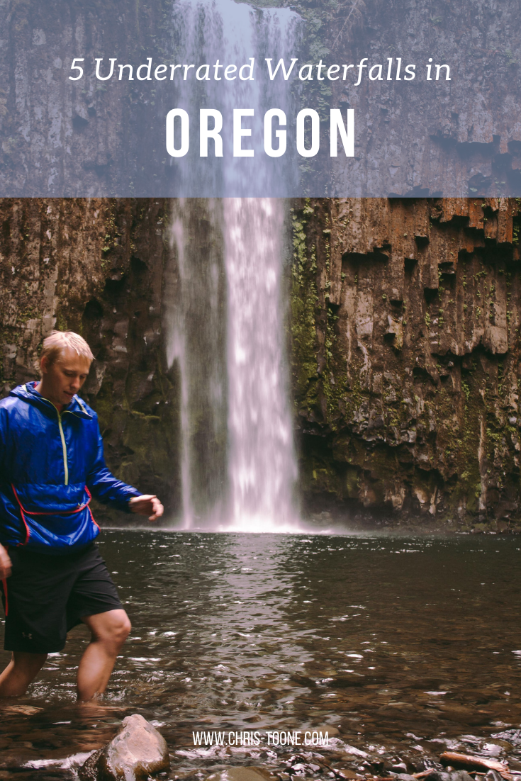
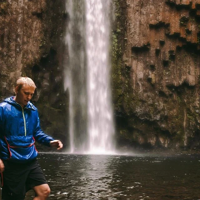
3. ABIQUA FALLS
Abiqua Falls is an out and back 5.3mi trail located near Scotts Mills, Oregon that features a short hike through the forest and along a crystal clear river before reaching the 92ft. waterfall.
The trailhead can be found by following a single lane dirt road, with parking available in turnouts along the way. Continue following the road by foot as it descends deeper into the forest until reaching the trailhead. From here it’s a short 0.8mi. hike to the waterfall, but keep in mind the elevation gain becomes difficult on the way back out.
Keep telling yourself that it’s worth it because it is! If you’re daring like me, be sure to take a quick dip in the freezing, yet refreshing, pool below the falls. Note: The hike is on private property and can get steep at times. Exercise caution and be respectful.
Hiking Distance: 5.3mi. out and back (dependent on parking location), 0.8mi. to the waterfall from the trailhead
Elevation Gain: 1,397 feet
Rating: Hard (mostly due to the elevation gain on the way out)
Fee: None
Bathrooms: Not available


4. McDOWELL CREEK FALLS TRAIL (ROYAL TERRACE FALLS)
In search of a hidden wonder in Oregon? Look no further than McDowell Creek County Park, located 16mi. east of Lebanon. Here you’ll find McDowell Creek Falls Trail, a 1.8mi loop that leads to two beautiful waterfalls: Royal Terrace Falls and Majestic Falls.
Cascading a total of 119 feet between the two levels, Royal Terrace Falls was named from its unique terraced appearance, often found in royal palaces around the world. The trail itself winds its ways through the lush forest, taking hikers along bridges, stairs, and platforms, all providing the perfect views of the falls.
A great day trip for all ages!
Hiking Distance: 1.8mi. loop trail
Elevation Gain: 288 feet
Rating: Easy
Fee: None
Bathrooms: Not available


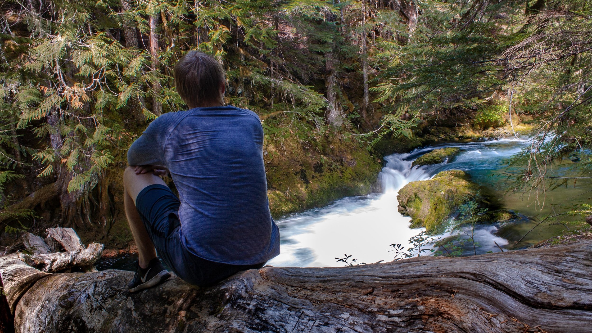
5. KOOSAH AND SAHALIE FALLS
Do you recognize any of the pictures below? Dig deep into the 90’s Disney movie vault… Sahalie Falls was featured in Homeward Bound! Still not ringing a bell? It’s ok - it’s still worth a visit!
The Waterfall Trail is a 2.6mi loop that runs adjacent to the McKenzie River as it winds past Koosah (70ft) and Sahalie (100ft) falls.
Along the way, accessory paths veer off and provide viewpoints of the area that many hikers fail to experience, so make sure to wander a bit! The main trail is marked, making it easy to stay on course. Pro Tip: Park at and start the hike from Koosah Falls instead of Sahalie. This lot is typically less congested.
Hiking Distance: 2.6mi. loop trail
Elevation Gain: 357 feet
Rating: Easy
Fee: None
Bathrooms: Vault toilets are available at Sahalie Falls parking lot


Ready to get out and explore yet? Wherever you are the world, make sure to leave time for a new adventure and, if you ever find yourself in Oregon, be sure to check out one of these hikes!
Thanks for reading and as always, stay safe & happy travels.
Enjoy what you read? Pin this post and share with others!