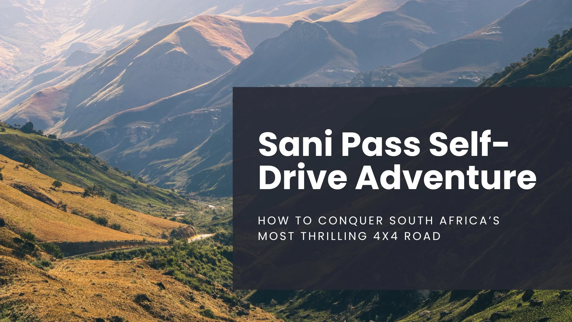
Sani Pass Self-Drive Adventure: How to Conquer South Africa’s Most Thrilling 4x4 Route
The 13 hairpin turns and the 1:3 gradient up/down the Drakensberg Escarpment well, let's say it's not for the faint of heart. So, if you're seeking a thrilling road trip with jaw-dropping scenery and a real sense of accomplishment, driving the Sani Pass should be high on your list…
*Note: All informations is up to date as of April 2025
If you're like me, then when planning trips you'll find one thing, maybe a place to stay or a sight to see, latch onto it, and then build an entire itinerary around that.
On my one-month road trip around South Africa, the thing I latched onto the most was self-driving the Sani Pass, a notorious 9km stretch of tumultuous terrain connecting the country with the mountain kingdom of Lesotho.
Why did I choose the Sani Pass experience? Truthfully, I'm not sure. It's just one of those things that when you know, you know.
The 13 hairpin turns and the 1:3 gradient up/down the Drakensberg Escarpment well, let's say it's not for the faint of heart. But, in some false-confidence part of my brain, I told myself the spectacular views of the mountains would be well worth the effort (and by effort, I mean risk).
So, if you're seeking a thrilling road trip with jaw-dropping scenery and a real sense of accomplishment, driving the Sani Pass should be high on your list.
Winding from the lush foothills of KwaZulu-Natal, South Africa into the highlands of Lesotho, this is one of Africa's most iconic mountain passes — and a must-do for adventurers (don't forget to buckle up).
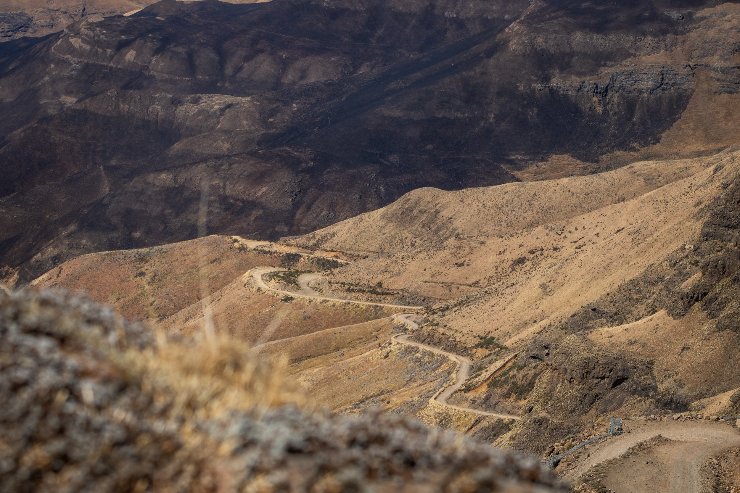
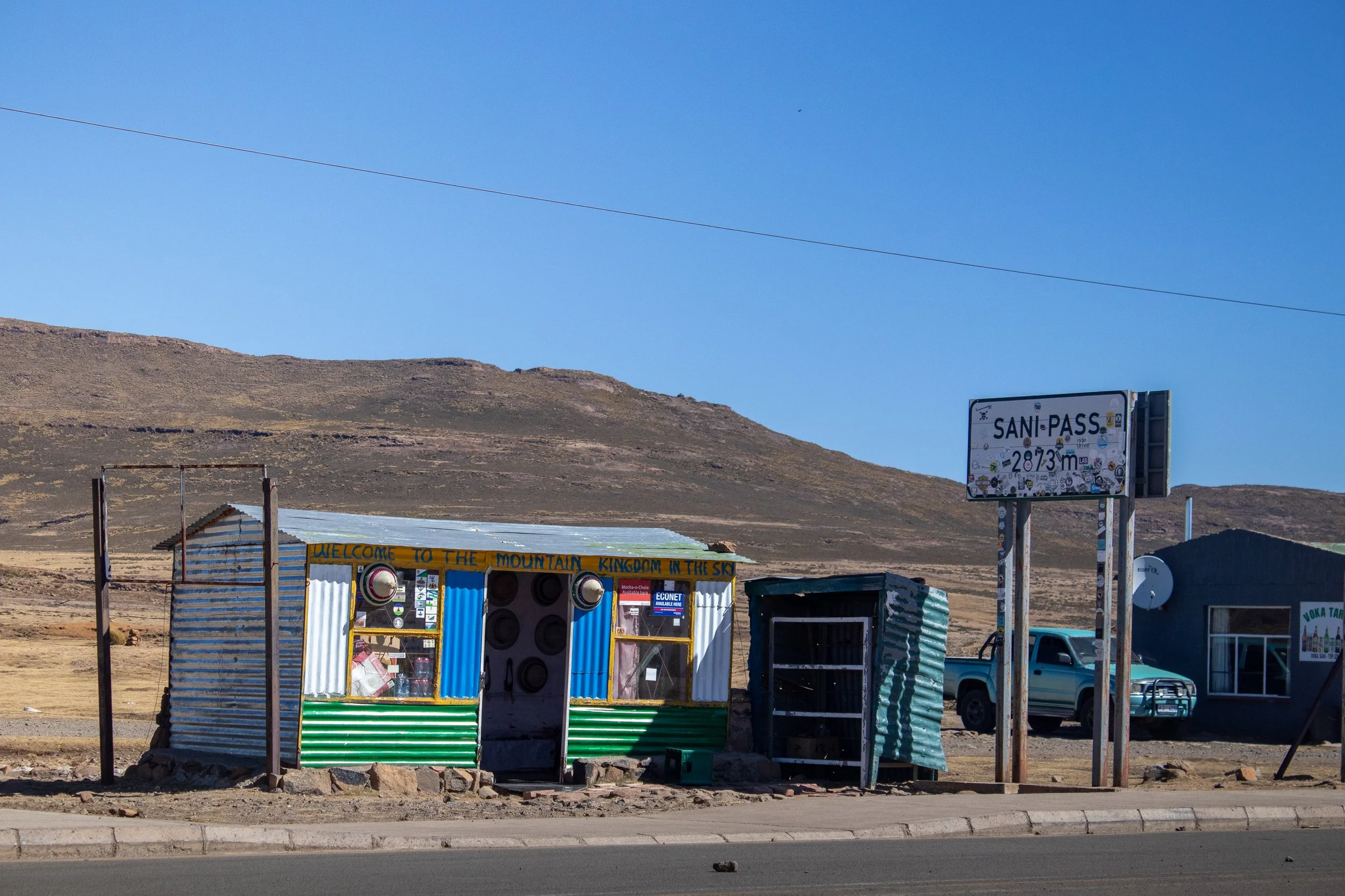
The infamous Sani Pass winds its way from Lesotho down into South Africa
What is the Sani Pass and why is it so special?
The Sani Pass is a high mountain road that links the borders of South Africa and Lesotho (the only border in Kwazulu-Natal), ascending over 1,000 meters in less than 10 kilometers.
Completed in 1950, the road starts at 1544m in elevation on the South African side and rises to 2876m on the Lesotho border, earning it’s name as the “Roof of Africa”. Previously utilized for pack animals, it is now one of the most challenging and dramatic 4x4 drives in Southern Africa and attracts off-road enthusiasts, photographers, and curious travelers alike (I'm the latter).
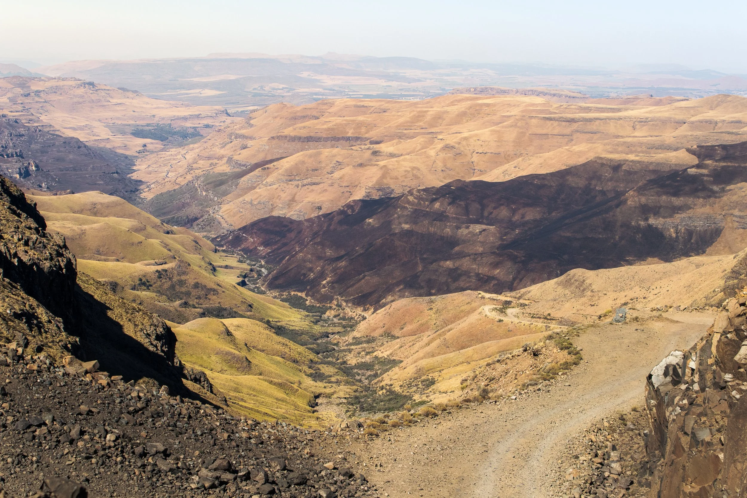
If you can brave the occasionally maintained loose gravel track, test your nerves on Devil's Corner and Suicide Bend, and survive being flanked by a steep drop-off for the entirety of the journey, you'll be treated to spectacular views of the surrounding Drakensberg Mountains, and a trip to the Highest Pub in Africa.
The beauty in this particular journey is in the remoteness. Nothing comes close to the feeling of standing on top of the pass, peering over the edge to see the winding road below. Meanwhile everything is eerily silent except for the wind whipping about, reminding you of just how forceful Mother Nature can be.
Ready to leap, or in this case slowly and arduously drive? Let's get into the details.
Looking for more South African adventures?
How difficult is it to drive the Sani Pass?
Make no mistake — driving the Sani Pass is not for the faint of heart.
With tight turns and oncoming traffic, it's important to have some prior driving experience not just for your safety but for everyone's. Remember, you won't be the only one on the road.
Despite re-graveling and flattening every month, the road is steep, rough, and unpredictable, with hairpin bends testing even experienced drivers. This, combined with the ever-changing weather, it’s best to have an alternative plan incase you’re forced to forego the drive that day.
It's not uncommon for drivers to embark on the Sani Pass before turning around and bailing out but, if you're committed to it, the drive requires 1.5-2 hours of constant concentration.
This is long enough to go slow, pull over for breaks, and pictures, or to give yourself a little pep talk, and still make it to the top safely.
Although I did a solo self-drive Sani Pass experience, it's safest to go with at least one other person to help you pick your lines of clearance. Some parts of the road can be a challenge and one wrong move can send you closer to the steep drop-offs.
The Sani Pass is made up of steep declines, narrow paths, and abrupt drop-offs
Sani Pass Requirements
First things, first, is a 4x4 required to drive the Sani Pass? Yes. It’s mandatory and is actively enforced at the South African border.
Even if you do have a 4x4, the border patrol agents have been known to turn away vehicles they deem not fit for the current conditions.
In addition, you'll need to meet the following requirements:
Passport.
No visa is required for Lesotho if visiting for 14 days or less.
Proof of Ownership of Vehicle.
It’s standard practice to provide registration documentation when entering and exiting any country.
Letter of Authority.
Rental cars must obtain a letter of authority from the agency that gives the driver permission to cross specific borders. This comes at an additional cost to the rental rate, usually around R650, about USD 35.
Spare Tire.
It's not necessarily a requirement that's checked, but it is safest to have one. The road is often littered with rocks and boulders, and if I have a choice between a flat tire and veering towards the ledge, I'm choosing the tire every time.
Finally, it's important to note that both the South African and Lesotho borders open their gates between 6 am and 6 pm. You must clear both by that time, otherwise, you'll be stuck.
This means that for a round-trip adventure, assuming a slow 2-hour journey, plan to start from South Africa no later than 12 pm and be checked in at Lesotho immigration by 2 pm.
Spend an hour or so snapping pictures and calming your nerves at the Sani Mountain Lodge, maybe purchase a quick souvenir from one of the small shops at the top of the pass, and exit Lesotho no later than 4 pm.
When to Drive the Sani Pass
Best time:
The best time to drive the Sani Pass is during the dry months. May to September offer clear skies and stable conditions.
Maybe it's not as photogenic (there will be less greenery on the pass), but it's still an unbelievable experience.
Avoid:
The worst time to attempt to drive is during the rainy summer months (November–March). Storms move through the mountains every afternoon, often striking at unpredictable times.
With such a steep gradient, you can imagine how prone the road is to landslides and flooding.
Winter note:
Winter on the Sani Pass is from June to August and is generally drier, making for an optimal experience. With that said, it's not uncommon for snow and ice to coat the road, making it slippery and un-passable.
It’s ideal to plan for winter months and when no recent storms have hit (easier said than done, I know).
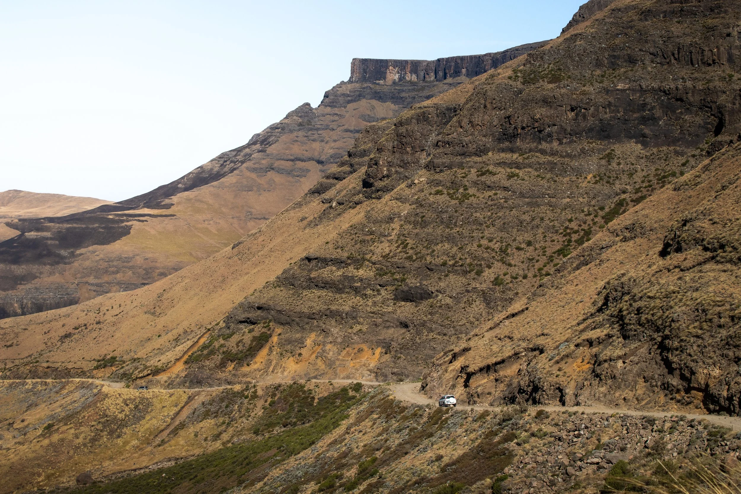
A car carefully drives the perilous Sani Pass
Best Sani Pass Tours (2025)
Still interested, but maybe you're questioning your ability (or sanity) at this point? Don't worry, there are plenty of daily tours leaving from Underberg on the South African side.
Most depart at 9 am and include lunch at the Sani Pass Lodge and a visit to a Basotho Village in Lesotho before descending the Sani Pass and back into South Africa.
Total time is typically between 6 and 7 hours.
Here are a few reliable options to check out (all departing from Underberg):
Private Sani Pass Classic Tour (Top Rated)
First-Hand Experience: What it’s like to drive the Sani Pass
Here's where I need to put a disclaimer, don't do what I did. But, before you pass judgment, let me explain.
As I mentioned earlier in this post, driving the Sani Pass was imprinted into my brain while planning my road trip around South Africa. I made sure to book a 4x4 in Johannesburg, thinking I would be driving up the pass, across Lesotho, and back into South Africa somewhere else.
Spoiler alert: that plan fell apart very quickly.
When I arrived at the rental desk, they told me no 4x4s were available and I would have to wait multiple hours if there was any chance of locating one, but it wasn't guaranteed.
Meanwhile, time is ticking away to check in at the Black Rhino Game Lodge and, at some point, the gates will close and I'll be out of luck.
Once the rental agency sent me to the garage to pick up a BMW, I immediately said no, trying not to laugh at them knowing what I had planned. Their second try yielded a Rav4 that was, at least, AWD and had a downhill lock for the breaks.
At that point a decision needed to be taken. Do I put my foot down and demand a 4x4, wait it out and hope for the best? Or do I stay on track and adjust elsewhere?
Ultimately, I decided to take the Rav4 and reverse my itinerary. Instead of ascending Sani Pass from the South African side, I would enter Lesotho and Caledonspoort and descend.
An overnight stay in Mokhotlong, Lesotho before attempting the Sani Pass
There were a couple of reasons for this. For starters, it's much easier to go down than up. I can see the track better, make safer decisions, and gravity is in my favor when trying to get over rough terrain. Secondly, I took a gamble that if Lesotho border patrol wouldn't check the vehicle's 4x4 capacity. By the time I got back down to South Africa what could they do? I felt I had a better chance of still driving the Sani Pass if I planned it like this.
Again, get a 4x4. The only reason this crazy plan worked, was because I lucked out with a beautiful day and dry conditions.
So, I crossed my fingers, drove across Lesotho, and reached the top of Sani Pass after staying the night in Mokhotlong.
From the warm comforts of the Sani Mountain Lodge, I watched the morning traffic slowly crawl to the top, carefully maneuvering over every rock and boulder, fighting the wind to stay stable.
Why was I doing this again? Is this really a good idea? But, at that point, the only other option was to drive straight back across Lesotho.
After striking a full-on athletic-dad stance to avoid the whipping wind at the overview to snap a few pictures and once the Highest Pub in Africa reached capacity with adrenaline-filled tourists, it was clear that my time was now or never.
I stumbled over to border patrol while fighting the wind and, before I could say anything, the agent looked at my passport, mumbled something under his breath, and handed back my booklet with an exit AND entry stamp, failing to see I had entered Lesotho elsewhere. Instead, he assumed I had just failed to get my passport stamped once at the top, probably a common theme as people are filled with the cathartic feeling of escaping death on Sani Pass.
Either way, my passport now has two entry stamps into Lesotho and only one exit, so I guess it's a good thing it's not an electronic system and no one has bothered to check!
As the car slowly rolled under the "Thank you for visiting Lesotho" sign, that was the moment I realized there was no turning back and I had to lock in.
The hairpin turns and steep decline came quick. The phrase 'slow and steady wins the race' has never been so true. So much so that I let tourist vans pass me on their way back down.
As you'll read later in this post, patience and humility are two keys to success when driving the Sani Pass. Let everyone else go at their pace! In hindsight, one of the best decisions I made was to arrive at Sani Mountain Lodge in the morning and wait for those ascending to finish.
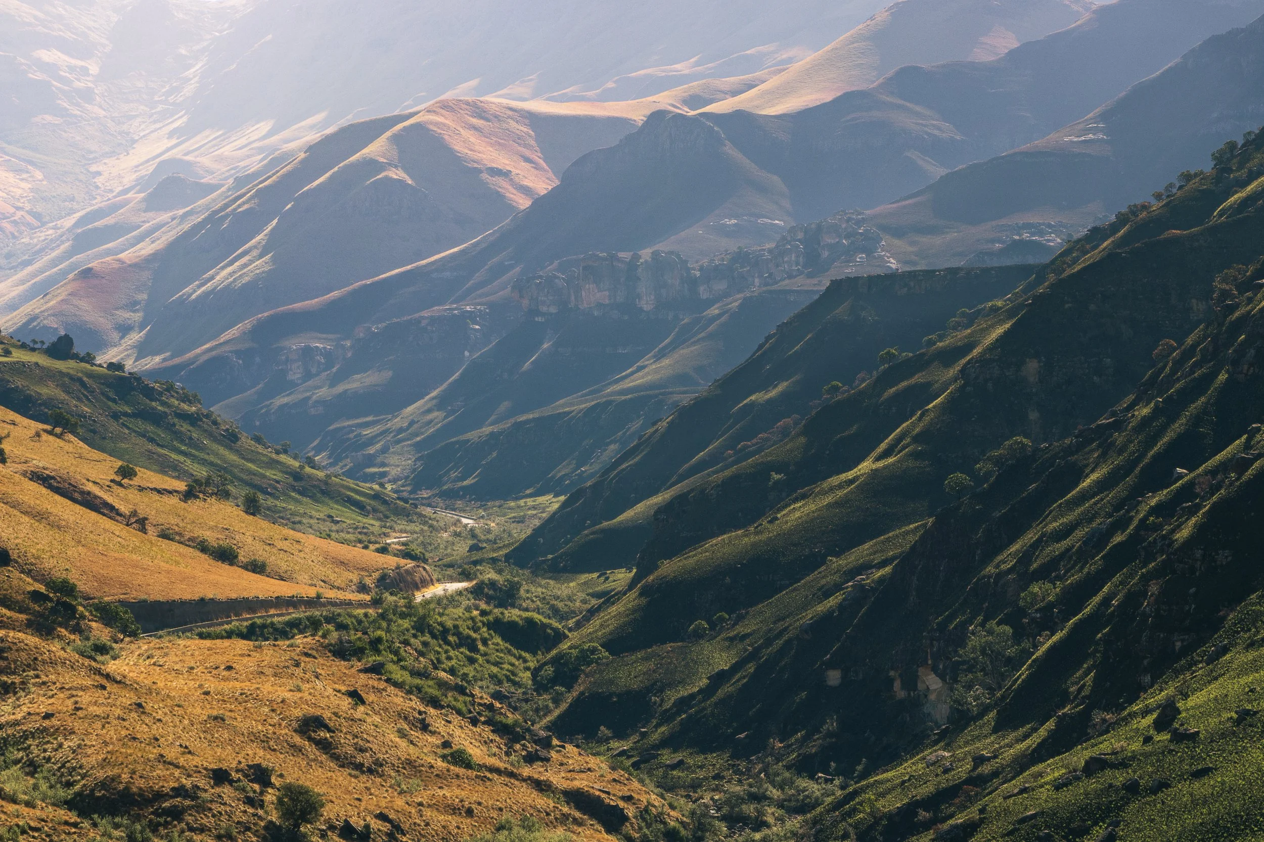
Looking back up towards the Sani Pass, from the South African Side
I can't imagine having to descend with traffic on the way up. Instead, I ran into maybe one car on their way to Lesotho. This allowed me to remain fully focused on white-knuckling the steering wheel and methodically trying to plot every minor adjustment to the tire angles while also not killing the undercarriage of the car because, as a reminder, a Rav4 is generally not equipped for this South African adventure.
After about an hour of riding the gas pedal, the slope leveled out and the anticipation of being on South African soil and paved roads again became real. It wasn't long before the little roadside "Welcome to South Africa" sign came into view and I was greeted by the smiling border patrol.
"How are you," they asked.
"Better now," I replied, laughing as I stomped on the pavement.
The gentleman checked some documents, looked in my passport, and glanced up at me before stamping and returning it. Surely he would be curious about why I have two entry stamps into Lesotho, right?
Instead, as he handed my passport back, he asked "This is a 4x4, right?"
Panic set in. I mumbled some deflection about how it "got the job done".
He smiled unconvincingly, and I drove off into the literal sunset, parking farther down the road to look back on what I had just accomplished.
Long story short, yes the Sani Pass is self-drivable, even for solo travelers like me, but there are some important factors to consider.
It's one hell of an adventure and one that I won't soon forget!
What to do at the top of the Sani Pass
The Drakensberg Mountains are an incredible playground in the wild, full of natural beauty and trails and the Sani Pass drops visitors at the perfect starting point. Whether you plan a round-trip excursion or want to see more of Lesotho, here's what you can do:
Grab a Drink at the Sani Mountain Lodge
Unless you're on a tour, be careful with what "drink" you choose. Remember, at 2,874 meters above sea level, alcohol will have an amplified effect and you do not want to be compromised on your descent down the Sani Pass.
Grab a cappuccino and a warm ham and cheese toastie and marvel out the window at your latest accomplishment as you watch cars struggle up the pass. This is also the optimal spot for some photos from the top of the pass as it looks out across the valley below and surrounding Drakensberg Mountains.
Explore Lesotho's Highlands
Consider continuing into Lesotho's remote interior for a few days before heading back down the Sani Pass to South Africa, or do what I did in reverse and exit Lesotho via Caledonspoort to see both Lesotho's stunning terrain and spend some time in Clarens, SA.
If you choose to traverse the Moutain Kingdom during the winter months, be sure to stop over at AfriSki and carve some turns on the African continent!
Overnight Stay
Wanting to stay overnight at the top of the pass? Here are some options:
Sani Mountain Escape ($-$$)- From 1 May 2025 to 31 August 2025, all accommodation at Sani Mountain Escape will be closed for renovation.
The Highest Pub in Africa remains open, but as such a high-demand destination, it now requires a R100 entrance fee and can often reach capacity at peak hours (get there early).
Sani Lodge and Cottages ($$-$$$) - Nestled at the base of the Sani Pass in South Africa, they have a range of accommodation available ranging from campsites to Rondavels (a traditional, circular hut).
The lodge also partners with Drakensburg Adventures, a Fair Trade Tourism company, making it easy to get in and out of Lesotho.
Sani Stone Lodge ($-$$) - For a more authentic Basotho experience, book a stay at Sani Stone Lodge. A bed in a mixed dorm costs R250, around USD 15, while a twin room with ensuite will run R1,100, or USD 60.
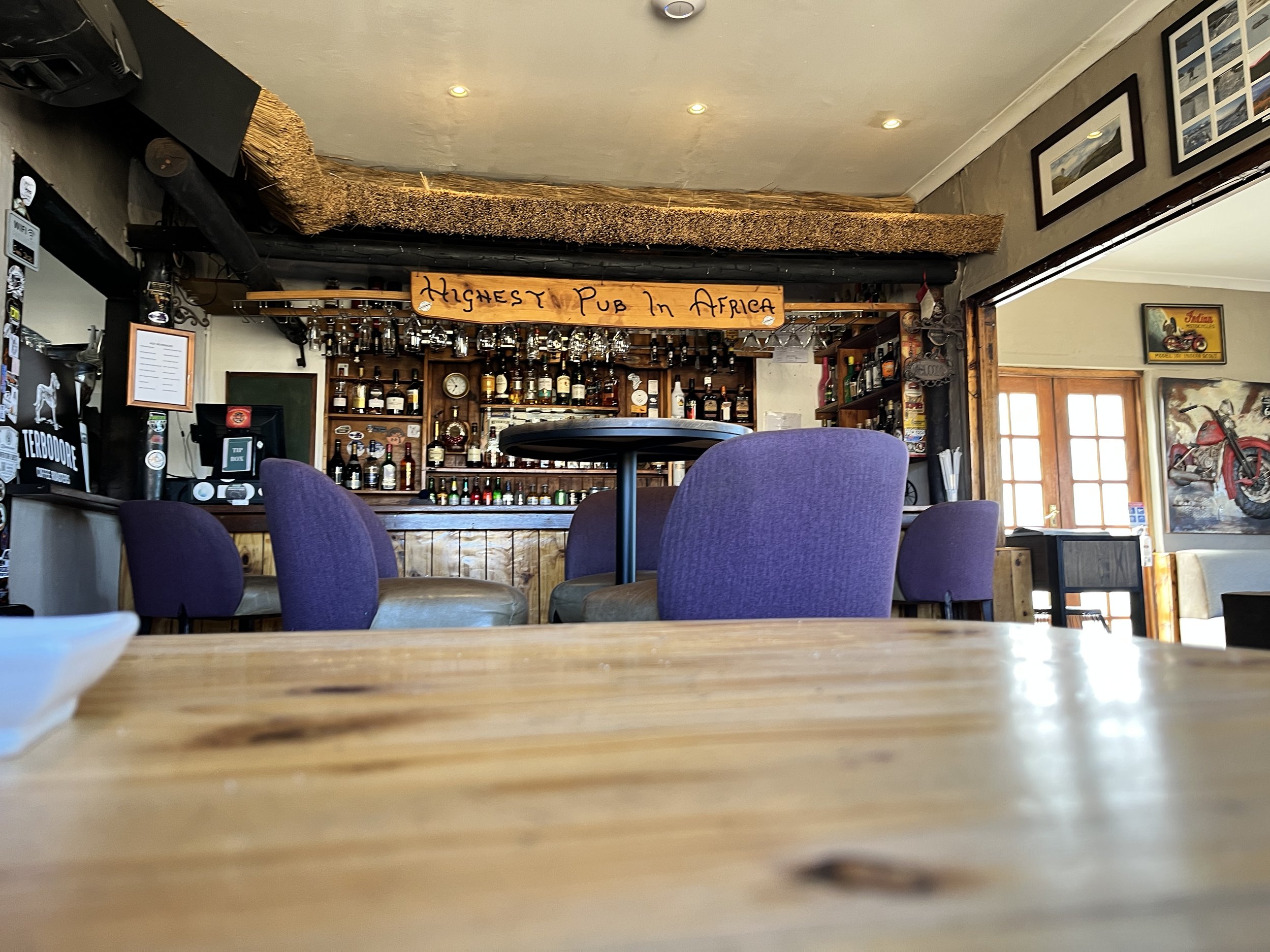
Take a break at the Highest Pub in Africa before heading down the Sani Pass
Top tips for self-driving the Sani Pass
Ready for your adventure?
This is truly one of the most beautiful drives in the world, but it's also one of the most challenging so it's important to come prepared. Here are some of my top tips for self-driving the Sani Pass:
Stick to the 4x4 Rule:
Don't attempt this in a regular vehicle. Seriously. Learn from the error of my ways.
What Goes Up, Must Come Down:
When I was unable to secure the 4x4 I had promised, I figured what goes up, must come down, right? In my experience, it was far easier to maneuver a Rav4 on the descent than the ascent, so I changed my route.
Consider which direction you want to drive and what makes most sense with your experience and expertise.
Less Congestion Equals Easier Maneuvering:
Morning drives offer better visibility and fewer vehicles, but it's also best to be aware of the tours.
I spent my morning sipping cappuccinos at the Highest Pub in Africa, watching the tour convoys haul their customers up and, when the restaurant became congested, that was my time to take off and descend the pass with far less ascending traffic.
How Low Can You Go:
Use low gear, especially on the descent. I cannot express this enough. You will be driving slower than you walk.
Thankfully, the Rav4 had downhill locks to keep sustained pressure on the breaks and limit the speed.
Pack Essentials:
This can mean different things for everyone, but in general consider water, snacks, warm clothing, a spare tire, and a sense of adventure.
Here are some of the things I brought along:
Hand warmer/power bank - Because you never know when you’ll need that little extra bit of warmth (or a flashlight, but hopefully just the heat).
Cotopaxi Fuego Down Vest - A great choice for layering. All the warmth, with more freedom! Add a windbreaker on top and you’re ready to brave the Sani Pass.
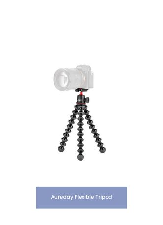
Mini Tripod - You won’t want to miss capturing the views, but at the same time it’s crucial to stay focused on the road. Set the tripod up in the car and rest assured you’ll collect some great images and videos.
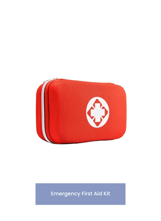
First Aid Kit - It sounds unnecessary until it’s not and I didn’t want to risk the car rental not providing one, so I brought along my mini first aid kit.
Pocket Knife - Again, you never know when it comes to the Sani Pass. Better to be prepared for the unexpected.


Small shops line the roads at the top of the Sani Pass
Don’t Forget…
Fill the Tank:
Petrol is not readily available on either side of the border, so plan to fill up in Underburg (if coming from South Africa) or Mokhotlong (if arriving from Lesotho).
Don't Feel Pressured:
Yes, self-driving the Sani Pass is one of the most difficult 4x4 road-trips in South Africa, if not the southern part of the continent. It is still a route used by local transportation and many locals drive the road for leisure.
Don't panic if someone is passing you or ascends in 45 minutes. That's fine. Be patient, stick to what you're comfortable with, and trust the process.
Time doesn't matter, but remaining in one piece to share your adventure does!
Carry Cash:
The Sani Mountain Escape is now cashless and, oddly enough, even one or two of the small souvenir shops at the top of the road take cards, but it's best to still carry some cash.
The shop I wanted something from the most, of course, didn't take card and I was left with the memory (not a bad consolation prize, though).
South Africa SIM:
Be sure to use your South Africa SIM card in case of emergency.
If you haven't yet, try the Airalo e-sims. I've quickly grown to love the ease of flipping between SIM cards without fumbling through my bag to find something to open the slot with.
In the event of an emergency, the South African Border number is +27 033 202 1169.
Stamp the passport:
South Africa has a car park to pull into and it's very clear where you need to go. Lesotho, at the top of the Sani Pass, is a bit more relaxed.
Don't forget to walk over to the immigration window on both entry and exit. If you're doing a one-way self-drive, like me, be sure to tell them to avoid a wrongful assumption that you forgot to stamp into the country.
However it does make for a fun story, how I have two passport stamps into Lesotho and only one stamp out!
Sharing is caring! Pin this post for later.


Can you feel the excitement building?
Then it's probably time to book that trip to South Africa and experience the infamous Sani Pass in person!
Grab a drink at the Highest Pub in Africa, marvel at the surrounding geography, swap stories with other adventurers, and have the (literal) ride of a lifetime.
The Sani Pass awaits.
Anything I've missed? Have you visited before? Let me know in the comments below and, as always, stay safe & happy travels!


Discover Ghana’s Hidden Gem: Amedzofe
Ghana is home to countless hidden gems, and one of its best-kept secrets is the town of Amedzofe. Nestled in the picturesque mountains of the Volta Region, this serene and welcoming town offers a perfect blend of natural beauty, history, and adventure. Whether you're a nature lover, a history buff, or simply seeking an off-the-beaten-path destination, Amedzofe has something special to offer...

Please note: All info below is accurate as of September 2024
Ghana is home to countless hidden gems, and one of its best-kept secrets is the town of Amedzofe. Nestled in the picturesque mountains of the Volta Region, this serene and welcoming town offers a perfect blend of natural beauty, history, and adventure. Whether you're a nature lover, a history buff, or simply seeking an off-the-beaten-path destination, Amedzofe has something special to offer.
Sounds like paradise, right? Here’s everything you need to know before a visit.

Canopy Walkway - Amedzofe, Ghana
History of Amedzofe
Amedzofe, the highest habitable settlement in Ghana, sits about 750 meters above sea level. Historically, it served as a strategic location for the Ewe people, providing a natural defense against attacks. During colonial times, German missionaries arrived and their influence is still visible today in the architecture, such as the iconic German-built Presbyterian Church. The area’s rich history is intertwined with its cultural heritage, making it a fascinating destination for those interested in learning about Ghana’s past.
Experience more of Ghana’s nature and check out these posts:
How to get to Amedzofe
Amedzofe is approximately 2.5 to 3 hours by road from Accra, the capital of Ghana. Depending on traffic, it’s safer to plan for 4-5 hours of travel!
The best route is via the Accra-Ho road, which offers a smooth drive until you reach the scenic, winding roads that ascend the Amedzofe hills. Public transport is available, but if you're looking for convenience, renting a car or booking a private ride might be the best option.
The final stretch of the journey will treat you to breathtaking views of lush valleys, mountains, and distant villages.
If driving yourself, be aware that once entering Amedzofe the roads deteriorate. Mount Gemi is accessible, but many people choose to park elsewhere and take motobikes to the start of the canopy walkway, especially in rainy season.
Top things to do in Amedzofe, Ghana
Mount Gemi:
One of the town’s main attractions is Mount Gemi, a prominent peak that offers panoramic views of the Volta Region. Atop the mountain stands a stone cross, erected by German missionaries in the early 20th century. A short hike to the summit (~20 minutes) will reward you with sweeping vistas of the surrounding landscape, including Lake Volta on a clear day.
At the top, you’ll find a cross that overlooks the village below. This is a sacred place to the community and it’s not uncommon to see people making pilgrimages to pray.
Cost: 55 GHS (USD 3.50) for foreigners
Note: Although Mt. Gemi is a hike, minimal fitness levels are required. Multiple routes of varying inclines exist, making this attraction suitable for everyone.
Amedzofe Canopy Walk:
Amedzofe is home to a beautiful, lesser-known waterfall that cascades gently into a natural pool. The short but steep hike to the waterfall is an adventure in itself, as you pass through verdant forests and enjoy the peaceful sounds of nature. Don’t forget your camera and swimsuit—this spot is perfect for capturing the tranquil beauty of Ghana’s natural wonders and bathing below the falls.
If it’s between Kakum Canopy and Amedzofe, choose here. It’s far less trafficked and, as a result, the serenity of the surroundings are preserved.
Cost: 75 GHS (USD 4.75) for foreigners. Discounts applied for students.
Hours: The entrance building opens at 8am, 7 days a week. Get there early to have the entire place to yourself.
Note: There is a required level of fitness for this as the path to the canopy walk leads to a steep descent of 259 steps.
Explore Local Culture:
Amedzofe is a culturally rich town, and visitors have the opportunity to interact with the friendly locals, learn about Ewe traditions, and explore the historical sites dotted around the town. The Presbyterian Church and old missionary quarters are great places to start, giving you a glimpse into the town's colonial past.
Birdwatching and Nature Walks:
The area around Amedzofe is a haven for birdwatchers and nature lovers. The lush environment is home to a variety of bird species, including the colorful and rare African grey parrot. Guided nature walks can be arranged for visitors interested in learning more about the local flora and fauna through the local tourism board.

Canopy Walkway and Oti Falls, Amedzofe
Accommodation: Where to stay in Amedzofe
Accommodation is limited but affordable, with local guesthouses offering rooms for as little as GHS 100 (USD 8) per night.
Basic meals at local eateries will cost around GHS 15 to GHS 30 ($1 to USD 3), with more upscale options available in nearby towns like Ho.
Additionally, there are camping options, including equipment rentals, at Mt. Gemi.
Nearby Attractions
Less than an hour from Amedzofe lies the village of Liati Wote. This quiet spot near the border with Togo is another tranquil gateway into nature. Here you can climb Ghana’s tallest free-standing mountain (Mount Afadjato), hike to and swim at Tagbo Falls, or enjoy an afternoon eating some of the best food in the country at the Tagbo Falls Eco-Lodge as you relax in the courtyard. Another 45 minutes north leads to Wli, the home of West Africa’s tallest waterfall.
Other attractions:
Tafi Atome Monkey Village

Amedzofe, Ghana from above
Whether you’re hiking to the top of Mount Gemi, marveling at the cascading waterfall, or immersing yourself in local culture, Amedzofe is sure to leave a lasting impression. For those yearning for adventure and serenity, this charming town in the Volta Region promises to be a rewarding journey.
Pack your bags, hit the road, and leave the bustling streets of Accra, and the tourist trail, behind—Amedzofe awaits!
Sharing is caring! Pin this post for later.


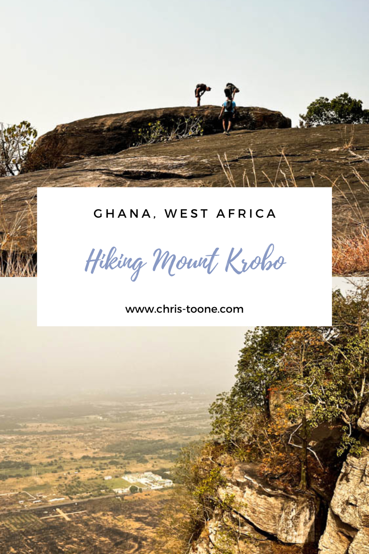
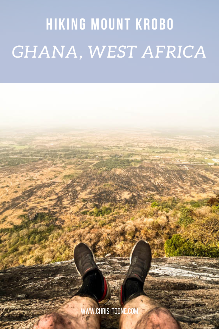
Hiking Mount Krobo, Ghana: Everything You Need to Know
Within a week of regularly driving the Tema-Akosombo road, it was clear that one mountain towered above the rest: cue Mount Krobo. After weeks of trying to arrange a hike the plans finally panned out. Here’s everything you need to know for a great half-day adventure…
Please note: all info below is accurate as of January 2023
Having been to Ghana on and off for the past decade, my trips were isolated to the same stretch of road between Accra, Kumasi, and Berekum leaving the Eastern Region of the country an untouched landscape full of adventure.
Within a week of regularly driving the Tema-Akosombo road, it was clear that one mountain towered above the rest: cue Mount Krobo. After weeks of trying to arrange a hike the plans finally panned out.
Here’s everything you need to know for a great half-day adventure!
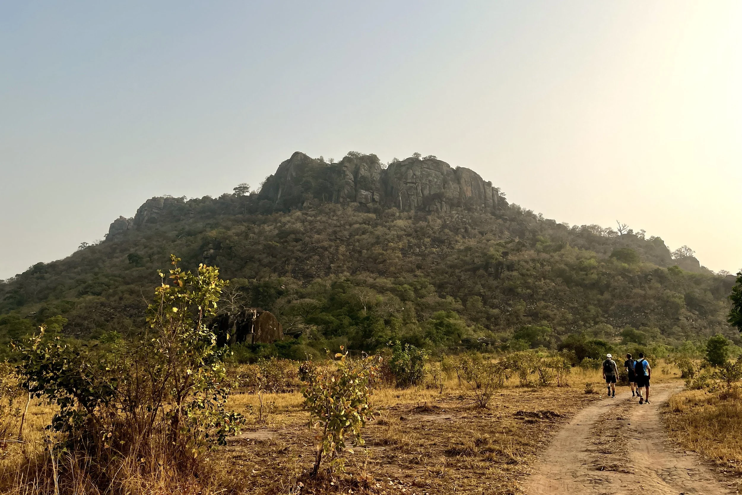
Hiking the base of Mount Krobo, Ghana
A brief history of Mount Krobo
Dating back to the 16th century, the Dangme people of East Africa up and left their settlements, deciding to migrate towards present day Ghana. Once they reached West Africa, the group made friends with other ethnicities as they passed through, including the Ewe people.
As the trek progressed, a split from the Ewe became necessary and it was at this point in their journey that the Krobo refer to as Lorlorvor, meaning “love has ended.”
The Krobo people crossed the Volta River in continued search of a new settlement when they found themselves surrounded by the Akan and Guan ethnic groups. Fear of these perceived threats forced them to climb an isolated mountain on the plains near the river, known today as Mount Krobo.
Having experienced first-hand the difficult climb as a natural safety measure they began to establish their new settlement, quickly erecting multi-story homes and irrigation systems.
As the Krobo population continued to expand, the colonial government found it increasingly difficult to monitor and control the settlement. As a result in 1892, the British rulers gave the community 3 days to leave the mountain. The people fled with as much as they could carry and what was left behind was destroyed.
To this day, the Krobos continue to organize a pilgrimage to pay homage to their ancestors.
Experience more of Ghana’s hiking scene. Don’t miss these posts:
How to get to Mount Krobo in Ghana’s Eastern Region
Not the most conveniently located attraction in Ghana, the easiest way to access Mount Krobo is by taking a tro-tro or taxi to Akuse Junction. From here, the unmarked trailhead is 3.1km south on the left side of the road, just past Kings and Queens Teaching Hospital.
Although possible to walk from the intersection, it’s not advisable given the volume of speeding traffic along the Tema-Akosombo Road.
If all else fails, the trailhead is pinned below, and the path can be seen from Google satellite images.
When to go
For sweeping views across the plains, it’s best to avoid the Harmattan season which runs from November to March as the horizon is often laden with dust that obscures the landscape.
Helpful Information
Some reports indicate a 7.50 GHC entrance fee to a local farmer, but we did not encounter anyone. It’s also vital to bring plenty of water and sunscreen as the mountain is exposed most of the ascent.
Other things to consider:
A reliable and comfy day pack
Pack snacks or buy fruit from the stands at Akuse Junction
Wear shoes with plenty of tread
Wear long, lightweight pants
Bring bug spray
Plan for 4 hours, round trip
Walking poles
Start early in the morning to avoid the hottest part of the day


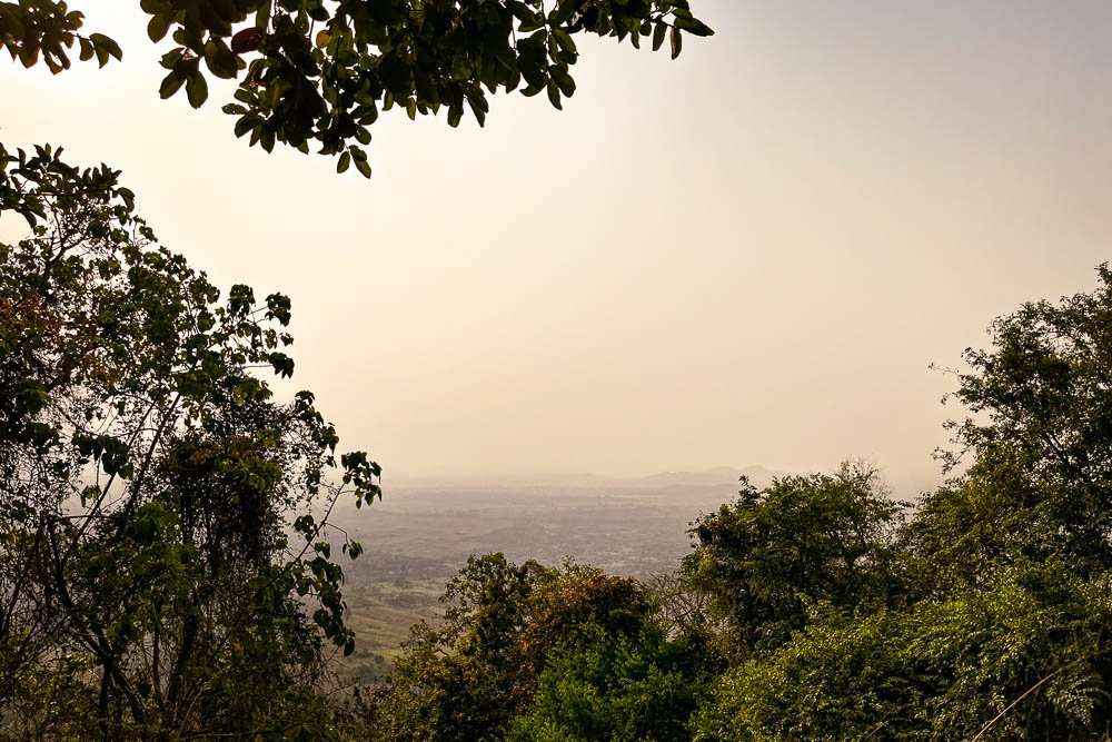
A glimpse of the landscape from the top of Mount Krobo, Ghana
What to expect while hiking Ghana’s Mount Krobo
Once turning off the Tema-Akosombo Road, the hike starts flat as the dirt path winds through the brush and approaches the eastern face of the mountain. The tree-lined trail concludes at a clearing with a shelter, washrooms, and a beautiful baobab tree.
From here, the trek begins to quickly ascend through the trees. Remember to pace yourself and stay hydrated – it’s not a race to the top. Take advantage of the many lookouts along the way for some well-deserved rest.
On this particular day, the brush had just been burned along the trail, so the breaks were a welcomed reprieve from breathing in the Harmattan dust and ashy air.
Eventually, the path opens up to ruins from the Krobo civilization that once dwelled on the mountain. We wandered around the old foundations of houses while uncovering clay pots that had slowly been reclaimed by the Earth.

Ruins of the Krobo settlement
At this point, it is not much farther to the first vista that looks west over the plains. Once you have had a chance to take in the sweeping landscape, continue walking north along the top of the mountain to reach the trail's end, marked by a metal cross.
Relax, refuel, and enjoy the views.
The easiest and safest thing to do is treat Mount Krobo as an out-and-back trail. There is no loop however a local Ghanaian we met at the peak insisted we try the “shortcut” down. This included descending a solid rock wall into a ravine and galloping down the western face of the mountain that we had previously labeled “too steep to climb” as we reached the trailhead from the main road that morning.
Truth be told we would never have found this path without a guide, so best to descend back through the Krobo ruins.
Important notes for visiting Mount Krobo
Here’s what I wish we would’ve done differently:
Pin the location of the trailhead and have the taxi stop at the mark. We got out too early at Akuse Junction and had to walk the 3.1km down the Tema-Akosombo road
Bring hiking shoes. I used runners and immediately regretted my decision as we started the steep descent through the ashy brush
Wear long pants. The trail is clearly defined, but that doesn’t mean brush doesn’t get in the way. I left the mountain with scrapes and cuts up and down my legs. Nothing serious, but next time I’ll pack pants
Get the taxi driver’s phone number to call on the descent and meet at the end of the trailhead to avoid walking back to Akuse Junction for a ride

Views from the top of Mount Krobo, Ghana
All in all, it made for a great morning adventure. Be sure to do a little digging on the Krobo people before the hike. Knowing the history of the mountain made the experience meaningful beyond the beautiful fauna and striking landscape.
Have you hiked Mount Krobo before or know of other adventures you want me to experience in Ghana? Leave a comment below and let’s keep exploring!
As always, thanks for reading & happy travels.
Sharing is caring! Pin this post for later.

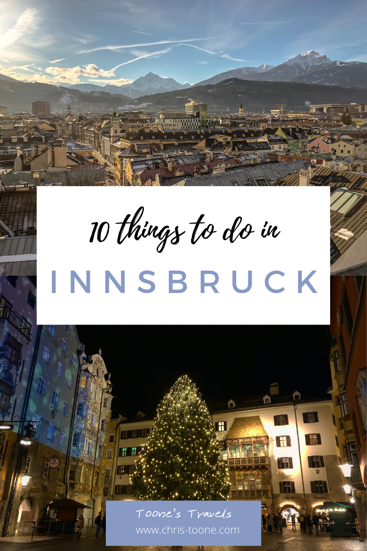
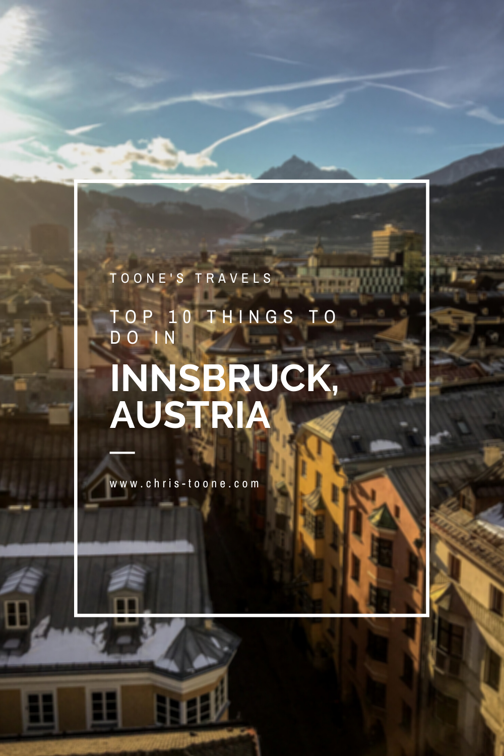
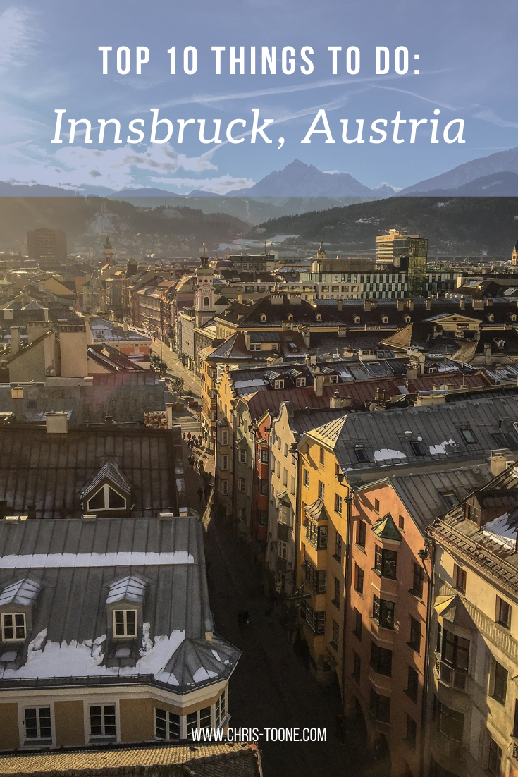
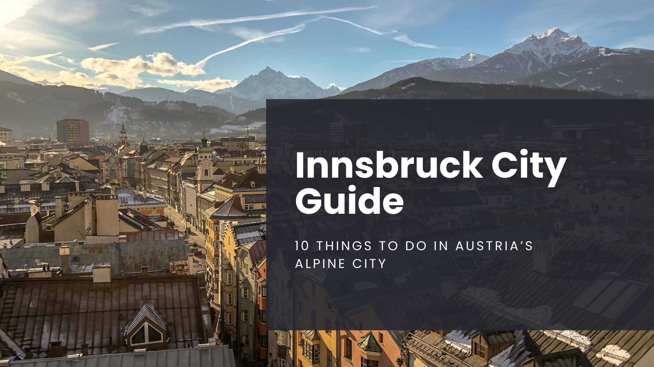
Innsbruck City Guide: 10 things to do in Austria's alpine city
From the local flavors of speck and strudel to the stunning mountainous views that surround the city, Innsbruck has something for everyone. It continues to sit at the top of the list of my favorite European cities and I can guarantee you’ll have a great time!
Please note: All information listed below is up to date as of May 2023
Tucked away within the shadows of the surrounding Alps lies Innsbruck, Austria.
A mountainous paradise that’s known for its rich Tirolean history and the epicenter of winter sports, having hosted the Olympics in both 1964 and 1976.
To this day, it remains one of my favorite European cities of all time and by the end of this post, you should have a pretty good idea as to why!
Let’s explore 10 of the top things to do when in Innsbruck, Austria.
1. SAVOR A STRUDEL AT CAFE KROLL
Nestled within Innsbruck’s old town, Cafe Kroll serves up some of the city’s best homemade strudel as voted by tourists and locals alike.
You can be sure to find a steady stream of customers from the moment the doors open in the morning straight until closing. It’s easy to be overwhelmed by the sheer volume of variety offered, but I would personally recommend giving the apricot and hazelnut strudel a try if in the mood for something sweet or the spinach and feta for savory.
Pro Tip: Cafe Kroll offers several gluten-free items, so there’s no excuse to stay away!
Hours: 6am - 9pm daily
Address: Hofgasse 6, 6020 Innsbruck, Austria
Website: www.strudel-cafe.at
2. EXPERIENCE THE JEWEL OF THE ALPS
Widely known as the “jewel of the Alps", the Nordkette mountain range sits just north of Innsbruck and rises to 8,651 feet at its highest point (Kleiner Solstein Peak) and is part of Austria’s largest Nature Park, the Karwendel.
Find your way to Innsbruck’s Hungerburgbahn Station and hop in the Hungerburg Funicular before catching a tram up to Seegrube (6,250ft.) and Hafelekar (7,401ft.) to enjoy the panoramic views of the city and surrounding mountains.
In the winter months, the area becomes a popular ski destination, the Hafekeler run being one of the steepest in all of Europe, and in the summer months, visitors can enjoy expansive hiking, climbing, and mountain biking.
It made for a great Christmas Day adventure during our most recent trip!
Pro tip: The Hungerburg Funicular will also take visitors to the Alpine Zoo, the highest in all of Europe. A combination ticket for the funicular and zoo entry will cost 19 euros per person.
Helpful Hints: The funicular from Hungerburgbahn Station is operational from 7:15am - 7:15pm M-F, 8am - 7:15pm Saturday and Sunday and runs every 15 minutes. The Seegrube cable car is open daily from 8:30am - 7:30pm while the Hafelekar tram operates from 9am - 5pm daily. Both run every 15 minutes.
Address: Hungerburgbahn Station, Rennweg 3, 6020 Innsbruck, Austria
Cost: Varies based one how many trams you choose to take, but expect to pay around 36.50 euros per person to get from the Hungerburgbahn Station to the top of the Hafelekar cable car (ski pass not included).
Website: More information on the entire area can be found by clicking here.

View from the top of the Hafeleker cable car
3. LOSE YOURSELF IN THE LAND OF SWAROVSKI CRYSTALS
Opening in 1995, the Swarovski Kristallwelten (crystal worlds) welcomes tourists to wander around 17 different underground “chambers of wonder,” each filled with stunning crystal art created by international artists.
When strolling through the gardens, be sure to not miss the Crystal Cloud, a piece comprised of 800,000 hand-mounted Swarovski crystals. Another fan favorite is the Crystal Dome, a room that contains 595 mirrors all working together to create stunning lighting and reflections.
At the very least, exploring the halls is a humble reminder to keep saving your money!
Pro Tip: Although the Kristallwelten is located outside of Innsbruck, a shuttle runs back and forth 5-6 times a day from various locations and costs 10 euros for a round trip ticket. More info can be found here.
Address: Kristallweltenstrasse, Wattens, Austria
Hours: 8:30am - 7:00pm, daily
Cost: 19 euros or free with an Innsbruck Card.
Website: www.kristallwelten.swarovski.com
4. STEP INTO THE RENNAISSANCE AT AMBRAS CASTLE
Once home to Archduke Ferdinand II, Ambras Castle is located in the southern part of Innsbruck and can easily be reached by tram and bus.
Ferdinand II was the prince known for elevating arts and sciences to new levels during his lifetime and the castle’s residential rooms have been transformed into the Habsburg portrait gallery (open to visitors between April and October).
Tickets cost just 12 euros and can be purchased ahead of time by visiting the castle’s website.
Address: Schlossstrassse 20, 6020 Innsbruck, Austria
Hours: Daily from 10:00am - 5:00pm, closed during the month of November
Website: Click here for more information or to purchase tickets.
5. CLIMB TO THE TOP OF INNSBRUCK CITY TOWER
I’ve visited Innsbruck more times than I can count, often passing through for a day or two, but I always make sure to leave time to climb the 148 stairs to the top of the Innsbruck City Tower.
It’s easily my favorite 360-degree view of the city, standing amongst the rooftops and watching life pulsate through the city streets below.
When the tower was still operational, it was manned by watchmen who were tasked with announcing the time every hour and warning the townspeople of incoming danger. The building also housed a prison during the Middle Ages on the ground floor.
Costing only 4 euros per person, this is one of the best “bang for your buck” things to do in Innsbruck and it doesn’t take much time at all! Important note: There is NO elevator available, so it may not be suitable for everyone.
Address: Herzog-Friedrich-Strasse 21, Innsbruck, Austria
Hours: Daily from 10:00am - 5:00pm (winter) and 10:00am - 8:00pm (summer)
Website: Click here for more information

View from the top of the Innsbruck City Tower
6. DEVOUR A PLATE OF SPECK AT TIROLER SPECKERIA
Since 1909 Tiroler Speckeria has been serving up some of the best Tyrolean bacon, commonly known as speck, found in all of Innsbruck.
Do yourself a favor and order the specialty board (15 euros per person). It’s a great way to experience the diversity of Tyrolean flavors and I assure you it will be worth every cent.
If you’re short on time, the owners also offer up sandwiches to take on the go, but I’d recommend taking the time to sit down for a short meal. It’s hard to beat the ambiance and delicious food.
Address: Hofgasse 3, 6020 Innsbruck, Austria
Hours: Daily from 9:00am - 6:00pm
Website: www.speckeria.at
7. CATCH A LOCAL SPORTING EVENT
There are two main sporting events to check out: Football Club Wacker Innsbruck and Hockey Club Tiroler Wasserkraft Innsbruck.
Formed in 2002, FC Wacker plays their home matches at Tivoli Stadium in downtown Innsbruck and currently competes in the Austrian Football Second League. The 16,000-seat stadium played host to the likes of Spain, Russia, Sweden, and Greece during the 2008 European Championships.
HC Tiroler Wasserkraft plays across the street from Tivoli Stadium at the Olympia World Innsbruck Complex. Along with soccer and alpine skiing, ice hockey is one of the most popular sports in all of Austria, so rest assured you’ll be in for quite the local experience without the normal influx of tourists.
Be sure to check the competition schedules during your trip!
Address: Stadionstrasse 1, 6020 Innsbruck, Austria
FC Wacker Innsbruck Website: https://fc-wacker-innsbruck.at/
HC Tiroler Wassercraft Innsbruck Website: https://www.hcinnsbruck.at/de-DE
8. REACH NEW HEIGHTS FROM THE TOP OF THE BERGISEL SKI JUMP
If you couldn’t tell already, I’m all about gaining new perspectives wherever I go in the world and the top of the Bergisel Ski Jump certainly offers a unique one!
Used in both the 1964 and 1976 Winter Olympics, the tower rises 47 meters towards the sky and features a restaurant at the top that rewards visitors with stunning 360-degree views of the surrounding mountains and city below.
The 28,000-seat stadium continues to hold the famed Four Hills Tournament each year, a staple of the winter sports world, so if you’re visiting in January then make sure to check a calendar ahead of time!
Address: Bergiselweg 3, 6020 Innsbruck, Austria
Hours: June to October from 9:00am - 6:00pm, November to May from 9:00am - 5:00pm
Entry Fee: 11 euros
Website: https://www.bergisel.info/at/
9. STROLL THROUGH INNSBRUCK’S OLD TOWN (ALTSTADT VON INNSBRUCK)
Take an afternoon to wander through Innsbruck’s 800-year-old city center and experience the charm and sophistication that exudes the mix of baroque and gothic architecture.
Walk along the Inn River to see the pastel-colored homes across the way, visit the Golden Roof and learn about the royal box where Emperor Maximillian I once watched over the city, or shop along the famed Maria-Theresien-Strasse.
Here is where you’ll stumble upon the Triumphal Arch which was commissioned in 1765 by Empress Maria Theresa to commemorate the marriage of her son to the Spanish Princess Maria Ludovica. Unfortunately, Maria Theresa’s husband passed away during the festivities, so the arch depicts a wedding on the southern facade and the mourning of her late husband on the northern. An interesting tale to say the least.

Golden Roof as seen from above
10. GO BACK IN TIME AT INNSBRUCK’S IMPERIAL PALACE
Constructed in the 1400s, the Imperial Palace is now split into several different museums including a furniture display, an ancestral gallery, and a painting gallery.
Next to the Vienna Hofburg and Schönbrunn, the Innsbruck Imperial Palace is amongst the three most significant cultural buildings in all of Austria!
Entry is free for children and only 9.90 euros for adults, making it a great value and the perfect rainy day activity.
If you’ve ever wondered what the inside of a palace looks like, this is the place to go!
Address: Kaiserliche Hofburg, Rennweg 1, 6020 Innsbruck, Austria
Hours: Daily from 9:00am - 5:00pm
Website: hofburg-innsbruck.at
So, there you have it: 10 of the top things to do when visiting Innsbruck, Austria! In a city that’s filled with so much history, culture, and beautiful mountains, it’s hard to go wrong with whatever you end up deciding to do. I hope you enjoy your trip!
Have you been to Innsbruck before? Did I leave something out? Let me know about your experiences in the comments below and, in the meantime, stay safe & happy travels!
Looking for a tour? Check out these great options!
Was this post helpful? Pin it for later!