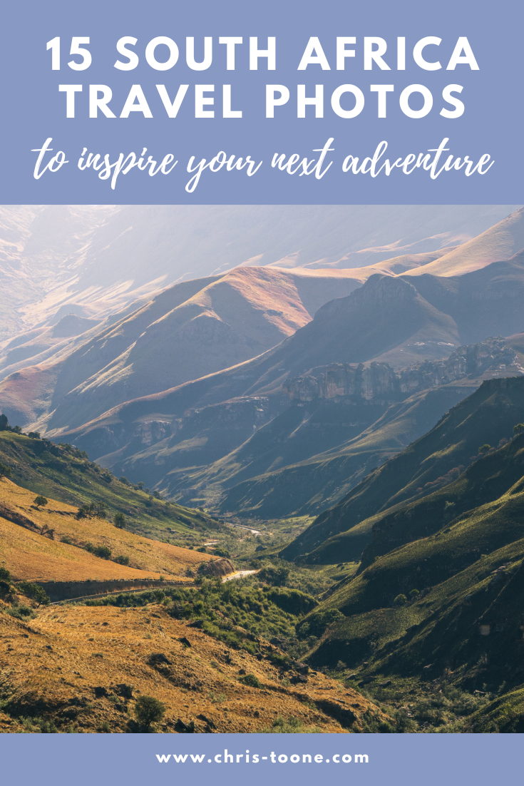
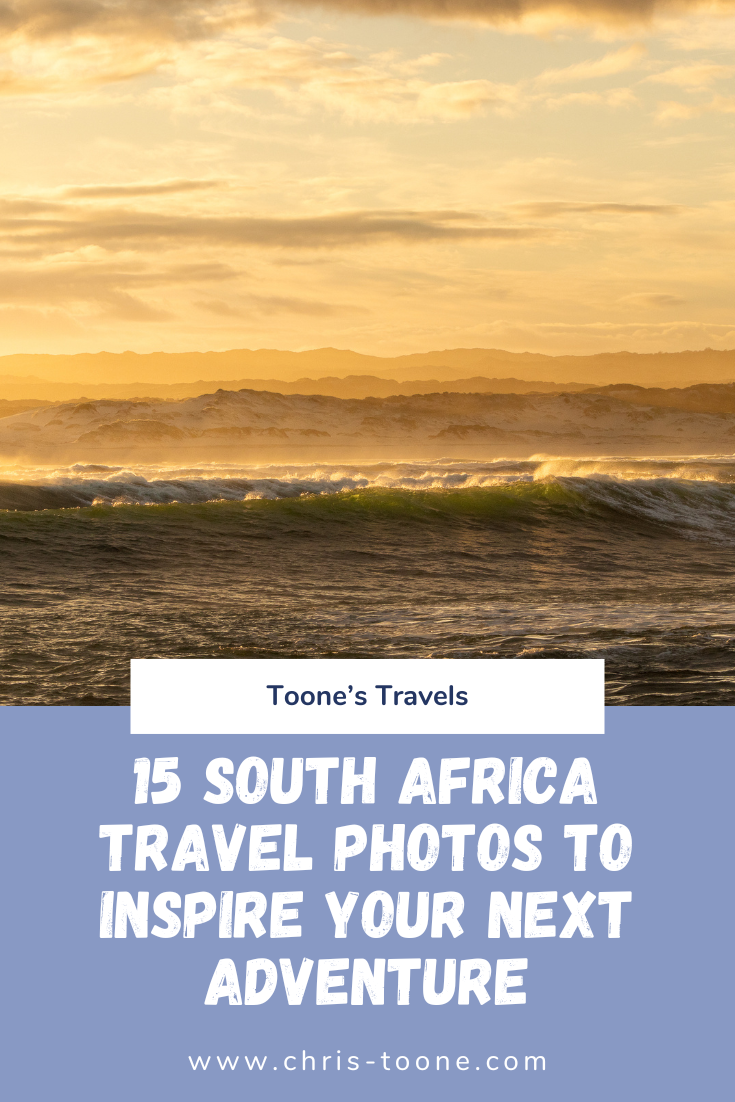
15 Stunning South Africa Travel Photos To Inspire Your Next Trip
The first time I visited South Africa was in 2010 on Semester at Sea. It was a crisp spring morning on the bow of the ship as the sun breached the horizon, lighting up the mighty Table Mountain—and in that moment, I was hooked…

The first time I visited South Africa was in 2010 on Semester at Sea. It was a crisp spring morning on the bow of the ship as the sun breached the horizon, lighting up the mighty Table Mountain—and in that moment, I was hooked.
Fast forward fifteen years. With a month off work and already situated on the African continent, there was only one place calling me back: South Africa.
It’s no secret that South Africa exists in a constant state of tension between its apartheid past and present-day realities. Townships still dot the outskirts of major cities, and crime rates continue to top the continent. But despite this complex backdrop, South Africa has a way of pulling you in—and refusing to let go.
From world-changing history, both evolutionary and geopolitical, and iconic wildlife to unforgettable safaris, dramatic coastlines, and vast landscapes, South Africa is one of the most visually striking countries in the world to photograph.
So, off I went—camera in hand.
Maybe these 15 stunning South Africa travel photos will inspire your next trip (fingers crossed).
Ready for more South Africa content? Don’t miss these posts:
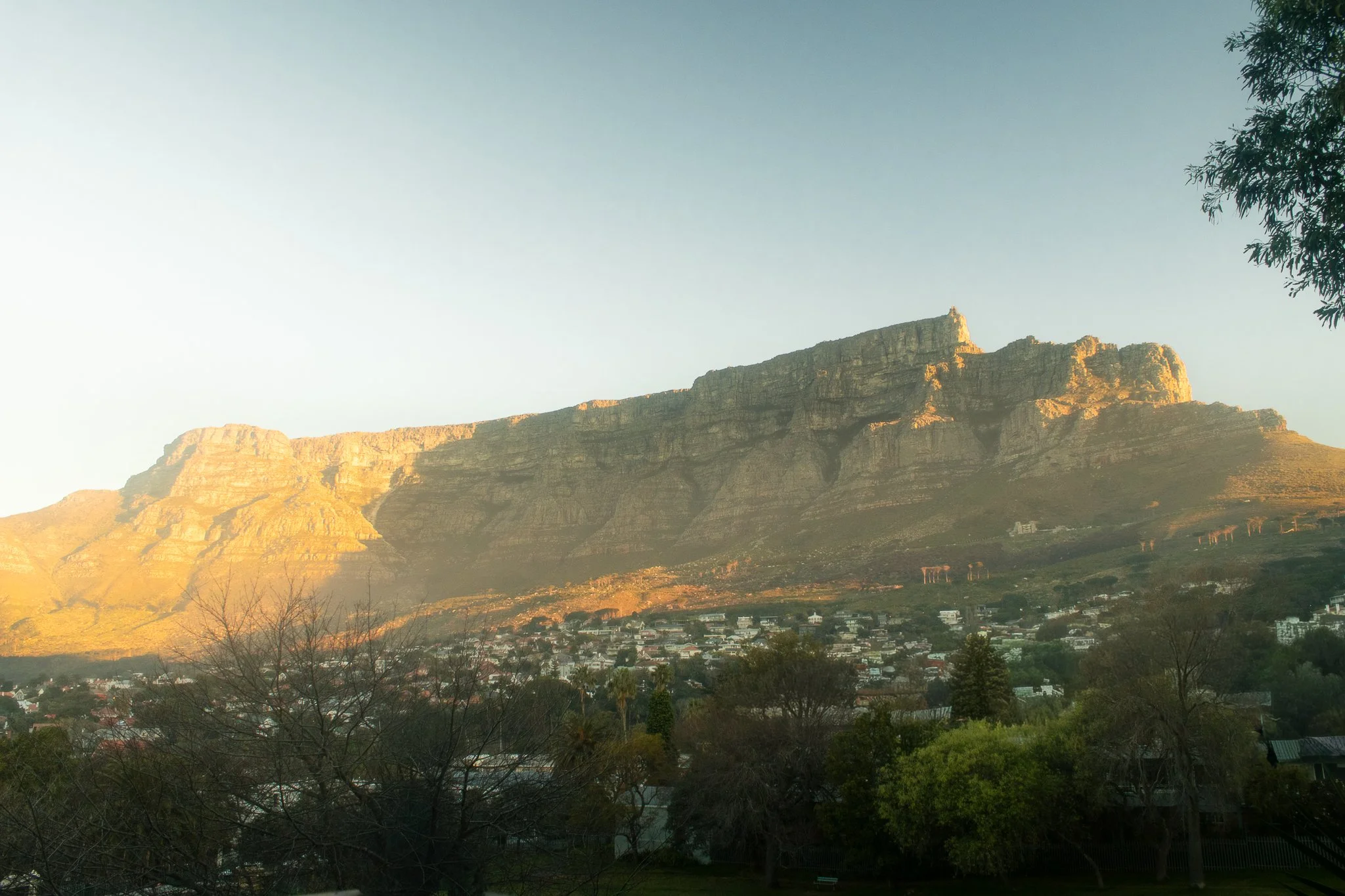
1. Good morning, Cape Town
Location: Cape Town, South Africa - Table Mountain
Is there any secret as to why Cape Town is consistently ranked as one of the most beautiful cities in the world for South Africa travel photography? All it takes is a window seat on approach into the airport to understand why. The magestic Table Mountain makes for one of the most unique city backdrops in the world, and is also a reason why it’s so hard to take a bad travel photo here.
This particular photograph was taken from the balcony of my apartment and it quickly became a daily ritual to watch the light move across Table Mountain on several crisp winter mornings.
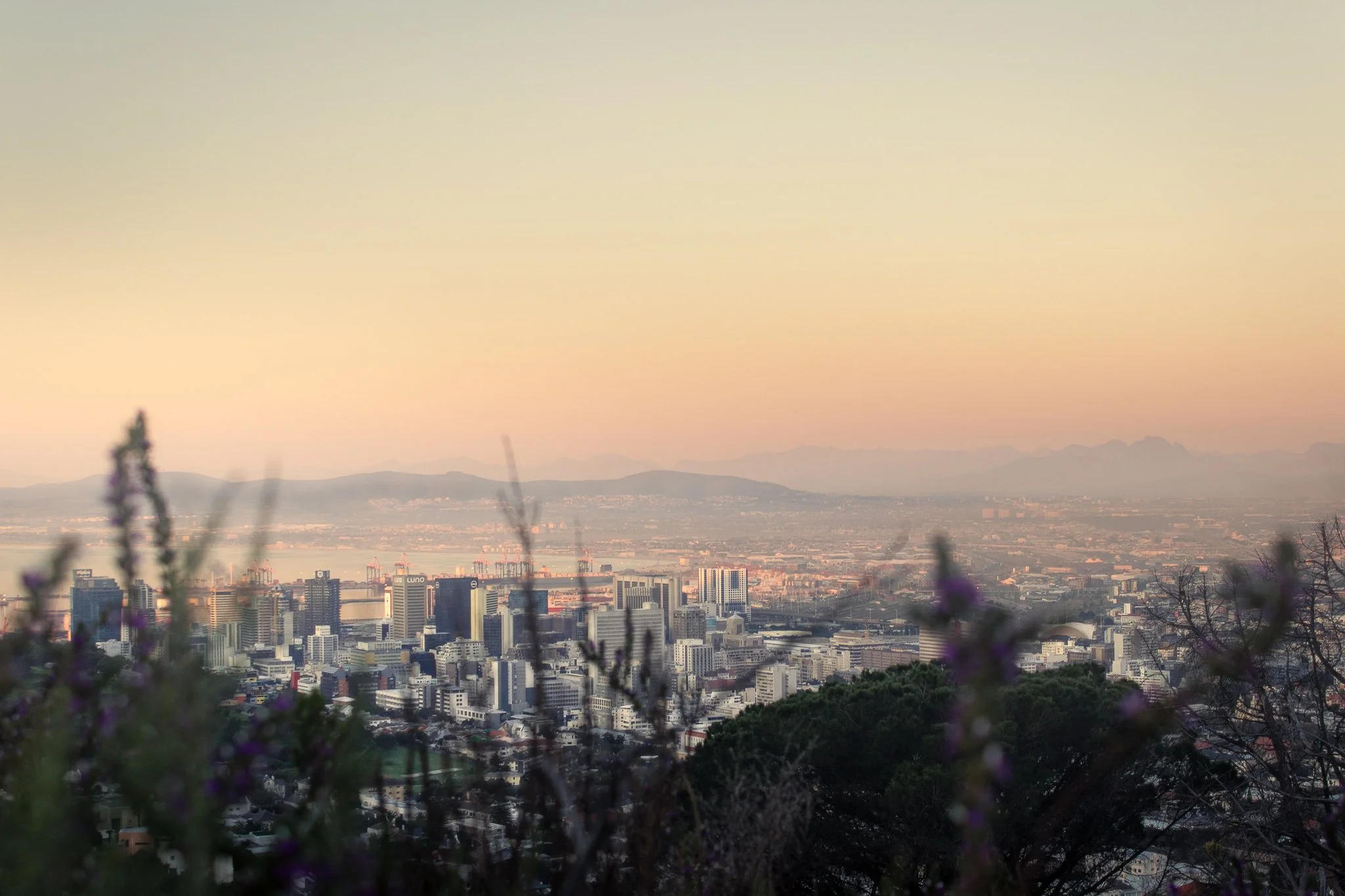
2. Cape Town in Pastel: View from the Gardens
Location: The Gardens Neighborhood, Cape Town, South Africa
Not long after arriving in Cape Town, I fell ill and quickly realized I had brought a case of malaria with me from Ghana (don’t worry—South Africa is malaria-free). Each afternoon, the fever would break just long enough for me to get outside and explore.
The walking paths behind the Gardens neighborhood quickly became my go-to, and it’s easy to see why. Soft pastel buildings, quiet streets, and views toward Table Mountain make this one of my favorite spots in the city—and one of my favorite South Africa travel photos to date. For me, it perfectly captures the calm, colorful essence of Cape Town travel photography.
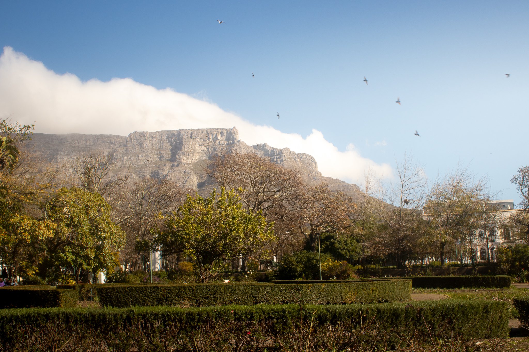
3. An Afternoon City Break in Cape Town’s Company’s Garden
Location: The Company’s Garden, Cape Town, South Africa
Despite visiting towards the end of the winter months, I stumbled upon one of my favorite Table Mountain viewing spots: The Company’s Rose Garden in the Central Business District.
Originally established in the 1650s to bring fresh supplies for ships passing through, the land now serves as a public park and the perfect spot for some stunning Cape Town travel photography, capturing city life in South Africa.
Once you’re done watching the birds and clouds (the “Tablecloth”) move in over Table Mountain, walk around the corner to Truth Coffee Roasting on Buitenkant Street for one of the best cups of coffee in your life (no embellishment necessary).
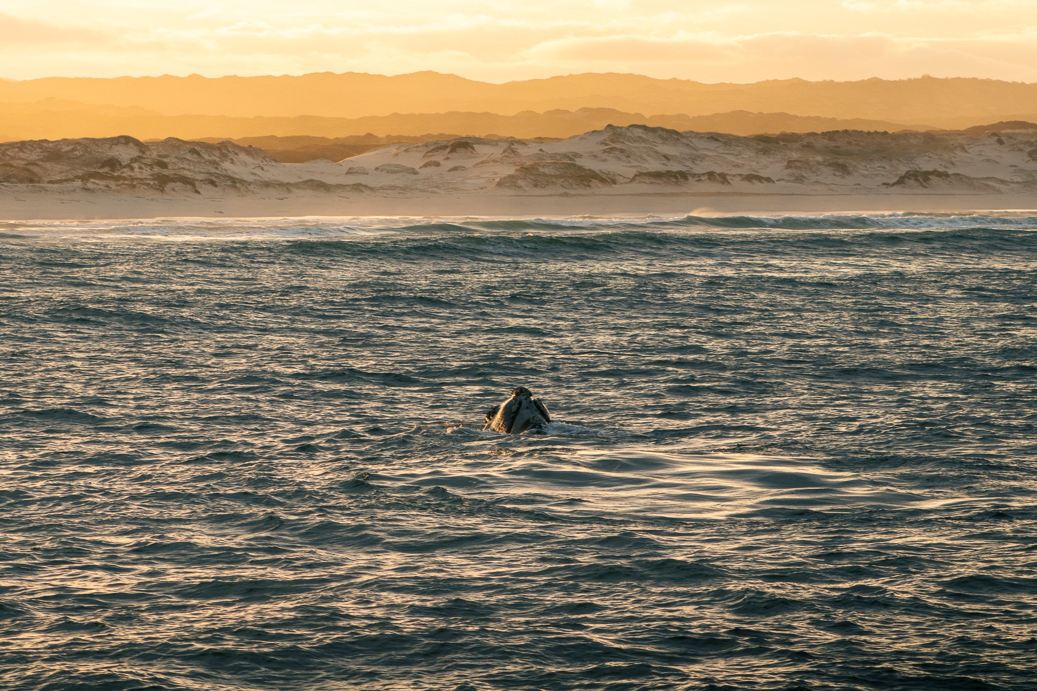
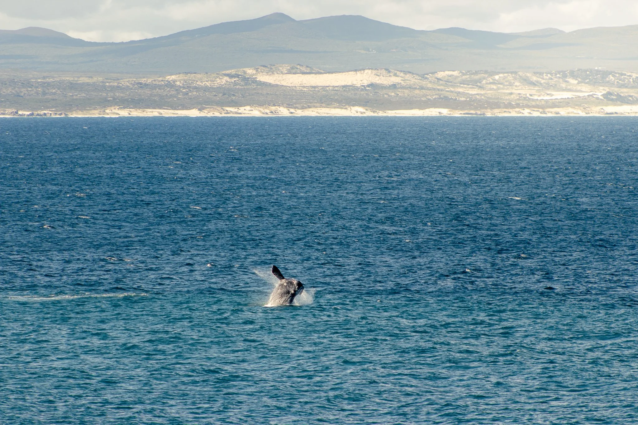
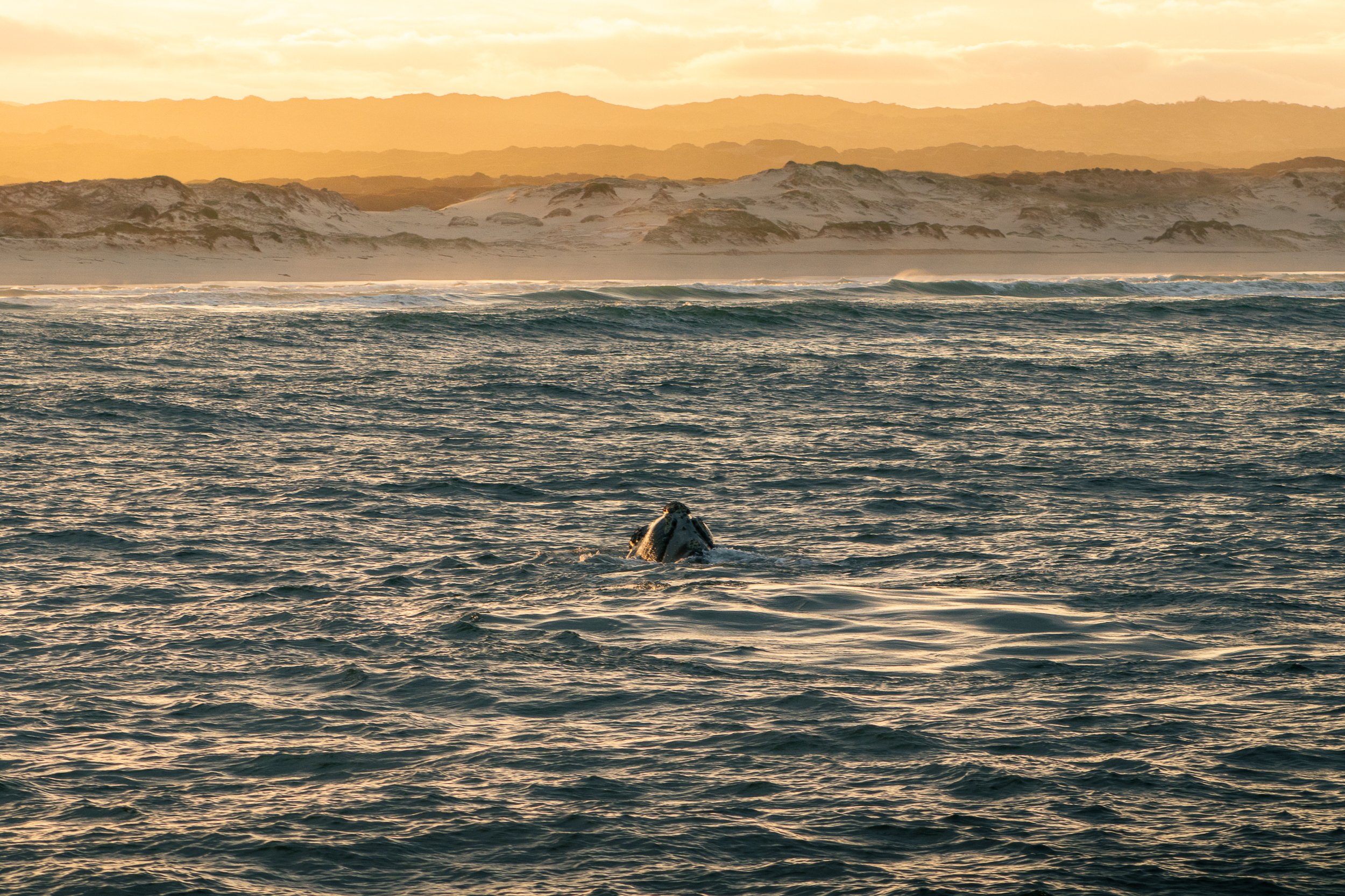
4. Golden Glow: Whale Watching in Hermanus
Location: Hermanus, Western Cape, South Africa
Every year, the quaint seaside town of Hermanus attracts so many visitors to Walker’s Bay that it’s commonly referred to as the “Whale Watching Capital of the World.”
After a month of solo-traveling around this incredible country, whale watching in Hermanus at sunrise was the experience of a lifetime that I hope to not soon forget.
The 5am wake up and freezing temperatures were worth it to capture this golden moment, one of my favorite travel photos from South Africa.
5. South Africa’s Nature Bath: Hermanus
Location: Hermanus, Western Cape, South Africa
The coastal landscapes are so pleasing to look at here that doctors once used to prescribe visits to Hermanus for recovering tuberculosis patients. The proof is in the medicine, right?
Even if getting out into the bay isn’t your cup of tea, there’s still plenty of South Africa’s nature to take in. Breathe a little easier and take the two hour drive from Cape Town. It’s worth the effort.

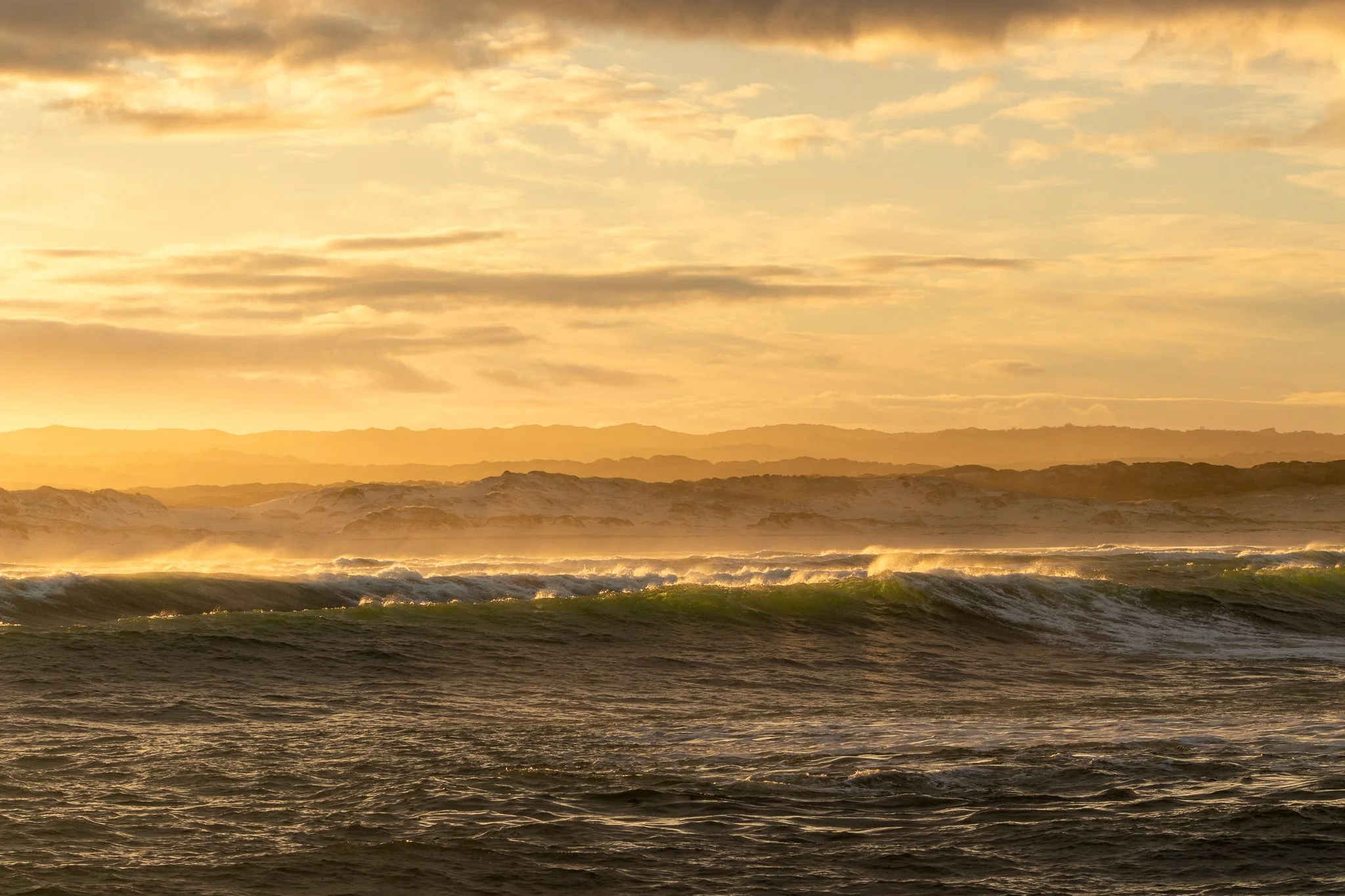
6. Golden Hour in Hermanus: Whales and Crashing Waves
Location: Hermanus, Western Cape, South Africa
No, I’m not done with Hermanus just yet. This travel photo lives rent-free in my mind so I wanted it in yours, too (you’re welcome).
Crashing waves, a golden sunrise, and whales rolling in the water. The coastal scenery provides all the recipe for a South Africa travel photography stunner, making a whale watching excursion in Hermanus a must-do activity.
7. Pure Bliss on the Hermanus Cliff Walk
Location: Hermanus, Western Cape, South Africa
If whale watching by boat isn’t for you there are still plenty of things to do in Hermanus, including a 12km cliff walk along the shore, making it easy to spot wildlife in the bay. The town even employs an official “Whale Crier”, blowing his conch every time one is spotted so you’ll never miss a beat.
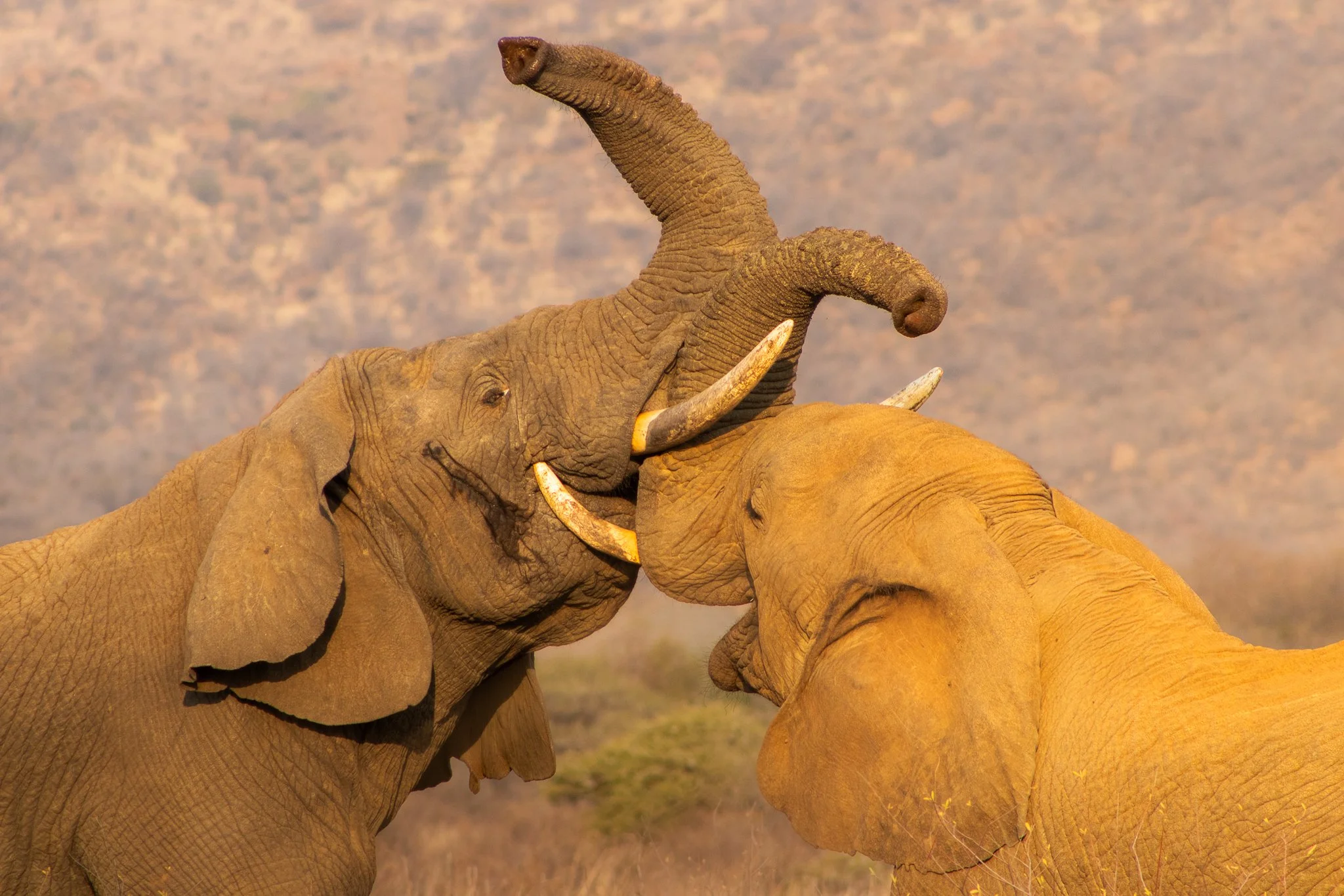
8. Generational Differences: A Pilanesberg Safari Moment
Location: Pilanesberg National Park, North West Province, South Africa
A three hour drive from Johannesburg lies Pilanesberg National Park. Not nearly as vast as nearby Kruger, it serves as a smaller-scale safari for shorter trips.
On one of my final game drives, the jeep was nearly empty and we came across this scene: an older male “arguing” with a teen. Luckily we were the only ones there to bear witness.
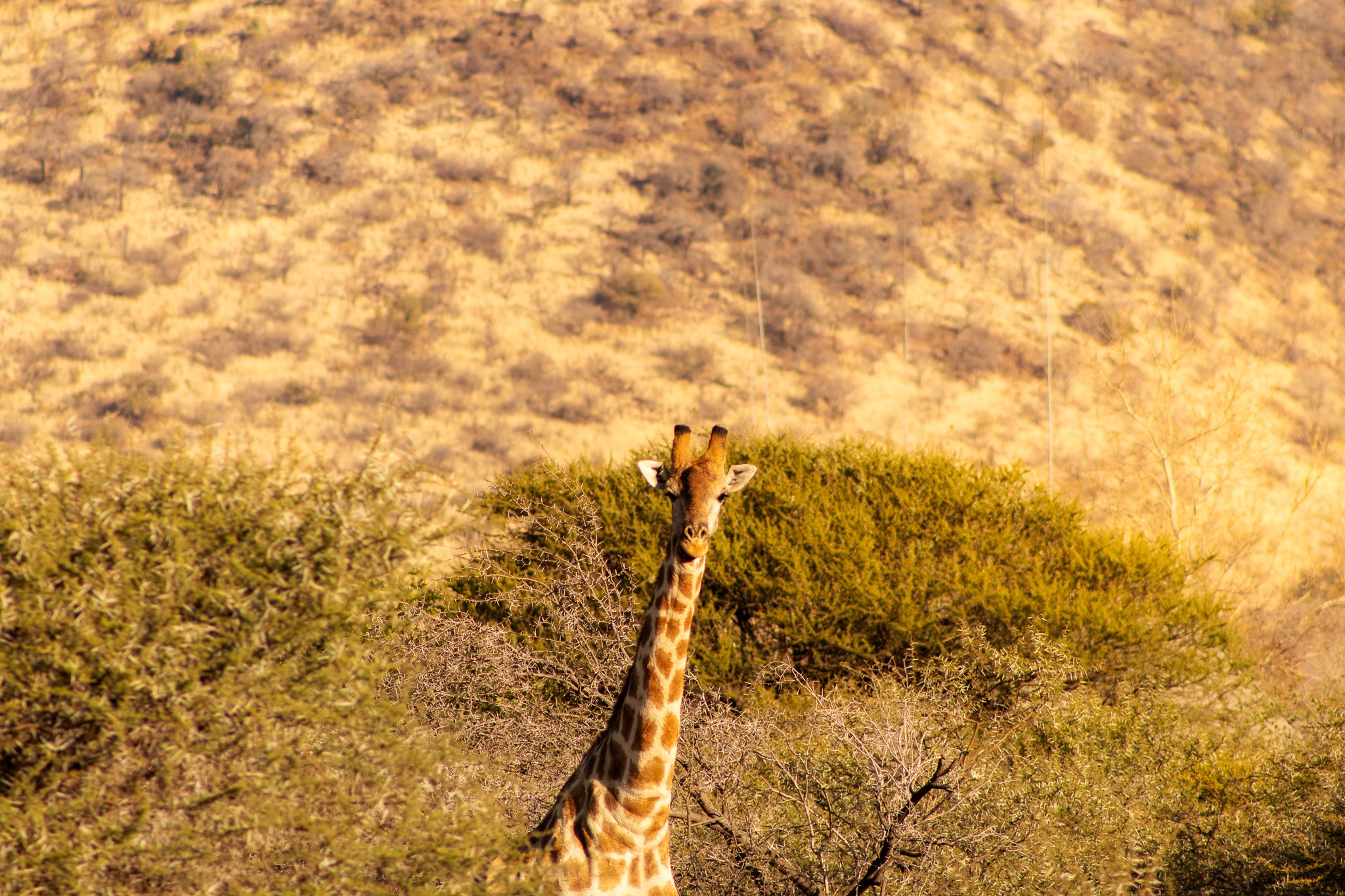
9. The Spotter Becomes the Spotted in Pilanesberg National Park
Location: Pilanesberg National Park, North West Province, South Africa
Our guide pulled over after spotting a giraffe hidden behind the bush. As I fiddled with my camera, it slowly emerged and turned to face us at the perfect moment.
We quickly became “the spotted” on our game drive as the tables turned—creating one of my favorite South Africa travel photos, captured during a quiet safari moment in Pilanesberg.
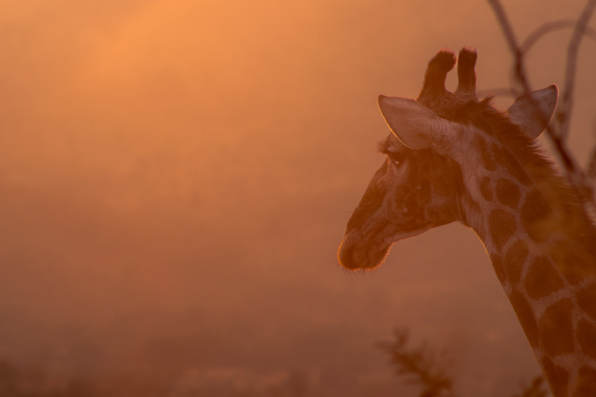
10. “Giraffe Valley” Mornings
Location: Pilanesberg National Park, North West Province, South Africa
An unofficial nickname, the phrase “Giraffe Valley” quickly took hold during my stay at Black Rhino Game Lodge because every time we drove this particular area, we were greeted by several giraffes.
On this particular morning in the freezing cold, the sun hit the frost and mist just right to create this orange glow. We couldn’t find what this giraffe was staring out over the valley, but it never diverted its gaze.
11. Into the Pilanesberg Sunset
Location: Pilanesberg National Park, North West Province, South Africa
Once the aforementioned generational scuffle ended, we were treated to this scene: both elephants rumbling off into the sunset. One of the more peaceful South Africa travel photos I was able to capture and my favorite Pilanesberg safari moments.

Here’s my go-to camera gear when traveling:


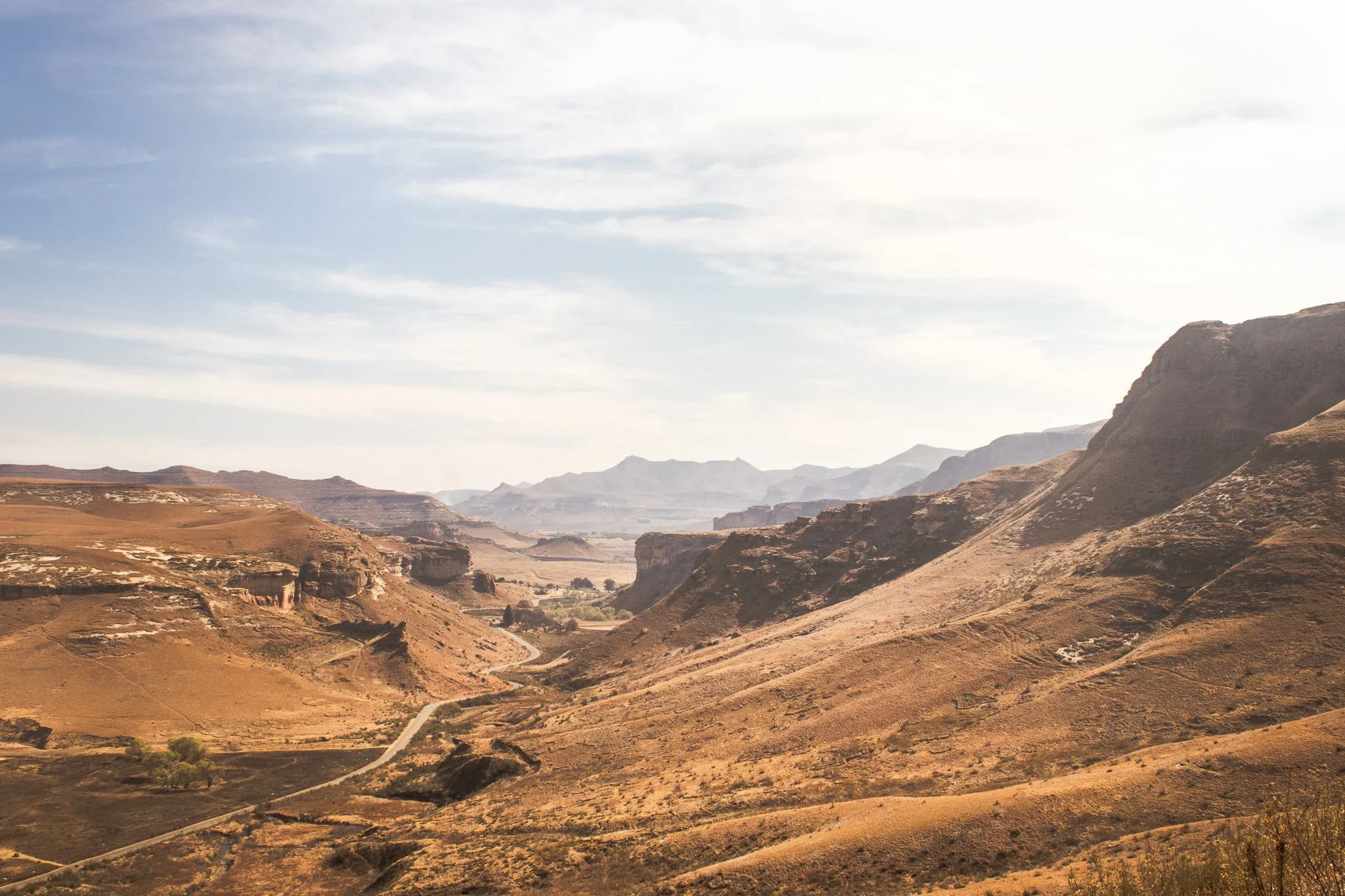
12. The Road to Nowhere in Golden Gate Highlands National Park
Location: Golden Gate Highlands National Park, Free State, South Africa
I had a gap in my plans during my South Africa roadtrip after visiting Pilanesberg National Park. One thing led to another and I ended up in nearby Clarens as a base to visit Tugela Falls via the infamous Chain Ladders Route, the second-highest waterfall in the world.
Long story short, a combination of poor planning, time of day, and weather nixed that hike. But the drive back to Clarens passed through Golden Gate Highlands National Park and I decided to pull off and do a short walk. I was treated to the stunning Free State landscapes, herds of wild zebra, and solitude. The afternoon was a lesson in following your gut: things will work out.
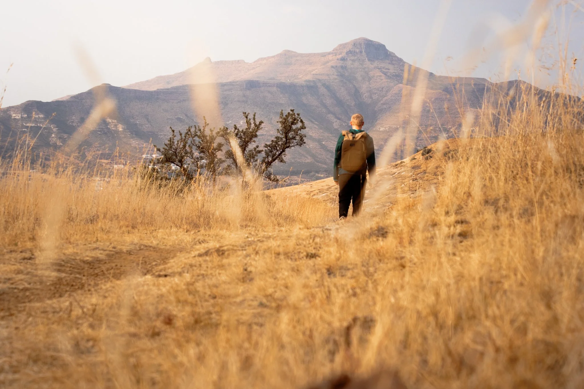
13. The Perfect Stopover in Clarens, South Africa
Location: Clarens, Free State, South Africa
Clarens was never part of the plan, but it seemed a good home base for the next stage of my trip — driving into Lesotho.
Lined with cafes, breweries, and art galleries, this quaint town in South Africa’s Free State is also at the doorstep of jaw-dropping landscapes at neighboring Golden Gate Highlands National Park.
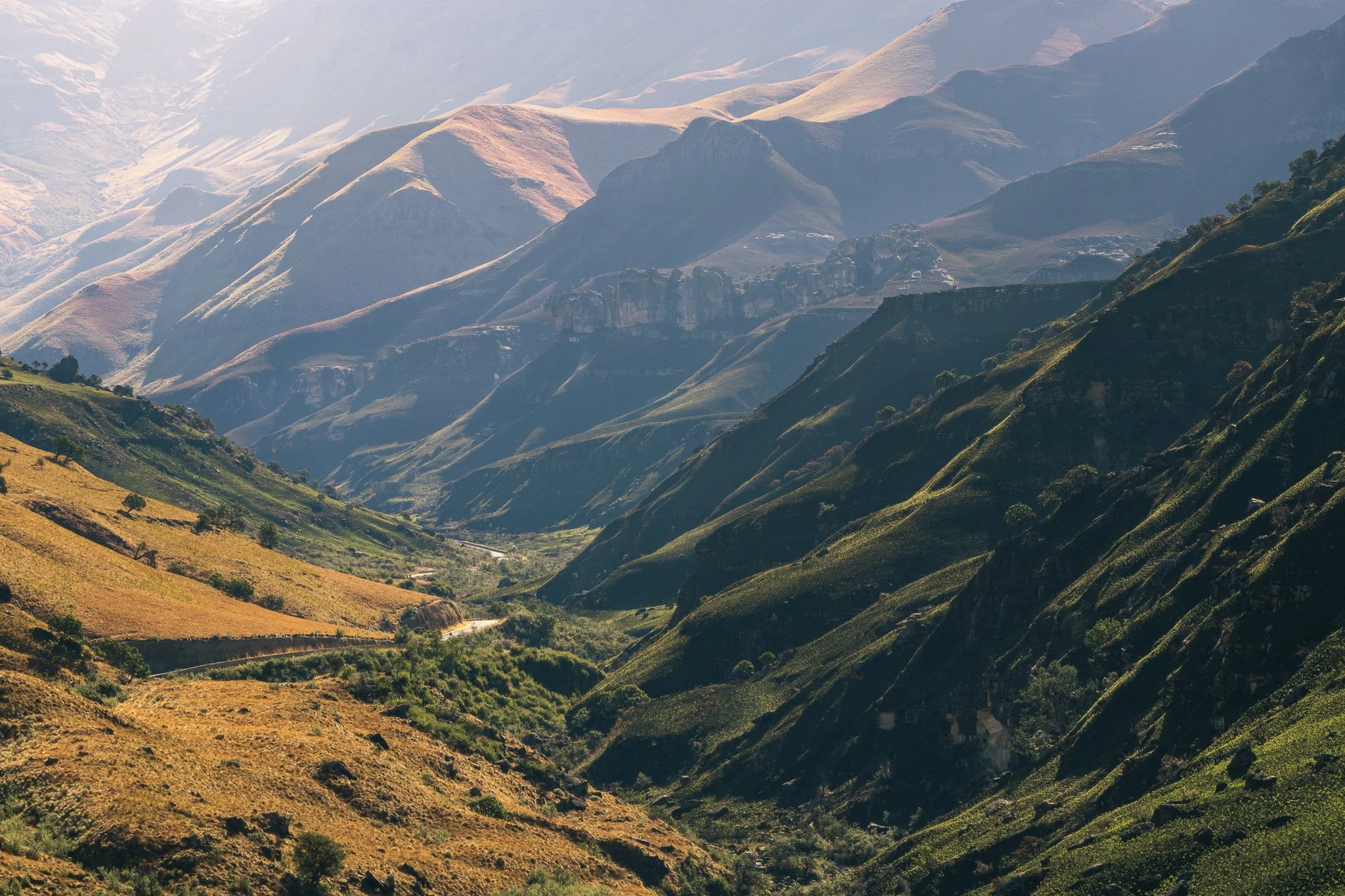
14. Toyota RAV4 vs. Sani Pass
Location: Sani Pass, Drakensberg Mountains, Lesoth-South Africa Border
Driving the Sani Pass was the top item to accomplish during my solo travel around South Africa, so when the rental company in Johannesburg couldn’t give me a 4x4 as was required to drive the road, I had a decision to make.
Do I skip it, or find a way?
That’s the story of how my trusted RAV4 and I (slowly) made our way down from Lesotho and back into South Africa along the infamous Sani Pass. The road was rough and the descent difficult, but the sweeping views of the surrounding Drakensberg Mountains were worth it.
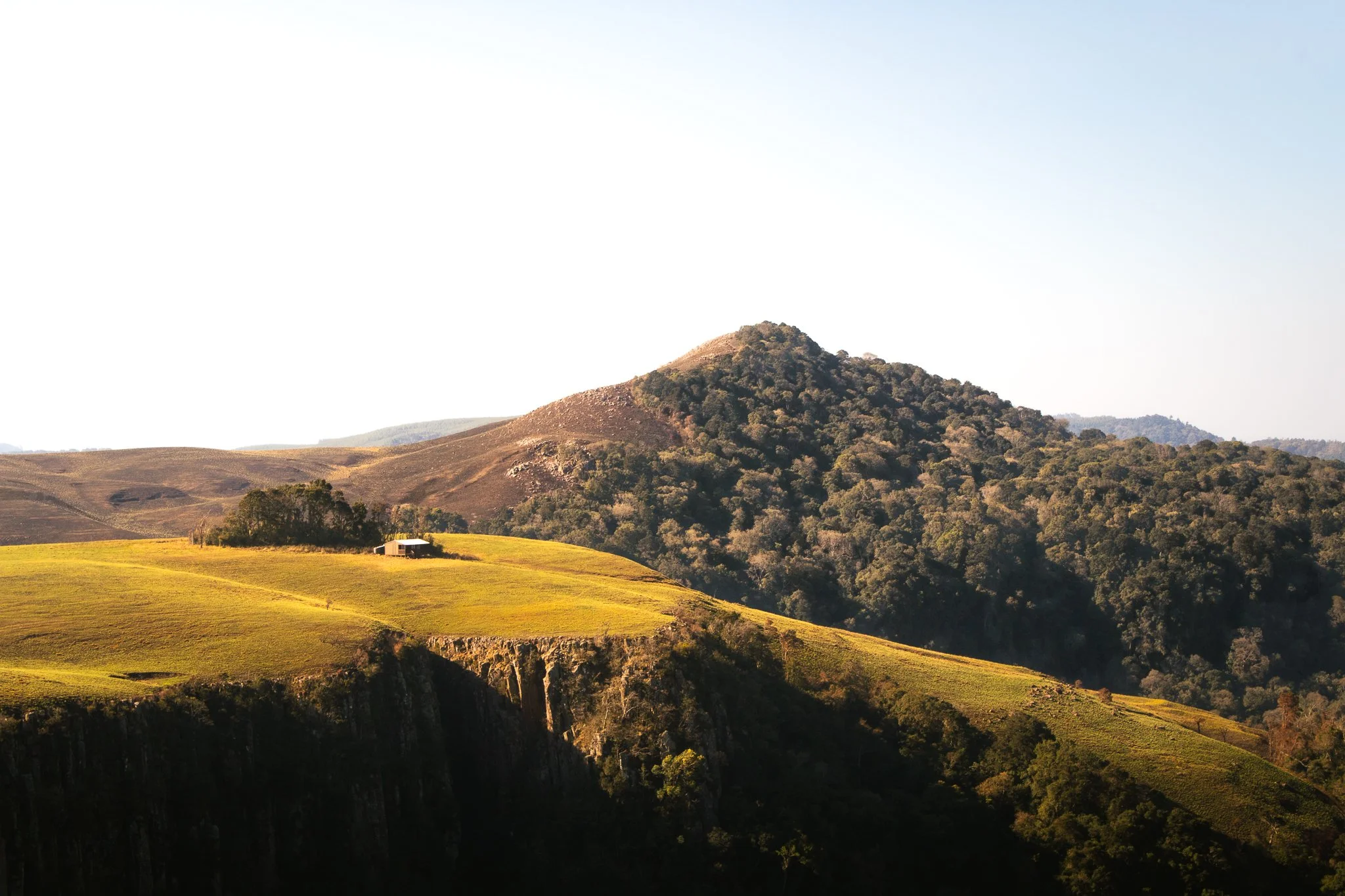
15. Unexpected Peace in KwaZulu-Natal
Location: Howick, KwaZulu-Natal, South Africa
From the Drakensberg Mountains, I made my way into the rolling hills of the KwaZulu-Natal Midlands with the intention of visiting Nelson Mandela’s capture site.
What I found instead was unexpected calm—gentle landscapes, open skies, and endless greenery like Gray Mare’s Trail in nearby Karkloof Nature Reserve. It was a quiet reminder that some of the most peaceful moments of travel come when plans take a back seat
My solo travel started in Cape Town, often named the world’s most beautiful city by Time Out Magazine — and it’s easy to see why. Mountains, outdoor space, coffee, rich culture and endless diversity… you could leave me there and I’d be set for life.
But when you inevitably book that trip, push yourself beyond the city limits and into the far corners of the country. Discover the KwaZulu-Natal Midlands and Drakensberg Mountains. Drive the wide-open roads of the Free State and jump into South' Africa’s wildlife.
You won’t regret it.
In the meantime, I hope these 15 South Africa travel photos help to keep that wanderlust alive and offer a little inspiration for your next adventure.
Questions? Anything to add? Drop it in the comments below. Until next time, stay safe & happy travels!
Sharing is caring! Pin this post for later.


Climbing Mount Afadjato: A Complete Guide to Hiking Ghana's Tallest Mountain
If you’ve been on this blog before, it’s no surprise that this is yet another post about the unbelievable nature of Ghana’s Volta Region. When I first moved to West Africa, I immediately searched for “top places to hike in Ghana,” and every result pointed back to this mountain. So naturally, the surrounding forests and waterfalls of Mount Afadja have become my safe haven…
Note: All information below is accurate as of April 2025
If you’ve been on this blog before, it’s no surprise that this is yet another post about the unbelievable nature of Ghana’s Volta Region.
When I first moved to West Africa, I immediately searched for “top places to hike in Ghana,” and every result pointed back to this mountain. So naturally, the surrounding forests and waterfalls of Mount Afadja have become my safe haven.
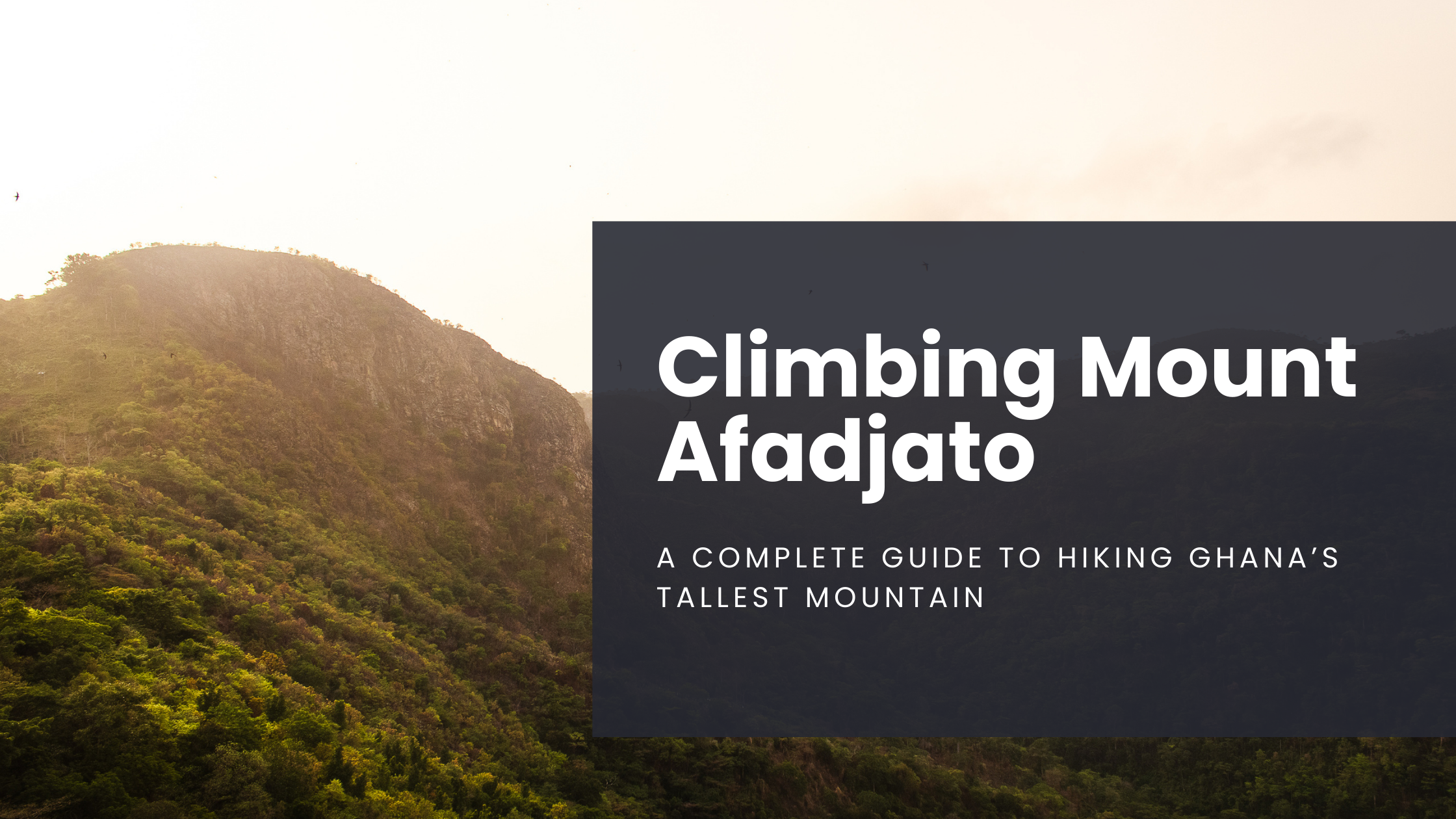
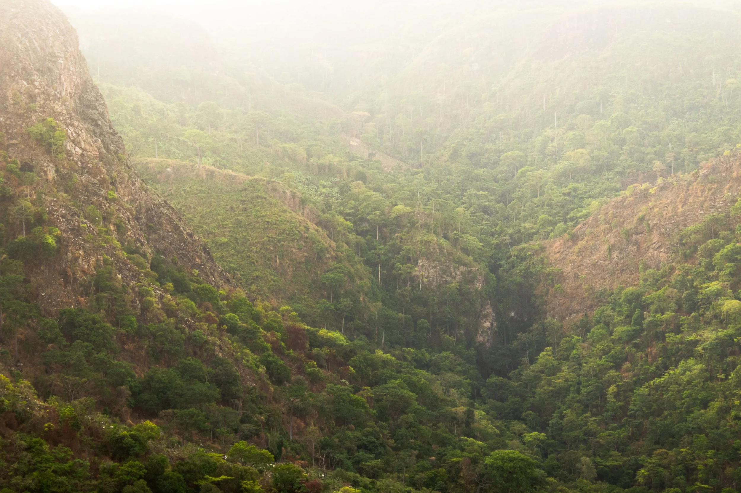
Standing at 885 meters (2,904 feet), Mount Afadjato is Ghana’s tallest mountain and offers stunning views of surrounding villages, verdant forests, and even neighboring Togo.
Even more, it’s located in a small, peaceful village with plenty of other trails and waterfalls to explore, including my favorite place to stay: Tagbo Falls Lodge.
Fancy a bit of outdoor adventure on your trip to Ghana? Mount Afadjato is for you!
The view of the Volta Region while hiking Mount Afadjato in Ghana
History and meaning of Mount Afadjato
Mount Afadjato derives its name from the Ewe word “Avadzeto,” meaning “at war with the bush.”
As the Ewe tribe settled here from Togo, they were prone to attacks from wild animals. The village revolted, pushing them back into the mountains but as they reached the forest, they were overcome by plants making them itch.
Afadja, Afadjato, it’s all the same! Another way to break it down in the Ewe language: ‘Afar’ means ‘war’, ‘dja’ means ‘plant’, and ‘to’ means ‘mountain.
Despite the name and history, I’m happy to report that the itching plants have since been tamed and it is very safe to hike the trails (but consider long pants, just in case)!
The area remains a symbol of pride for the Ewe people, as Mount Afadja is believed to house the spirits of their ancestors who look over and protect the surrounding communities.
Interested in exploring more of Ghana’s Volta Region? Check out these posts:
Location and how to get to Mount Afadjato
Nestled in the mountains that border Togo, the trailhead is located in the small village of Liati Wote in Ghana’s Volta Region. Sounds great, right? Here’s how to get to Mount Afadjato:
By Car:
From Accra, take the Accra–Hohoe road and follow signs to Liati Wote. The roads are well-maintained (for the most part), making the drive smooth and scenic as you wind through the mountains. The drive should take ~6 hours.
By Public Transport:
Buses and shared taxis from Accra to Hohoe are affordable. From Hohoe, hire a taxi or take a shared ride to Liati Wote. Another option is to take a tro-tro to Golokwati, but this often requires 2-3 changes in vehicles along the way.
From Nearby Attractions:
If you’re already exploring Wli Waterfalls or Tafi Atome Monkey Sanctuary, Liati Wote is just a short drive away (20-40 min depending on where you’re coming from).
If you don’t want to plan your own transportation, consider one of these pre-arranged tours from Get Your Guide. They depart Accra and sort travel, food, and accommodations along the way!
Pro Tip: Whenever I can, I try to travel around Ghana on Sundays. Everyone is in church and this means much less traffic and dangers on the road – and I get to where I’m going quicker! I have my own car, but your safest option is to either rent or hire a reliable taxi. Although cheap, tro-tros (Ghana’s public transportation) are prone to breakdowns and accidents.
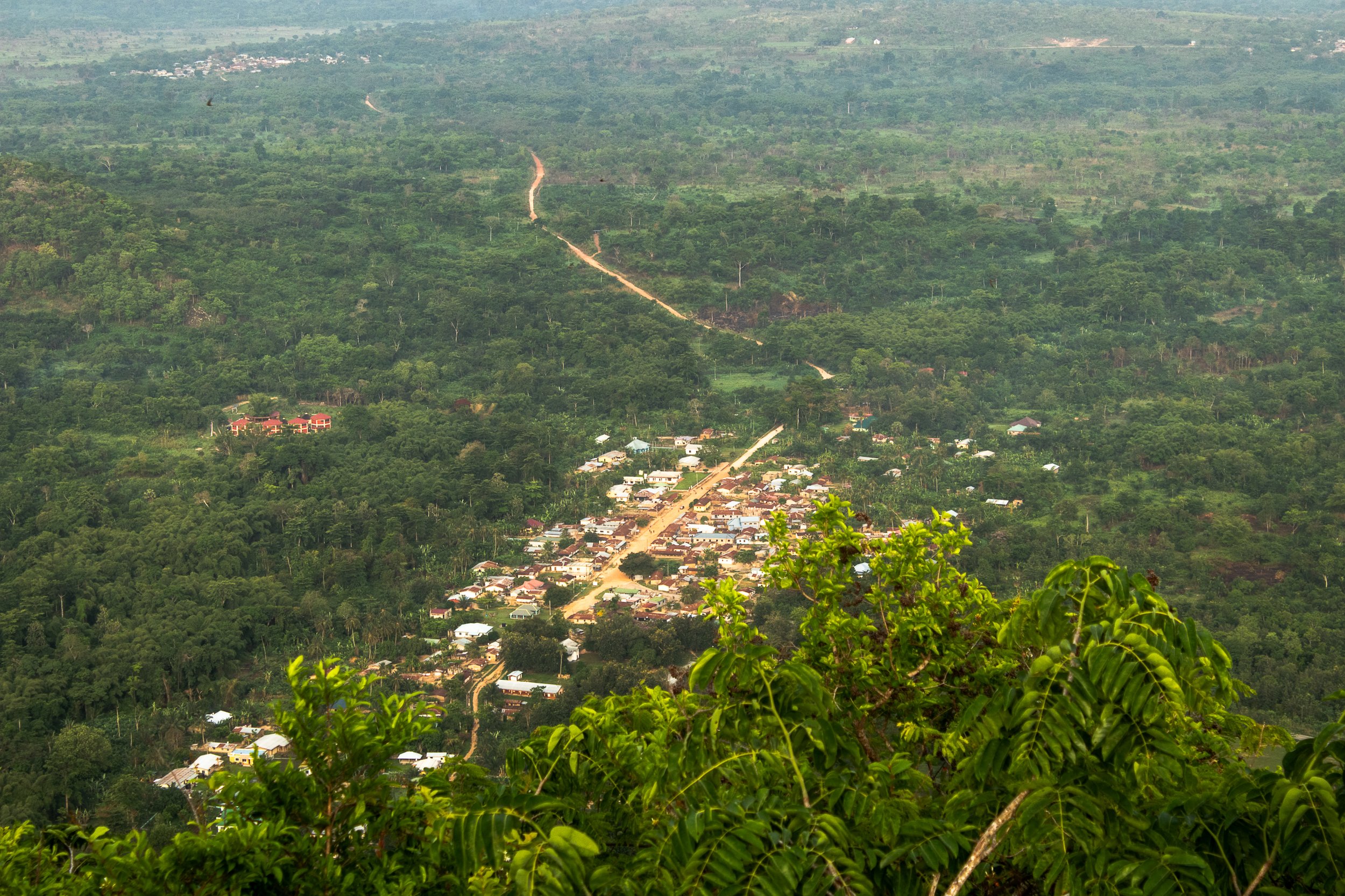
Aerial view of Liati Wote as seen from the trail of Mount Afadjato in Ghana’s Volta Region
Entrance fees & costs
Liati Wote markets itself as a tourist village (don’t worry, I was initially turned off by this as well, but it’s not what we’re used to when we see that tagline).
There are plenty of tours and options available around town, including multi-day hiking, local gin tours, and surrounding waterfalls, but be warned that each one requires a guide (this is used as a means to boost the local economy).
You can find a guide and look at the options available by checking in at the Liati Wote Toursim Office upon arrival, located at the base of Mount Afadja on the main road of town and typically open 8am, daily.
The tourism office accepts cash only, so come prepared as there are no ATMs within a one hour radius.
Hiking only Mount Afadjato requires a modest fee:
Ghanaians: 25 GHS (USD 1.60)
Non-Ghanaians: 50 GHS (USD 3)
You can add on and combine with a trip to Tagbo Falls (GHS 40/USD 2.50 for Ghanaians, GHS 80/USD 5 for non Ghanaians), or continue past Mount Afadjato to Mount Aduadu (GHS 70/USD 4.50 for Ghanaians, GHS 100/USD 6.50 for non-Ghanaians).
A Note on Guide Fees: Guides for hiking Mount Afadjato and surrounding tours don’t get paid from trail fees, so come prepared to tip them for their service to support their income. For this hike, GHS 50-100 is reasonable (USD 3-6).
The trail fees do, however, contribute to maintaining the paths and supporting local community projects, such as their recycling initiative – something that is unique to this village!
Pro Tip: There are many guides and not many visitors, meaning it’s important to find one of quality. The only one I’ll use is Faith (+233 55 083 0914). I will meet him at the reception office, pay the entrance fee, give him a tip, and often he’ll let me take myself on the trail!
What to Expect: Hiking Mount Afadjato
Although Mount Afadjato is considered a popular tourist destination in Ghana, let me be direct with you: It’s not for everyone. The trail starts on a flat path, but quickly becomes a leg burner, what feels like a perpetual stair climber machine.
Most people will tell you it takes, on average, around 2 hours round trip, which I found to be accurate, but it was by no means easy. It’s important to wear sturdy shoes and bring plenty of water and fuel.
Along the way you’ll come across convenient rest stops with scenic views, offering the perfect spot to recharge your legs and observe surrounding wildlife.
Did you know that Ghana is home to over 860 species for butterflies? Don’t worry, I didn’t before moving here, but spotting them is one of my favorite parts of spending time in the Volta Region!
Finally, after 45min-1 hour you’ll reach the peak and soak up the sweeping views across Lake Volta, neighboring Togo, and Liati Wote below. You may even spot Togolese coffee farmers wandering the foohills!
The Volta Region is where both Kawa Moka and Jamestown, two of Ghana’s top coffee companies, produce their beans.
For the most part, the trail is well preserved and shorts and t-shirt will suffice, but if you’re planning to go beyond the peak to nearby Mount Aduadu as I did, be sure to wear long pants.
Reaching this secondary mountain requires bushwhacking lesser-frequented pathways and it’s not uncommon to come across snakes and biting ants.
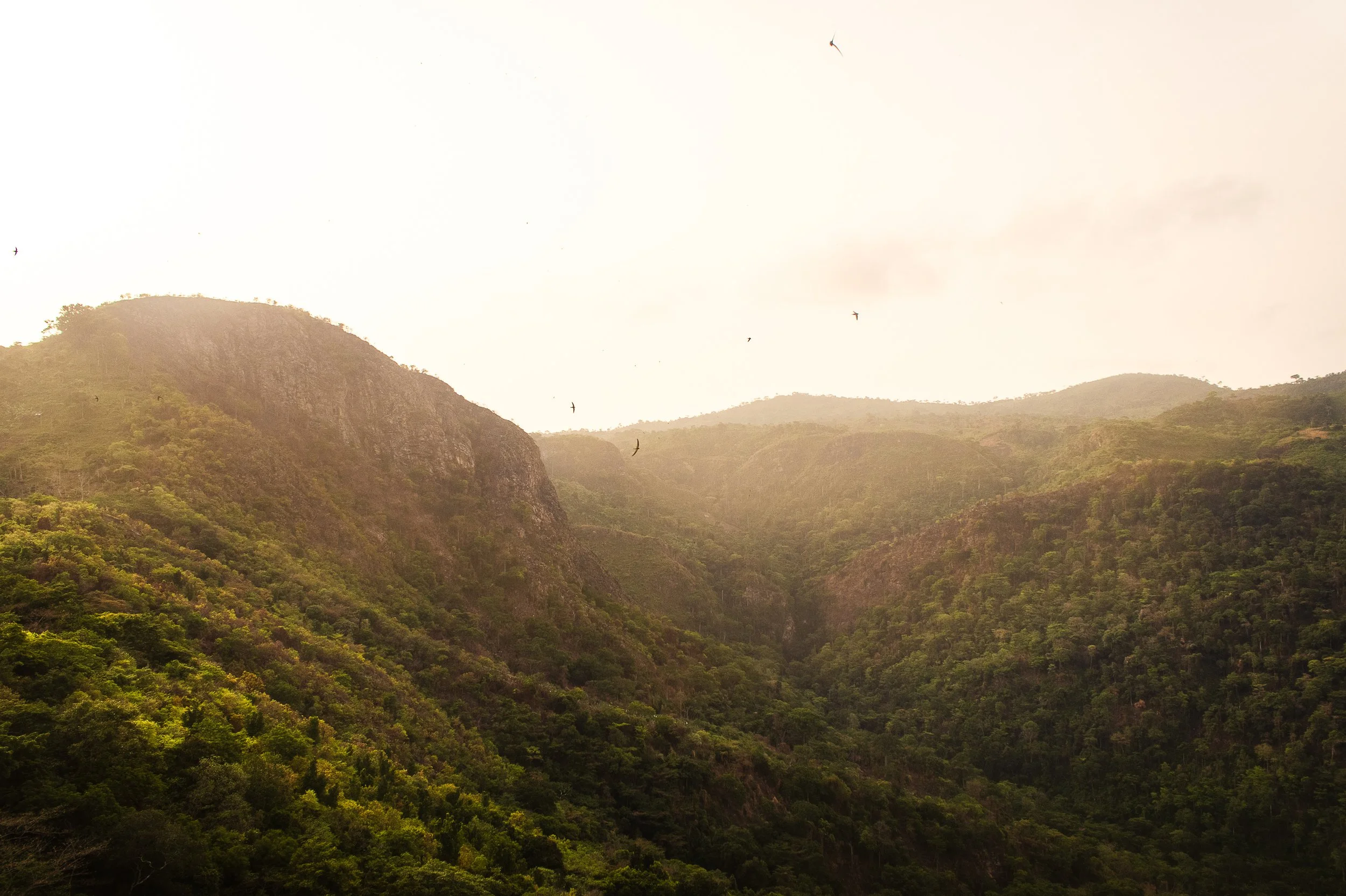
View of Mount Aduadu at sunrise, shot from the peak of Mount Afadjato
Nearby attractions
Tagbo Falls:
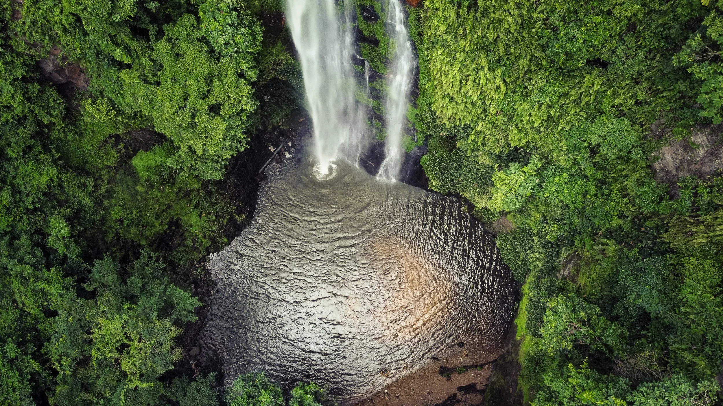
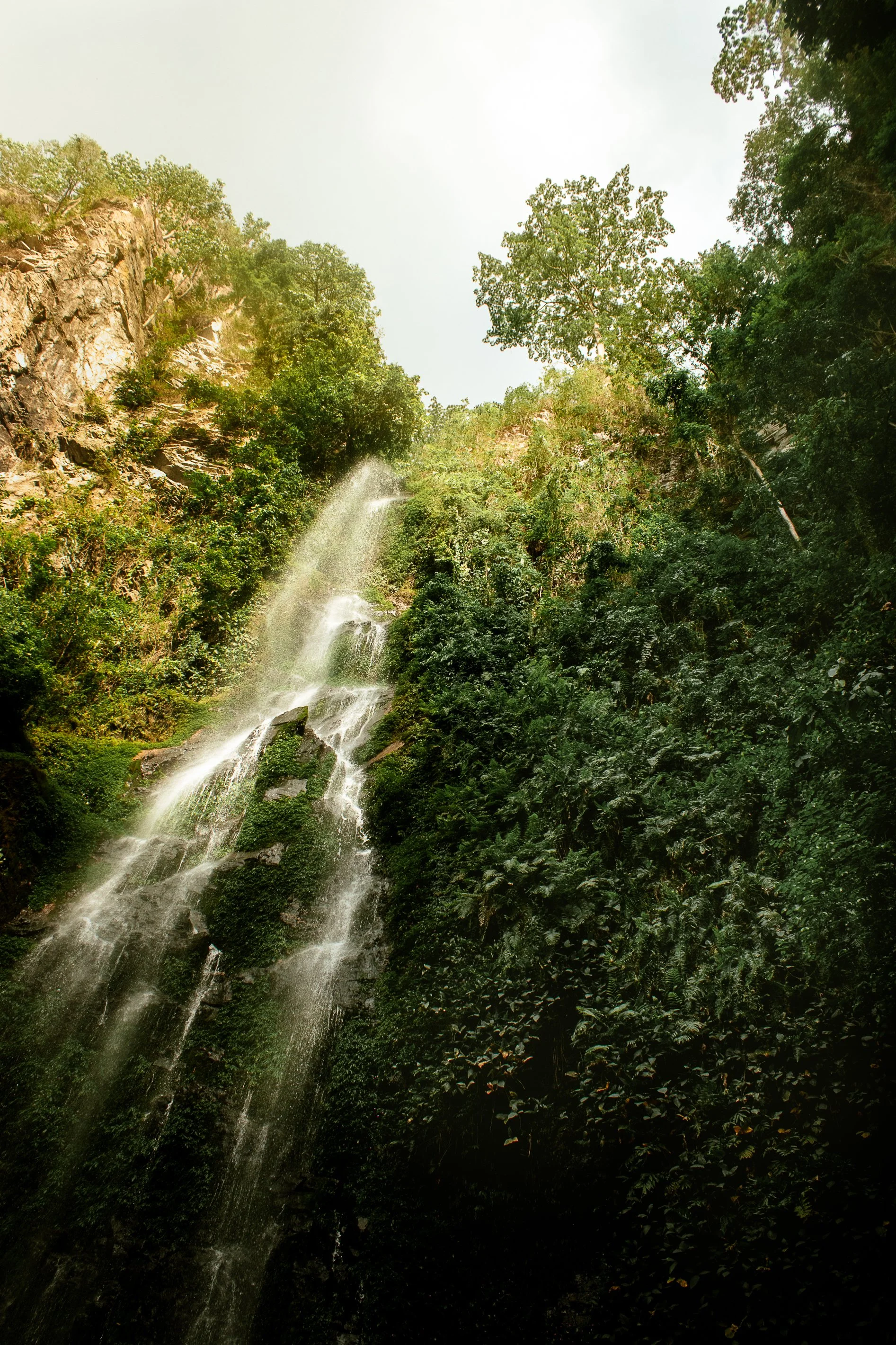
Located near Mount Afadjato, this tranquil waterfall is an excellent spot to cool off after your hike. I’d recommend climbing Afadja in the morning, and then continuing on (for an additional trail fee) to Tagbo Falls. It’s a flat, short, 40min hike and the trailheads start from the same location! It’s one on my favorite places to spend an afternoon swimming.
Wli Waterfalls:
Ghana’s highest and most famous waterfall is just a short drive away (20min) and offers another fantastic nature experience. Similar to Tagbo, this short trail is accessible to everyone and cooling off in the pool under the cascading water is a spiritual experience.
Amedzofe Village:
Amedzofe is Ghana’s highest-elevated settlement, originally established by the Germans during colonial times. The area offers cooler weather, more waterfalls, a better (and less frequented) canopy walk than Kakum National Park, and a small climb to the cross on top of Mt. Gemi. If coming from Ho, you’ll pass the turnoff for Amedzofe along the way (less than 1 hour from Liati Wote).
Best time to hike Mount Afadjato
The Harmattan, or dry season, (November to April) is the best time for hiking, as the trails are less muddy. However, the dust being blown from the Sahara can significantly reduce visibility (although makes for beautiful, glowing sunrise).
The rainy season (May to October) brings lush greenery, making the scenery even more vibrant, but the steep trail can get slippery, so be sure to wear proper footwear and plan accordingly.
Finally, beat the heat and hike Mount Afadjato in the morning. If arranged ahead of time, your guide can meet you at the tourist office before sunrise and you can start on the trail before fighting the humidity.
Top packing tips for your hike to Mount Afadjato
Shoes are essential. Especially if planning to visit during rainy season. The trail is steep and can quickly become slippery, so it’s safest to have good treads.
Sunscreen and insect repellent. The trail itself traverses dense forest, and the peak is completely exposed so you’ll have to plan for all elements. After years of sweating off my sunscreen in the humidity, I’ve finally switched over to using a stick instead and it’s been a gamechanger!
A good camera. The top of Mount Afadjato provides some of the most stunning views in the area. If you’re into landscape photography, this is the place to come. Personally, my Canon 80d has been my best travel companion over the years.
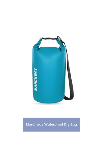
A quality dry bag. Hiking in West Africa can be unpredictable, especially during the rainy season. I’ll always bring my Marchway dry bag to protect my valuables.
Don’t forget a quick-dry towel. Whether caught in the rains or planning to add on a visit to Tagbo Falls, a lightweight towel is the perfect item to add to your pack.
Water and Fuel. Regardless of season or time of day, you’ll work hard to get to the top of Mount Afadjato. Come prepared with plenty of water and snacks. There aren’t many options available in town, but you can always also your guide where to pick up supplies.
A reliable SIM card. Traveling outside of Accra is never easy and it pays to have a reliable in-country SIM. Recently, I’ve been using Airalo on my travels and, although I enjoy collects SIM cards, they take away the stress of losing it or always looking for a pin to open the port!


A view into the valley below, shot from the peak of Mount Afadjato
Standing on top of Ghana’s tallest mountain at sunrise is a scene I won’t soon forget. Accra is great, but experiencing the breathtaking nature in the Volta Region is a must during any visit to Ghana, and Liati Wote is the perfect place to base.
Explore, rest, and walk away refreshed from your time in these stunning mountains.
Have you conquered Mount Afadjato or plan to visit? Share your experience in the comments below. As always, stay safe and happy travels!
Sharing is caring! Pin this post for later.


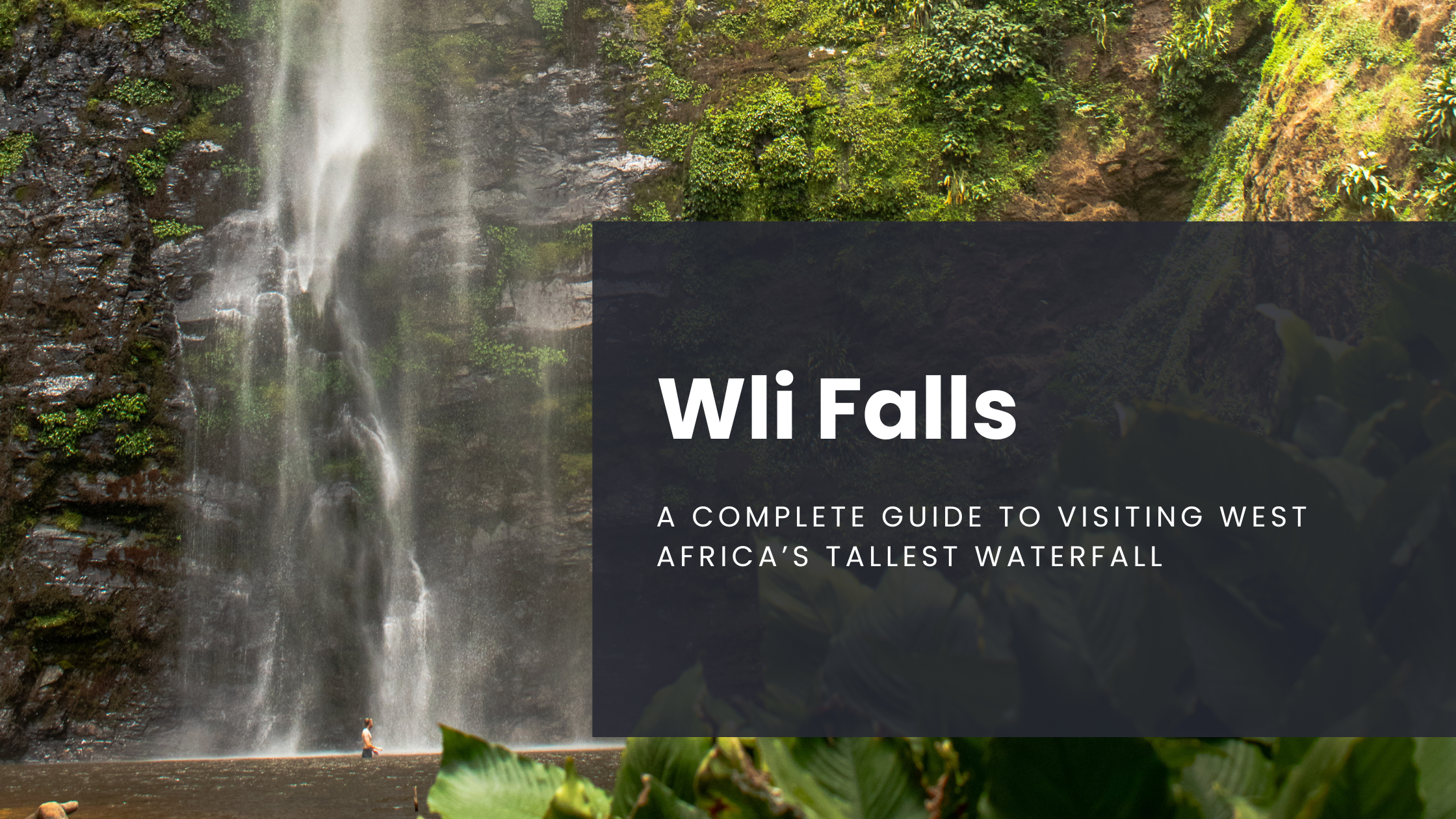
A Complete Guide to Visiting Wli Waterfalls in Ghana
Hidden in the lush greenery of Ghana's Volta Region lies a breathtaking natural wonder, offering an unforgettable experience for nature lovers and adventure seekers alike. Here’s your ultimate guide to making the most of your visit to Wli Waterfalls…
Note: All information below is accurate as of March 2025.
If you haven’t caught on yet, I’m a big fan of the nature in Ghana and, after moving here, I was surprised to learn that the highest waterfall in West Africa is only a short day-trip away from my home.
Hidden in the lush greenery of Ghana's Volta Region lies a breathtaking natural wonder, offering an unforgettable experience for nature lovers and adventure seekers alike.
Here’s your ultimate guide to making the most of your visit to Wli Waterfalls!

Ghana’s Volta Region is full of lush mountains along the border with Togo
Know Before You Go: Wli Waterfalls Background
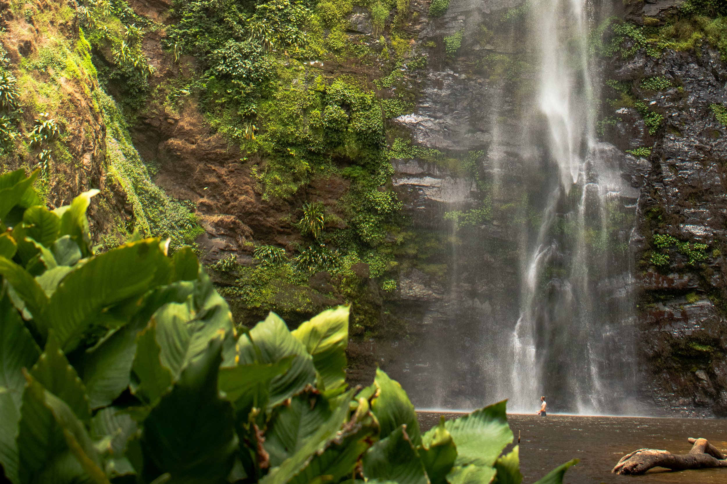
Wli Falls, also called Agumatsa Falls, means "let me flow" in the Ewe language. The falls are fed by the Agumatsa River, which comes from neighboring Togo, and plummets 80 meters over the cliffs and into the pools below.
Although a popular tourist spot, the surrounding nature is still relatively untouched, making for a serene and peaceful day in the forest. You’ll run into colorful butterflies, plenty of birds, and even a colony fruit bats along the cliffs.
So, now that you’re hooked, when’s the best time to visit Wli Waterfalls? Well, there are two options that depend on what your priority is.
Dry season in Ghana, also known as Harmattan, runs from November to March. During this time the hiking weather is more pleasant, but the flow of the falls will be slower.
In contrast, rainy season occurs from April to October and makes the hike a bit more difficult with muddy trails, but you’ll get to experience the roar of the waterfalls at full force. Personally, I’d choose the rainy season, but it’s a great place to spend an afternoon either way.
Finally, it’s important to be aware that there are two trails: one to lower falls, and one to upper. The lower trail is classified as easy and good for all ages, while the upper falls trail is moderate to hard and requires a guide (these can be found at the main office).
Choose your adventure and plan accordingly!

Standing beneath Ghana’s Wli Waterfalls
How to get to Wli Waterfalls
Wli Waterfalls is located near the town of Hohoe in Ghana's Volta Region and is most easily accessible by car from Accra. The good news is that, unlike other regions of Ghana, the roads in and out of the waterfall area are well maintained, making for a breathtakingly beautiful drive along the mountainous border with Togo.
To get here…
By Car: From Accra, it’s about a 4-5 hour drive (approximately 230 km). The route takes you through scenic landscapes and vibrant local villages. The biggest places to stop for petrol along the way are Atimpoku, Juapong, and Peki (if passing through Golokwati).
By Public Transport: Take a bus or shared taxi from Accra to Hohoe, then hire a taxi or moto to Wli, which is about 20min away.
Pro Tip: Share a taxi for the day or hire your own car. Local minibus transportation, also known as tro-tros, are notorious for accidents and breakdowns, especially when covering longer distances outside of Accra.
Entrance fees & costs
For a comprehensive list of admittance fees, including child and student discounts, visit the official Wli Waterfalls website.
Entry Fee (Lower Falls):
Ghanaians: 25 GHS (USD 1.60)
Non-Ghanaians: 60 GHS (USD 4.00)
Upper Falls Guided Hikes:
Ghanaians: 60-70 GHS (USD 4.00-4.50)
Non-Ghanaians: 80-90 GHS (USD 5.00-6.00)
Bring extra cash for souvenirs, snacks, or donations to support the local community. A small market is setup outside of the Tourism Office, making it easy to stock up on water and other supplies.
Pro Tip: Remember to tip your guide and get their contact information to recommend their services to others. Ghana’s economy functions off connections and who knows who, so this small gesture will go a long way.
Interested in exploring more of Ghana’s Volta Region? Check out these posts:
What to expact at Wli Falls
Lower Falls
A gentle, 30-minute walk through Ghana’s lush nature on a well-marked trail leads to the lower falls. You’ll cross scenic wooden bridges and enjoy the vibrant sights and sounds of the rainforest. The cascading waters create a refreshing natural pool perfect for a swim.
You’ll hear the falls before you can see them and pay close attention to the towering cliffs as they come into view between the tree-tops. This is where the fruit bat colony resides and, if you’re lucky, you’ll catch them flying off the rocks
Upper Falls
For a more challenging adventure, embark on a steep 3-4 hour hike to the upper falls (guide required). The trek rewards you with stunning views and a quieter, less-crowded experience. There is both a short loop and a long loop, so be sure to discuss with the Tourism Office before setting out on your adventure.
Unlike Lower Wli Falls, the Upper requires hiking through grassy foothills and on narrow paths, so be sure to bring appropriate footwear and long pants. A moderate level of fitness is required for this trail.
Pro Tip: To avoid the crowds, plan your visit for a Sunday morning. This will ensure you beat the post-church rush and as they move in, you’ll be on your way back out!
Swimming in the pools beneath Wli Falls in Ghana
Nearby places to visit
The Volta Region is full of amazing nature and experiences, so make your trip even more memorable by exploring more near Wli Waterfalls:
Amedzofe Canopy Walk:
A short 1 hour drive away, Amedzofe is the highest elevated settlement in Ghana and is where you’ll find a canopy walkway with the stunning Oti Falls as a backdrop.
Mount Afadja (Afadjato):
Ghana's tallest mountain offers a thrilling hiking experience and panoramic views in neighboring Liati Wote.
Tagbo Falls:
Another serene waterfall located near Mount Afadja, perfect for a peaceful escape and my favorite place to soak up Ghana’s nature.
What to bring
Hiking Boots: Especially if hiking the Upper Falls or visiting in rainy season.
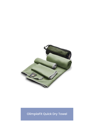
Swimsuit and Towel: Even if you don’t plan to swim, still bring it. The swimming pools act as a great way to cool off from Ghana’s heat and humidity! Pack lightly with a quick dry towel.
Waterproof Bag: Protect your valuables and be sure bring a waterproof bag, especially if there’s a risk of rain! I never hike in Ghana without my Marchway dry bag.
Water and Snacks: Wli Waterfalls is located within the Agumatsa Wildlife Sanctuary, so although these items are easily accessible at the trailhead, please remember to pack out what you bring in!
A Good Book: What better way to recharge then lounging at the base of West Africa’s tallest waterfall and enjoying a good book. Ever since moving abroad and traveling more extensively, I never leave home without my Kindle Oasis.

A visit to Wli Waterfalls is more than just a trip—it’s an immersion into Ghana's natural beauty and cultural richness. Whether you’re splashing in the lower falls or hiking to the upper falls, you’ll leave refreshed and ready for more of all Ghana has to offer.
Have you visited Wli Waterfalls or plan to go? Share your thoughts in the comments below!
Sharing is caring! Pin this post for later.


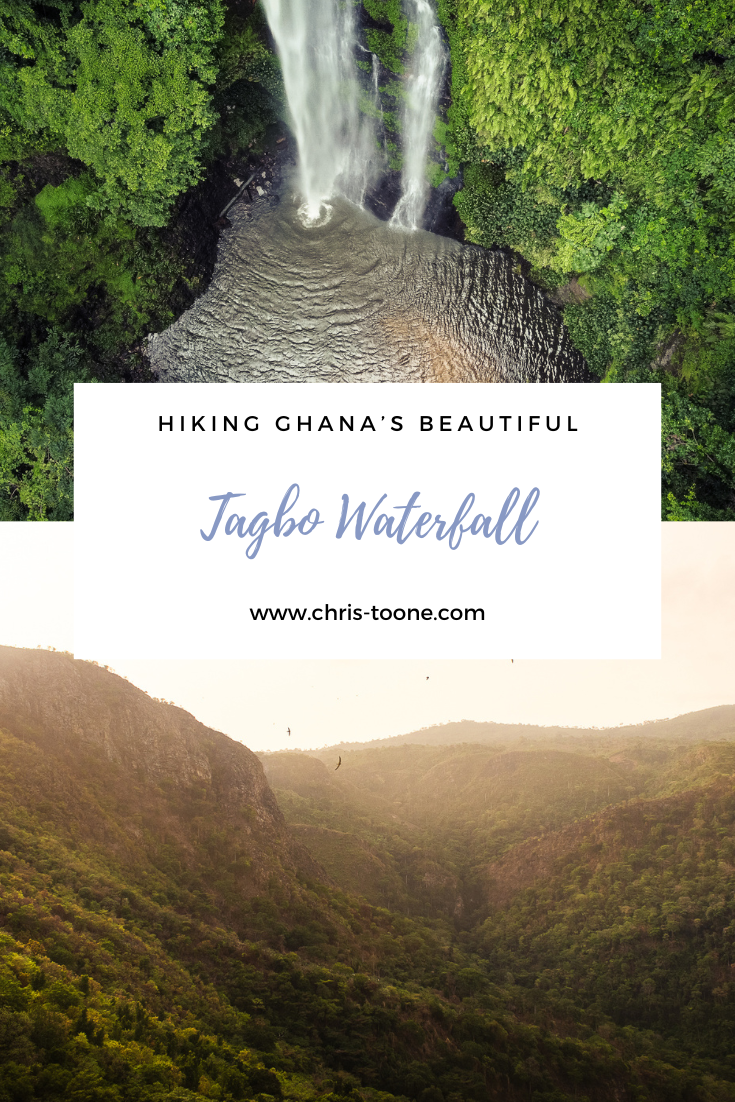
Tagbo Falls: A Hiker’s Paradise in Liati Wote, Ghana
The Volta Region is home to some of the country’s most breathtaking natural beauty, and nestled in this lush landscape is Tagbo Falls—a hidden gem and my favorite under-the-radar destination in the area….

Note: All information below is updated as of October 2024, but as Ghana’s economy fluctuates so to can costs of guides, accommodations, etc.
Ten years. That’s the amount of time I've been traveling in and out of Ghana without having visited the Volta Region and I’ll be the first to admit, I had no idea what I was missing. Verdant mountains rising high along the border with Togo, coffee farms, waterfalls, and endless hiking trails are all at your fingertips.
The Volta Region is home to some of the country’s most breathtaking natural beauty, and nestled in this lush landscape is Tagbo Falls—a hidden gem and my favorite under-the-radar destination in the area.
Hiking to Tagbo Falls is a relatively easy trail with minimal elevation gain and few obstacles. The trail winds through the serene rainforest, cacao farms and, if you time it right, butterfly colonies fluttering along the path, all culminating at the stunning falls.
Take a swim, enjoy the afternoon in the forest, and make the most of this hidden gem.

View overlooking the mountains in the Volta Region of Ghana, from the top of Mount Afadjato
How to get to Tagbo Falls
Tagbo Falls is located in the village of Liati Wote, just at the base of Mount Afadjato, Ghana’s highest free-standing peak. To reach Liati Wote:
From Accra:
It’s about a 3-4 hour drive (200 km). The most common route is via the Hohoe road. You can rent a car or take a tro-tro from Accra’s Tudu Station to Hohoe, then catch a taxi or motorbike to Liati Wote.
Through Golokwati:
An alternative route is to take a tro-tro (local transportation) from Accra through Atimpoku and Juapong, towards Golokwati. Once there, jump on a local motorbike to take you the rest of the way (80 GHC, around USD 5.50) and enjoy the dirt roads as you wind towards the fresh air in the mountains.

Aerial view of Liate Wote, Ghana at sunset
Hiking to Tagbo Falls & what to expect
Note: Remember, this is West Africa which means it’s important to keep an eye out for trail hazards, including snakes, ants, and even land crabs.
The hike to Tagbo Falls is around 45 minutes to an hour each way, depending on your pace and how often you stop to soak in the surroundings. The trail itself is moderate in difficulty, with one or two steep sections that are completely manageable, unless it’s rainy season.
The trail starts at the same point as Mt. Afadjato, branching off to the right from the community park, and is marked the entire way.
Interested in exploring more of Ghana’s Volta Region? Check out these posts:
Here’s a breakdown of what to plan for:
Lush Rainforest: The hike takes you through a rich tropical rainforest, where you’ll encounter towering trees, vines, and an array of birds and butterflies. Keep your eyes peeled for other wildlife – the last time I was on this trail we unexpectedly came across a land crab. It’s tempting to try the cacao pods, but remember this is someone’s livelihood and it’s best to leave the trail as you found it.
Streams and Bridges: As you approach the falls, you’ll cross a series of small streams, all structurally sound and easily navigable.
The Waterfall: Once you arrive, you’ll be greeted by the spectacular 60-meter-high Tagbo Falls. The waterfall cascades into a cool, clear pool at the base, which is perfect for a refreshing swim after the hike. Surrounded by the dense forest, the falls creates one of the best secluded spaces in Ghana in relax and unwind. There’s a sign post stating “No Swimming” but, as the guides say, this is to deter people that don’t know how to swim from trying.
Guides and Entry Fees: Liati Wote is an unconventional tourist destination (yet extremely less visited than the description suggests). Guides are volunteer and required for all excursions. They make their money on tips provided. That said, it’s also possible to pay the trail fee, include a tip, and go guide-free on some of the more common trails, including Tagbo Falls. This gives a bit more flexibility and allows you to enjoy the waterfall as long as you want.
The entry fee to Mount Afadjato and Tagbo Falls is GHC 80 (USD 4.50) for both. This price drops if you visit just the waterfall. A common practice is to tip 40-50 cedis per guide.
The swimming hole at Tagbo Falls in Ghana makes for the perfect afternoon relaxation spot
Packing tips & tricks for Tagbo Falls
Hiking shoes: Essential for navigating the sometimes muddy and uneven trail, especially if it has recently rained.
Swimsuit and towel: For a refreshing dip in the cool waters of Tagbo Falls. My go-to quick dry towel is from Olympia Fit. Lightweight and reliable, get it here.
Note: There is nowhere to change by the waterfall other than in the forest. Washrooms and changing stalls can be found at the community park at the trailhead.
Water and snacks: Shops in Liati Wote are minimal, at best. It’s recommended to pack in everything you think you’ll need.
Camera: The scenery is stunning, and you’ll want to capture the moment!
Waterproof Bag: Be sure to protect your valuables from the streams and waterfall spray. It’s also useful as you never know when a storm will blow through the forest. Check out this one from Marchway — I never hike in Ghana without it and it keeps my camera gear dry!


Best time to visit Tagbo Falls
The best time to visit Tagbo Falls is during the rainy season (from April to October) when the waterfall is at its fullest. However, the trail can be slippery during heavy rains, so be sure to wear sturdy hiking boots and plan accordingly. The dry season (November to March) offers easier hiking conditions, but the waterfall might be less dramatic.

It’s hard to pass on the swimming hole at the base of Tagbo Falls
Places to stay near Tagbo Falls
While Liati Wote is a small village, there are several accommodation options nearby for travelers:
Wli Waterfalls Lodge:
Located in Wli, about a 30-minute drive from Liati Wote, this cozy lodge offers comfortable rooms, delicious local meals, and easy access to both Wli and Tagbo Falls. A room here can cost between USD 20 and 40.
Afadjato Guesthouse:
This simple guesthouse is located right in Liati Wote and is a great option if you want to stay close to the trailhead. It offers basic amenities and a friendly, local atmosphere.
Tagbo Falls Lodge:
This is by far and away my favorite place to stay in Ghana. The eco-lodge is located in Liati Wote, adjacent to the guesthouse, and provides unparalleled meals from their organic garden at affordable prices. The phone network is limited, making it the perfect place to disconnect and unwind. A room here costs between USD 20 and 35. Be sure to book ahead of time as this is a popular retreat due to its limited hosting capacity. Be sure to try Madam Philomina’s stove-top bread with garlic butter!
Nearby Attractions
Mount Afadjato:
If you’re feeling adventurous, why not tackle Mount Afadjato? It’s a short hike from Liati Wote, and reaching the summit offers stunning views over the Volta Region and even into neighboring Togo. There’s nothing better than a sunrise hike to the summit followed by an early morning swim at Tagbo on the way back to town.
Wli Falls:
Just 30 minutes away, Wli Falls is another must-see waterfall. It’s the tallest in West Africa, and the hike to the lower falls is less challenging, making it easily accessible for all fitness levels. Additional options are available, including a more strenuous journey to the upper falls, skirting the border with Togo.
Amedzofe Canopy Walk:
About an hour’s drive from Liati Wote leads to Amedzofe, Ghana’s highest elevated settlement. Here you’ll find untouched nature and one of the most picturesque canopy walkways, nestled in the mountains with Oti Falls flowing underneath. It’s definitely a spot worth checking out!
The sunlight makes a beautiful scene as it illuminates the top of the canopy above Tagbo Falls
It may sound extreme, but a visit to Tagbo Falls is the best way to experience one of Ghana’s most beautiful natural landscapes.
Whether you’re a solo traveler or exploring with friends, this adventure offers the perfect combination of challenge, reward, and tranquility.
So lace up your boots, pack your bags, and get ready for a day full of nature in the heart of the Volta Region!
In the meantime, stay safe & happy travels!
Have you hiked Tagbo Falls before? Share your experience in the comments!
Sharing is caring! Pin this post for later.


Discover Ghana’s Hidden Gem: Amedzofe
Ghana is home to countless hidden gems, and one of its best-kept secrets is the town of Amedzofe. Nestled in the picturesque mountains of the Volta Region, this serene and welcoming town offers a perfect blend of natural beauty, history, and adventure. Whether you're a nature lover, a history buff, or simply seeking an off-the-beaten-path destination, Amedzofe has something special to offer...

Please note: All info below is accurate as of September 2024
Ghana is home to countless hidden gems, and one of its best-kept secrets is the town of Amedzofe. Nestled in the picturesque mountains of the Volta Region, this serene and welcoming town offers a perfect blend of natural beauty, history, and adventure. Whether you're a nature lover, a history buff, or simply seeking an off-the-beaten-path destination, Amedzofe has something special to offer.
Sounds like paradise, right? Here’s everything you need to know before a visit.

Canopy Walkway - Amedzofe, Ghana
History of Amedzofe
Amedzofe, the highest habitable settlement in Ghana, sits about 750 meters above sea level. Historically, it served as a strategic location for the Ewe people, providing a natural defense against attacks. During colonial times, German missionaries arrived and their influence is still visible today in the architecture, such as the iconic German-built Presbyterian Church. The area’s rich history is intertwined with its cultural heritage, making it a fascinating destination for those interested in learning about Ghana’s past.
Experience more of Ghana’s nature and check out these posts:
How to get to Amedzofe
Amedzofe is approximately 2.5 to 3 hours by road from Accra, the capital of Ghana. Depending on traffic, it’s safer to plan for 4-5 hours of travel!
The best route is via the Accra-Ho road, which offers a smooth drive until you reach the scenic, winding roads that ascend the Amedzofe hills. Public transport is available, but if you're looking for convenience, renting a car or booking a private ride might be the best option.
The final stretch of the journey will treat you to breathtaking views of lush valleys, mountains, and distant villages.
If driving yourself, be aware that once entering Amedzofe the roads deteriorate. Mount Gemi is accessible, but many people choose to park elsewhere and take motobikes to the start of the canopy walkway, especially in rainy season.
Top things to do in Amedzofe, Ghana
Mount Gemi:
One of the town’s main attractions is Mount Gemi, a prominent peak that offers panoramic views of the Volta Region. Atop the mountain stands a stone cross, erected by German missionaries in the early 20th century. A short hike to the summit (~20 minutes) will reward you with sweeping vistas of the surrounding landscape, including Lake Volta on a clear day.
At the top, you’ll find a cross that overlooks the village below. This is a sacred place to the community and it’s not uncommon to see people making pilgrimages to pray.
Cost: 55 GHS (USD 3.50) for foreigners
Note: Although Mt. Gemi is a hike, minimal fitness levels are required. Multiple routes of varying inclines exist, making this attraction suitable for everyone.
Amedzofe Canopy Walk:
Amedzofe is home to a beautiful, lesser-known waterfall that cascades gently into a natural pool. The short but steep hike to the waterfall is an adventure in itself, as you pass through verdant forests and enjoy the peaceful sounds of nature. Don’t forget your camera and swimsuit—this spot is perfect for capturing the tranquil beauty of Ghana’s natural wonders and bathing below the falls.
If it’s between Kakum Canopy and Amedzofe, choose here. It’s far less trafficked and, as a result, the serenity of the surroundings are preserved.
Cost: 75 GHS (USD 4.75) for foreigners. Discounts applied for students.
Hours: The entrance building opens at 8am, 7 days a week. Get there early to have the entire place to yourself.
Note: There is a required level of fitness for this as the path to the canopy walk leads to a steep descent of 259 steps.
Explore Local Culture:
Amedzofe is a culturally rich town, and visitors have the opportunity to interact with the friendly locals, learn about Ewe traditions, and explore the historical sites dotted around the town. The Presbyterian Church and old missionary quarters are great places to start, giving you a glimpse into the town's colonial past.
Birdwatching and Nature Walks:
The area around Amedzofe is a haven for birdwatchers and nature lovers. The lush environment is home to a variety of bird species, including the colorful and rare African grey parrot. Guided nature walks can be arranged for visitors interested in learning more about the local flora and fauna through the local tourism board.

Canopy Walkway and Oti Falls, Amedzofe
Accommodation: Where to stay in Amedzofe
Accommodation is limited but affordable, with local guesthouses offering rooms for as little as GHS 100 (USD 8) per night.
Basic meals at local eateries will cost around GHS 15 to GHS 30 ($1 to USD 3), with more upscale options available in nearby towns like Ho.
Additionally, there are camping options, including equipment rentals, at Mt. Gemi.
Nearby Attractions
Less than an hour from Amedzofe lies the village of Liati Wote. This quiet spot near the border with Togo is another tranquil gateway into nature. Here you can climb Ghana’s tallest free-standing mountain (Mount Afadjato), hike to and swim at Tagbo Falls, or enjoy an afternoon eating some of the best food in the country at the Tagbo Falls Eco-Lodge as you relax in the courtyard. Another 45 minutes north leads to Wli, the home of West Africa’s tallest waterfall.
Other attractions:
Tafi Atome Monkey Village

Amedzofe, Ghana from above
Whether you’re hiking to the top of Mount Gemi, marveling at the cascading waterfall, or immersing yourself in local culture, Amedzofe is sure to leave a lasting impression. For those yearning for adventure and serenity, this charming town in the Volta Region promises to be a rewarding journey.
Pack your bags, hit the road, and leave the bustling streets of Accra, and the tourist trail, behind—Amedzofe awaits!
Sharing is caring! Pin this post for later.


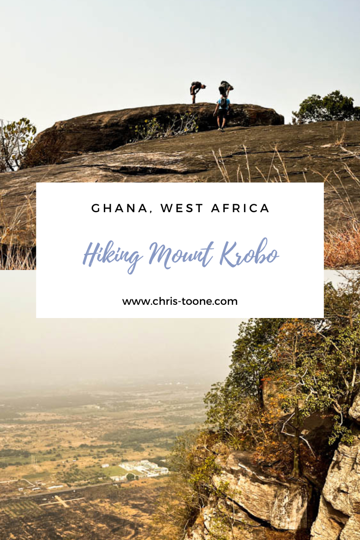
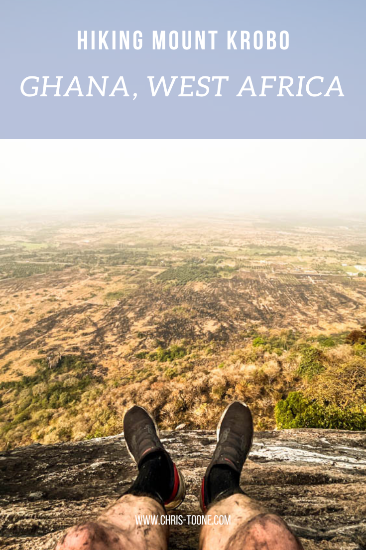
Hiking Mount Krobo, Ghana: Everything You Need to Know
Within a week of regularly driving the Tema-Akosombo road, it was clear that one mountain towered above the rest: cue Mount Krobo. After weeks of trying to arrange a hike the plans finally panned out. Here’s everything you need to know for a great half-day adventure…
Please note: all info below is accurate as of January 2023
Having been to Ghana on and off for the past decade, my trips were isolated to the same stretch of road between Accra, Kumasi, and Berekum leaving the Eastern Region of the country an untouched landscape full of adventure.
Within a week of regularly driving the Tema-Akosombo road, it was clear that one mountain towered above the rest: cue Mount Krobo. After weeks of trying to arrange a hike the plans finally panned out.
Here’s everything you need to know for a great half-day adventure!
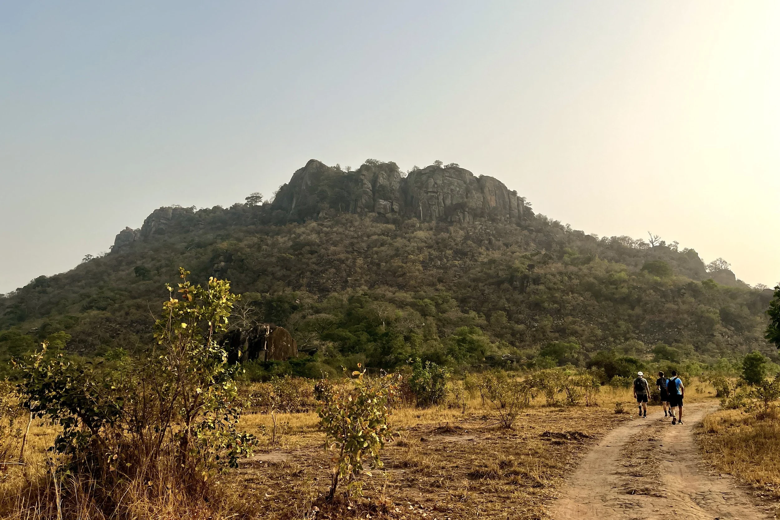
Hiking the base of Mount Krobo, Ghana
A brief history of Mount Krobo
Dating back to the 16th century, the Dangme people of East Africa up and left their settlements, deciding to migrate towards present day Ghana. Once they reached West Africa, the group made friends with other ethnicities as they passed through, including the Ewe people.
As the trek progressed, a split from the Ewe became necessary and it was at this point in their journey that the Krobo refer to as Lorlorvor, meaning “love has ended.”
The Krobo people crossed the Volta River in continued search of a new settlement when they found themselves surrounded by the Akan and Guan ethnic groups. Fear of these perceived threats forced them to climb an isolated mountain on the plains near the river, known today as Mount Krobo.
Having experienced first-hand the difficult climb as a natural safety measure they began to establish their new settlement, quickly erecting multi-story homes and irrigation systems.
As the Krobo population continued to expand, the colonial government found it increasingly difficult to monitor and control the settlement. As a result in 1892, the British rulers gave the community 3 days to leave the mountain. The people fled with as much as they could carry and what was left behind was destroyed.
To this day, the Krobos continue to organize a pilgrimage to pay homage to their ancestors.
Experience more of Ghana’s hiking scene. Don’t miss these posts:
How to get to Mount Krobo in Ghana’s Eastern Region
Not the most conveniently located attraction in Ghana, the easiest way to access Mount Krobo is by taking a tro-tro or taxi to Akuse Junction. From here, the unmarked trailhead is 3.1km south on the left side of the road, just past Kings and Queens Teaching Hospital.
Although possible to walk from the intersection, it’s not advisable given the volume of speeding traffic along the Tema-Akosombo Road.
If all else fails, the trailhead is pinned below, and the path can be seen from Google satellite images.
When to go
For sweeping views across the plains, it’s best to avoid the Harmattan season which runs from November to March as the horizon is often laden with dust that obscures the landscape.
Helpful Information
Some reports indicate a 7.50 GHC entrance fee to a local farmer, but we did not encounter anyone. It’s also vital to bring plenty of water and sunscreen as the mountain is exposed most of the ascent.
Other things to consider:
A reliable and comfy day pack
Pack snacks or buy fruit from the stands at Akuse Junction
Wear shoes with plenty of tread
Wear long, lightweight pants
Bring bug spray
Plan for 4 hours, round trip
Walking poles
Start early in the morning to avoid the hottest part of the day


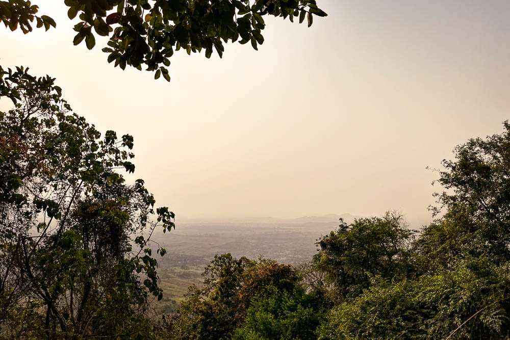
A glimpse of the landscape from the top of Mount Krobo, Ghana
What to expect while hiking Ghana’s Mount Krobo
Once turning off the Tema-Akosombo Road, the hike starts flat as the dirt path winds through the brush and approaches the eastern face of the mountain. The tree-lined trail concludes at a clearing with a shelter, washrooms, and a beautiful baobab tree.
From here, the trek begins to quickly ascend through the trees. Remember to pace yourself and stay hydrated – it’s not a race to the top. Take advantage of the many lookouts along the way for some well-deserved rest.
On this particular day, the brush had just been burned along the trail, so the breaks were a welcomed reprieve from breathing in the Harmattan dust and ashy air.
Eventually, the path opens up to ruins from the Krobo civilization that once dwelled on the mountain. We wandered around the old foundations of houses while uncovering clay pots that had slowly been reclaimed by the Earth.

Ruins of the Krobo settlement
At this point, it is not much farther to the first vista that looks west over the plains. Once you have had a chance to take in the sweeping landscape, continue walking north along the top of the mountain to reach the trail's end, marked by a metal cross.
Relax, refuel, and enjoy the views.
The easiest and safest thing to do is treat Mount Krobo as an out-and-back trail. There is no loop however a local Ghanaian we met at the peak insisted we try the “shortcut” down. This included descending a solid rock wall into a ravine and galloping down the western face of the mountain that we had previously labeled “too steep to climb” as we reached the trailhead from the main road that morning.
Truth be told we would never have found this path without a guide, so best to descend back through the Krobo ruins.
Important notes for visiting Mount Krobo
Here’s what I wish we would’ve done differently:
Pin the location of the trailhead and have the taxi stop at the mark. We got out too early at Akuse Junction and had to walk the 3.1km down the Tema-Akosombo road
Bring hiking shoes. I used runners and immediately regretted my decision as we started the steep descent through the ashy brush
Wear long pants. The trail is clearly defined, but that doesn’t mean brush doesn’t get in the way. I left the mountain with scrapes and cuts up and down my legs. Nothing serious, but next time I’ll pack pants
Get the taxi driver’s phone number to call on the descent and meet at the end of the trailhead to avoid walking back to Akuse Junction for a ride

Views from the top of Mount Krobo, Ghana
All in all, it made for a great morning adventure. Be sure to do a little digging on the Krobo people before the hike. Knowing the history of the mountain made the experience meaningful beyond the beautiful fauna and striking landscape.
Have you hiked Mount Krobo before or know of other adventures you want me to experience in Ghana? Leave a comment below and let’s keep exploring!
As always, thanks for reading & happy travels.
Sharing is caring! Pin this post for later.